To save content items to your account,
please confirm that you agree to abide by our usage policies.
If this is the first time you use this feature, you will be asked to authorise Cambridge Core to connect with your account.
Find out more about saving content to .
To save content items to your Kindle, first ensure no-reply@cambridge.org
is added to your Approved Personal Document E-mail List under your Personal Document Settings
on the Manage Your Content and Devices page of your Amazon account. Then enter the ‘name’ part
of your Kindle email address below.
Find out more about saving to your Kindle.
Note you can select to save to either the @free.kindle.com or @kindle.com variations.
‘@free.kindle.com’ emails are free but can only be saved to your device when it is connected to wi-fi.
‘@kindle.com’ emails can be delivered even when you are not connected to wi-fi, but note that service fees apply.
The outflow channels that emptied into Chryse Planitia provide the best evidence that great quantities of water once flowed on the Martian surface. Some channels were created when the cryosphere ruptured and ground-water discharged from chaos or from cavi along major fault zones. Some chaos formed on channel floors when fluvial erosion thinned the cryosphere, leading to catastrophic breakout of confined groundwater. These chaos can be used to estimate the cryosphere thickness, crustal heat flux and climate trends. At Iamuna Chaos the cryosphere was 700–1000 m thick when Ravi Vallis formed, indicating a cold, long-term climate similar to present-day Mars. The discovery of outflow channels at elevations >2500 m in Ophir Planum shows that Hesperian recharge likely occurred in upslope areas to the west (e.g. Sinai Planum, Tharsis highlands, Syria Planum). The larger circum-Chryse channels were carved by floods that issued directly from the ancestral canyons, which likely were smaller and less interconnected than today. A plausible mechanism for water release was catastrophic drainage of chasm lakes caused by the collapse of topographic barriers or ice-debris dams. We report evidence that a megaflood filled Capri Chasma and overtopped its eastern rim, carving two crossover channels and spectacular dry falls cataracts. This flooding may represent an initial outpouring of canyon lakes via a gateway in eastern Coprates Chasma. The recent discovery of hematite and abundant hydrated sulphates in the Valles Marineris canyons provides compelling evidence of a water-rich history.
Catastrophic out-bursts of water from lakes impounded by glacial ice or debris such as moraines have caused large freshwater floods on Earth in recent times at least back to the Quaternary. Resultant large-scale depositional sedimentary landforms are found along the courses of these floodwaters. On Mars, similar floods have resulted from catastrophic efflux of water from within the Martian crust. This latter conclusion is based on large-scale and mesoscale landforms that appear similar to those identified in flood tracts on Earth. Both on Earth and on Mars, these landforms include suites of giant bars – ‘streamlined forms’ – of varying morphology that occur primarily as longitudinal features within the floodways as well as in flooded areas that were sheltered from the main flow. Flow-transverse bedforms, notably giant fluvial dunes and antidunes also lie within the floodways. The flood hydraulics that created these forms may be deduced from their location and morphology. Some other fluvial landforms that have been associated with megafloods on Earth have yet to be identified on Mars.
Introduction
Exceptionally large freshwater floods on Earth are associated with the catastrophic draining of glacial lakes Missoula and Agassiz amongst others in North America (Teller, 2004). Other glacially related large floods occurred in the mountains of Eurasia, which have only recently received attention (Grosswald, 1999; Montgomery et al., 2004), and geomorphological evidence of other large floods may be discovered in formerly glaciated terrain on other continents.
High-energy fluid flows such as occur in large water floods can produce large-scale erosional landforms on Earth and potentially on Mars. These forms are distinguished from depositional forms in that structural and stratigraphical aspects of the sediments or bedrock may have a significant influence on the morphology of the landforms. Erosional features are remnant, in contrast to the depositional (constructional) landforms that consist of accreted waterborne sediments. A diversity of erosional forms exists in fluvial channels on Earth at a range of scales that includes the millimetre and the kilometre scales. For comparison with Mars and given the present-day resolution of satellite imagery, erosional landforms at the larger scales can be identified. Some examples include: periodic transverse undulating bedforms, longitudinal scour hollows, horseshoe scour holes around obstacles, waterfalls, plunge pools, potholes, residual streamlined hills, and complexes of channels. On Earth, many of these landforms are associated with present day or former (Quaternary) proglacial landscapes that were host to jökulhlaups (e.g. Iceland, Washington State Scablands, Altai Mountains of southern Siberia), while on Mars they are associated with landscapes that were likely host to megafloods produced by enormous eruptions of groundwater. The formative conditions of some erosional landforms are not well understood, yet such information is vital to interpreting the genesis and palaeohydraulic conditions of past megaflood landscapes. Correct identification of some landforms allows estimation of their genesis, including palaeohydraulic conditions. Kasei Valles, Mars, perhaps the largest known bedrock channel landscape, provides spectacular examples of some of these relationships.
Subglacial landforms across various scales preserve the history of movement, deposition and erosion by the last great ice sheets and their meltwater. The origin of many of these landforms is, however, contentious. In this chapter these forms are described both individually and as suites that make up entire landscapes. Their interpretations are discussed with reference to the megaflood hypothesis. A description is provided of individual forms via their size, shape, landform associations, sedimentology and the relationship between landform surfaces and internal sediments. The possible origins of each are then discussed. To simplify the chapter the landforms are categorised by their size (micro, meso, macro and mega), although, importantly, it should be noted that several landforms show similarities across scales. Also discussed is the relevant subglacial hydrology associated with the described forms, especially the volume and discharge rates of megaflood flows, and where water may have been stored prior to the megaflood events.
Introduction
As early as 1812, Sir James Hall interpreted the famous Castle Rock in Edinburgh, Scotland, a crag and tail, as a landform created by immense, turbulent floods. Likening the hill to features carved in snow by wind, he could only hypothesise that water was responsible; probably giant tidal waves, as, at that time, he knew of no other mechanism that could conceivably create such streamlining. It is now very clear that the streamlined forms first noted by Hall are part of a continuum containing landforms of many shapes and sizes.
After centuries of geological controversy it is now well established that the last major deglaciation of planet Earth involved huge fluxes of water from the wasting continental ice sheets, and that much of this water was delivered as floods of immense magnitude and relatively short duration. These late Quaternary megafloods, and the megafloods of earlier glaciations, had short-term peak flows, comparable in discharge to the more prolonged fluxes of ocean currents. (The discharges for both ocean currents and megafloods generally exceed one million cubic metres per second, hence the prefix ‘mega’.) Some outburst floods likely induced very rapid, short-term effects on Quaternary climates. The late Quaternary megafloods also greatly altered drainage evolution and the planetary patterns of water and sediment movement to the oceans. The recent discoveries of Mars missions have now documented the importance of megafloods to the geological evolution of that planet. As on Earth, the Martian megafloods seem to have influenced climate change.
Introduction
Up until the middle nineteenth century considerable progress was being made in scientific studies of the role of catastrophic flooding in the geological evolution of river valleys. While some of these studies invoked a kind of biblical catastrophism, much of the work merely employed hypotheses of immense floods because these inferences seemed to provide the best explanations for such features as scoured bedrock and accumulations of huge, water-transported boulders.
During the Quaternary, the Altai Mountains of south-central Siberia sustained ice caps and valley glaciers. Glaciers or ice lobes emanating from plateaux blocked the outlet of the Chuja–Kuray intermontane basins and impounded meltwater to form large ice-dammed lakes up to 600 km3 capacity. On occasion the ice dams failed and the lakes emptied catastrophically. The megafloods that resulted were deep, fast-flowing and heavily charged with sand and gravel, the sediment being sourced from the lake basins and also entrained along the course of the floodways. The floods were confined within mountain valleys of the present-day rivers Chuja and Katun but large quantities of sediment were deposited over a distance of more than 70 km from the dam site in tributary river-mouths, re-entrants in the confining valley walls and on the inside of major valley bends. The main depositional units that resulted are giant bars, which blocked the entrances to tributaries and temporarily impeded normal drainage from the tributaries into the main-stem valley such that minor lakes were impounded within the tributaries behind the bars. Fine sediment from the tributaries accumulated in these lakes as local lacustrine units. Later the bars were breached by the tributary flows and the local lakes were drained. Sections of the giant bar sediments and the local lacustrine units are used to describe the nature of the megaflood valley fill, which was deposited primarily during marine isotope stage 2.
The four youngest megaflood channels on Mars – Mangala Valles, Marte Vallis, Grjotá Valles and Athabasca Valles – date to the Amazonian Period and originate at fissures. The channels show common in-channel morphological indications of flood activity (streamlined forms, longitudinal lineations, scour), as well as evidence for volcanic, tectonic, sedimentary and/or glacial/ground ice processes. The fissure sources and channel termini have varied expressions, suggesting various triggering mechanisms and fates for the floodwaters. Possible triggering mechanisms include magmatic processes (dyke intrusion), tectonic processes (extensional faulting) and a combination of both types of processes. Surface morphology suggests that each of these mechanisms may have operated at different times and locations. Upon reaching the surface, the water likely would have fountained at least a few tens of metres above the surface, producing some water and/or ice droplets at the fountain margins. The likely sources of the floodwater are subsurface aquifers of a few kilometres' thickness and a few tens of degrees Celsius in temperature.
Introduction
Megaflooding on Mars has varied in origin and amount throughout the history of the planet. During the Noachian Period, the most ancient period, flooding originated from crater basins (Irwin and Grant, this volume Chapter 11). During the Early Hesperian Epoch, megafloods originated at chaos terrain often set within Valles Marineris chasmata (Coleman and Baker, this volume Chapter 9). During the Amazonian Period, the most recent period, megaflooding originated from fossae produced by extensional tectonism.
A wide variety of sedimentary structures occur in modern jökulhlaup deposits and an important question arises when trying to identify jökulhlaup deposits in the sedimentary record: which sedimentary structures are distinctive of jökulhlaup deposition? A given sedimentary structure can be formed by more than one process, and in isolation cannot be used to distinguish a jökulhlaup deposit from those formed by other fluvial and flood processes. This chapter identifies those sedimentary structures that are thought to be unique or highly distinctive in jökulhlaups. Some structures are only formed by jökulhlaups in the proglacial environment, but can be found in other fluvial environments. Distinctive sedimentary features of jökulhlaup flows may include hyperconcentrated flow deposits, thick (greater than 5m) upwards coarsening units formed by accretion during the rising stage of a flood and large gravel cross-beds (indicating formation by large gravel dunes) and flood bar deposits. Additional, non-distinctive indicators of jökulhlaup deposition include reactivation surfaces in gravel bedforms, widespread erosion surfaces and consistent palaeoflow indicators. Ice-block and rip-up clast related sedimentary structures are also non-unique, given that they can be formed under non-flood conditions, but their size and numbers are many times greater when formed by a jökulhlaup. To illustrate the points made in the review, this chapter presents a case study using ground-penetrating radar data that describe the sediments of a flood bar deposited during the November 1996 jökulhlaup in Iceland.
The conditions under which large volumes of water may have flowed at high speeds across the surface of Mars are considered. To assess the likely ranges of initial water temperature and release rate, the possible conditions in subsurface aquifers confined beneath the cryosphere are explored. Then the transfer of water to the surface in fractures induced by volcanic activity or tectonic events is modelled and the physical processes involved in its release into the Martian environment are discussed. The motion of the water across the surface is analysed with standard treatments for fluvial systems on Earth, modified for Mars by taking account of the differing environmental conditions and removing what may be considered to be the unsafe assumption that most channels involved bankfull flows. The most commonly discussed environmental difference is the smaller acceleration due to gravity on Mars. However, an important additional factor may have been the initially vigorous evaporation of water into the low-pressure Martian atmosphere. This process, together with the thermal losses incurred by assimilation of very cold rock and ice eroded from the cryosphere over which the water travels, causes minor changes in the depth and speed of a water flood but, eventually, produces major changes in the flood rheology as the total ice and sediment loads increase. The roles of these processes in determining the maximum distance to which the water may travel, and the relative importance of erosion and deposition in its bed, are discussed.
Breached dams formed naturally of rock or rock debris have produced many of the largest floods of Earth history. Two broad classes of natural impoundments are (1) valley-blocking accumulations of mass movements and volcaniclastic debris, and (2) closed basins rimmed by moraines, tectonic depressions, and calderas and craters formed during volcanic eruptions. Each type is restricted to particular geological and geographical environments, making their incidence non-uniform in time and space.
Floods from breached natural dams and basins result from rapid enlargement of outlets. Erosion commonly is triggered by overtopping but also by piping or mass movements within the natural dam or basin divide as the level of impounded water rises. Breaching also can be initiated by exogenous events, such as large waves caused by mass movements or ice avalanches, and upstream meteorological or dam-break floods.
The peak discharge and hydrograph of breached rock-material dams depends mainly on the impounded volume, breach geometry and breach erosion rate. For impounded water bodies that are large with respect to final breach depth, including most tectonic and volcanic basins and many ice-dammed and volcanic-dammed lakes, the peak discharge is primarily a function of final breach geometry. These floods typically last longer and attenuate less rapidly than smaller impoundments. For impoundments of smaller volume relative to final breach depth, such as most moraine-rimmed lakes and landslide and constructed dams, peak discharge is a nearly linear function of vertical breach erosion rate.
Breaches of large natural basins, usually initiated by high runoff or meltwater production in their contributing watersheds, have been responsible for the most intense recognised terrestrial floods. Some of the many impact craters and intercrater basins in the Martian highlands also apparently overflowed during the Noachian Period (>3.7 Ga), forming relatively wide and deep outlet valleys. Broad, mid-latitude basins overflowed to carve Ma'adim Vallis and the Uzboi–Ladon–Morava Valles system, which are similar in scale to the terrestrial Grand Canyon but record much larger formative discharges. Other valley network stems of comparable size are also associated with smaller breached basins or broad areas of topographic convergence, and even the smaller basin outlets are typically deeper than other valleys in their vicinity. Little evidence for catastrophic (by terrestrial standards) meteorological floods has been recognised to date in Martian alluvial deposits. For these reasons, basin overflows may have been disproportionately important mechanisms for valley incision on Mars. Many of the Martian outflow channels also head in topographic settings that favoured ponding, including large canyons, impact or intercrater basins, chaotic terrain basins and grabens. Draining of this topography may have supported peak discharges of ∼106–108 m3 s−1, particularly in the largest channels, but the basin overflow mechanism does not eliminate fully the need for large subsurface outflows.
Jökulhlaups, or glacier outburst floods, are complex flood phenomena, with hydraulics that vary considerably spatially and temporally. However, jökulhlaups occur too suddenly, are too powerful and often too infrequent and remote for direct measurements of hydraulics to be made. Thus various palaeohydraulic methods have been applied to reconstruct jökulhlaup hydraulics from geomorphological and sedimentological evidence. However, these techniques fail to sufficiently characterise transient jökulhlaup hydraulic phenomena, in both space and time. A detailed understanding of these transient hydraulics is important for understanding rapid landscape change, high-magnitude flood mechanisms of erosion, transport and deposition, and hence jökulhlaup hazard management.
Therefore this paper reconstructs transient jökulhlaup flow phenomena using boulder clusters, the slope-area method and a depth-averaged two-dimensional (2D) hydrodynamic model. Kverkfjöll volcano on the northern edge of Vatnajökull, Iceland, provides the study site. Jökulhlaups inundated anastomosing bedrock valleys and exhibited transient hydraulic phenomena including sheet or unconfined flow, channel flow, flow around islands, hydraulic jumps, multi-directional flow including backwater areas and hydraulic ponding. Reconstructions of these jökulhlaups indicate peak discharges of 50–100 000 m3 s−1, which attenuated by ∼65% within 20 km. Frontal flow velocities were ∼1.6 m s−1 but as stage increased velocities reached 5–15 m s−1. Shear stress and stream power reached 1 × 10⁴ N m−2 and 1 × 10⁵ W m−2 respectively. Flows were largely supercritical due to steep channel gradients and shallow flows and highly turbulent due to high hydraulic roughness. Kverkfjöll jökulhlaups thus achieved geomorphological work comparable to that accomplished by ‘megafloods’.
David Levy's entertaining, well-researched book is aimed at the amateur enthusiast who likes to learn enjoyably. Beginning with advice on binoculars and telescopes, and how to observe the night sky effectively, the author goes on to describe thoroughly the field of variable star observation, a field in which amateurs have made important contributions. He shows how to interpret variations in light output in terms of the life of a star, from birth through to sometimes violent death. All of the major variable stars are described and classified, as well as other variable objects such as active galaxies, asteroids, comets and the sun. The book also contains a guide to the seasonal night sky. Throughout, practical observations serve to complement the text, producing an exciting, very readable introduction to this fascinating subject.
Based on field notes made by the author during his own career as an amateur astronomer, this unique guide covers both the traditional and novel approaches to studying the night sky. In addition to the more standard techniques, it discusses the latest modern resources available to today's astronomer, such as personal computers, the Internet, and computerized telescopes. It includes practical advice on aspects such as site selection and weather; provides the reader with detailed instructions for observing the Sun, Moon, planets, and all types of deep-sky objects; and it introduces newer specialities such as satellite observing and the use of astronomical databases. The book concludes with detailed information about 200 stars, clusters, nebulae, and galaxies, suitable for viewing with modest-sized telescopes under suburban conditions. Written to complement How to Use a Computerized Telescope, this book will also appeal to astronomers with more traditional equipment.
Globular clusters are roughly spherical, densely packed groups of stars found around galaxies. Most globular clusters probably formed at the same time as their host galaxies. They therefore provide a unique fossil record of the conditions during the formation and early evolution of galaxies. This volume presents a comprehensive review of globular cluster systems. It summarizes their observed properties, and shows how these constrain models of the structure of stars, the formation and evolution of galaxies and globular clusters, and the age of the Universe. For graduate students and researchers, this volume provides the definitive reference on globular cluster systems.
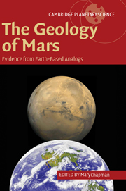
Research into the geological processes operating on Mars relies on interpretation of images and other data returned by unmanned orbiters, probes and landers. Such interpretations are based on our knowledge of processes occurring on Earth Terrestrial analog studies therefore play an important role in understanding the geological features observed on Mars. This 2007 book presents direct comparisons between locales on Earth and Mars, and contains contributions from leading planetary geologists to demonstrate the parallels and differences between these two neighboring planets. Mars is characterized by a wide range of geological phenomena that also occur on Earth, including tectonic, volcanic, impact cratering, eolian, fluvial, glacial and possibly lacustrine and marine processes. The book provides terrestrial analogs for data sets from Mars Global Surveyor, Mars Odyssey, Mars Exploration Rovers and Mars Express, and will therefore be a key reference for students and researchers of planetary science.