

No CrossRef data available.
Article contents
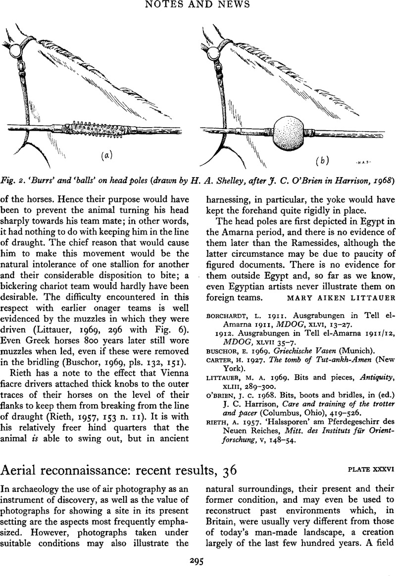
Aerial reconnaissance: recent results, 36
Published online by Cambridge University Press: 02 January 2015
Abstract
An abstract is not available for this content so a preview has been provided. As you have access to this content, a full PDF is available via the ‘Save PDF’ action button.
- Type
- Notes and News
- Information
- Copyright
- Copyright © Antiquity Publications Ltd 1974
References
Blaeu, J.
1645. Atlas major, sive cosmographia Blauiana, Vol. V (Amsterdam). (The plate of the fens, titled ‘Regiones inundatae’ is redrawn from a map by H. Hondius dated 1632.)Google Scholar
Hayward, W.
1604. Plan of the Fenns. (This map is only known from ‘an exact copy’ by the surveyor Tayler Smyth, made in 1727: this is now held in the Cambridgeshire County Record Office.)Google Scholar
 You have
Access
You have
Access