


Introduction
The archaeological record of the first millennium AD in West Polynesia is central to our understanding of the in situ development of chiefly polities and the nature of political systems that were carried by colonists from West to East Polynesia (Burley & Clark Reference Burley, Clark and Sand2003; Harris et al. Reference Harris2020). West Polynesia—defined here as Tonga and Samoa, along with the smaller islands of Futuna and 'Uvea—was colonised by Lapita groups around 2850 years ago (Burley et al. Reference Burley, Edinborough, Weisler and Zhao2015). Traditional Polynesian culture developed later in this region (Kirch & Green Reference Kirch and Green2001; Addison & Matisoo-Smith Reference Addison and Matisoo-Smith2010) before an expansive phase of migration in the period, AD 700–1100 (Wilmshurst et al. Reference Wilmshurst, Hunt, Lipo and Anderson2011; Sear et al. Reference Sear2020), to the islands within the three archipelagos—the Hawaiian Islands, Rapa Nui/Easter Island and Aotearoa/New Zealand—that delineate Triangle Polynesia (Figure 1).

Figure 1. Map of the Pacific Ocean showing Triangle Polynesia (dotted line) and colonisation movements (arrows) from West Polynesia (dashed line) to East Polynesia c. AD 700–1100 (figure by authors).
There is a post-colonisation research lacuna within the records of the first millennium AD for Tonga and Samoa, a period that is termed the ‘Dark Ages’ or ‘Formative Development’ stage (Burley Reference Burley1998; Green Reference Green, Ladefoged and Graves2002). This knowledge gap bridges the interval between the abandonment of ceramics and the appearance of vernacular and monumental architecture associated with traditional Polynesian societies, chiefdoms and titles (Martinsson-Wallin Reference Martinsson-Wallin2016). The Formative Development stage in Tonga spanned AD 400–1200, during which time it is hypothesised that the population on the main island of Tongatapu grew to a point where all available arable land was in use (Kirch Reference Kirch1984: 222; Burley Reference Burley, Kirch and Rallu2007). The implications of demographic expansion during the Formative Development stage include competition for land and the appearance of hierarchical political groups led by elites. Yet archaeological correlates of emergent complexity, particularly the creation of raised structures such as large mounds and earth fortifications, have only been dated to the second millennium AD (Burley & Clark Reference Burley, Clark and Sand2003: 240–41; Clark & Reepmeyer Reference Clark and Reepmeyer2014).
The expansion of durable architecture in the region after 1000 AD has been linked with external migration, sustained population growth and the rapid development of traditional Polynesian leadership systems that organised and managed agricultural and residential space (Harris et al. Reference Harris2020; Quintus et al. Reference Quintus2020). Researchers have long noted, however, that dating Pacific field monuments is difficult (Davidson Reference Davidson and Jennings1979; Wallin et al. Reference Wallin, Martinsson-Wallin and Clark2007), raising the possibility that their construction began earlier, and therefore that population growth rates and Polynesian social complexity developed in situ over a longer interval.
This article reports on the excavation of Mala'e Vakapuna, a large earth mound on the main island of Tongatapu that was built around 1500 years ago, making it the oldest known example of Polynesian architecture. The size and prominent location of the mound is consistent with construction for the control of land and demonstrates the existence of formative political structures, as proposed by Burley and Clark (Reference Burley, Clark and Sand2003), centuries before the advent of the Tongan maritime state (Clark & Reepmeyer Reference Clark and Reepmeyer2014). Age determinations from Mala'e Vakapuna reported here are the first to confirm a substantial time depth for the intensively modified landscapes of West Polynesia (Freeland et al. Reference Freeland, Heung, Burley, Clark and Knudby2016; Frimagacci Reference Frimagacci2016; Jackmond et al. Reference Jackmond, Fonoti and Tautunu2018). Results also suggest that the colonists who settled East Polynesia came from societies that had experienced centuries of social and political stratification.
Location and stratigraphy
The mound identified as 39-Mala'e Vakapuna (Tongan ‘airport’) is located to the east of Fua'amotu International Airport on the summit of a small hill (53m elevation) that overlooks central Tongatapu and the Fanga 'Uta Lagoon (Figure 2). The site is covered by a dense growth of Hibiscus tiliaceus (fau) (Figure 3) and lies 6km from the lagoon and 2.8km from the limestone south coast. The composite and fertile soils of the area belong to the Vaini and Lapaha series consisting of a shallow and younger tephra soil that has developed over an older weathered tephra clay (Cowie Reference Cowie1980). The mound is a rounded rectangle with base dimensions of 38 × 41m, a top area of 16 × 21m and a height of approximately 2–3m, depending on the hill slope (Figure 4).

Figure 2. LiDAR image showing Mala'e Vakapuna and the location of earth mounds (dots), sunken roads (dashed lines) and forts (squares) in central Tongatapu (figure by authors).

Figure 3. LiDAR perspective view of Mala'e Vakapuna mound (left), aerial view showing dense vegetation (Hibiscus tiliaceus) covering the mound site (right) (figure by authors).

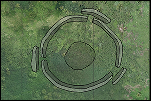
Figure 4. Plan (a) and cross-section (b) of the Mala'e Vakapuna site. Also seen in plan are smaller mounds around the site, including a western cluster that appears to demarcate an open space in front of the hill on which Mala'e Vakapuna was constructed (figure by authors).
The mound has previously been recorded as part of a fortification complex (Spennemann Reference Spennemann1989a: 483; Burley et al. Reference Burley, Tuinukuafe and Clark2016; Parton et al. Reference Parton, Clark, Reepmeyer and Burley2018). Surrounding the mound is a shallow ditch, the excavated earth from which was used to make a low rampart (see Figure 3 & 4). Many Tongan fortifications were built in the nineteenth century (Parton et al. Reference Parton, Clark, Reepmeyer and Burley2018) and charcoal found beneath the rampart returned accelerator mass spectrometry (AMS) radiocarbon dates from the Civil War era (AD 1790s–1852) confirming that the defensive earthworks were built during the nineteenth century AD.
A 1.3m × 0.7m trench was opened at the centre of the mound, along an east-west orientation, and excavated to a depth of 2.43m. Access steps made to reach deeper layers reduced the excavated surface area with increasing depth (Figure 5). Consideration of the stratigraphy of the trench shows that the mound consists of around 2m of earth deposited in alternating layers of fill. Red layers and lenses are apparent and represent in situ combustion features made on fill surfaces that oxidised and hardened the underlying clay, leaving concentrations of charcoal and ash. Fill deposits are composed of mixed clay and topsoil and have a mottled appearance. The unmodified tephra clay (7.5YR 4/6) found above limestone bedrock is weakly developed with moderate stickiness and plasticity while the ‘A’ horizon soil (5YR 2.5/1) that the mound was built on is strongly developed and friable. Initial mound layers (5c + d, see Figure 5) are clay and humic soil with increasing amounts of dark humic soil in layers 5a and 4. Upper layers (1a, 2a & 2b) have less humic soil and more clay. The buried topsoil (layer 6) beneath the mound is a dark, compact and well-structured loam with occasional charcoal. Below this, at a depth of 2.25–2.35m, layer 7 is a compact dark-brown soil containing scattered cultural material, including six plain pot sherds, abundant charcoal, more than 30 limestone oven stones, a few shellfish and bones from small fish and mammals, probably representing a midden deposit. Layer 8 is a weathered tephra clay with fragments of pumice and limestone devoid of cultural material.

Figure 5. Stratigraphy at Mala'e Vakapuna as illustrated by the west and east profiles of the trench, with B1–B6 dated burn events highlighted (figure by authors).
Radiocarbon dating
A series of 15 charcoal and marine shell samples were dated with AMS at the Australian National University (ANU; Table 1). A fragment of mammal/human bone recovered from Layer 7 was submitted for dating, but failed pre-treatment. Charcoal samples from in situ combustion features and the midden deposit and oven in layer 7 were examined under high magnification and compared with tropical reference material. Two samples were identified as coconut endocarp (SANU-59938, SANU-57831) and two samples with a narrow diameter appeared to be from twigs/small branches (SANU-59931, SANU-57839). Radiocarbon determinations were obtained using a NEC Single Stage AMS at the ANU Radiocarbon Laboratory (Fallon et al. Reference Fallon, Fifield and Chappell2010). Charcoal samples were cleaned using a standard acid-base-acid protocol to remove exogenous carbonates, humic acids and degraded charcoal. Two bivalve shells from layer 7 were also sent for analysis; the outer layers of the shells were removed with a drill and the remainder washed in dilute acid. Charcoal dates were calibrated with Calib Rev8.2 using the SHCal20 data set (Hogg et al. Reference Hogg2020). Shell ages from Tongatapu can be influenced by hardwater making them appear older so the marine shell results were calibrated with the Marine13 calibration curve (Reimer et al. Reference Reimer2013) using the Gafrarium age (SANU-59410) adjusted with a ΔR of 273 ± 34 years and the Anadara age with a ΔR of 187 ± 76 years following Petchey and Clark (Reference Petchey and Clark2011).
Table 1. AMS ages from the Mala'e Vakapuna main excavation (see Figure 5).

Bayesian modelling
Bayesian analysis (OxCal 4.2, Bronk Ramsey Reference Bronk Ramsey2017) was used to model four sequential events in the main excavation sequence: 1) pre-mound (oven use); 2) pre-mound (age of buried topsoil—layer 6 top); 3) mound construction; and 4) fortification (see online supplementary material (OSM) section 1 for more details). Activity in the sequence was divided by uniform boundary priors with the model span constrained by the end of the Civil War period in AD 1852 when fortifications ceased to be made (Figure 6). The estimate for oven use is broad (440–40 BC, 95.4% of the highest posterior density interval (HPDI)) due to multiple age intercepts on the SH20 calibration curve (Hogg et al. Reference Hogg2020). Radiocarbon samples at the interface of the buried topsoil (layer 6 top) and an early stage of mound building (B6 burn event, see Figure 5) demonstrate that mound building had commenced by AD 350–500 (95.4% HPDI). The large age difference between the final burn event (see Figure 6: B1 End) and nineteenth-century posthole age associated with site fortification prevents us from precisely dating mound completion. However, the mound was likely completed shortly after burn event B1 (see below) and the Bayesian model based on the burn event sequence indicates completion by AD 530–670 (95.4% HPDI), with modelling of the mound-building phase indicating a conservative construction span between 25 and 250 years (95.4% HPDI). A charcoal sample taken to date the onset of topsoil formation on the south side of the mound gave an age of 1472 ± 22 BP (see OSM section 2) with a calibrated range of AD 590–650 (95.4% confidence) consistent with mound completion in the first millennium AD. A recent age returned on charcoal from a posthole cut from the mound surface (186 ± 22 BP) is consistent with dates obtained from beneath the fortification bank, indicating the addition of defences to the site during the nineteenth-century Civil War era.

Figure 6. Bayesian analysis of activity at Mala'e Vakapuna (figure by authors).
Construction sequence
LiDAR imagery indicates that the hill surface around Mala'e Vakapuna provided the fill used to construct the mound. The stratigraphy shows that basal fill layers were composed of a mixed topsoil-clay sediment (layers 4 & 5) with upper layers predominantly of clay (layers 1 & 2). An inverted sediment sequence is common in Tongan earthworks and is caused by removal of the organic topsoil and subsoil to create an initial foundation with deeper substratum clays excavated to increase volume and height. The burn layers are evidence of sequential construction events when vegetation, presumably growing on the mound, was collected and burned before additional deposits of earth fill were added. It is possible that significant burn layers (B1–B3) were made during the refurbishment or replacement of a structure made on the mound but there are no artefacts or layers of sand/gravel suggestive of a significant construction hiatus, as observed in several earth mounds excavated by Spennemann (Reference Spennemann1989b: 160, 326–29), and no topsoil development above fill layers. We suspect, therefore, that the mound was constructed over a span of 3–5 generations. The overlapping radiocarbon ages support this hypothesis, as does a volume analysis of the recent fortification ditch and embankment which demonstrates that these earthworks did not contribute additional material to the mound (see OSM sections 2 & 3). If the upper part of the mound—particularly the upper 0.46m of clay sediment above B1—was deposited centuries later, then these layers should contain substantial amounts of organic-rich soil from the removal of topsoil horizons that formed after AD 500. Layers 2a and 2b are, however, predominantly clay indicating the excavation of deeper sediments before thick organic soils had been able to form. A test excavation on the southern edge of the mound disclosed stratigraphy equivalent to layers 4 and 5 in the main trench, indicating that the horizontal and vertical dimensions of Mala'e Vakapuna were attained in the first millennium AD.
Mound dimensions
The Mala'e Vakapuna mound was made on a small hill (Figure 3) and was a prominent structure with a base area of 1290m2 and a volume of roughly 1700m3. Figure 7 shows the dimensions of the mound compared with over 10 000 mounds in the Tongatapu LiDAR dataset (Freeland et al. Reference Freeland, Heung, Burley, Clark and Knudby2016), with the monumental burial structures of the paramount Tu'i Tonga at Lapaha labelled for comparison (Clark et al. Reference Clark, Burley and Murray2008). In the Tongatapu dataset, Mala'e Vakapuna is in the top 97th and 98th percentile for height and volume and in the top 95th percentile for basal area. These values highlight the ‘substantial’ size of Mala'e Vakapuna relative to other earth mounds. Nonetheless, labour estimates indicate a modest workforce could have been used to build Mala'e Vakapuna with a total of 1008 person/days required or just over a month with a work crew of 30 people (see earthwork labour calculations in Parton et al. Reference Parton, Clark, Reepmeyer, Clark and Litster2022).

Figure 7. Plot of Tongatapu mound dimensions (light grey circles) showing Mala'e Vakapuna (red circle) and monumental tombs (blue squares) of the paramount Tu'i Tonga dynasty (AD 1200–1800, see Clark et al. Reference Clark, Burley and Murray2008) (figure by authors).
Mound context
Near Mala'e Vakapuna there is a western cluster of 14 mounds distributed on either side of a sunken road (Figure 4). An open space is demarcated by this cluster at the base of the hill and may correspond with ethnographic examples of a village green (mala'e). We interpret the road that runs through the mound cluster as an early route that ran from the Fanga 'Uta Lagoon to the exposed south coast. Close to Mala'e Vakapuna is the remnant of a road junction that connected to the southwest-to-southeast arc of a high-density settlement spread across a 60m ridgeline (Figures 2 & 4). Together these roads indicate that the southern part of the island was an early and important area of occupation that interacted with lagoon-based communities. Previous research has shown an almost continuous band of ceramic and shellfish debris along Tongatapu's sheltered northern lagoon coast (Groube Reference Groube1971; Spennemann Reference Spennemann1989a) that may have supported ‘one of the densest Lapita populations in the ancient Pacific world’ (Dickinson Reference Dickinson, Bedford, Sand and Connaughton2007: 184). That people were travelling inland from settlements along the north coast of Tongatapu using an informal track that eventually developed into a throughfare is suggested by the presence of pottery and marine shellfish below the Mala'e Vakapuna mound dated to c. 900–400 BC and oven use around 300–200 BC.
The mounds in the surrounding landscape have yet to be investigated and radiocarbon dated. Nonetheless, we draw attention to the potential association of Mala'e Vakapuna with nearby residential structures and roads as they are features of the built landscape observed in later chiefdom-era settlements that have a deep history based on linguistic reconstructions in Proto-Polynesian. The location of large mounds with a volume greater than 1500m3 in central Tongatapu and in the vicinity of Mala'e Vakapuna is shown in Figure 2. Like Mala'e Vakapuna, large mounds are frequently associated with a road; this pattern remains apparent despite the fact that many sunken roads have been destroyed by development. For example, the nine largest structures of the Tu'i Tonga at Lapaha (Clark et al. Reference Clark, Burley and Murray2008) were recorded as adjacent to a large road which no longer exists (Clark Reference Clark, Martinsson-Wallin and Thomas2014). Large mounds are also commonly located close to other mounds/residential structures that surround an open community area (mala'e) adjacent to a road (see OSM section 4). Historical linguistics identifies mound foundations (*qafu) made for residential and communal buildings, roads (*hala), an open meeting/ceremonial area (*malaqe) and cultivated fields (*maqala) as elements of a Polynesian settlement pattern that emerged in West Polynesia sometime after 2500 years ago (Kirch & Green Reference Kirch and Green2001; Pawley Reference Pawley, Bradshaw and Rehg2001). Although built landscapes are palimpsests, we believe that large mounds like Mala'e Vakapuna were not isolated constructions and were likely associated with transport, residential and agricultural structures that comprised an ancient form of Tongan settlement.
Discussion
Numerous studies have investigated and attempted to date different types of durable architecture in West Polynesia, including monumental mounds (Wallin et al. Reference Wallin, Martinsson-Wallin and Clark2007; Clark et al. Reference Clark, Burley and Murray2008), fortifications (Best Reference Best1984; Frimagacci Reference Frimagacci2016; Clark et al. Reference Clark, Parton, Reepmeyer, Melekiola and Burley2017), stone terraces (Pearl Reference Pearl2004), linear mounds (Quintus et al. Reference Quintus2020), circular mounds (Spennemann Reference Spennemann1989a) and pigeon-snaring mounds (Burley Reference Burley1996; Sand et al. Reference Sand, Baret, Bole, Ouetcho and Sahib2018; Quintus & Clark Reference Quintus and Clark2019). Two indicators frequently used to examine the onset of social complexity in West Polynesia are significant landscape change, as an indicator of agricultural intensification, and the construction of durable architecture. The age of built structures is particularly important as the development of specialised architecture is linked with the presence of complex chiefdoms, growing populations and intensified forms of food production. Corollaries of chiefdom societies include increasing inequality and conflict, population aggregation and declining habitat suitability. These conditions are associated with hierarchical subjugation and despotic control of land that may have stimulated population dispersal from West Polynesia to East Polynesia (Kennett & Winterhalder Reference Kennett, Winterhalder, Clark, Leach and O'Connor2008).
There are no detailed palaeoenvironmental records from Tongatapu to identify when agricultural intensification, environmental infilling and expansion to marginal zones occurred, but research in Fiji, Samoa and Futuna suggests significant landscape change between AD 100 and 1000 (e.g. Dickinson et al. Reference Dickinson1998; Roos et al. Reference Roos, Field and Dudgeon2016; Kirch Reference Kirch2017: 244; Gosling et al. Reference Gosling2020).
In contrast, all substantial architecture in West Polynesia has been dated to after the first millennium AD. Monumental mounds faced with carbonate stone in Tonga are no older than AD 1250 (Clark & Reepmeyer Reference Clark and Reepmeyer2014) and the first phase of the Pulemelei mound on Savai'i was constructed in either AD 1000–1400 or AD 1050–1250 (Rieth & Hunt Reference Rieth and Hunt2008; Martinsson-Wallin Reference Martinsson-Wallin2016: 112). Genealogical reckoning indicates that large earth mounds on the island of Upolu date to the seventeenth century AD, while Samoan pigeon mounds were probably built in the seventeenth–eighteenth century AD (Sand et al. Reference Sand, Baret, Bole, Ouetcho and Sahib2018). Oral traditions suggest that Tongan pigeon mounds may be older, and some could date to the fifteenth century AD (Burley Reference Burley1996). Built fortifications and defences also appear after AD 1000 in Tonga, Fiji and Samoa (Field & Lape Reference Field and Lape2010; Martinsson-Wallin Reference Martinsson-Wallin2016; Clark et al. Reference Clark, Parton, Reepmeyer, Melekiola and Burley2017).
Dating of the construction of Mala'e Vakapuna to AD 500 corresponds with the palaeoenvironmental evidence for increased land alteration that suggests the existence of other early structures in Fiji-West Polynesia. Although there are potential examples of structures built in the first millennium AD (see OSM section 5) it is notable that the dating of field monuments in Fiji-West Polynesia is problematic and this has contributed to conservative estimates for the onset of earth and stone architecture. New dating of field monuments is now needed, especially multiple radiocarbon analyses from mound stratigraphies and dating of material collected from ground surfaces buried beneath structures. Such programmes of study might initially focus on built sites that are large and potentially old such as the Vailele mounds in Samoa and other large mounds on Tongatapu (Figure 2).
Turning to the interpretation of Mala'e Vakapuna, the Tongan archaeological sequence is marked by continuity and is potentially different to Samoa where the arrival of a new population has been linked with the late production of architecture (Harris et al. Reference Harris2020). The complex chiefdom of the Tu'i Tonga dynasty arose in AD 1100–1200 by incorporating regional chiefdoms across the archipelago under a paramount authority. The existence of simple chiefdoms centuries before the advent of the Tongan state is indicated by Proto-Polynesian terms including *kainanga; a social group consisting of smaller residential groups (*kaainga) that held residential and agricultural land and led by a *qariki—the male leader of a senior land-holding group who inherited his position patrilineally (Kirch & Green Reference Kirch and Green2001: 214, 217, 231). It is currently unclear what type of structure was built on Mala'e Vakapuna, but ethnographic, genealogical and traditional history repeatedly identify large mounds and the structures on them (i.e. high-status residences, burial sites, religious and communal buildings) as the property of chiefs (e.g. Davidson Reference Davidson, Green and Davidson1974; Gifford Reference Gifford1985; Barnes & Green Reference Barnes and Green2008: 27, 36; Martinsson-Wallin Reference Martinsson-Wallin2016). A parsimonious reading of Mala'e Vakapuna is that it marks a simple chiefdom, possibly a single community in which power was held by a senior kin-group or hereditary leader.
Conclusion
The ancestral cultures of West Polynesia gave rise to diverse Polynesian societies that encompassed archaic states and chiefdoms with different levels of stratification (Kirch Reference Kirch2017). As our results demonstrate, the next phase in understanding Pacific landscapes requires the critical addition of chronological data to the spatial architecture record (e.g. Quintus et al. Reference Quintus2020) to examine Polynesian settlements and chiefdoms from the poorly understood first millennium AD through to the early European contact era. Due to the presence of fires on construction surfaces that were subsequently sealed by layers of earth fill, Mala'e Vakapuna is currently the best dated prehistoric structure in West Polynesia. Whether early architecture was made in other island groups is uncertain but appears likely given the difficulty in accurately dating earth and stone structures.
The relatively late and rapid development of traditional Polynesian chiefdoms seen in the chronological record of durable architecture has given rise to the implication that their formation was catalysed by particular events such as the intensification of food production systems, increased inter-group competition as a result of the Little Ice Age (around AD 1400–1800), or demographic expansion connected with migration in the past 1000 years (Addison & Matisoo-Smith Reference Addison and Matisoo-Smith2010; Field & Lape Reference Field and Lape2010; Harris et al. Reference Harris2020). A longer trajectory for Polynesian social complexity is indicated by Mala'e Vakapuna, particularly the existence of population aggregations 1500 years ago focused on territorial units that were marked with landesque capital, referring to the repeated construction of permanent social and economic structures on a landscape. In West Polynesia, monumental and substantial structures used in late prehistory were clearly linked to high-status leaders (Martinsson-Wallin Reference Martinsson-Wallin2016), and Mala'e Vakapuna suggests this association is an ancient Polynesian trait. The age and size of Mala'e Vakapuna has implications for understanding socio-political conditions prior to the formation of the ancient Tongan state, including the likelihood that early population agglomeration propelled settlement inequality and inter-group competition in the first millennium AD. The age of Mala'e Vakapuna also indicates that by the time that East Polynesia was colonised, approximately 1000 years ago, well-developed chiefdoms and field monuments were already extant in West Polynesia.
Acknowledgements
We thank the Lapaha Community and Nobles (His Serene Highness Prince Kalaniuvalu Fotofili, Her Serene Highness Princess Marcella Taumoepeau Tupou Kalaniuvalu Fotofili and Her Royal Highness the late Mele Siu'ilikutapu Kalaniuvalu Fotofili), Semisi Tongia (Culture Division, Tonga Ministry of Tourism) and Malia Melekiola of Lapaha.
Funding statement
Fieldwork and analyses were funded by Discovery Project grants to G. Clark from the Australian Research Council (DP160103778 and DP200102872).
Supplementary material
To view supplementary material for this article, please visit https://doi.org/10.15184/aqy.2023.200.


 Open access