-
Select format
-
- Publisher:
- Cambridge University Press
- Publication date:
- 05 March 2014
- 14 February 2013
- ISBN:
- 9781139567015
- 9781108058827
- Dimensions:
- Weight & Pages:
- Dimensions:
- (229 x 152 mm)
- Weight & Pages:
- 0.47kg, 318 Pages
You may already have access via personal or institutional login
Book description
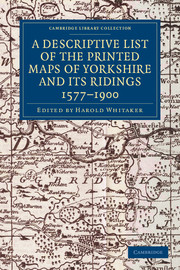
Originally founded in 1863 to promote interest in the history and archaeology of the Huddersfield area, the Yorkshire Archaeological Society expanded its purview in 1870 to cover the whole of Yorkshire. In 1884 it began publishing its Record Series, which aimed to make historical information available through the reprinting of original documents, diaries, letters, and charters. First published in 1933 and reprinted for the society in 1971, this well-illustrated work is an extensive catalogue of maps of the Yorkshire area, drawn between 1577 and 1900. The editor's introduction sets the maps within the history of cartography in Britain, and in the context of pioneering work by previous cartographers. The entries give a description of what each map depicts, along with information on dates and dimensions. This work remains a valuable resource for local historians and geographers.
Contents
Metrics
Altmetric attention score
Full text views
Full text views help Loading metrics...
* Views captured on Cambridge Core between #date#. This data will be updated every 24 hours.
Usage data cannot currently be displayed.
Accessibility standard: Unknown
Why this information is here
This section outlines the accessibility features of this content - including support for screen readers, full keyboard navigation and high-contrast display options. This may not be relevant for you.
Accessibility Information
Accessibility compliance for the PDF of this book is currently unknown and may be updated in the future.

