


Introduction
The 1960 Expédition Antarctique Belge (Leader G. Derom) was organized by the Centre National de Recherches Polaires de Belgique. The expedition’s headquarters, Base Roi Baudouin (lat. 70° 26′ S., long. 24° 19′ E.), were constructed by the 1968 Expédition Antarctique Belge (Leader G. de Gerlache). The programme of the expedition included geological and gravity reconnaissance surveys of the Sør-Rondane, for which the author was responsible. Geodetic and topographic work by K. V. Blaiklock provided basic data for the author’s surveys. A combined programme of ice thickness by gravity measurements and ice-movement measurements was carried out by the author and K. V. Blaiklock. Other sledging companions during the 1960 Expédition Antarctique Belge were S. Berckmans, J. Verheye and L. Goossens. “Transport by dog sledge was supported by aircraft.
The Sør-Rondane forms a 250 km. long, east—west, wedge-shaped mountain range about 200 km. south of Base Roi Baudouin. The major glaciers draining the ice from the polar plateau subdivide the range into its major topographic units. Small local glaciers and ice caps, independent of the plateau supply, also occur within the range. Thinning of the plateau ice sheet has severed the ice supply for some of the glaciers and reduced the flow of the others. As a result of the reduction of the ice flow from the plateau many glaciers have disappeared completely. Parallel with the reduction of the plateau glacierization, the local glazierization has been reduced considerably. Many dry glacial valleys have been observed within the mountain range (Reference AutenboerVan Autenboer, in press). The ice mounds described here were observed during the reconnaissance surveys. Other field observations are now being prepared for publication by the author.
A map (scale—1:250,000), drawn from air photographs taken by the U.S. Navy Antarctic Expedition of 1946–47 (Operation “Highjump”) and published by the Norsk Polarinstitutt in 1957, proved to be most valuable during the field work. However, the altitudes have had to be changed considerably as a result of the triangulation and barometric profiles by Blaiklock (unpublished).
Ice Mounds
Ice mounds were seen in three separate localities in the Sør-Rondane mountains:
-
At the north-western extremity of Brattnipane, where an isolated mound, covered with morainic material and rising above the general level of a small ice surface within a moraine, was observed by the author.
-
On the south-east side of Gillockbreen. This was reported by K. V. Blaiklock, who later identified it with similar structures on photographs of the Gunnestadbre occurrence.
-
On the east side of Gunnestadbrecn, an active plateau outlet glacier. This occurrence was observed carefully and will be described more fully below.
The Gunnestadbre occurrence
In this area three ice mounds rise above the smooth horizontal surface of an “ice lake”. This ice lake is enclosed by a mountain cliff to the north-east, by the valley of an extinct glacier (unofficially called the “Jan valley”) to the south-east and by the bulging side of Gunnestadbreen with its lateral moraine to the west.
The small glacier in “Jan valley” disappeared completely during the recent glacial recession which has been generally observed throughout the whole mountain range. Its former presence is shown by a typical U-shaped valley, the bottom of which is covered by morainic material on which typical stone polygons have developed (Fig. 1).

Fig. 1. The “ice lake” al the bottom of the dry “Jan valley”, from the Smalegga ridge east of the ice mound occurrence. The “Gunnestadbre plateau” outlet glacier in the background ends on an ice fall bordered by the lateral moraine. The ice mounds cannot be distinguished in this photograph
The gap created by the withdrawal of this glacier has been partly compensated by the slow-moving Gunnestadbre (maximum speed observed was 40 m./yr. for the period 1959–60; a maximum ice thickness of 1,100 m. was estimated from gravity measurementsFootnote *).
The lower part of “Jan valley” is a gently rising moraine-covered area, which lies approximately 70–80 m. below the general surface level of Gunnestadbreen. The side of this glacier forms an advancing bulge and descends in an impressive cascade of crevasses and seracs terminating on a lateral moraine. The lowermost area, bordered by the lateral moraine of Gunnestadbreen and the rising valley floor, disappears beneath a blue, icy, partly snow-covered, horizontal surface covering about 1 km.2 which was referred to as an “ice lake” (Fig. 1).
Three dome-shaped mounds rise above this flat surface. They are 15 m. in diameter and attain a maximum height of 2 m. These mounds are cut by a gently curving, generally north—south orientated, crevasse with its maximum width and depth through the apex of the dome. From this main crevasse secondary ones branch off at right angles. All the crevasses pinch out near the edge of the mound (Fig. 2).
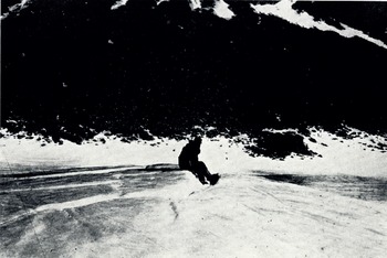
Fig. 2. Ice mound in the “ice lake”, showing radial and secondary crevasses
The ice composing the mounds appears to be much richer in air bubbles than the rest of the “ice lake”. A sample of the lake ice was taken and analysed for its 18O/16O isotopic composition by Professor E. Tongiorgi at the Laboratorio di Geologia Nucleare del Comitato Nazionale per l’Energia Nuclearc, Univcrsita di Pisa. The measured ratio was found to be lower than that of the other samples taken at this general elevation from the active mountain glaciers and to correspond with samples taken south of the mountain range on the southernmost rises towards the polar plateau (personal communication from E. Picciotto).
At the present stage of our knowledge this seems to indicate that the “lake” ice might be a remnant of the now extinct “Jan glacier” and that it might belong to an even colder climate before the present recession. The altitude of the “lake” is about 1,250 m. above sea-level.Footnote *
No meteorological observations were made in this area but the sledge parties noted no positive air temperature during the summer months of 1959 and 1960, and the mean annual temperature should be close to −25 ° C, as read from the map of the average annual temperatures in Antarctica (Wexler and Rubin, 1961).
Melt Phenomena
By analogy with structures generally reported from the Arctic and the tundra areas (frost mounds, soil blisters and pingos), the origin of the mounds must be sought in the expansion of a freezing volume of water internal to the ice. In the case of the pingos described by Reference MüllerMüller (1959) this freezing body of water either originates by the upward movement of sub- or intrapermafrost water or belongs to an unfrozen zone within the permafrost.
The extreme temperatures of the site make this origin difficult to accept in the present case. It should be remarked, however, that, although prevailing negative temperatures in this area are not usually associated with melt phenomena, they do not prevent the melting of snow and ice in limited quantities.
The large difference between the absorption of solar heat radiation and the conduction of this heat causes the ice to melt preferentially in areas of the rock wall exposed directly to the sun or around pebbles and boulders lying on or embedded in the ice.
Some of these phenomena observed in the Sør-Rondane will be described here since they might lead to a possible interpretation:
-
Occasionally the formation of a gap was observed along rock—ice contacts exposed to the sun. At Utsteinen one of these gaps was to cm. wide and continued downwards for 2 or 3 m.
-
In the case of an isolated pebble lying on the ice, water is often formed around it. Aided by its own weight, the pebble progressively sinks deeper and deeper with the water refreezing above it; however, the pebble remains surrounded by water produced by the hot-house effect. This has been observed to depths of over 1 5 m., and all intermediate stages are present.
Figure 3, taken near Bulken, shows the rose pattern produced by the progressive sinking of a wind-deposited pocket of gravel. This is similar to the cryoconite holes described by Reference GajdaGajda (1958) and others. Successive stages of sinking are marked by the annular dust layers retained at the edge of the pocket.
-
In the case of a moraine where the blocks are prevented from sinking, melting around a heap of boulders can be sufficient to produce a small stream of water. This was observed on Gunnestadbreen, where a small stream was flowing on a floor of gravel beneath a sheet of thin ice acting as a hot-house.
-
Where the moraine is still internal but only covered by a thin layer of ice, the higher parts of it are visible through the ice as darker circular zones. On breaking through one of these zones the morainic gravel was found lying in a small pool of water only a few centimetres below the surface. Between the gravel and the overlying ice there was a gap of a few centimetres. This is another typical example of melting by the hot-house effect. Figure 4 shows this zone when it had been partly broken through, disclosing the underlying gravel and water.
These zones are especially frequent along the east sides of Gunnestadbreen, Gillockbreen and Ellisbreen where no superficial snow cover exists. They are aligned along the glacier sides parallel to the irregularities of the rock walls, thus clearly indicating their relationship to the lateral moraines.
-
K. V. Blaiklock has reported a considerable area of smooth ice, covered by water 5 cm deep, on the western side of the northern nunatak of Perlebandet, between peaks “1790” and “1890” on the Norwegian map. This water has formed from melting of ice at the end of a small glacier snout terminating on a moraine before reaching the ice plain. The refreezing of the upper layer of water did not prevent the underlying water from being further supplied from underneath. The “Jan ice lake” might well have been formed in a similar way, the small relict glacier which provided the melt water having now disappeared completely.

Fig. 3. Cryoconite hole with rose pattern produced by the sinking of a wind-blown pocket of gravel. The annular dust layers at the edges show the intermediate stages.

Fig. 4. Dark circular zone above underlying maraine, photographed in Gunnestadbreen. This zone is partly broken through, showing the underlying gravel in wader produced by the hot-house effect
Discussion
These examples of limited melting suggest a partial explanation for the volume of water which could produce the mounds by refreezing.
Melting by the hot-house effect may have started above the higher hillocks of the moraine beneath the ice, but this does not appear to be sufficient to produce the required quantity of water to raise the mounds. The rest of the water must have been produced by the hot-house effect on ice free of rock fragments, as in the case analysed by Reference TakahashiTakahashi ([1960]), in a less severe climate. He has reported the formation of puddles on the sea ice near “Syowa” (the Japanese station). Solar radiation is absorbed by ice and water from the surface to a fairly great depth, whereas nocturnal radiation is emitted only from a thin surface layer. The snow begins to melt and as the proportion of water increases the hot-house effect correspondingly increases.
Although this phenomenon was observed in a less severe climate, it might be supposed that it could also occur in the more severe conditions of the “Jan valley” ice lake, once melting had been initiated above the highest moraine hillocks. Once water had formed there, the phenomenon could be accelerated and the pool thus created would drain the small quantity of water necessary to increase its volume from the surrounding ice, where the hot-house phenomenon, in the absence of the morainic “catalyst”, would be active at shallower depths.
On refreezing, the increased quantity of ice could only expand one way: upwards through the overlying layer of ice. Further evidence of this origin is the fact that three ice mounds were observed in this same frozen lake, whereas the pingo-type structures are usually limited to one in a particular lake.
The absence of ice mounds formed from the puddles at “Syowa” must be due to the greater mobility of the sea ice and the fragile ice layer in which they would refreeze.
As to the age of the ice mounds, some relation to the unusually warm years of 1946–47, as recorded in the ice layers found in the glaciological pit and the deep bore hole at Base Roi Baudouin (personal communication from E. Picciotto), must not be excluded.
Acknowledgements
The author wishes to express his gratitude to his sledging companions, to Professor de Béthune of the Université de Louvain for his valuable advice, and to Mlle P. Doyen of the Centre National de Recherches Polaires de Belgique who undertook a large part of the bibliographic research.


