

Introduction
Glacial change, particularly in mountainous regions, is a sensitive indicator of global climate. It has been suggested that further shrinkage of glaciers must occur with a warmer climate (Reference Oerlemans and FortuinOerlemans and Fortuin, 1992; Reference Dyurgerov and MeierDyurgerov and Meier, 2000), and many mountain glaciers will disappear during this century in a warming climate scenario (Reference Haeberli and HoelzleHaeberli and Hoelzle, 1995; Reference ShiShi, 2001).
According to the Chinese Glacier Inventory (CGI; Reference Wu and LiWu and Li, 2004), there are 46 252 glaciers in China covering an area of 59 402 km2. The total glacier area in China is about 8.7% of the global area covered by glaciers (680 000 km2) outside Antarctica and Greenland (Reference Meier and BahrMeier and Bahr, 1996) and 47.6% of the area covered by glaciers in Asia (124 900 km2). Glaciers can indicate regional and global climatic change and they can serve as the major water source and runoff recharge for the arid and semi-arid regions of western China. But, in recent years, glacier shrinkage has been speeding up in such mountain areas as the Himalaya, Qilian Shan and Tien Shan (Reference ShiShi, 2001).
The Himalaya is an especially sensitive area for global climatic change (Reference ThompsonThompson and others, 1989). It contains one of the largest concentrations of glaciers outside the polar regions and glacier changes are thought to be more rapid in the Himalaya than in many other places because of the extraordinary warming trend evident on the Qinghai–Tibetan Plateau. These changes are expected to continue during this century (Reference Ageta and KadotaAgeta and Kadota, 1992; Reference Nakawo, Fujita, Ageta, Shankar, Pokhrel and TandongNakawo and others, 1997). In addition, glacier retreat in the Himalaya will potentially influence human welfare in downstream regions because it will result in glacial lake outburst floods, which often have catastrophic effects on the community, economy and sustainable development of Nepal. Supported by the United Nations Environment Programme, the International Centre for Integrated Mountain Development has launched projects to study glacier change and to identify the potentially dangerous glacial lakes in the Hindu Kush–Himalaya (Reference Mool, Bajracharya and JoshiMool and others, 2001). The work presented here is a report of one of those projects. The Pumqu river basin was chosen as our research area. It is located in the southern part of the Tibetan Plateau, neighboring Nepal. The geographic extent is 27º49′–29º05′ N, 85º38′–88º57′ E, with an area of approximately 25 307 km2 and a mean elevation around 4500 m (Fig. 1). There are a large number of glaciers covering an area of about 1400 km2 and more than 200 glacial lakes. According to the guidelines of the World Glacier Inventory, the whole basin was divided into five subbasins with codes 5O193, 5O194, 5O196, 5O197 and 5O198 (Fig. 1).

Fig. 1. Map of the Pumqu river basin, Tibetan Plateau, showing the different sub-basins.
Data and Methods
The data used in this work include:
-
1. Fifteen topographic maps at a scale of 1 : 100 000 and 47 topographic maps at 1 : 50 000, based on aerial surveys from 1974 to 1983 (Table 1). These were used as the baseline to study glacier change. These maps were also the ‘working’ documents of the CGI, and the glacier outlines on these maps were refined with the help of aerial photographs taken from 1970 to 1980 (Table 1). Thus, the glacier outlines on the topographic maps reflect the state of glaciers in the 1970s.
Table 1. The type, scale and year of data sources for the 1970s glacier inventory

-
2. CGI XI (Reference Mi, Xie, Luo, Feng, Ma and JinMi and others, 2002) was used as a complementary data source.
-
3. Sixteen scenes of Advanced Spaceborne Thermal Emission and Reflection Radiometer (ASTER) images, mainly in October 2001 with low cloud cover, were acquired. The regions where the ASTER images are unavailable were covered by two scenes of the China–Brazil Earth Resources Satellite (CBERS).
-
4. A digital elevation model (DEM) derived by digitizing the contour lines from topographic maps at the scale of 1 : 50 000 was generated to derive relative parameters.

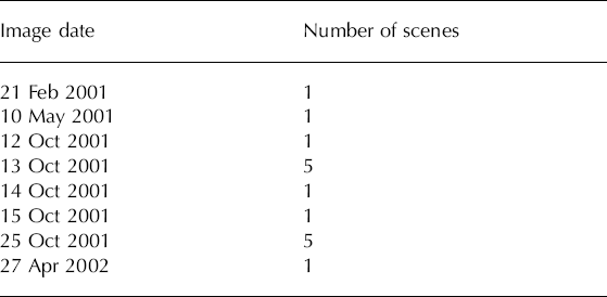
The ASTER and CBERS images with low snow cover that are free of cloud are suitable for identifying glaciers. Least snow cover generally occurs during the summer from June to August in the Himalaya. But during this season, monsoon cloud always blocks the view. In this work, most of the images were acquired in October 2001 under conditions of low seasonal snow cover and little cloud (Table 2).
Table 2. ASTER image dates
False-color composites were produced using ASTER L1B data with 15 m resolution and CBERS. Geo-reference was performed using Earth Resource Data Analysis System imagery. The registration accuracy was within one pixel in most regions. The glacier outlines in the 1970s were obtained from the ‘working’ topographic maps and those in 2001 were derived from ASTER and CBERS images by manual interpretation.
Glacier attributes of the new inventory, especially those that are relatively stable (e.g. orientation and glacier type) were duplicated directly from the old inventory. Parameters related to height (e.g. the highest elevation, mean elevation and elevation of glacier tongue) were obtained from the DEM by overlaying the glacier outlines. Glacier area was computed using ArcView.
We used manual interpretation in this work which, though low in efficiency, is considered a more accurate but less objective method. There may be misinterpretation resulting from snow cover, debris cover and shading, so experience and knowledge of the physical characteristics of the glaciers are necessary. The texture and distribution characteristics of snow and glacier ice are important indicators for the interpretation. Glaciers appear white to light-blue in color, with linear and regular shapes having fine to medium texture. The distinct linear and dendritic pattern associated with slopes and valley floors in the high mountains covered with seasonal snow can be distinguished from glaciers.
Debris cover is an issue because of its spectral similarity to the surrounding terrain (Reference Williams, Hall and BensonWilliams and others, 1991; Reference Paul, Kääb, Maisch, Kellenberger and HaeberliPaul and others, 2002). In this work, using manual interpretation, we were able to detect some of the moraine-covered glacier ice using experienced-based indicators such as white to light-grey color and concave/convex surface.
Shading by terrain also influences the interpretation, especially in high mountain areas in winter, where and when terrain can cast strong shadows on glaciers. In this work, we rely on experience and old glacier inventories to deal with shadows.
Results
Data about glacier distributions and changes in the study area between the 1970s and 2001 can be summarized as follows:
There were a total of 999 glaciers in the Pumqu river basin in the 1970s. They were categorized into seven classes by area. The glaciers with areas <1 km2 made up 15.8% of the total glacier area, while larger glaciers >1 km2 accounted for 84.2% (Fig. 2). The results show that while small glaciers predominate in numbers, larger glaciers account for most of the total area.

Fig. 2. Pie chart indicating the proportion of (a) the total number of glaciers, and (b) the total area of glaciers, within each glacier size category (labeled in km2) for the Pumqu river basin in the 1970s.
Comparison of glacier area in the two periods shows that the glaciers are in rapid retreat (Table 3). Glacier numbers in the Pumqu river basin had shrunk to 900 by 2001, i.e. about 10% of them had disappeared. The total area was reduced by 9%. The total measurement accuracy depends on registration technique, the pixel resolution of the image and the accuracy of glacier position shown on the map (Reference Hall, Bayr, Schöner, Bindschadler and ChienHall and others, 2003). The area uncertainty due to registration (15 m x 15 m = 0.000225 km2) and pixel resolution (2 × 15 m x 15 m x vГ = 0.000450km2) (Reference Williams, Hall, Sigurdsson and ChienWilliams and others, 1997; Reference Hall, Bayr, Schöner, Bindschadler and ChienHall and others, 2003) is very small and can be ignored in the total uncertainty. According to the CGI, the uncertainty of the glacier area on topographic maps is <5%. So the total uncertainty of each sub-basin and the whole Pumqu river basin can be estimated by
Table 3. Glacier numbers and areas, and percentage changes in each sub-basin of the Pumqu river basin, for the period 1970s–2001

where S n is glacier area and n is number of glaciers.
As has been found by other investigators, the smaller the glaciers, the larger their percentage change in area (Reference ShiShi, 2001; Reference Kulkarni and BahugunaKulkarni and Bahuguna, 2002; Reference Paul, Kääb, Maisch, Kellenberger and HaeberliPaul and others, 2002). In Figure 3 the 797 glaciers with area loss noted in the 2001 inventory are analyzed. The results demonstrate the same findings, indicating the larger sensitivity of small glaciers to climatic effects. Most small glaciers in the region shrank drastically or even disappeared. The reason for the higher sensitivity of small glaciers is that when the equilibrium-line altitude increases, it can extend above the altitude of many of the small glaciers, whereas the debris on the tongues of large glaciers often prevents them melting.

Fig. 3. Decrease in area of each class of glaciers (categorized by area) in the Pumqu river basin between the 1970s and 2001.
Discussion and Conclusions
Glaciers change as a consequence of climate fluctuations. Among many factors, snowfall and summer temperature are the two major ones controlling glacier development on the Qinghai–Tibetan Plateau. Summer temperature dictates ablation, while snowfall influences accumulation. Investigations have shown that the increase in air temperature during the last century has started to affect glaciers in the Himalaya (Reference Shi, Huang, Yao and DengShi and others, 2000; Reference Kulkarni and BahugunaKulkarni and Bahuguna, 2002).
There is only one meteorological station, Shegar (28º38′ N, 87º05′ E), in the study area. We collected annual mean temperature and precipitation data at this station from 1959 to 2000. There is a clear increasing trend in temperature while the annual precipitation varied significantly and showed a slight increasing trend (Fig. 4). Even when precipitation increases, in a climate-warming scenario it is possible for glacier recession to occur. The equilibrium line can be expected to rise by 100–160 m with the 1 ºC increase in mean air temperature from June to August. In order for the equilibrium line to remain unchanged, the annual increase in precipitation would need to be above 40%, even 100% (Reference KangKang, 1996; Reference Shi, Huang, Yao and DengShi and others, 2000). This kind of increase is almost impossible because the mean annual precipitation has been 247mm during the last 40 years. Thus, with the current temperature increase, the glaciers are expected to continue to shrink.

Fig. 4. Variations in annual mean air temperature and annual precipitation during the last 40 years at the Shegar meteorological station (28°38′N, 87°05′E; 4300 m).
The main consequence of glacier recession in the Himalaya is that glacier retreat might prompt frequent glacial lake outburst floods, often with catastrophic effects downstream. We investigated changes in glacial lakes in the region and found larger areas than in the 1970s. Among the 225 glacial lakes listed in the inventory, 24 in the Pumqu river basin were identified as potentially dangerous. Criteria examined included lake type, distance from the mother glacier, slope, change in rate of mother glacier, etc. (Reference Che, Jin, Li and WuChe and others, in press).
The work presented here shows that over the past 30 years the glaciers of the Pumqu river basin have been in rapid recession. The number of glaciers in the Pumqu river basin has decreased by about 10%, from 999 to 900 between the 1970s and 2001. The total glacier area has reduced by 9%.
Acknowledgements
We thank D.S. Mi for instruction in the manual interpretation of glacier data, and Scientific Editor R. Naruse and two reviewers for helpful comments. The ASTER images used in the work were provided by the Global Land Ice Measurements from Space (GLIMS) project. This work was supported by the National Science Foundation of China 90202014 and by the China Key Basic Research Project 2001CB309400.


