Introduction
Archaeological research in South Sudan has been almost non-existent, the exception being preliminary surveys conducted by the British Institute in Eastern Africa (BIEA) in the gap between civil wars in 19771981 (David et al. 1981; Reference PhillipsonPhillipson 1981; Reference Robertshaw and MawsonRobertshaw & Mawson 1981; Reference Robertshaw and MawsonMack & Robertshaw 1982) and more recent surveys of slave trading zara'ib (fortified camps) by Paul Lane (Lane & Johnson 2009). However, this limited data suggests that the potential for archaeological research in Africa's newest nation is huge and can contribute substantively to broader debates concerning a range of 'big topics' such as the emergence of complex hunter-foragers during the mid-Holocene, the spread of food production and metal working, agricultural intensification and the colonial encounter. There are also strong calls from within South Sudan for the development of national heritage and a national historical narrative (e.g. Jok Madut Jok 2011) as well as for the conduct of archaeological and heritage assessments in advance of rapid infrastructural development.
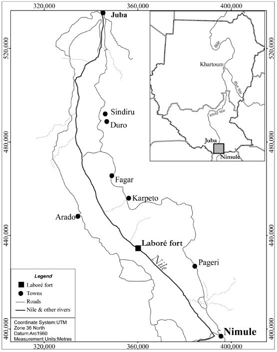
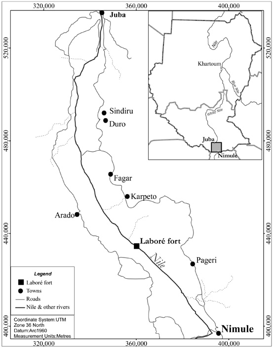
Most recently, Reference DaviesDavies (2009) was able to conduct preliminary archaeological surveys, as part of the Bahr El Jebel Hydroelectric Power Project, along the Juba-Nimule stretch of the Nile (Figure. 1). This located a wide range of sites, most notably a Turco-Egyptian garrison fort at Laboré which was among the stations established by General (then Colonel) Charles Gordon between 1874 and 1878, and governed by his successor Dr Eduard Schnitzer (Emin Pasha), 18791888 (Reference Mounteney-JephsonMounteney-Jephson 1890). This fort exemplifies the great possibilities for archaeological research in South Sudan but also the potentially contested nature of archaeological and historical accounts within the context of nation building.
Map of South Sudan showing location of Laboré garrison fort.
Gordon's fort at Laboré
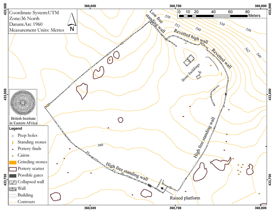
The Laboré garrison fort is a large structure with an enigmatic imperial history, which complicates its potential for development as South Sudan's first major protected historical monument. It is a drystone walled enclosure, sub-rectangular in shape, measuring c. 185 x 170m, located on a small bluff overlooking the Nile (Figure. 2). The drystone walling is substantial, commonly over 1.5m high, some 0.81m wide, and built of two rows of neat coursing enclosing a rubble core. A large rectangular raised platform with ascending ramp is built into the south-western wall and rises more than 2.2m above the present ground surface; it may have been a major gate. At irregular intervals small defensive 'peep-holes' are built into the exterior walls.
Map of Laboré fort.
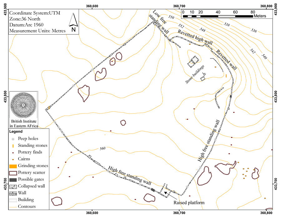
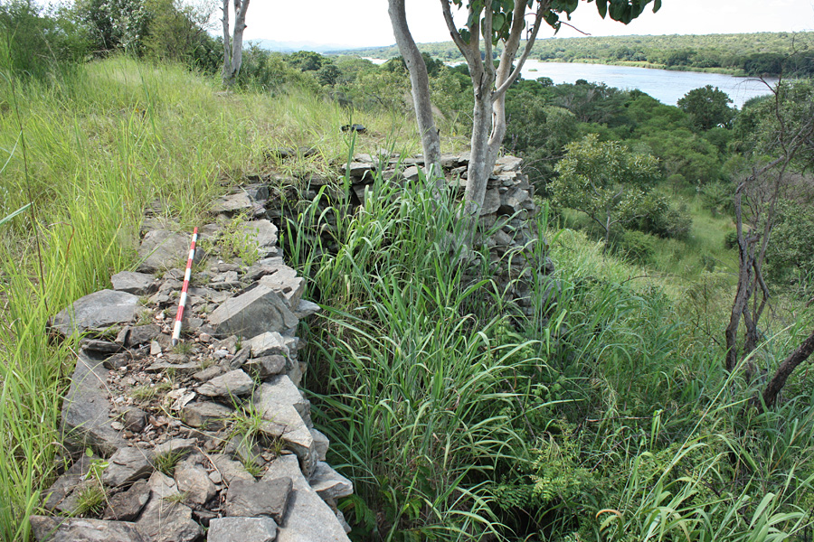
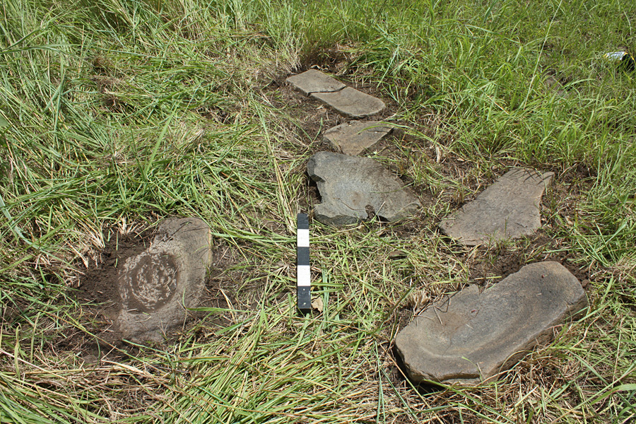
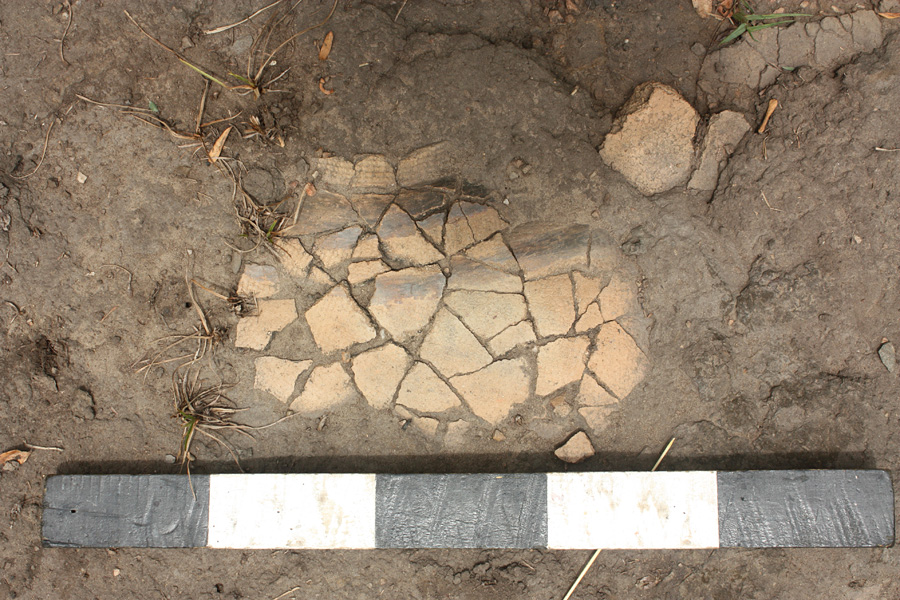
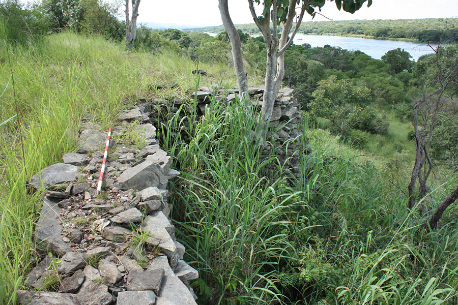
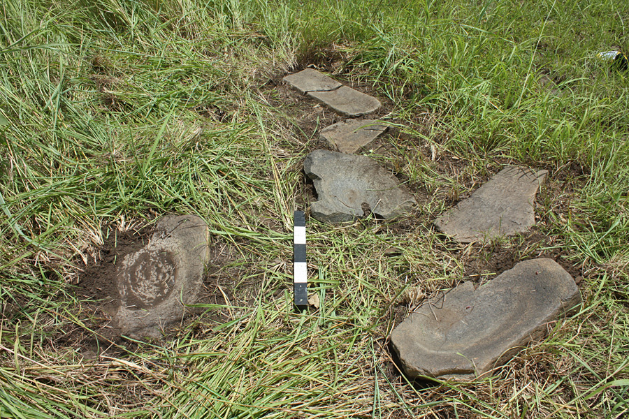
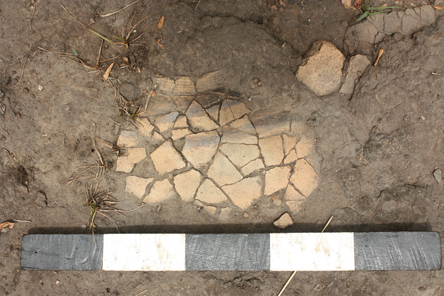
The north-eastern part of the site comprises a large raised natural 'platform' with external revetment some 4m in height and built up against the natural slope of the bluff (Figure. 3). On the interior edge of the northern platform are the substantial remains of two drystone buildings each measuring c. 6 x 6m, probably magazines. The large open central part of the site is densely vegetated but concentrations of local ceramics, burnt dagga (daub) and iron slag, as well as numerous grindstones were located. Most interesting are a concentration of at least seven grindstones and the remains of a near-complete locally made pot with roulette and graphite decoration (Figures 4 & 5). Small quantities of imported nineteenth-century glass and porcelain were also recovered. Together, this evidence suggests a sizeable population living within the walls and making use of local materials. The relatively low frequencies of imported glass and porcelain also tentatively suggest that there were few 'well-off' foreigners among the population.
Northeast revetment walls of Laboré fort, overlooking the Nile.
Local grindstones inside Laboré fort.
Local ceramics inside Laboré fort.
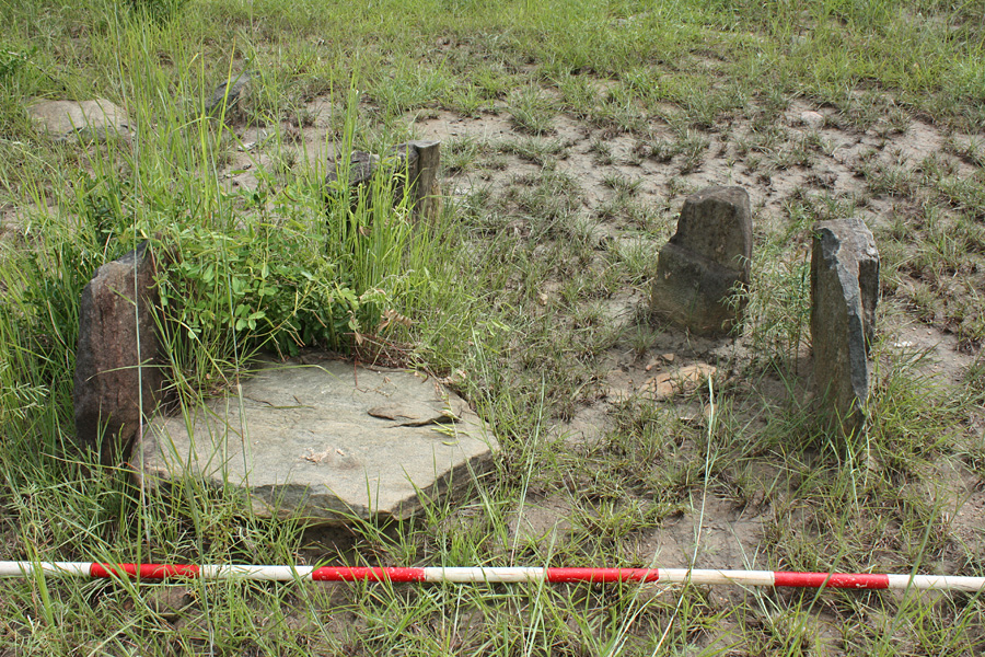
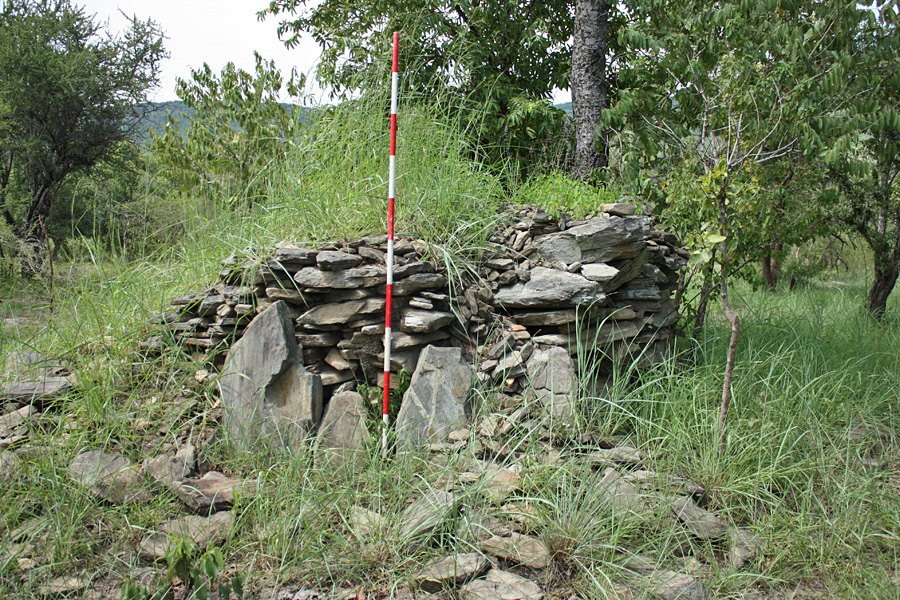
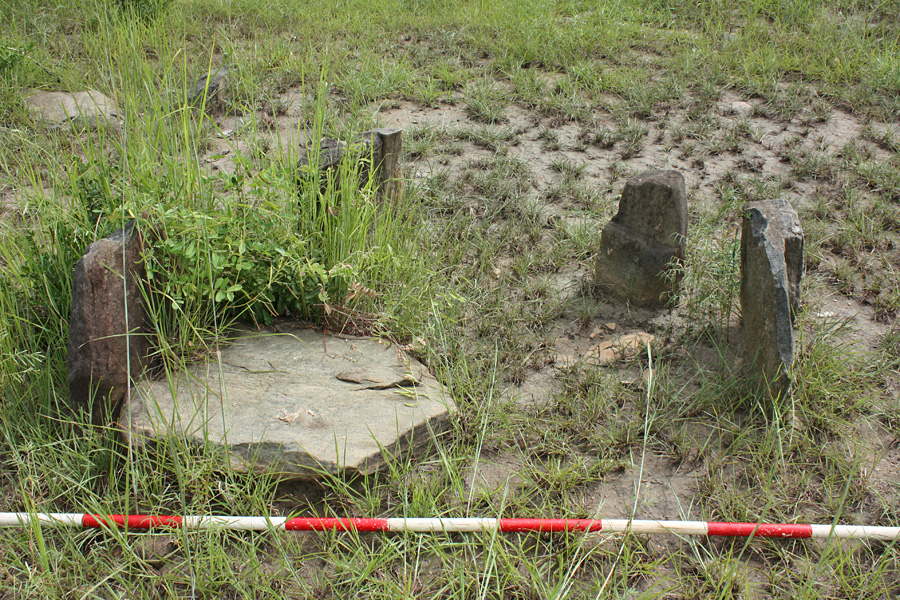
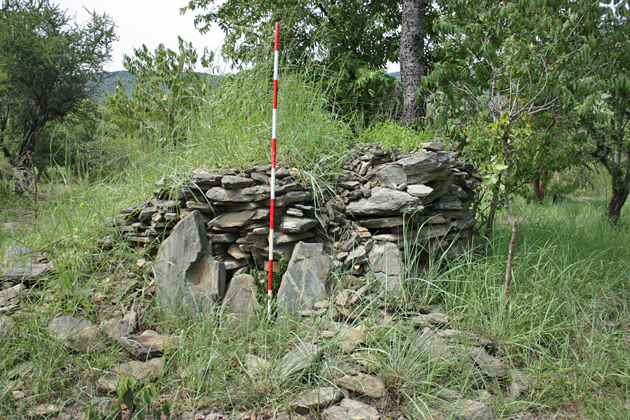
Extensive features relating to settlement and farming immediately surrounding the site were observed. The most common are circular or oval cairns consisting of small stones and loose gravel ranging in size from <1 to >5m in diameter. Numbers of standing stones with notched tops were found in circular or rectangular arrangements; by ethnographic analogy they appear to represent granary bases (Figure. 6). Also widespread are large neatly coursed drystone platforms, sub-rectangular in shape and generally 2 x 2m at their base and c. 1.5m high with a rubble core (Figure. 7). The purpose of the cairns and platforms is likely to be related to agricultural field clearance. One final class of 'agricultural' features, abounding in the area surrounding the fort, consists of stone field terraces, probably serving the dual purposes of field clearance and soil retention; they rarely exceed 0.3m in height and are roughly constructed of loose stones and gravel.
Granary bases outside Laboré fort.
Stone platform outside Laboré fort.
Overall, these features offer excellent potential to assess the extent of the population living within the immediate vicinity of the fort and therefore to explore the relationship between the fort and the local community. The agricultural nature of the surrounding population and the overlaps of material culture between interior and exterior suggest considerable interaction, and the likelihood that the surrounding community also played an important role in supplying the garrison. Reliance on the surrounding population would surely have become even more pronounced during the Mahdist uprising in the 1880s, when Emin Pasha's troops were cut off from their supply lines to the north.
Possibilities and pitfalls
The archaeological remains at Laboré offer an opportunity to develop broader accounts of late nineteenth-century Sudan. They offer the potential to explore relations between imperial forces and local people, and the legacy of this period for subsequent governance and state-making. However, the archaeological evidence may challenge or complicate prevailing attempts to construct national historical narratives. As Jok Madut Jok (2011:78), academic and senior official in South Sudan's Ministry of Culture writes, 'South Sudan's official history is a history from the perspective of victimhood... A history of victimization remained a very effective force for unity." The new government has dated this history of subjugation and exploitation by external forces back to 1820, when Mohamed Ali's invasion of northern Sudan heralded the southward expansion of slaving and imperial frontiers. To suggest then that the commercial and government garrison forts of the nineteenth century might have been dependent on local peopleand that the latter were not always simply 'victims'is controversial. Suggestions of local collaboration and support may well be less than welcome and a more standard account in which local voices remain muted might be preferred at local and national levels.
Laboré embodies some of the fundamental contradictions of archaeological and historical research in the context of nation building and reconstruction in the new South Sudan. The site does not tell one single story but can be made to tell multiple stories depending on one's stance. But accounts are inherently political and may be turned to a variety of uses. Indeed, our endeavour to address these multiple narratives may simply contribute material for others to use for their own ends. Ultimately our contributions to a national heritage in the new Sudan might be as divisive as they are unifying. This does not mean that we, and others, should not continue this work, only that we must be aware of the impact this research may have and actively engage with the various ways it is interpreted.
Acknowledgement
Thanks must go to the Government of South Sudan and to the Snowy Mountains Engineering Corporation (SMEC) for facilitating the survey work which was conducted as part of the Bahr El Jebel Hydroelectric Power Project. Also many thanks to all members of the survey team.