Introduction
The Discovery Programme, Ireland’s state funded research institute in archaeology, set out to examine the rich archaeological material emanating from Irish Lakes. In particular the Programme was interested in a further understanding of sites such as crannogs, landing places, monastic sites and fishing places. The overall aim is to get a better grasp of how people related to lakes at different points in time and how that connected to their dwelling activities.
In particular the project was set out to investigate through regional projects as well as a series of cameoprojects:
-
• patterns of long-term change and continuity in lake-settlement over time
-
• the diverse roles of lake-settlements in the landscape
The research portfolio
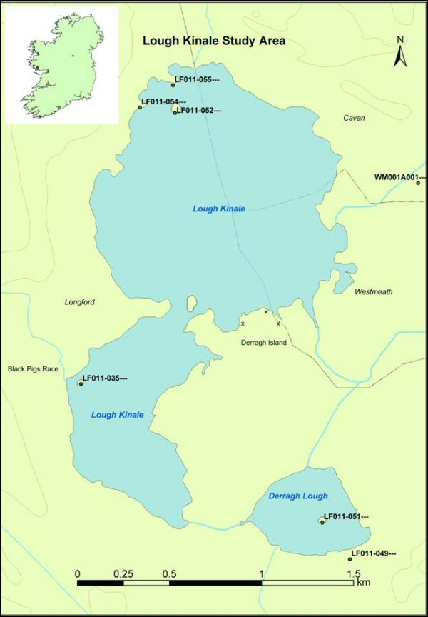
Kinale I One of the main parts of the Lake Settlement Projects research portfolio is Kinale I, which is a regional landscape study of the area around Lough Kinale in the Irish Midlands from the Mesolithic to the present (Figure 1). Lough Kinale was previously known for its collection of Mesolithic artefacts as well as for the rich early medieval items which derived from the lake’s three crannogs during illegal treasure-hunting activities. Among the artefacts were the Kinale bookshrine (Reference KellyKelly 1991), and a silver chalice and paten (Reference RyanRyan 1990). Kinale I is a multidisciplinary study that tries to understand the issues of long-term change and continuity in people’s activities centred on this lake (Reference FredengrenFredengren 2002a). The study shows that the major use of the lake took place during the Mesolithic period, while peoples’ attention turned elsewhere during the Neolithic, Bronze and Iron Ages with monument concentrations located away from the lake-lands and some of the megalithic tombs being deliberately placed so as to avoid a view over the lakes. The multi-proxy environmental study carried out by Exeter University also supports this interpretation. It was in the early medieval period that people returned to the lake with the building of crannogs and the opening up of the surrounding landscape. The Kinale I publication gives an account of our geomorphological investigations, the vegetation history, the interpretation of distribution of sites and artefacts on land and water, and a study of place-names and folklore (Reference FredengrenFredengren et al. in press; Reference BrownBrown et al. 2005; Reference O’BrienO’ Brien et al. 2005; Reference SelbySelby et al. 2005). The first project monograph will present these investigations and focus on issues relating to the formation of the lake-dwellers’ identity and social connections with the landscape (Reference FredengrenFredengren et al. 2004; in press).
Lough Kinale Study area.

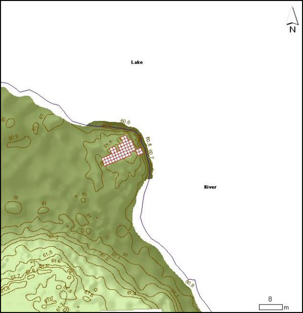
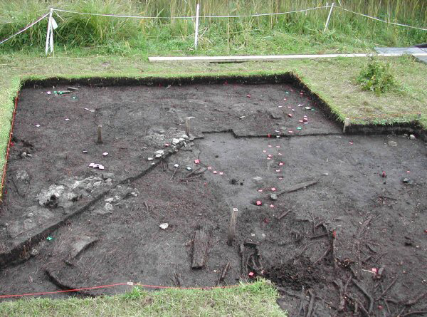
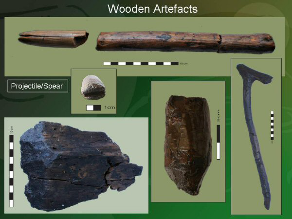
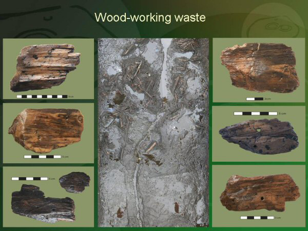
Kinale II - excavation of a Mesolithic site During the fieldwork connected with Kinale 1, the project identified a lake-platform from which the existing Mesolithic collection may derive (Reference FredengrenFredengren 2004; Reference Fredengrenin press (a); in prep). The platform (Figure 2) consists of numerous layers of stone, brushwood, peat and habitation debris (Figure 3). It was excavated from 2003-2005 and has given evidence for a settlement dating from around 5500 cal. BC which was being re-used and re-built until c. 4000 cal. BC. The site was also used in the transition to the Neolithic period. Post-excavation work is ongoing on both the lithic and wood assemblages. The large assemblage of worked wood presents an opportunity to discuss the Irish Mesolithic without lithics (Figures 4 and 5).
Topographical survey of platform, located where the lake meets the river and excavated trenches.

Excavation of the Mesolithic man-made platform at Derragh td. Co. Longford, Ireland (hearths and stake-structure).

Worked wood from the platform at Lough Kinale, Derragh td. Co. Longford, Ireland.

Woodworking waste from the platform at Lough Kinale, Derragh td. Co. Longford, Ireland).

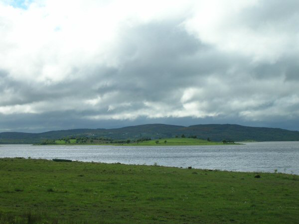
The Upper Shannon lakes The Lake Settlement project has carried out a survey of the lakes in the north-western counties of Sligo, Leitrim and Roscommon. The aim is to establish a broad comparison to the work carried out at Lough Kinale in the Irish midlands. A targeted research module which focuses on the social and religious aspects of lakes and lake-settlement in the transition between the Bronze Age and Iron Age and into the early medieval period has been formulated (Reference FredengrenFredengren 2007). The focus is Inch Island which is located in the centre of Lough Gara, Co. Sligo (Figure 6). Investigations of a crannog off the southern shores of Inch Island have produced structural dates from the Late Bronze Age, although Early Iron Age artefacts are also provenanced to the area. Underwater geophysics has been used to map the lakebed and identify and artifact depositions in the water.
Inch Island, Lough Gara, Co. Sligo, Ireland.

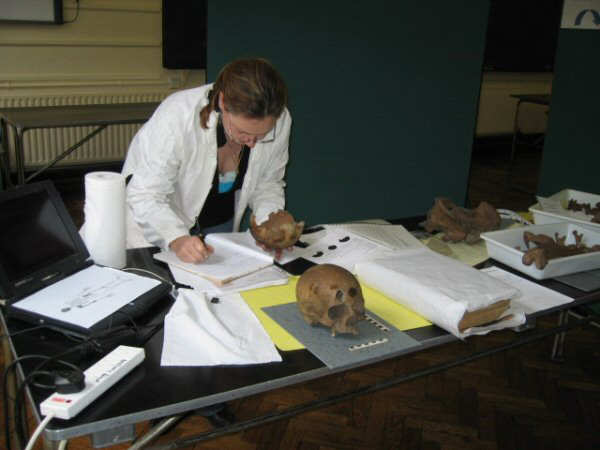
Islands of the dead During the work with the preparation of the book ‘Crannogs’ (Reference FredengrenFredengren 2002b) the connection between crannogs and human skulls was noted. The Lake Settlement Project has searched museum archives both in Ireland and Northern Ireland and managed to retrieve samples from about 70 individuals, all of which have been sent for radiocarbon dating (Figures 7 and 8). This year the project is working from with a landscape perspective, trying to identify patterns in artefact collections and monument placing at these find-spots. The Islands of the Dead cameo-project investigate the role of lakes and crannogs as places where human remains have been deposited and hence query the distinction between these sites as settlements or ritual places.
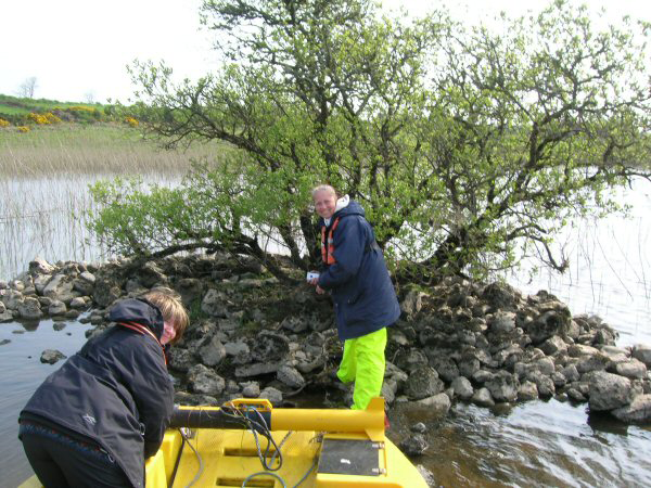
Underwater Survey, Ross td. Iron Age crannog, Lough Gara, Co. Sligo, Ireland.

Osteologist Patricia Lynch examining human remains from lakes.

Lisnacrogher In 2005 the project carried out limited fieldwork in the area from where the Lisnacrogher, Co. Antrim, Iron Age hoard was retrieved. A general landscape characterisation was made and through archival and map searches additional information about the connection between the hoard and a crannog was revealed. Issues about the religious meaning of lakes in late prehistory are approached (Reference FredengrenFredengren in press (b)).
The Lake Settlement Project: Dr Christina Fredengren (Project Director), Birgitta Larsson (Senior Archaeologist) and Claire Anderson (Research Archaeologist). Environmentalist: Dr Ingelise Stuijts.