

Before the twentieth century, irrigation ditches (or acequias, zanjas, canals)Footnote 1 carried water through nearly every city in the arid U.S. West (Figure 1). They supplied water for every purpose, household as well as irrigation, urban as well as agricultural. Proto-modern water mains began delivering in most cities in the mid to late nineteenth century, making ditches obsolete according to accounts both then and now. Yet in every city they lasted longer than expected, by decades at least, and in many cities ditches still flow well into their second century of ostensible obsolescence. They are remarkably persistent considering that water was and is scarce and contested. This article examines the persistence of the urban ditch waterscape, based on detailed study of San Antonio, Texas; Los Angeles, California; Salt Lake City, Utah; and Phoenix, Arizona.Footnote 2
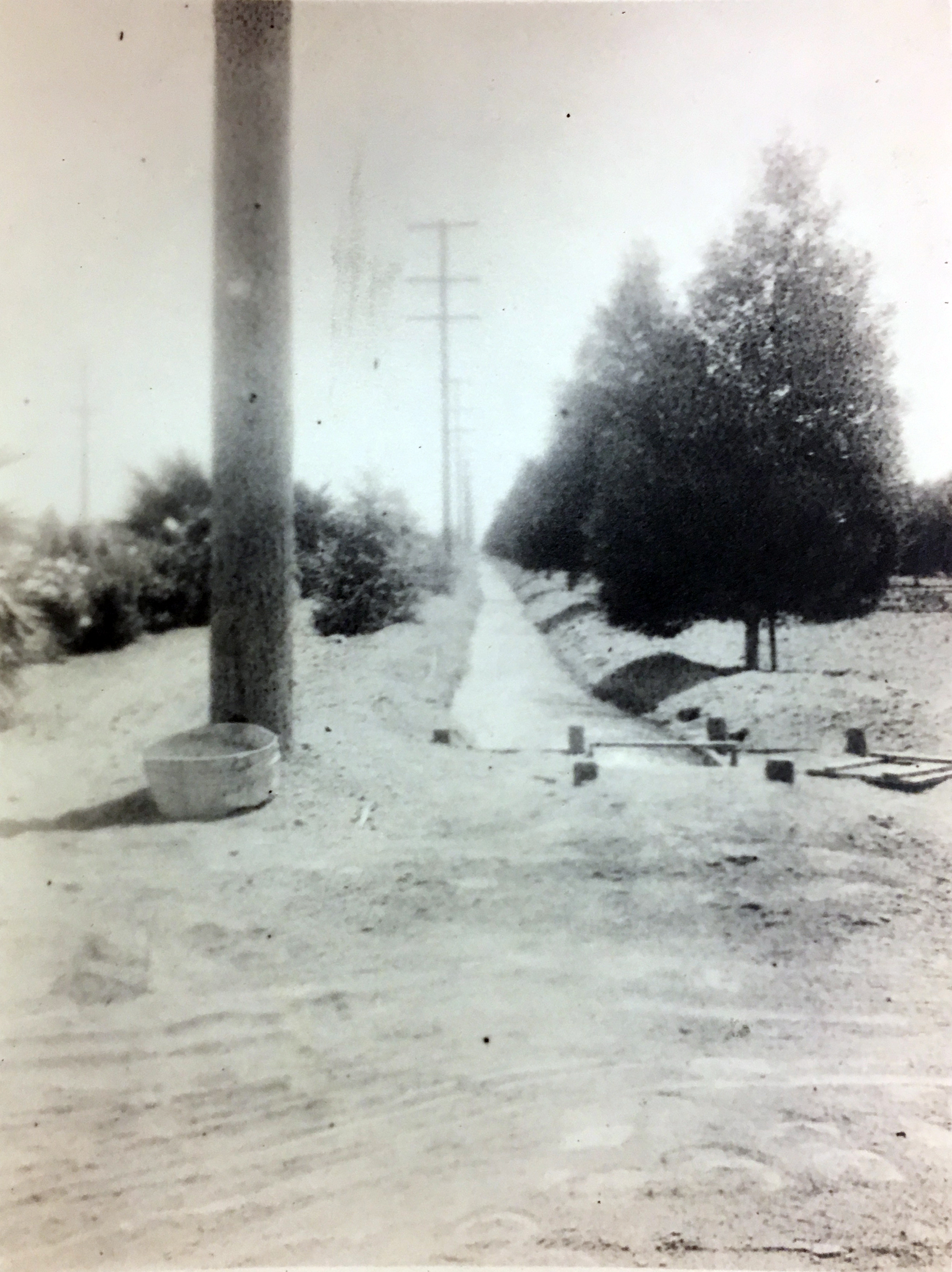
Los Angeles: Zanja 8-R along Figueroa Street, c. 1890 (detail). C. C. Pierce collection, Huntington Library, San Marino, CA.

This was a waterscape of profound strangeness in a U.S. context, to our eyes today and to contemporary observers from back East. Little channels, often along one or both sides of every street, flowed with clean water. Yes, “clean” could be a relative term, but if “ditch” conjures a mental image of drainage and waste then you don’t yet have the picture.Footnote 3 For Spanish colonial settlers and some of their Indigenous predecessors, these were traditional landscapes embedded in traditional culture of how to make, use, govern, and understand them. But most Western cities had no Hispanic roots, and even in San Antonio and Los Angeles, by the 1870s Anglo migrants dominated the economy, administration, and soon most of the landscape. No Anglo settlers came from ditch landscapes, none considered them normal, they were part of no Anglo culture. These people came from or they aspired to piped water supply; water brought through a ditch violated norms and expectations. Nonetheless they found themselves digging and using ditches that they told themselves were temporary. They adapted ditches to every urban water supply purpose.
Later, as water mains proto-systems were launched in each city, reality began to align with hydraulic expectations. Water could be summoned through a pipe in one’s home or business—modernity achieved! But ditch networks continued growing, alongside the mains, as a complementary urban water supply. This detour from modernity continued to prove expedient, which is not so surprising; early water mains were in no way prepared to take over delivery to all ditch functions, nor to all their service area. These channels did more than deliver water; they shaped settlement patterns, choreographed daily rhythms, and created distinct urban ecologies. The ditches carved pathways that humans followed, fostered microclimates that made desert cities livable, and sustained ecosystems that resisted erasure even as modernity promised total control over water’s flow. Water’s material presence throughout the urban landscape shaped what was possible in these cities.
The advent of a mains system, and efforts to build it out, tended to eclipse ditches in public policy attention. The ditch network, even as it grew, faded from the prospective view of urban residents, especially elites, who were both promoters and early adopters of mains water. Residents who continued using ditches as their source of domestic water dropped thoroughly out of view, to the point of denial that they existed (with some middle-class exceptions, such as the east side of Los Angeles, and the Nineteenth Ward in Salt Lake City). Ditches’ invisibility to planners may have helped make them available for continuing bottom-up adaptation to new urban uses such as industrial process water.
Adaptation was easier for ditches because unlike mains they were unpressurized—this wonkish distinction is important for understanding users’ relationship with the technology. Pressurized water must inherently remain apart from people, invisible until it appears in their unpressurized world, out of a tap or a sprinkler head. Unpressurized water is water in the world. It moves by gravity. The ditch may be covered in a culvert or a pipe, and many eventually were, but this was fundamentally different from a water main. Unpressurized water can reappear in the open, in a junction box or an open channel, for a foot or for a mile.Footnote 4 Individual users, and often whole branches, usually took delivery on a schedule. Thus many of these channels regularly and predictably sat empty, available for manipulation. While mains were hidden underground and obscured by “the relatively arcane nature of civil engineering discourse,”Footnote 5 ditches were accessible, both physically and conceptually. They were hackable.
The growth of this hybrid infrastructure, and its waterscape of urban ditches, brings us to the point where this article’s story begins. Let’s call it Peak Ditch, the time when a city’s ditch network was at its most extensive and its greatest visibility throughout much of the urban fabric. This time was a period not a moment, and varied for each city.Footnote 6 But in each city there came an inflection point when urban ditches began to be abandoned more than extended, when the primacy of water mains became more than rhetorical. In broad outline, this time came when urban development displaced urban agriculture over large enough areas that parts of the ditch network lost their largest users, and when the mains system really was mature and extensive enough to begin providing for all urban purposes, including irrigation. Branches and whole ditches began to be shut down, and urban ditch waterscapes began to shrink.
Most urban ditches eventually disappeared, in many neighborhoods rapidly and completely. But in others they proved persistent. This is notable because ditches are networks. They are not like wells or cisterns, which may be maintained through decisions by individuals. Ditches in an urban setting require continuing communal effort for maintenance and operation, and often episodic efforts to sustain increasingly contested rights to water and public space. Ditch delivery requires more effort from users than taking water from a tap, often much more effort as users may be the ones maintaining, operating, and defending the system. Complicating the story, as I will explore below, is the particular interplay between forces that worked to make ditches go away, and users and others who wished to keep them.
The reasons for this long, unexpected, and unheralded persistence were, first, ditches’ continuing utility to their users, and sometimes to those who controlled the urban mains systems. Then, unfolding over many decades, some factors shifted in favor of the ditches that still survived. The quality of their water improved as urban sanitation improved and ditches, along with other urban waterways, served as sinks less often and for less noxious wastes. This augmented their utility, and also allowed shifts in expectations and values. More urban residents began to view ditches as amenities, or sought to make them so, including the recreational amenity of larger canals as rights-of-way through the urban fabric. Some came to be seen as heritage—initially only a few selected acequias, eventually most surviving ditches. Finally, ecology came increasingly to be valued, and perceived not only in wilderness but urban settings, where some flowing ditches supported riparian ecosystems, at first unintentionally.
•••
The urban waterscape of ditches is largely lost to historical accounts, a footnote on the way to modern water systems. Historians, like contemporaries, mostly took their narratives from the boosters who promoted the new thing. Historians, paradoxically, are future-focused—we like beginnings. As Svante Lindqvist observed, historians of technology mainly center their accounts on episodes of innovation, rather than the longer periods of coevolution of new and old systems. David Edgerton and Elizabeth Shove advise looking instead at technology-in-use, foregrounding users rather than providers.Footnote 7 This approach shows that the displacement of one incumbent technology by another, for example gas lighting by the incandescent bulb, typically takes half a century and involves complex give and take among providers and users of the two systems.Footnote 8
But urban historians writing about Western cities, if they wrote about urban ditches at all, usually ended their accounts at the advent of mains water. “Water plurality”—multiple redundant infrastructures simultaneously supplying water for different purposes—was a pre-modern norm in cities around the world, and it did not end with the first pressurized mains.Footnote 9 Plurality is a user-centric perspective, and it has not been part of most urban water history in the U.S. West.Footnote 10 Zooming out from cities, the regional historiography of water has traditionally been about agriculture or big engineering. Big engineering means federal Reclamation and epic municipal projects such as William Mulholland’s Los Angeles Aqueduct. Earlier technologies are often treated as prologue, and their persistence as epiphenomenal.Footnote 11 Zooming out once more, to recent scholarship in the global history of urban water, one theme is “hydro-modernity.” These writers examine the power relationships of engineered urban water, and its cultural assumptions: the superiority and inevitability in each city of a single universal source of uniform water; the taming of unruly nature by rational science; the necessity that production be centrally controlled by experts, separated from consumers who become passive recipients. These accounts are sometimes attentive to the interplay between modernity and earlier systems, though usually elsewhere than in cities of the Global North.Footnote 12
Some authors have begun to create histories with room for the American urban ditch waterscape. New Mexico has its own literature, with a fine-grained focus on traditional acequias, their users, and their persistence to the present, and Phoenix’s canals are so conspicuously present that they are hard to ignore. Environmental historians are not so distracted by hydro-modernity as were an earlier generation of urban historians.Footnote 13 But these works still have limitations. Most are single-city studies. Many focus on water supply not users or landscape. And too many authors are still ready to accept conventional narratives about the obsolescence and decline of ditch systems.
In this article, I take a cultural landscape view of the city, and a socio-technical view of infrastructure.Footnote 14 What these approaches share is an explanatory framework looking to broad categories of actors, human and non-human: water managers acting through networks of institutions, ordinary individuals exercising their agency, however modest, with cumulative effects; inanimate actors such as the water in the ditch, the various artifacts that may or may not control it, the cottonwoods that may or may not have been planted, the unruly river. This need not mean investing these things with volition or intention, only that they are reckoned as actors because their actions do not always respond to human intentions. I take a longue durée view, and I look particularly to the agency of users, not because they are the most important actors (sometimes they are) but because their role is most often neglected.Footnote 15
•••
This article’s subject is a counternarrative of persistence, the story of ditches after Peak Ditch. I begin with brief summary narratives of water systems in the four case study cities; the concept of Peak Ditch will serve as a benchmark for comparing their asynchronous chronologies throughout the rest of the article. Next comes a tour of the Peak Ditch waterscape, the urban uses to which ditch networks had been adapted, and their place in the experience of the city. Then comes a review of the forces that worked toward the elimination of these water systems, which track closely with the claims of hydro-modernists. The longest part of the article will consider the reasons that this modernist transition has remained incomplete, including old factors about the ways these systems worked and continued working, and new ones that gave them additional functions and reasons to persist. Finally, the article will end with reflections on better framing the history of urban water technology and waterscape in the West.
Four Western Cities
San Antonio and Los Angeles each were founded as part of the Spanish crown’s efforts to reinforce the farthest frontiers of its empire. San Antonio was established in 1718 and grew by the 1730s to a pueblo and five missions, each with their own acequias drawing from a lush little river fed by powerful springs. A century later it became a frontier of the American empire, and then grew as a culturally hybrid city within the U.S. economy. Anglos expanded the network of urban ditches. In San Antonio, Peak Ditch came in the 1880s, with decline of the acequias hastened through dewatering of springs by artesian wells, including for the city’s water mains system. The last urban acequia closed in 1912. Some mission ditches, downstream on a better-watered part of the river, today within the city limits, continued flowing. Two of them still do.
Los Angeles, founded in 1768, remained remote after it was taken by the United States, as growth in the new state of California centered on gold discoveries in the north. By the 1870s, Los Angeles (L.A.) began its first wave of a new kind of urban growth boom, amenity-driven migration not as a seasonal resort but as a primary residence. As in San Antonio, Anglos expanded the network of ditches—here called zanjas—that they inherited from the colonial pueblo. Of the four cities, Peak Ditch came earliest in Los Angeles, in the 1870s and 1880s, and the end came faster and more deliberately. William Mulholland shut off the zanjas on May 31, 1904, in order to take the entire flow of the Los Angeles River into city water mains while he built the Los Angeles Aqueduct. But ditches in L.A. had a sort of afterlife in the San Fernando Valley, where Mulholland distributed Aqueduct water to farms through a new ditch network, small parts of which survived at least until the 1960s.Footnote 16
Salt Lake City was the first city in the arid West founded by settlers who did not come from an irrigation culture. Mormons who arrived in 1847 created a city, and a ditch network, bigger than San Antonio or Los Angeles by 1860. It differed from them in its distinctive American grid, with ditches laid out as a regular part of the streetscape. Since Peak Ditch at the turn of the twentieth century, municipal mains have grown through exchanges that supplied non-potable water for ditch irrigation in order to reserve good mountain water for the mains. Thus in suburbs and some parts of the city itself, neighborhoods continue to water yards and gardens from little street ditches.
Phoenix is the oldest and newest of the four ditch city cases. The Hohokam peopleFootnote 17 built and operated a network of canals in the Salt River valley for nearly a millennium until about 1450, supporting nucleated settlements comparable in scale and population to the Phoenix area in 1900. The city was refounded in 1867 as an agricultural supplier for Arizona mining districts. The valley grew around multiple centers—Phoenix, Tempe, and Mesa were the first—making a multi-nucleated metropolitan area today. By the 1880s, Phoenix canals achieved a scale unlike any other urban ditch waterscape.Footnote 18 The U.S. Reclamation Service, created in 1902, chose the Salt River Valley for one of its first projects, uniting the formerly private canals as a federal not municipal system. Phoenix’s Peak Ditch came later, in the early decades of the twentieth century. At least as late as the 1950s, new subdivisions were being built with yards designed for ditch irrigation through laterals that were increasingly put underground. Thousands of city residents still use them. The major canals have become the spine of a regional open-space and recreation network.
Other major cities in the region—Denver, Colorado; Albuquerque, New Mexico; El Paso, Texas; Tucson, Arizona—developed waterscapes similar in many aspects to the four above, each with its own variations and trajectory over time, as did many smaller cities where ditches are even more likely to persist.
The Peak Ditch Urban Waterscape
What did the Peak Ditch waterscape look like, how did it function, what was it like to live in these cities at this time a century or more ago? To begin with a measure of scale, Salt Lake City in 1910, at about Peak Ditch, held within its 45 square miles 390 miles of streets, and 557 miles of ditches. Denver counted more than 1,000 miles.Footnote 19
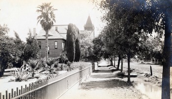
Ditches made oasis cities; that was their purpose. Anglos used them to recreate familiar landscapes of the humid East. Street trees were an Anglo project from the earliest days, and with their toes in the water the trees grew rapidly; a mature urban forest shaded much of the Peak Ditch city (Figure 2). Angelenos and Phoenicians by this time had also created an alternative cultural landscape of oasis exotica, palm trees and banana trees and bougainvillea, often side by side with replicas of East Coast streets and lawns.
Phoenix: Monroe Street, c. 1900. Barry Goldwater Historic Photographs, Greater Arizona Collection, Arizona State University Library, Tempe, AZ.

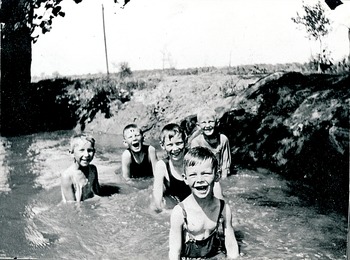
These landscapes served not only as cultural markers but as thermal mitigation. The arid West is often hot; trees provide shade and they cool through evapotranspiration. Ditch-side sites beckoned leisure activities such as picnics. In both San Antonio and Los Angeles, “Lovers’ Lane” referred to a path along a ditch.Footnote 20 Bath houses were constructed in each of the four cities to use ditch water. In San Antonio these took the form of little structures placed in the acequias by individual households, sheathed with fabric to cool by evaporation.Footnote 21 And everywhere, people swam in ditches (Figure 3).
The Whitney boys and their Michigan cousins swimming in Lateral 19, c. 1915. Glendale Arizona Historical Society, Glendale, AZ.

Agriculture continued to be integral to urban fabric well into the twentieth century, even in the East. In the sunny West, irrigation enabled intensive cultivation on small urban plots; orchards, vineyards, and kitchen gardens remained throughout most of the city, displaced only in the very core of downtown. Lands served by ditches were seldom fallow. Ditch deliveries by volume almost always went mainly to plants in the landscape, whether agricultural or ornamental.
Yet ditches also continued to deliver water for other domestic purposes. The rate of adoption of mains water varied considerably by city and neighborhood, depending on policy and pricing. Significant portions of the urban population remained outside of mains service areas, or within them but did not subscribe for reasons of expense or of preference.Footnote 22 If they did not take water directly from a ditch, they relied on wells which might be recharged by ditch seepage, or water vendors who might fill their carts at a ditch.Footnote 23
Ditches also brought water to animals. Urban agriculture included livestock, large and small, and even after the advent of electric streetcars, horses and mules remained the main source of urban motive power. The peak horse city came in the twentieth not nineteenth century, and animals needed water as they worked.Footnote 24 In the center, they usually drank from mains-supplied troughs. Elsewhere, there were ditches, sometimes deliberately arranged to be accessible to animals.Footnote 25
Ditches were enlisted to supply bulk water for a great variety of industrial and municipal purposes. In San Antonio, when acequias no longer watered horsecar horses, the Alamo Acequia cooled the boilers that powered electric streetcars.Footnote 26 Ditches provided power directly; in Los Angeles dozens of water wheels and small water turbines took advantage of even modest elevation drops in the zanjas.Footnote 27 Industrial users drew process water from them. When sanitary sewers were added to the portfolio of municipal infrastructure networks, ditches were adapted to provide water for flushing them.Footnote 28
Firefighting was one of the main logics for pressurized mains water, yet in all four cities, once firefighters had hydrants they discovered a need for auxiliary sources, often taking their supply from ditches. Many cities built cisterns beneath downtown streets; San Antonio filled these directly from acequias, and Phoenix from wells that produced water only when the ditches flowed. Los Angeles industries reduced their insurance rates by pumping zanja water into elevated tanks for fire suppression.Footnote 29 And in 1898, just six years before the zanjas were shut off, the Standard Oil refinery burned in L.A.’s then-largest fire ever, fought directly from a zanja.Footnote 30
Factors Working against Urban Ditches
What forces and interests operated to end this waterscape? The first of course was competition for water. As cities grew, droughts forced reckonings. Modern tap water demanded a consistent supply at all times, while ditches mostly delivered on particular schedules, which could be reduced in response to scarcity. In Los Angeles in the dry year of 1903, William Mulholland restricted the supply to zanjas, before shutting it off entirely the next year, accelerating the movement of agriculture out of the city to districts farther south that relied on groundwater.Footnote 31 But crises of water supply could play out in different ways. After Peak Ditch, droughts in Phoenix and Salt Lake City also resulted in tapping groundwater, but in ways that avoided conflict between mains and ditches.Footnote 32
A second competition was for urban space. In contrast to the competition for water, which played out episodically in large decisions from above, urban space was contested continually, generally at modest scales. Property owners sought covering, relocation, or abandonment of stretches of ditch that they found to be in their way. Many miles of urban ditch were “flumed,” put into channels with orthogonal walls, usually of wood, for small gains in usable space around them. People asked for innumerable bridges, for pedestrians and vehicles. All of these structures required maintenance, expensive in the aggregate. The San Antonio City Council performed a sort of cost-benefit analysis and found the whole system wanting.Footnote 33 Seepage, leaks, and overflows became another kind of urban space conflict, as gardens and orchards were replaced by dense urban land uses where excesses of water were not tolerable.
Safety, like leakage, was a perennial concern that grew in currency. Ditches always presented potential hazards, particularly for small children, livestock, and the inebriated. These hazards came to be deemed less acceptable as urban populations swelled with newcomers who were unfamiliar with ditches and did not use them. At the same time, the scale of change in the built environment made it seem increasingly feasible to engage in large-scale covering, fencing, or even elimination of the ditches.Footnote 34
Every urban waterscape was appropriated as a sink at some time and to some extent, and ditches were no exception. This conflict was inherent in traditional arrangements that welcomed some drainage as a supplement to the ditch’s supply. When most downstream residents were users of ditch water, their response was to seek an end to sources of pollution. As more of the population used mains or saw them as an alternative, they more often responded to contamination by seeking to eliminate the ditch itself.Footnote 35
And urban homeowners, once they felt they could rely on the mains supply, even without any other impetus increasingly chose to irrigate from a tap rather than from a ditch. This can be framed as a cultural preference for modernity—many of these consumers used such language themselves. But we can also listen to and respect user agency. Mains water could be more convenient, not only for the ease of directing it through a hose rather than through earthen channels, but also by being available on the user’s timetable rather than a watermaster’s delivery schedule.Footnote 36 Mains water, at first everywhere unmetered, often could be taken in greater quantity than ditch water that came in a larger flow but for a limited time.
These factors—scarcity of water and urban space, hazards of safety and pollution, and plain convenience—presented a formidable array of challenges. Taken together they reinforced a rhetoric of the inevitability of modern mains water, a uniform and pure commodity universally available at all times at all places in the city, requiring nothing of the user but to turn a tap (and pay a water bill, and support the investments and policies that enabled such a system). Between the rhetoric and the many practical logics, most urban ditches went away by about the middle of the twentieth century. But not all.
We come now to the heart of this article, the reasons for this stubborn persistence of ditches. Most important was their continuing utility, both in their long-standing roles and for newly conceived purposes. Ditches persisted also because water itself resisted complete control. Water seeped beyond intended channels, supporting volunteer cottonwoods, replenishing aquifers, maintaining flows in ways engineers had not designed. Water asserted drainage functions of ditches that planners had overlooked. In time people came to appreciate ditches’ unplanned utility. The persistence of ditches resulted from both water’s own agency, and the knowledge and habits through which people continued imagining ditch-based solutions for evolving needs.
The Continuing Utility of the Urban Ditch
Ditches still worked. By the time of Peak Ditch, in each city at least two generations had figured out how to make this water system do what they needed done. This knowledge, together with its tangible embodiment in a waterscape, made for “technological momentum.”Footnote 37 In its most basic form, this meant the maintenance of amortized investments—“if it ain’t broke, don’t fix it.” Small-scale agriculture continued through much of each city; where its arrangements were made around ditch irrigation, there was little incentive to make new arrangements around mains, especially when growers felt that urban growth might limit their future. Similar logic applied for the kitchen gardens of householders who could not afford mains connections, and for businesses whose little ditch turbines continued turning shafts or pumps. Technological momentum also refers to the momentum of an entire socio-technical system, extending to its continuing adaptation for new uses by new users, and even the creation of new ditch waterscapes. This momentum included urban ditch irrigation in new places and new manners, and water power in the new method of hydroelectricity. It included the paradoxical adoption of ditches as supply for mains, or in new arrangements that supplemented mains and ensured their supply. And finally it included ditches’ use as drainage, usually unintentional or unauthorized, but devilishly hard to stop.
A dramatic example of momentum was the post-peak creation of whole new ditch waterscapes. After urban ditches came to their early-twentieth-century ends in both Los Angeles and San Antonio, de novo ditch networks were constructed soon afterward in suburban areas. William Mulholland, the Shiva of L.A. zanjas in 1904, became the agent of their reincarnation in 1915. Once the Los Angeles Aqueduct brought water from the Owens Valley, Mulholland in just a few weeks had the eight-mile Zelzah Canal dug to distribute its water for agriculture in the San Fernando Valley. Land promoters and water users over the next year or two added dozens of miles of distributing ditches (Figure 4). This was first a matter of expediency; the water needed to be put to use promptly to protect L.A.’s water rights while the city grew into its new supply.Footnote 38 The San Fernando Valley makes its own mini case study of the tension between modernity and persistence: while the Los Angeles Water and Power Department quickly worked to replace its new ditches with pipes, the farmers who took the water continued for decades to move it through open channels, at least into the 1960s as the valley suburbanized around them.Footnote 39 In San Antonio, new suburban ditches were built by real-estate developers, for example in Collins Gardens. They were fed by artesian wells, and as in the San Fernando Valley, their logic was to make profitable agricultural use of land meant to yield its final crop through further subdivision.Footnote 40
Lateral No. 1, three miles long, looking east along Sherman Way, San Fernando Valley, photo by C. F. Outland, c. 1915–1917. Historical Society of Southern California Collection, Huntington Library.
Whole new systems such as these were rare, new users and new uses for existing ditches more numerous. As the east side of Los Angeles suburbanized, so many homeowners used Zanja 9-E for domestic water through their own pipes that the city reconstructed it at great expense to better suit this new use.Footnote 41 The city continued approving these connections, as well as new industrial uses, until just months before the system was shut off.Footnote 42
Irrigation was itself an evolving use. Its objects had always included ornamental as well as productive plantings; the proportions shifted over time. Kitchen gardens gave way to lawns; orchards and vineyards yielded to parks and cemeteries and golf courses. The users’ end of water delivery also changed. By the 1930s, Phoenix-area residential lots were graded into flat, shallow pans that could hold a sheet of water to flood irrigate lawns. A later innovation delivered the water not through a little ditch but a pop-up hydrant in the turf, like a bathtub drain that flows up not down (Figure 5). In recent decades in other cities, small electric pumps have allowed many residential users to apply their ditch water through sprinklers. This evolving micro-infrastructure in turn lessens the inconvenience of ditches relative to mains. In a final layer of social infrastructure, some Phoenix neighborhoods for a century have employed private watermasters who take care of the last-hundred-yards logistics, putting ditch irrigation on par with any other contracted yard care.Footnote 43
Flood irrigation of lawn in Tempe, c. 1960s (Salt River Project).

A novel use was hydroelectric generation. Sometimes this was a successor to earlier waterpower applications, as in Los Angeles where a seventy-eight-foot drop that once turned the shafts for a textile mill was converted to electric generation to power the same facility as an ice-making plant (the one exception to Mulholland’s zanja shut-off). But electricity also made energy portable, so that water power was not limited to sites next to the falling water. Dr. A. J. Chandler, who developed the town of Chandler south of Phoenix, used water dropping from one canal to another to generate electricity that the town used above the level of the higher canal to pump groundwater, with power left over to sell to Tempe and Mesa.Footnote 44 In Phoenix, Arizona Falls, a twenty-foot drop where the Arizona Canal crossed a formation of bedrock, remained a scenic curiosity until 1902 when generators made its power usable closer to town. By 1915, around Phoenix’s Peak Ditch, power plants on the canals produced almost as much electricity as the giant Roosevelt Dam.Footnote 45
The most consequential new use of ditches has been their enlistment as water supply for modern urban water mains. Despite the rhetoric of obsolescence, some mains systems did not so much replace ditches as absorb them. In Los Angeles, William Mulholland rebuilt the zanjas’ Main Supply Canal as the Main Supply Conduit for the city before his aqueduct was completed in 1913 (Figure 6). Phoenix since 1953 takes part of its supply directly from the Arizona Canal, as do other suburban municipalities. These moves refute any implication that all ditch water was necessarily of inferior quality. Phoenix treats its Arizona Canal water, but Mulholland took his water straight from the ditch, as an improvement over what was then flowing to Los Angeles taps.Footnote 46
Main Supply Canal of Los Angeles’ zanjas becoming the Main Supply Conduit of its mains, 1903. Second Annual Report, Board of Water Commissioners.

In Salt Lake City, ditches serve the mains system indirectly by moving water to irrigators who have traded to the city their rights to water from high-quality canyon sources. The exchange water comes from Utah Lake, which is fresh water but too mineral-saturated to be palatable. In the late nineteenth century the city built the twenty-eight-mile Jordan and Salt Lake City Canal to bring this water for street ditches, reserving the pure waters of City Creek for the mains. As the city grew it negotiated exchange agreements with other irrigators, and during the twentieth century enlarged its network of canals to supply Utah Lake water for most ditch irrigation in the Salt Lake Valley.Footnote 47 Similar exchanges move water through ditches elsewhere in the West, particularly the Colorado Front Range, to allow metropolitan mains systems their chosen sources.
Salt Lake City found another way to use its ditches to supplement mains supply. Like other cities east and west at the turn of the twentieth century, it sprinkled streets to control airborne “dust” that consisted largely of pulverized waste from draft animals. Sprinkler carts refilled from hydrants for the ease of using pressurized water, thus using a significant amount of “culinary” water. Facing a shortage of such water during a drought in 1899, the city engineer designed a parallel hydrant system to be fed by the Jordan and Salt Lake Canal, à la Paris’s system of non-potable water for street cleaning. This proposal was not built, but the city found various temporary ways to sprinkle with canal or ditch water during shortages.Footnote 48 Pressurized “secondary systems” like this proposal have become something of a norm since the 1970s in some parts of the Salt Lake City area.Footnote 49
One more function of ditches, separate from water supply, is their role in drainage. Early ditches received surface runoff that both increased and became harder to redirect as the built environment became denser and more impervious. Storm drains were a relatively late addition to municipal infrastructure, in part because of the infrequent but copious rains of the arid and semi-arid climate. So ditches served an unplanned and sometimes unnoticed but essential role. This has proven a particularly intractable case of path dependency. An example was when San Antonio first closed the Alamo Acequia, the largest in the city, in 1901. When it rained, there was so much localized flooding that the acequia was reopened in 1903, specifically to serve street drainage. The city then completed expensive storm sewers to replace the acequia’s drainage role and closed it permanently in 1905.Footnote 50 A century later, a similar sequence played out in Englewood, Colorado, where a segment of Denver’s City Ditch, no longer delivering water, was maintained with a minimal flow once it became clear that this was far less expensive than replacing its drainage role with piped storm drains.Footnote 51 And in Millcreek, Utah, some streets drain into street laterals of the East Mill Creek Water Company, a user-managed not-for-profit that manages fifteen miles of urban ditches just outside Salt Lake City. The city of Millcreek recognizes this role by helping maintain the laterals after storms.Footnote 52
Changing Context
Over the course of a century, some of the factors working against ditches decreased, and some new ones emerged to favor them.
Urban water in general got cleaner, including the water carried by ditches. The “environmental Kuznets curve” refers to the observation that economic growth—for the purposes of this article, urban development—made environmental conditions worse before, eventually, making them better. The retreat from the ditch waterscape began at the nadir of urban water quality. Mains systems inadvertently contributed to pollution by encouraging the adoption of flush toilets, overwhelming cesspools that previously handled liquid wastes; cesspools’ overflow often found its way to ditches. Sanitary sewers followed mains as comprehensive infrastructure in each city, largely eliminating this egregious form of contamination. Further sanitary measures in turn removed other sources of the most severe pollution. Drainage from informal garbage and fly ash dumps was largely eliminated by municipal collection. Runoff from manure was reduced by regulating its storage, and eventually eliminated with the adoption of automobiles. Many industrial sources of pollution were reduced by regulation, or eliminated by relocation or technological changes such as the replacement of manufactured gas by natural gas.Footnote 53 These reforms grew out of general concerns about the urban environment and about water quality, not from any particular regard for ditches. Nonetheless by the 1920s or 1930s the qualities of water in ditches were seldom heard as an argument for closing them.
Another push that eventually lessened to some extent was safety concerns, though it is harder to track its rise and fall. It is also hard to find consistent sources on the ditch as hazard, but it appears that ditch casualties per capita have decreased over the longue durée. Drownings appear from the earliest records, and appeals to remediate particular dangerous sites or conditions almost as early. Horses were particularly likely to find the weak points in ditch coverings that became a norm in central urban areas. Natural watercourses were often even more dangerous, but ditch hazards were less tolerable because they were seen as less natural. Reliable analysis of ditch casualties is limited to the past half-century and to children and adolescents. The main drowning hazards, even in irrigation regions, are bathtubs and swimming pools. Ditches and canals are not tallied separately but included with other fresh water such as streams and lakes. Drowning rates declined significantly during much of this period, particularly for categories that would include ditches.Footnote 54
Agitation over ditch safety was most organized in the mid-twentieth century, when efforts were made to require ditch operators to fence or underground their waterways. The impetus may have been the vast suburbanization of former irrigated farmland that increased exposure to ditches, with new residents coming from other regions and encountering them for the first time. So how did this impulse recede? First, many ditches were in fact undergrounded, and canals fenced—usually not by the impecunious ditch companies but by better-financed developers. And as with highway design, as risk tolerance decreased, safety features became part of standardized canal detailing, adding railings, grates, and guards that separated people from water at particularly hazardous points, as well as steps and grab bars making it easier to climb out of these more-engineered channels.Footnote 55 Changes in child-rearing may have played a role; tragic early reports often involved toddlers playing unsupervised in ways that must have seemed imprudent with increasing automobile traffic.
•••
The longest-term, most fundamental changes in context involved shifts in how Americans saw their urban environment, and what they asked of it. As a result, ditch waterscapes have persisted not simply for water supply but also for newly conceived value as landscapes. New perceptions led to new sets of “users” who appropriated ditches as amenities. That included new categories of amenity such as recreation, heritage, and ecosystem services.
Scenic appreciation of ditches was not new, but in the earliest years these observations came mainly from visitors. In the twentieth century, urban residents reconsidered the living infrastructure of flowing water with new eyes.Footnote 56 Frederick Law Olmsted Jr., gave a particularly analytical account of the visual encounter. It “strikes the easterner unaccustomed to the irrigating ditch,” he wrote in 1910, that “the water … is relatively clean and sparkling; and … it is elevated close to the level of the adjacent ground, … thus catching the sunlight and holding the eye.” Olmsted proposed a parkway in Boulder following a ditch “as a formal ornamental canal or basin running down the center of the boulevard.”Footnote 57 His proposal was not realized, though one of Denver’s City Beautiful parkways soon took the same approach (Figure 7). In the 1930s, New Deal workers constructed more modest decorative stone channels for operating ditches in Phoenix and in Millcreek, Utah, just outside Salt Lake City.Footnote 58
Denver Marion Street Parkway, photo by Louis Charles McClure, c. 1913–1920. Denver Public Library Special Collections, MCC-1938, Denver, CO.

The apotheosis of urban design around the ditch waterscape is Scottsdale’s Waterfront District, a new downtown begun in the 1980s along the Arizona Canal. The canal passes through what was then an underused periphery of Scottsdale’s Old Town area. As the growing city planned a new larger-scale modern center, this broad line of flowing water in the desert seemed the redevelopment zone’s most conspicuous feature and its most valuable asset. Over the next decades this “waterfront” was built out as a relatively dense pedestrian area, centered on the redesigned canal (Figure 8). Since 2012 it has hosted an annual arts festival, “Canal Convergence.”Footnote 59
Arizona Canal at Scottsdale Waterfront, 2016. Photo by author.

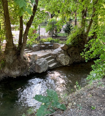
These formal designs are significant to the persistence story because public actions at least implicitly embody public policy. Ditch as amenity was recognized as a legitimate driver of urban form. Far more widespread, and equally significant in its own way, was the smaller-scale folk adornment of ditches as garden or streetscape features. Individuals recognized the ditch as amenity and as an opportunity for expression. A walk today along an urban ditch (the smaller the better) will bring you to ornamental bridges and garden features alongside the more utilitarian structures (Figure 9). This has likely been true for a very long time. One yard in Boulder, documented in postcards and photographs, in more than a hundred years has featured at least four successive ornamental bridges over the Farmers’ Ditch (Figure 10).
Garden terrace at Upper Canal, Holladay, Utah, 2024. Photo by author.

Farmers’ Ditch bridge at 603 Spruce Street, Boulder, Colorado, c. 1900. Carnegie Library for Local History/Museum of Boulder Collection, Boulder, CO.

•••
Vernacular innovation extended to thermal amenity. Young Phoenicians by the early 1930s invented pick-up-truck-powered water skiing (Figure 11). As Arnold Rovey recalled sixty years later, “we would take our surfboard and we’d go along Grand Ave, we’d go along 19th Avenue and the canal and we’d surf a mile or two along the canals. It was quite a sport then, it’s outlawed now …. All these canals were crowded with surfers, you know.” The unsanctioned practice continued through at least the 1960s.Footnote 60
Arnold Rovey skiing on the Grand Canal between Nineteenth and Seventh Avenues in Phoenix, c. 1932. Glendale Arizona Historical Society.

Ditch corridors have always served as paths for human movement. By the second half of the twentieth century, ditch rights-of-way came to be valued as recreational paths, separate from the street, often shady and offering the cooling proximity of water. Ditch corridors were increasingly designated, and to some extent redesigned, for this purpose.Footnote 61
In 1965, Maricopa County Parks and Recreation initiated the Sun Circle Trail, a 110-mile bridle trail proposed by the Arizona State Horsemen’s Association ringing the Phoenix metropolitan area using access paths along Salt River Project (SRP) canals.Footnote 62 At a time when canals were being fenced, this was an early assertion of a countervailing interest in public access. A similarly regional-scale effort in Denver around a single major channel, the seventy-two-mile High Line Canal, began in 1970 when Denver Water started signing public access agreements with local parks departments.Footnote 63
By the 1980s and 1990s, Salt River Project canals throughout the Phoenix area became sites for parks and trails, with their own advocacy organization, the Metropolitan Canal Alliance. Real estate listings and business ads today note access to canal trails (Figure 12).Footnote 64 Smaller-scale ditch-side trails can be found along the remaining acequias in San Antonio.
Joggers on Grand Canal trail, Phoenix, 1996. Photo by author.

These uses may survive the flowing ditch, as in a Salt Lake City urban trail over the now-piped Jordan and Salt Lake Canal, or the High Line Canal itself, which survives primarily as a trail and stormwater management channel as Denver Water continues diverting its water into mains.Footnote 65
•••
Also in the late twentieth century, ditches became an object of the growing historic preservation movement. Their reception as heritage had earlier roots in antiquarian appreciation for the San Antonio acequias. Texas Governor Oscar B. Colquitt in 1911 proposed a restoration of the Alamo that would reopen its recently closed acequia.Footnote 66 The San Antonio Conservation Society upon its founding in 1924 promptly began efforts to preserve the Espada Acequia and its aqueduct, an early-eighteenth-century arched stone structure unlike anything else north of Mexico. In the 1930s, Works Progress Administration crews in San Antonio uncovered and rebuilt sections of the acequia at the Alamo and the Upper Labor Acequia in Brackenridge Park, and the Conservation Society with Texas Centennial funds reconstructed a colonial mill and the acequia lateral that powered it at Mission San José.Footnote 67
Such appreciation spread to other cities in the 1960s and 1970s, with passage of the 1966 National Historic Preservation Act and the beginnings of local inventories for the National Register of Historic Places in 1969. Any surviving ditch, it turned out, was among the oldest artifacts in any scene.
Tempe has given city landmark designation to a short stretch of Kirkland-McKinney Ditch that remains daylighted in an earthen channel. And the Salt River Project, which covered hundreds of miles of its lateral ditches starting in the 1950s, has resolved to keep dozens of the remaining free-flowing ones as historic resources.Footnote 68 Remaining traces of Hohokam canals are a separate category, preserved as parkland and interpreted by one of the oldest and most active municipal archaeology programs in the United States, raising awareness of the ancient waterscape whose ashes are invoked by the name “Phoenix.” Canal heritage has always been at the core of the city’s effort to construct an identity.
San Antonio likewise celebrates a heritage with an outsized place for its tiny acequias. Its chain of missions in 1978 became the San Antonio Missions National Historical Park. Within the park flow the Espada and San Juan acequias, which had been maintained by generations of mostly Hispanic shareholders irrigating small plots on the city’s outskirts.Footnote 69 Planning for the park in the 1970s included ambitious proposals to restore much of the two acequias’ labores—the irrigated fields—as educational demonstrations, a small version of which was accomplished through the park’s limited resources and partnership with a local food bank.Footnote 70 San Juan Acequia flows today only because of an extraordinary effort to re-water it after flood control work in 1958 lowered the river and cut off the acequia’s source. The San Antonio Conservation Society and the National Park Service provided the institutional firepower to assert water rights on behalf of the shareholders, who had little capacity to stand up to the San Antonio River Authority on their own.Footnote 71 In a happy denouement to the years-long contest, River Authority personnel came to see heritage as a legitimate value and worked to find a solution to return water to the ditch.Footnote 72 The United Nations Educational, Scientific and Cultural Organization (UNESCO) in 2015 designated the San Antonio Missions a World Heritage Site, with the two flowing acequias as prized features.Footnote 73
•••
The most recent new value ascribed to ditch corridors is for their ecological role. There is no small irony in this, as plants and animals in and around the ditch were long counted as one of its failings as a modern water conveyance.Footnote 74 The Salt River Project in the 1950s slaughtered 20,000 mature cottonwoods along its canals to eliminate water loss to their roots. SRP periodically dragged its canals with chains to remove aquatic vegetation that impeded flow. In a revenge of ecology, this function is now served more effectively by grass-eating carp.Footnote 75
With many natural drainage paths undergrounded or hardened into grey infrastructure floodways, some ditch corridors serve as important wildlife migration paths.Footnote 76 In the Denver area, one riparian endangered species, the Preble’s Meadow Jumping Mouse, was found to have higher population densities along ditches than streams. The species Recovery Plan specifically allows ditch maintenance activities in order to sustain the viability of this habitat.Footnote 77 In cities with ditches, their seepage, as well as infiltration and return water from ditch irrigation, recharges riparian aquifers that maintain streamflow that in turn sustains aquatic life. Two miles of Silver Lake Ditch in Boulder were re-watered in 2001 to supply wildlife habitat. The High Line Canal, having created a lush vegetated corridor, will maintain some of it through a combination of drainage flows and (more irony) irrigation with mains water.Footnote 78
Conclusion
Every factor that has aided the persistence of urban ditches is one that counted against their modernity. The water that sustains vegetation, animals, and streamflows along the ditch’s path, and the water that delights the eye in Scottsdale or in a little street lateral, are inefficiencies in a calculus limited to water delivery only. Valorizing ditches as heritage can be seen as a rebuke to hydro-modernity.Footnote 79 The continuing utility of ditch-delivered water, in 2025 as in 1925, is a redundancy that contradicts the idea of a single, centralized, one-size-fits-all water system. When water systems enlisted old canals to move water into their mains, when modern drainage regimes acknowledged the functionality of fossil infrastructure that both brought and took away water, modernity was showing cracks.Footnote 80 The century of ditch persistence can be read as an implicit critique of hydro-modernity. Ditches survived, ultimately, because they worked with water’s nature rather than against it, allowing it to move by gravity, supporting unplanned ecologies both natural and human, responding to seasons and storms.
The ditch’s departures from the modern ideal have become assets in a new era of “green infrastructure.” This fuzzy term can mean achieving human ends using natural systems, or more broadly using modest solutions smaller in scale than those of high modernism. Very often these solutions are multifunctional, adding recreation, amenity, or ecological benefits to whatever infrastructural purposes they address. These modest interventions can be more efficient than single-purpose mega-projects, but only if one conceives efficiency along more than a single dimension. Infrastructural thinking, in other words, has belatedly caught up with ditch practice. Ecological and other costs and benefits are counted in a larger definition of efficiency. Advocacy for greywater networks and rainwater collection proposes a new water plurality.
The story of urban ditches is that in some places, water plurality never went away. That ought to change the way we think about urban water systems, making them more like other categories of infrastructure. Transportation, for example, has been dominated for a century by the automobile, but people still walk, bicycle, take trains, and buses and ferries—most of these are survivals from earlier eras, all of them continue to coevolve. In transportation terms, water too has “alt modes.” Ditch survivals are no longer, in most urban settings, a major alternative to mains water, nor does anyone claim they ought to be. But while water is one of the more thorough tales of triumphal modernity, we fail to understand the hegemony of mains if we do not see it within its pluralistic context. Mains, sewage systems, urban sanitation, and urban landscape all coevolved, and they coevolved with the urban ditch.
The closing of whole ditch systems in Los Angeles and San Antonio does not contradict but illuminates this story. The closings show the extreme circumstances that it took to stamp out ditches wholesale, in San Antonio the thorough disruption of an aquifer and the river that relied on it, in L.A. the equally extreme real-estate engine that crashed the city hard against the local hydraulic carrying capacity that had enabled its growth. These events look not so much like triumphs of hydro-modernity but rather large-scale failures to manage water resources. The resurrections of ditches in each of these cities, once conditions permitted, show the appeal of plurality, to water users and even to William Mulholland.
The ditch waterscape and its persistence is a story of many actors. Unlike modern mains infrastructure, which is out of sight and deliberately inaccessible to user interventions, ditches are visible and hackable. They rely upon some degree of user participation, both material and social. They make a rich and varied cultural landscape, in which users have agency and their actions shape the system. Many other people who do not use the ditch water may use the ditch landscape in other ways, and they too help to shape it. Where the urban ditch remains it is, and in most Western cities it was, a part of urban life.


 Open access