


Early studies of archaeoastronomy and cultural astronomy did not focus on coastal South America (e.g., Aveni Reference Aveni1982; Williamson Reference Williamson1981) but were followed by ethnographic and archaeological investigations of the coast (see Roselló et al. Reference Roselló Truel, Huapaya M. and Mazzotti S.1985; Urton Reference Urton1982). Our work has focused on coastal valleys in the Late Preceramic (Benfer Reference Benfer, Burger and Rosenswig2012, Reference Benfer, Šprajc and Pehani2013). Here we describe our investigation of nine small platform mounds associated with two giant animal effigy mounds at the site of El Paraiso. A total station map of the site made by the Peru Ministry of Culture allowed possible astronomical alignments to be measured directly by Pixelstick on the geolocated AutoCAD 2020.3.1 for Mac, along with Distance and Angle measurements from AutoCAD (Supplemental Figure 1). We corrected alignments for obliquity and the apparent curvature of the sun and moon over the crest of nearby ridges. Azimuths for astronomical events were obtained from Starry Night Pro Plus 6.4.3.
We found that 13 of 14 alignments were within 1° of predicted astronomical values. To account for these findings and those of the giant animal platform effigy mounds at the site, we propose a cosmology in the Late Preceramic of solar and lunar alignments and the linkage of supernatural animals to dark cloud constellations and astronomical orientations. The precision of alignments means that the building of these mounds must have been directed by astronomer priests. A shared belief in a cosmology that included a punishing force, gods, or also apus (animated mountains) may have eased transactions by engendering trust among individuals living across river valleys and at different altitudes. Knowing that another person, not a relative or member of your group, believed a supernatural force would punish wrongdoing could make trade and other interactions more secure. A great deal of evidence from experimental psychological, ethnographic, and archaeological findings exists to support this hypothesis (Norenzayan Reference Norenzayan2013). Supernatural powers other than gods may also have emerged (Watts et al. Reference Watts, Greenhill, Atkinson, Currie, Bulbulia and Gray2015). A sister site, Buena Vista, has a mud plaster image of the first god known for the Western Hemisphere (Benfer and Adkins Reference Benfer and Adkins2008), so this might be the time and place that such a system of supernatural control began.
Are the extensive sets of alignments at the Late Preceramic site of El Paraiso also found in a sister Late Preceramic site, Buena Vista, in the same valley (Figure 1)? If so, another site can be added to the Buena Vista Religious Astronomical Tradition (2200–1750 cal BC; Benfer Reference Benfer, Burger and Rosenswig2012; Benfer and Adkins Reference Benfer and Adkins2008; Benfer et al. Reference Benfer, Ojeda, Duncan, Ludeña, Vallejos, Rojas, Ocas, Ventocilla, Villarreal, Kaulicke and Dillehay2007, Reference Benfer, Ojeda, Duncan, Ludeña, Vallejos, Rojas, Ocas, Ventocilla and Villarreal2010), from the Chillon and other coastal valleys.
Map of location of El Paraiso with respect to Lima.

A temple at nearby Buena Vista has already been linked with one at El Paraiso. Both temples are made up of two open plazas with four circular structures surrounding a hearth describing the same astronomical alignment to the Milky Way extreme after sunset near the solstices. Figure 2a shows the Temple of El Paraiso del Valle in Buena Vista, which was named for its architectural similarity to the site of El Paraiso on the coast. The Temple (Unidad I) at El Paraiso (Figure 2b) shows a similar pattern of circular chambers and orientations.
(a) Late Temple at Buena Vista (by Bernardino Ojeda); (b) Late Temple at El Paraiso, Unidad I (from Quilter Reference Quilter1985). Arrows indicate lunar solstice, June solstice sunrise (JSSR), and Milky Way extreme.

El Paraiso was the first Peruvian site with monumental architecture to be associated with the Late Preceramic (Engel Reference Engel1966). Although a number of archaeologists have discussed the site (e.g., Patterson and Lanning Reference Patterson and Lanning1964), extensive excavations have been conducted only by Bernardino Ojeda, Jeffrey Quilter, Frederic Engel, and Joachim Narváez (Engel Reference Engel1966; Quilter Reference Quilter1985; Quilter et al. Reference Quilter, Ojeda E., Pearsall, Sandweiss, Jones and Wing1991). Only Quilter (Reference Quilter1985) and our team (Benfer Reference Benfer2011a, Reference Benfer, Burger and Rosenswig2012, Reference Benfer2018) considered astronomical alignments.
Astronomical Studies of the Chillon Valley in Late Preceramic Sites
El Paraiso (Figure 1) is located on the central coast of Peru, 1 km from the ocean at the mouth of the Chillon Valley (11°57.234′ S 77°7.100′ W). Buena Vista, the other major Late Preceramic site in the valley, is located 29 km toward the headwaters in the same valley. Numerous astronomical alignments have been identified for it (Benfer et al. Reference Benfer, Ojeda, Duncan, Ludeña, Vallejos, Rojas, Ocas, Ventocilla and Villarreal2010). Unlike the sites of Paradones and Huaca Prieta in the Chicama Valley, where separate mounds were created by early fisherfolk and farmers near the coast (DeSantis et al. Reference DeSantis, Dillehay, Goodbred, Feranec and Dillehay2017), there is only one large Late Preceramic mound—that created primarily by fisherfolks—near the mouth of the Chillon Valley and one monumental farming/pilgrimage site in the Middle Valley, Buena Vista (Benfer Reference Benfer, Burger and Rosenswig2012). Analysis of fauna and flora at El Paraiso indicated a fishing diet comprised primarily of small schooling fish, with some plants, most of which were gathered; however, there were also some cultivated plants (Quilter et al. Reference Quilter, Ojeda E., Pearsall, Sandweiss, Jones and Wing1991). Food remains from a feast that filled up an offering chamber at Buena Vista included a broad variety of cultigens with some shellfish (Duncan et al. Reference Duncan, Pearsall and Benfer2009).
Ojeda and Narváez (Reference Ojeda and Narváez2016) reported maize in the final occupation at El Paraiso, and we found maize in the final occupation of Buena Vista. The economy of Late Preceramic Buena Vista in the Middle Valley was more focused on agriculture, with some maritime foods (Benfer and Adkins Reference Benfer and Adkins2008; Duncan et al. Reference Duncan, Pearsall and Benfer2009) and maize in the final occupation. The presence of fisherfolk and farmers as separate ethnic groups in the same valley continued until historic times (Rostworowski Reference Rostworowski2004). In the Chillon Valley, both are associated with monumental architecture. As Smith and Schreiber (Reference Smith and Schreiber2016:14) argue, “Archaeoastronomical research on building alignments is one of the most methodologically and explicit approaches to ancient high-level meanings.”
Following these authors, we made a complete astronomical survey from viewing points from Buena Vista and El Paraiso, as well as incomplete studies of Late Preceramic sites in other valleys. We generally used viewing points to reference point alignments, rather than structure wall orientations, although they too have been shown to indicate astronomical events (e.g., Pinasco Carella Reference Pinasco Carella2007), as has shadow casting (Alva Meneses Reference Alva Meneses2013:117; Benfer Reference Benfer, Burger and Rosenswig2012:Figure 12.6). Our viewing points for this research are the centers of the back wall of small platform mounds, and the reference points were centers of the corridors of the entryway to the mound, although in one case the alignment continued to a stone enclosure to a projecting rock.
In Figure 2, dark arrows perpendicular to the square offering chamber are approximately to the extremes of the Milky Way after sunset or before sunrise around the solstices in Buena Vista and El Paraiso. It is in the Milky Way that the dark cloud South American constellations are embedded (Arnold Reference Arnold1992; Pucher de Kroll Reference Pucher de Kroll1950; Sullivan Reference Sullivan1996; Urton Reference Urton1981a). We earlier identified the two large effigy mounds at El Paraiso, also with that orientation, as two animal figures (Benfer Reference Benfer2011a, Reference Benfer and Ruggles2011b, Reference Benfer, Šprajc and Pehani2013). In previous work based on ethnography and ethnohistory, Urton (Reference Urton1982) suggested that monumental architecture might be oriented toward the Pleiades, other stars, or the zenith crossing. Although we discussed possible stellar alignments (Adkins and Benfer Reference Adkins, Benfer and Ruggles2011) and zenith ones (Benfer et al. Reference Benfer, Ojeda, Duncan, Ludeña, Vallejos, Rojas, Ocas, Ventocilla, Villarreal, Kaulicke and Dillehay2007) using Google Earth and satellite images and evaluated by ground truthing, we found that, like El Paraiso, most early monumental architecture is aligned with the orientation of the Milky Way, an orientation emphasized by Urton (Reference Urton1981b) in another site. It should be noted that it was Urton who discovered (with Benfer independently) the Milky Way orientation of the El Paraiso mounds (Quilter Reference Quilter, Ojeda E., Pearsall, Sandweiss, Jones and Wing1991).
Painted animal figures are located in an arch across the dome of the principal temple of the Inca in Cuzco, the Coricancha; the painting represents the Milky Way. Andean constellations are almost certainly very ancient (Bauer and Dearborn Reference Bauer and Dearborn1995). Animal figures in the Milky Way are also recognized in the tropical lowlands (Eeckhout Reference Eeckhout1998; Itier Reference Itier1997). They are present in Nazca (Proulx Reference Proulx2010) and Paracas deserts (Fossa Reference Fossa2019), and there are other ground drawings on the Peruvian coast and in coastal valleys (e.g., Isbell Reference Isbell1978; Pozorski et al. Reference Pozorski, Pozorski and Rick1991; Wilson Reference Wilson1998). Dark cloud constellations and the Milky Way have been associated with the late Preceramic sites of Buena Vista (Benfer Reference Benfer, Burger and Rosenswig2012; Benfer and Adkins Reference Benfer and Adkins2008; Benfer et al. Reference Benfer, Ojeda, Duncan, Ludeña, Vallejos, Rojas, Ocas, Ventocilla and Villarreal2010) and El Paraiso (Benfer et al. Reference Benfer, Ocas Q, Guerrero, Ojeda R., Craig, Villarreal, Ventocilla and Rivera2014), as well as with walls from various time periods at the coastal oracle site of Pachacamac (Pinasco Carella Reference Pinasco Carella2007).
The Buena Vista stairs to the principal temple run to the lunar standstill (116°39′ over a ridge at 22° elevation). The moon only reaches its southernmost limit toward the Pacific every 18.6 years, setting erratically over a period of weeks; yet despite the rarity of this event, architectural alignments to this event are common (e.g., Adkins and Benfer Reference Adkins and Benfer2009; González-García et al. Reference González-García, Solís, Ricra, Criado-Boado and Belmonte2021; Pinasco Carella Reference Pinasco Carella2007). The arrows in Figure 2 cross circular offering structures oriented approximately to the June solstice sunrises (JSS) and lunar standstills at Buena Vista. One difference in the chambers at the two sites is that the circular offering chambers at El Paraiso are elevated, whereas those at Buena Vista are pits. Both have central hearths, with the one at El Paraiso presenting more ash over a larger area.
These previously unnoticed architectural similarities between the two sites indicate a valley-wide knowledge of astronomical phenomena and architectural planning by the astronomer priests. Because both temples are from the terminal occupation, their similarities may be associated with new rituals intended to fend off collapse in difficult times when religious leaders were failing to manage changes in the climate. Moore (Reference Moore1996) previously noted a lack of emphasis on ritual in the Late Preceramic. However, we published an example of a feast and possible offering in a Mito temple at the Late Preceramic component of the site of Buena Vista (Duncan et al. Reference Duncan, Pearsall and Benfer2009), and there is a Mito temple for ritual offerings at El Paraiso in Unidad IV. Mito styles of architecture of subterranean pits with ventilation shafts were previously known from slightly later Late Preceramic sites in the Andes at Kotosh (Burger Reference Burger, Renfrew and Bahn2014), but the temples at Buena Vista reflect the coastal priority of that architectural style.
It is generally accepted that religious leaders directed the construction of Late Preceramic complexes (e.g., Burger Reference Burger, Renfrew and Bahn2014), and we argued, based on the astronomical alignments evident in all the Late Preceramic monumental sites we investigated, that astronomer priests directed the construction and ritual interment of late Preceramic temples (Benfer and Adkins Reference Benfer and Adkins2008; Benfer et al. Reference Benfer, Ocas Q, Guerrero, Ojeda R., Craig, Villarreal, Ventocilla and Rivera2014).
New Astronomical Alignments at El Paraiso in Smaller Platform Mounds
All but one of the smaller platform mounds at El Paraiso lacked a distant marker. One side of most platforms appeared to open to a single direction, as indicated by the directions of the patio walls, which we took to be the intended alignment by the astronomer priest architects. Alignments to the west were treated as independent to alignments to the east. We measured the suggested alignments on a Ministry of Culture total station map with DIST for AutoCAD for Mac and ANGLES for Windows and an online protractor, Pixelstick 2.16.2 (Pixelstick hereafter). The azimuths obtained were similar for the three procedures, although we present only Pixelstick azimuths here, because they were easier to obtain as a precise alignment. In a few cases where the map image was not sharp, Google Earth verified the azimuths. We measured elevations and the horizontal displacements of the path of the sun over the ridges with AutoCAD DIST.
We determined the astronomical azimuth of the solstice or equinox or, separately, major lunar standstills for the time of occupation of the site that most closely resembled the archaeological azimuth using Starry Night Pro Plus 6. We obtained the necessary Julian dates for Starry Night from Fourmilab (https://www.fourmilab.ch/documents/calendar/) using available radiocarbon dates. Extremes of radiocarbon date confidence intervals from the side of the site where most small platform mounds were built extend from approximately 1440 to 2400 BC (Quilter et al. Reference Quilter1985). We used 2000 BC for Starry Night Pro. A discrepancy of a few hundred years did not change the azimuth obtained from the planetarium program by more than a few minutes for the solstices and lunar standstill.
Solar solstices are seen on the ground as the most southern or northern extent of sunrise or sunset over the horizon; major lunar standstills (“lunistices”) are a related lunar equivalent. The orientation of the Milky Way after sunset on the solstice was very important for the Inca (Urton Reference Urton1982) and in El Paraiso. The apparent movement of the sun or moon is curved, so hills or other impediments will affect the observed rise or set on a solstice, equinox, or lunar day as seen from behind them (Figure 3a). In the case at El Paraiso, ridges occur on at least one side as seen from most mounds. In Figure 3a, large arrows indicate the observed sunrise of the solstice or equinox; small arrows show the flat horizon azimuth in Figure 3b. Where there is a horizontal deviation such as a ridge or intervening structure, the actual solstice rise and set would be less to the east and more to the west. Figure 3c shows an orientation of 34° for the Milky Way just after the December solstice sunset, and Figure 3d shows the similar orientation of the giant effigy mounds at El Paraiso. The one on the left is clearly a bird, as shown in Figure 4; an eye in the head is evident from an intensive circle of ash. A wing and the tail are also visible. A plane table map in Figure 3d make clear the outline of the two principal linear mounds that extend from the central temple toward the December solstice sunset. Figure 4 shows a total station map of the two. The bird, probably a condor, is clearly defined as is the Monstruo, first defined by Bischof (Reference Bischof1994; see Benfer Reference Benfer2011a, Reference Benfer and Ruggles2011b). Other bird effigies are also known (Benfer Reference Benfer, Šprajc and Pehani2013).
(a) Upper: Diagram of solstices and equinox against a hypothetical ridge; lower: azimuths of solstices over flat horizons; (b) Milky Way from space before sunset on the December solstice at the same 34° angle as (c) giant animal effigy mounds from El Paraiso.

Map of El Paraiso showing Unidades discussed in the text (map drawn by Joachim Narváez under the direction of the Ministry of Culture; inset photo, upper left, courtesy of Deborah Pearsall).

Although the sun is not affected by the precession of the equinoxes, as are constellations and stars, obliquity—the wobble in the sun primarily from the gravity of Jupiter—will change, over 4,000 years, the sun's sunrise azimuth by a half-degree from its present 23.5°, so that was also corrected for in the planetarium simulation program. The actual location of the moonrise or moonset, which is of interest here, is more complex than that of the sunrise or sunset (Adkins and Benfer Reference Adkins and Benfer2009). Briefly, instead of a single day there is a period of some days during which the moon appears to rise at the most extreme position. Thus, the moon, every 18.6 years, has a standstill season: a time of oscillating rises and sets. During one-half of the cycle, high tides are suppressed, whereas they are augmented during the other half, with consequences of considerable importance to fisherfolk. The moon was an important celestial deity as shown in later murals and for the Inca. All major southern major standstills occur near the June solstice (Adkins and Benfer Reference Adkins and Benfer2009). A cluster of lunar eclipses occurred in 1997, 1999, and 2010 BC, which would have been harbingers of evil for the Indigenous coastal peoples (Eeckhout Reference Eeckhout1998:126). These eclipses would also have emphasized the importance of the moon during the occupation of El Paraiso.
Effigy Mound Images from Space
Google Earth imagery has revolutionized archaeology survey from the sky, given that commercially available satellite maps for large areas are prohibitively expensive. Although Peru is famous for ground drawings, including animal figures such as those at Nazca, our team identified—for the first time—giant animal effigy platform mounds in coastal Peruvian valleys (Benfer Reference Benfer2011a, Reference Benfer, Šprajc and Pehani2013, Reference Benfer2018; Benfer et al. Reference Benfer, Ocas Q, Guerrero, Ojeda R., Craig, Villarreal, Ventocilla and Rivera2014). These were first seen clearly in Google Earth Pro and in commercial satellite images and then “truthed” on the ground. Large, three-dimensional mounds of stone and earth like those formerly common in North America and associated with constellations (Lankford Reference Lankford, Kent Reilly and Garber2007) were not previously described for Peru.
Giant platform mounds from the Late Preceramic of the central coastal valleys of Peru, like the figures identified as condor or Monstruo in Figures 3c and 4, have curvilinear outlines and complex internal structures and present as giant animal figures. Some effigies, like those at El Paraiso, are hundreds of meters in length. A few smaller figures, clearly condor and fox, are known from other sites (Pozorski et al. Reference Pozorski, Pozorski and Rick1991; Rocha Revilla Reference Rocha Revilla2011). A falcon and a serpent are known from Buena Vista and Chupacigarro/Caral, and animal figures are also known in other valleys (Benfer Reference Benfer2018). The Monstruo could be seen as an Amaru, a mythical serpent or dragon (Steele Reference Steele2004:98–99). The Amaru is a two-headed serpent with feet and wings, like a dragon, that lives at the bottom of lakes and rivers. The Monstruo at El Paraiso has feet but only one head, although the other end is heavily damaged (Figures 4 and 5, lower left)
Monstruo of El Paraiso. Left, total station map from Museo de los Minerales, Lima; right, Google Earth and plane table map of a detail on the head of the Monstruo by Bernardino Ojeda; center, drawings of bone carvings of Monstruos by Henning Bischof. Photograph on the right is of a carved bone Monstruo from the Museo Nacional de Antropología.

The Monstruo could possibly represent a cayman, a mythical animal discussed by Lathrop (Reference Lathrop and Reed1971). Lathrop posited the Upper Amazon as the hearth of Andean civilizations, not knowing that early dates on the central coast would be later discovered. Quilter's (Reference Quilter2014) exhaustive review of the central coast did not find representations of caymans. In addition, the mythical animal named the Monstruo by Bischof (Reference Bischof1994) from carved images differs from a cayman in having three flames from its snout, one of which appears visible in the total station map in Figures 4, 5, and 6b; the other two, if they existed, were destroyed by modern construction. The map was made by surveyors from the Museum of Minerals who were unaware of this three-flamed feature of Bischof's Monstruo. The plane table map insert in Figure 5 was made by Bernardino Ojeda, who thought the furrows that define the figure were irrigation canals until the figure came into focus on his map. The upper-left insert on Figure 4, a side view, shows that there was no entry or exit for water from the mound because of the higher elevation at the center of what appears to be an animal.
Urin Sector Machu Picchu (Google Earth Pro) and Monstruo, both aligned to the Milky Way extreme but in opposite directions.

The condor effigy, if that is what the bird is, at El Paraiso is of obvious interest. In Andean rituals today, after the lights are extinguished in the home or cave, the apu, an animated mountain spirit, appears to the celebrants as a condor or a falcon (Millones Reference Millones1983:66). The condor's most important duty is to relay information on human activities from the fox to the condor, who then flies to report to the apu; this myth is portrayed at Buena Vista (Benfer and Laura Reference Benfer and Laura2019). Most true platform effigy mounds are made of rock quarried from mines immediately above the site and often have external stone walls (Benfer Reference Benfer2011a, Reference Benfer, Šprajc and Pehani2013). They also have rectangular and sometimes sunken subterranean circular stone structures within or near them. Most have a U-shape with a central mound flanked by two long side mounds, which are almost always oriented to the Milky Way extreme. Late Preceramic mounds tend to be extremely symmetrical (Benfer Reference Benfer, Burger and Rosenswig2012).
Roselló and others (Reference Roselló Truel, Huapaya M. and Mazzotti S.1985) first reported Late Preceramic astronomical alignments near El Paraiso in the Canto Grande region. Canto Grande is on the border between the Rimac and Chillon Valleys, and it has a single radiocarbon date that is as early as the earliest one at El Paraiso. We found two geoglyphs with Middle Horizon pottery in the form crosses there, intact except for a recently bulldozed road that passed through their centers (11°50′40.59″S 76°55′42.63″W). Their short axes are to the lunar standstill, and the larger cross has a long arm that is, like the effigies at nearby El Paraiso, oriented to the Milky Way. Stanish and colleagues (Reference Stanish, Tanteleán, Nigra and Griffin2014) report December solstice sunset alignments to the south in a similar series of early lines and central features in the Chincha Valley. Radiocarbon dates from the geoglyphs are similar to those from El Paraiso.
El Paraiso
The principal temple at El Paraiso (11°57′14.05″S 77° 7′5.95″W) lies in a small bowl (Figure 4). A preliminary pedestrian investigation revealed that it had several possible astronomical markers (Benfer et al. Reference Benfer, Ojeda, Duncan, Ludeña, Vallejos, Rojas, Ocas, Ventocilla, Villarreal, Kaulicke and Dillehay2007), in addition to the Milky Way orientation of the arms (Quilter Reference Quilter, Ojeda E., Pearsall, Sandweiss, Jones and Wing1991). The temple faces two large arms that form an asymmetric U. The site also has nine smaller platform mounds (Figure 4). A tenth, Unidad X, is shown on the map but was destroyed by a squatter. We identified the giant arms as animal effigies of the condor and Monstruo. The alignment of the principal temple, Unidad I, runs through the eye of the bird effigy and along one of the arms (Figure 4), although the corridors have a slightly different alignment (Figure 2b). Thirty-four degrees is the center of the northeastern extreme of the Milky Way. The bird is flying toward its location before sunrise on the solstice. It probably reflects the dark cloud constellation above (Urton Reference Urton1981a). The view from the pass behind Temple I over the temple extends directly to the eye, although as noted, it is a few degrees different from the orientation of the corridors of the temple (Figures 2a, 4). Williams (Reference Williams Léon and Donnan1985) found many U-shaped complexes with this approximate orientation, which our fieldwork has confirmed in other valleys. However, Williams did not note that their orientation of approximately 30°–35° was to the Milky Way.
It has been proposed that the orientation of a figure presented by the Urin sector of Machu Picchu is related to one of three fault patterns that produced accessible rocks for construction (Menegat Reference Menegat2019). This explanation aligns with ours (Figure 6; see Benfer Reference Benfer2018), because the mythical orientation of the site would have been more easily achieved by construction in the direction of the fault, one of whose fault directions is 30°/330°; therefore, the site could have been chosen because it runs along the sacred Milky Way. The Monstruo (Figure 6) is actually much larger, being 375 m in length, whereas the Urin sector of Machu Picchu is about 210 m in length, although they are presented as equal in size to emphasize their similar pattern.
Some claim that the Inca capital of Cuzco was constructed in the form of a puma (Niles Reference Niles1987; Paternosto Reference Paternosto1989). However, Barnes and Slive (Reference Barnes and Slive1993) disagree, providing the most comprehensive review of the evidence against the puma hypothesis. We note that the town of Cuzco, if viewed as a figure of an animal, is oriented toward the June solstice sunrise, the day of the Inti Raymi celebration—the most important one of the Inca year. We claim that the Urin sector of Machu Picchu is an Inca period site that appears in the form of an animal, as do the effigy mounds we reported in coastal valleys (Benfer Reference Benfer2011a; Benfer et al. Reference Benfer, Ocas Q, Guerrero, Ojeda R., Craig, Villarreal, Ventocilla and Rivera2014), including the two at El Paraiso.
The Condor: Unidad II-A and Unidad II-B (11°56′55.92″S 77° 6′53.85″W)
We interpret Unidad II-B as a tail and Unidad II-A as the body in Figure 4, together comprising a Condor Effigy mound (Benfer Reference Benfer2011a, Reference Benfer and Ruggles2011b). Figure 4 shows the condor's association with the principal temple Unidad I, which has an azimuth of approximately 34°: that is the extreme orientation of the Milky Way after sunset around the December solstice and is close to the mean of monuments reported for all U-shaped coastal monuments by Williams (Reference Williams Léon and Donnan1985). A line with an azimuth of 35°18′ from the western corridors of Unidad I that goes from an offering chamber through the body of the condor bisects the eye, which is an area of intense ash. The eye of the Monstruo is not visible except on the ground as a 1 m in diameter and 1 m in depth conical excavation.
The condor figure orientation explains a previous mystery. The site of El Paraiso is U-shaped, with a central figure and three long arms, a common form for Late Preceramic sites. However, the temple is not in the apex of the U (Figure 4) as are all the other U-shaped sites, but instead is oriented to the condor through its eye. A ridge keeps the eye from being visible from the principal offering chamber. The Inca also had alignments that crossed impeding hills (Bauer Reference Bauer1992). The viewing point might have been a pass (see Figure 4) behind the temple, with an alignment to the condor eye of 34°. Figure 3a shows the 34°12′ hour cycle of the Milky Way in brown bars (Urton Reference Urton1981b:62). These giant mounds, full of structures, are surrounded by smaller constructions. We found 10 astronomical alignments at Buena Vista (Benfer and Laura Reference Benfer and Laura2019; Benfer et al. Reference Benfer, Furbee and Ludeña2011), although preliminary investigation had only produced three at El Paraiso (Benfer et al. Reference Benfer, Ocas Q, Guerrero, Ojeda R., Craig, Villarreal, Ventocilla and Rivera2014). We wondered whether the small platform mounds would exhibit more astronomical alignments.
Smaller Platform Mound
Our model predicted that all the mounds would have at least one astronomical alignment. Unidades V, XIII, and IX were examined for both east and west alignments within 1° of the predicted azimuth from the planetarium program. Table 1 presents the summary of results. They were obtained from the georeferenced Ministry of Culture AutoCAD map (Supplemental Figure 1) and are shown in lower resolution in Figure 4. As can be seen, all alignments (except Unidad XII) are within 1° of an astronomical event, which was a surprise to our team. Could this have been due to chance?
Azimuths from Pixelsticks Lines and DIST and ANGLES from AutoCAD Map Contrasted with Astronomical Events Obtained from Starry Night Pro Simulation Program for DSSR, JSSS, Zenith, and Major Lunar Standstill.

1 DSSR is December solstice sunrise; JSSS is June solstice sunset.
2 Unit XII is not a rectangular platform like the rest, it has a snake design of rocks on the surface; still the obtained JSSS lies only 45′ outside our required 1° limit.
3 Unit IIIB is very poorly defined on the map; azimuths are from Google Earth Pro.
4 Unit IX is very poorly defined on the map and in Google Earth Pro; from which these azimuths were taken.
Probabilities. The probabilities of two independent events, such as a hit or a miss of an astronomical event, can be obtained by using the laws of combination, where the likelihood of two independent events is their product. Thus, the chances of rolling two ones on a pair of dice is 1/6 × 1/6 =1/36 = 0.03; rolling two ones consecutively on three rolls is (1/6)^3 = 0.005, and so on.
How likely is it for a temple alignment to strike one of the three celestial events, as locations in the sky looking to the east with a 1° accuracy? We treat eastern and western alignments as independent. Accepting a hit as any one of the sum of the two solstices, the equinox, and the southern lunar standstill moon set, we assign 8° of the sky as available targets (identifying each of four events as ±1° = 2°). We divide these possibilities by 53°, which is the total number of degrees within which the sun can rise or set—114° − 66° = 48°—plus the southern moon, which is 5° more extreme, equals 53°. We obtain 151 as the likelihood of striking any one of the 53° in the sky by chance. Unidad IV, known to have an astronomical alignment before the study began, was not included in the probability estimations but was included in the results (Table 1). A convenient way of calculating expected values for combinations is by the binomial expansion, which also uses a factorial method.
For the 13 remaining alignments shown in Table 1, 12 are hits. Using 151 as the likelihood of a hit, the Vassar Binomial Calculator produces an expected probability of 1.572e-9 that there would be 12 or more hits out of 13 with a one-tailed test, a result far removed from chance. The average Pixelstick difference from the celestial event is 22.75′ with a standard deviation of 17.6′. The measurements are from the AutoCAD map (see Supplemental Figure 1), not the lower-quality image presented here. A more conservative estimate is to consider the opposite directions of the mounds for which we identified only one direction as misses. In that case, there are 13 hits of 18 possible alignments, which still produces a very low probability of 8.55e-8. Chance can be ruled out as an explanation.
The Alignments
December Solstice Sunrise Temples
There were five December solstice sunrise temples, which marked the austral summer solstice sunrise (Table 1). This is an agriculturally important date but also one important to fishermen (Benfer and Adkins Reference Benfer and Adkins2008). December 21 would announce the flooding of the Chillon River for agriculture, but it would also be the date that would allow one to know whether an El Niño event could yet occur. After that date, absent El Niño, fishermen could count on another good year of fishing. Marine indicators of an El Niño year—the losses of large fish and avian or mammalian carnivores—would no longer be anticipated.
The five June solstice sunsets could have marked important harvest dates if planting occurred around the December solstice sunrise. This would be especially true if a strain of cotton with that growing time was available. Such a strain is available today. The cigar-shaped Unidad VII, not a platform mound, may have marked the March equinox. Pixelstick yielded 94°0′; Google Earth, 96°55′, and the Starry Night Pro planetary program, 96°16′, so depending on which ruler is used, it does or does not mark the equinox within our limits. We use Starry Night because, unlike Stellarium, a more commonly used planetarium program in cultural astronomy, it gives correct results to the day in BC times (Adkins and Benfer Reference Adkins and Benfer2018), which is important for the equinox.
Although most platforms are aligned with solar events, four are aligned with the moon, at the major lunar standstill when the moon rises at its most southerly point. We were able to take photographs of some of the temples from some surrounding ridges. Where that was not possible, we present images from Google Earth or AutoCAD. We surveyed surrounding ridges to the east without finding other markers than the first one with Unidad IV (Figure 7). Other markers to the west would have been destroyed by modern construction.
Condor head in a recently collapsed rectangular structure aligned with Unidad IV (photograph by Robert A. Benfer).

December Solstice Sunrise
Of the five temples with December solstice sunrise alignments (Table 1), three are shown in Figure 8 and two in Figure 9. From one of those temples—Unidad IV (see Figure 4)—following the alignment by transit on the ground, we discovered a 2 m high stone walled enclosure against the hill. This enclosure opened to Unidad IV. A projecting stone was in the rear, aligned with Unidad IV (112°10′). We identify it as a “condor” head after its resemblance to stones so identified in the Andes (Figure 7). The wall of the enclosure has collapsed since we first saw it in 2017, leaving only the footings, but the condor head is still intact. We found a similar stone condor head at Buena Vista in a ravine. It lies within 0.5° of a line from a fox mural in a temple to an offering chamber to a rare black stone to a stone pillar carved into a condor with an equinoctial alignment (Benfer and Laura Reference Benfer and Laura2019). Unidad IV also had a Mito offering chamber (Ojeda and Narváez Reference Ojeda and Narváez2016:31). One difference between the sites is the presence of a dog buried in the third level of the chamber in Unidad IV at El Paraiso. Apparently, Unidad IV did not have a hearth as did the Temple of the Fox and the Temple of El Paraiso del Valle at Buena Vista.
Platform mounds: (a) IV; (b) X; (c): III-A and III-B.

Platform mounds: (a) V (photograph by Robert A. Benfer); (b) XII and XIII.

June Solstice Sunset Temples
Figures 9a and b (Unidad XIII) and 10a show three of the four June solstice sunrise structures noted in Table 1. Note that Unidad XIII aligns with Unidad V, whereas Unidad IV aligns with the condor enclosure. Unidad XII lies 0.45′ outside our 1° limit from the June solstice sunset, so it is treated as a miss. It was unusual in having a zigzag, snake-like set of rocks on its crest with rhomboid rocks as a head, although these have since been disturbed by unknown persons.
Platform mounds: (a) IX; (b) VI.

Lunar Standstill Temples
There are four structures with major lunar standstill alignments (Figure 8c [Unidad III-B]; Figure 9b [Unidad IX upper, VII lower], and Figure 10 [Unidad VII upper, Unidad VI lower]). Unidad VI is poorly defined in the map (see Figure 4) and difficult to measure by Pixelsticks, but with a Google Earth photograph, one sees a lunar azimuth of 120°48′ over a 1° elevation.
We see no architectural pattern among the three sets of platform mounds with solar and lunar alignments that would distinguish one from the other.
Conclusions
In addition to the previously reported alignments to the central temple (Benfer Reference Benfer, Burger and Rosenswig2012:328), we show here that matching azimuths for astronomical events exist for 13 of the 14 suggested alignments at the smaller platform mounds. Quilter and others (Reference Quilter, Ojeda E., Pearsall, Sandweiss, Jones and Wing1991) note that the control of cotton was a determining factor in making nets that provided most of the animal protein from the sea, although cotton nets for anchovies would not have been strong enough to catch fish larger than anchovies or sardines. At Buena Vista, 29 km up the valley, we also identified considerable cotton, which could have been traded. We do not recognize early monumental settlements as examples of true urbanism (see Makowski Reference Makowski2006, Reference Makowski2012), although later Initial period sites do rise to that level (Smith and Schreiber Reference Smith and Schreiber2016:13). We consider an alternative hypothesis that identifies them as indicative of pilgrimage and other ritual sites with substantial local populations; this explanation perhaps better fits Buena Vista, whose structures have only a few stone rooms but mythic art, than El Paraiso with its animal effigy mounds made up of rooms, some of considerable size.
All events registered in the architecture orientations must have played a role in the cosmology motivating the builders, and we argue that all must have had some economic meaning, as they did for the Inca and continue to do so today. Large-scale theocratic artworks are present in Buena Vista but not in El Paraiso in the same period, which suggests that Buena Vista had more ritual meaning than El Paraiso, despite the similar pattern of their temples. The Chillon River floods at about the December solstice sunrise, toward which date four temples are oriented, and the river subsides around the equinox, a time possibly announced by the cigar-shaped structure Unidad VII. Later harvesting could also have been celebrated at four temples oriented toward the June solstice. Sunsets may have followed the metaphor of endings, whereas sunrises—planting time—marked the beginning of the year's economic activities.
For these peoples whose primary animal protein came from the sea and river, the movements of the moon were tracked carefully through four temples: the moon controlled the tides and light for catching fishing and shellfish. The flood plain of the river also provided resources for agriculture. The adaptation of exploiting marine and terrestrial products, at the coast and in the middle valley, even with supernatural assistance, was not entirely successful. Compared to the physical condition of the previous almost exclusively fisher populations, health—after increasing through the Middle Preceramic at villages such as Paloma (Benfer Reference Benfer1990, Reference Benfer and Pearsall2007)—actually declined in the Late Preceramic, despite the increased use of cultigens and continued intensive fishing (Pechenkina et al. Reference Pechenkina, Vradenburg, Benfer, Farnum, Cohen and Crane-Kramer2007). Paloma's simple domestic structures had an astronomical orientation in its final occupation, around 3000 BC (Benfer Reference Benfer and Pearsall2007), but the growth of the much more complicated Buena Vista religious astronomy tradition followed the abandonment of the last Paloma village.
Demography suggests that expanding agricultural populations in the Late Preceramic (Pechenkina et al. Reference Pechenkina, Vradenburg, Benfer, Farnum, Cohen and Crane-Kramer2007; Vradenburg et al. Reference Vradenburg, Benfer, Sattenspiel and Paine1997) brought people into contact with strangers outside their local group; a shared belief in supernatural punitive forces might have explained their peaceful interactions (Norenzayan Reference Norenzayan2013). All the alignments in the smaller temples at the Late Preceramic site of El Paraiso are associated with either solstices or the lunar standstill, and possibly the equinox, as predicted by our model. None were associated with the Pleiades, zenith passage, or stars. The single miss, Unidad XII, lies just one-half degree outside our acceptable range. These alignments cannot be explained by chance.
The entire site is oriented to the Milky Way. Today, due to the lights of Lima, our galaxy is not impressive in the moonlit sky. But imagine a time without artificial light. I have been in Andean towns on moonless nights when Venus cast a shadow and one could not see one's hand in front of one's face—and yet the blazing Milky Way, at 12° latitude overhead was dazzling. Archaeologists without this experience cannot visualize the importance of a river of stars that moves to the extreme east and then west every 12 hours near the December solstice. It is in a river of stars where one finds dark cloud representations of South American animal figures (Urton Reference Urton1981a). This system, the Buena Vista Astronomer-Priest Tradition (Benfer et al. Reference Benfer, Ojeda, Duncan, Ludeña, Vallejos, Rojas, Ocas, Ventocilla and Villarreal2010), is widespread in the central coastal valleys of Peru and now includes El Paraiso.
Acknowledgments
The archaeologist José Joaquín Narváez kindly permitted us to work at the site he was investigating. We also thank the Museo de Minerales and the Ministerio de Cultura for their exceedingly useful maps. The Museo de Antropología, Agricultura Andina, Biodiversidad y Alimentación (MUNABA) of the Universidad Nacional Agraria La Molina provided laboratory space, and we thank its director, Master Julio César Alfaro Morenom for his kind support. Lucio Laura was the field archaeologist. Eva Spinnazí and Jeffery Quilter made useful comments as did three anonymous reviewers. Steve Guilberg helped with our understanding of Cuzco.
Funding Statement
We thank the Curtiss T. and Mary G. Brennan Foundation, the National Geographic Society, and the University of Missouri for support of the work presented here.
Data Availability Statement
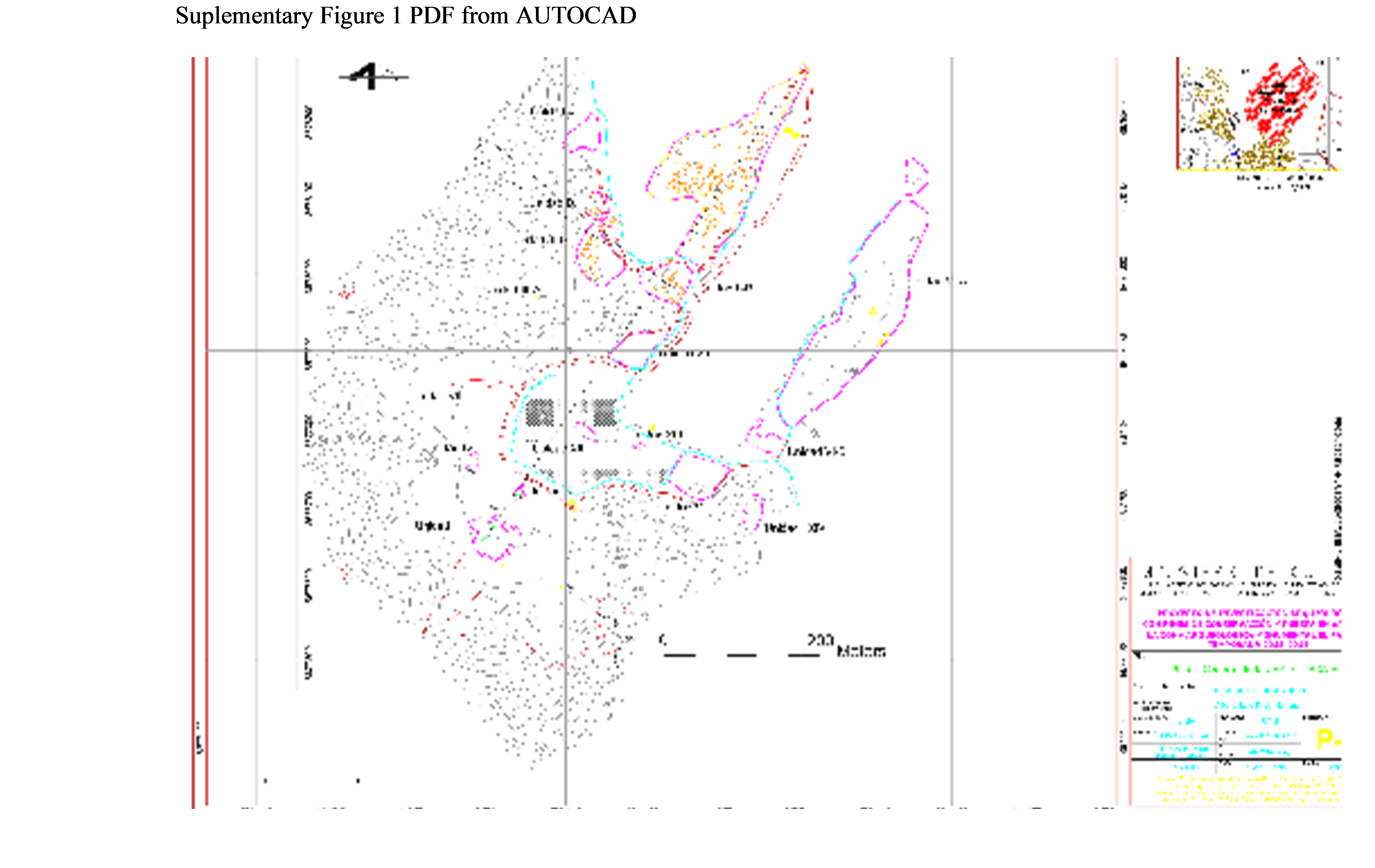
These data are available through Google Earth by the coordinates presented and can be duplicated from Figure 4. A higher-resolution PDF version of an AutoCAD image of Figure 4 is available in Supplemental Figure 1.
Competing Interests
The authors declare none.
Supplemental Material
For supplemental material accompanying this article, visit https://doi.org/10.1017/laq.2023.51.
Supplemental Figure 1. Total station map of the Monstruo by the Museo de Minerales de Lima.


 Open access