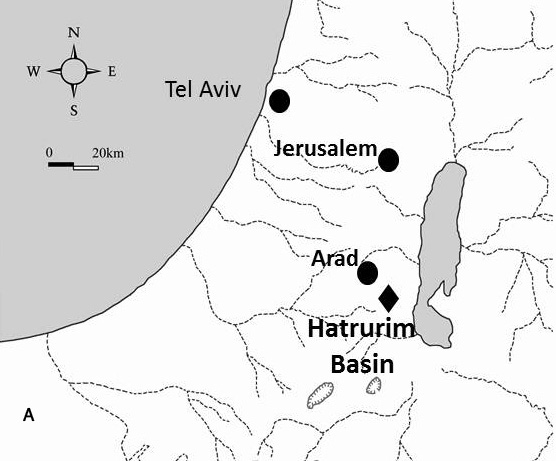
Map with location of the Hatrurim geological basin.

Introduction
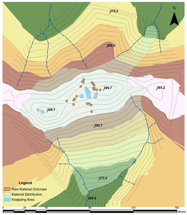
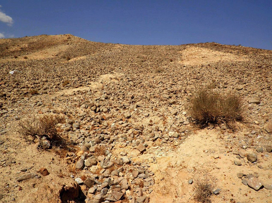
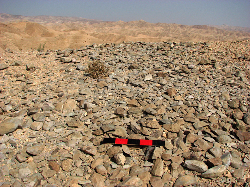
A large concentration of knapped waste and bifacial tools was recently discovered by Y. Vapnik, of the Geology and Environmental Sciences Department at Ben-Gurion University of the Negev, on Har-Parsa (Hoof Mountain in Hebrew) in the southern part of the Judean Desert, Israel. The mountain belongs to the Hatrurim geological formation and the site is located on Har-Parsa's ridge overlooking a tributary channel of Nahal Boqeq between Arad and the Dead Sea (Figure 1). Preliminary investigation of the site and its vicinity shows that it served as a major quarry and production site for Neolithic and Chalcolithic bifacial larnite tools. The main features of the site include a vast and thick coverage of knapped waste, partially modified bifacial tools and numerous loose larnite rock cobbles on the northern and southern hill slopes (Figures 2 & 3). Shallow mounds of knapping waste are scattered on the narrow ridge top (Figure 4). The total area of the site is approximately 10 000m².
Plan of the Har-Parsa quarry and production site.

View from the lowest point of the southern slope of the site of Har-Parsa.

A knapping mound on the hilltop.

The site
The site of Har-Parsa is exceptional in several ways. First, it is most probably one of the largest bifacial tool production sites in the Levant. It contains production waste of all stages of the tool knapping process as well as partially modified tools. Second, Har-Parsa is significant because the tools made there are of a unique and rare metamorphic rock, larnite (Reference GrossGross 1977). To date, larnite has not been recognised in the archaeological record. The magnitude of biface production at the site of Har-Parsa is intriguing since the raw material commonly used for the production of bifacial tools of the Neolithic and Chalcolithic in the Levant was flint (Reference BarkaiBarkai 2005) with a small proportion of basalt or limestone bifaces (Reference BarkaiBarkai 2005; Rosenberg et al. 2008).
Raw material properties
Larnite (β-Ca2SiO4), like other common rock forming minerals of the Hatrurim formation, is a metamorphic modification of the bituminous carbonate protholite. This modification occurred during sub-surface combustion in the Miocene and then in the Pliocene (Porat et al. 1991; Burg et al. 1992; Gur et al. 1995). The mineralogy resembles that of the primary process in the formation of Portland cement clinker (Reference Kolodny and SkalnyKolodny 1979).
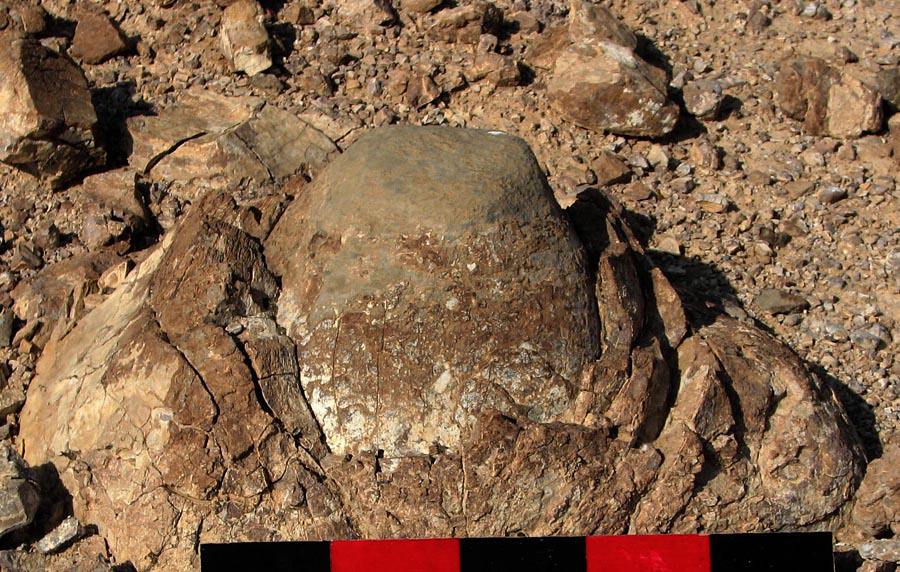
The larnite rocks appear on the site in the shape of oval or round black lenses, up to tens of centimetres in diameter. The larnite lenses are dense, fine-grained and homogeneous, with a very hard mineral mass. The lenticular appearance is the result of weathering, in pockets of weathered larnite rock (Figure 5). Signs of extraction of larnite lenses are visible close to the hilltop and on the slopes, evident as a series of emptied pockets—the negatives of quarried nodules. Several cobbles were left in situ.
A larnite egg-shaped lens.

Larnite is heavier than flint by c. 15–20 per cent, based on comparison of tools found at the site with bifacials of the same volume made of flint. Prior studies have shown that larnite density is around 3.3g per cm³ (Reference BridgeBridge 1966), while flint is lighter (2.65g per cm³). The colour of the larnite rock's interior is black. This makes it visually similar to certain basalt rocks but their chemical composition is totally different, as larnite is metamorphic while basalt is volcanic.
Preliminary results
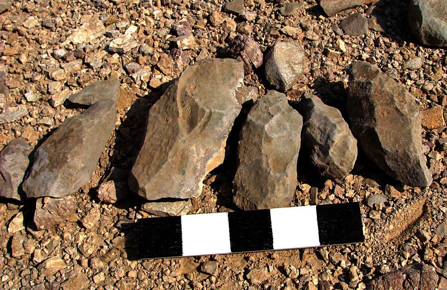
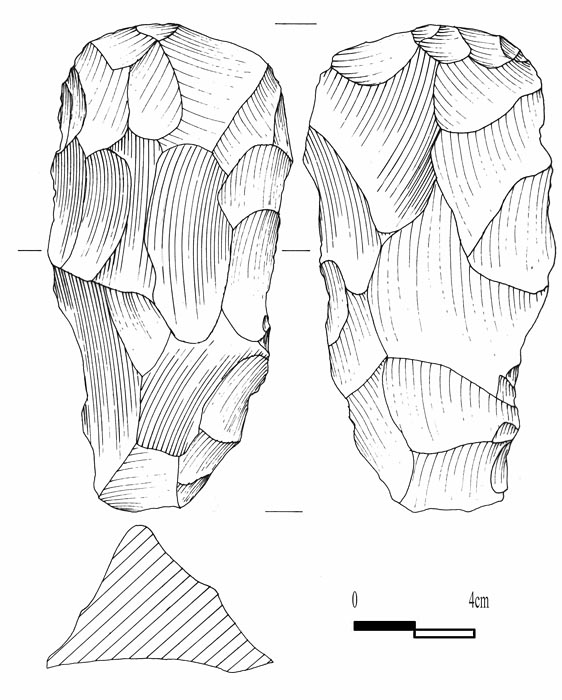
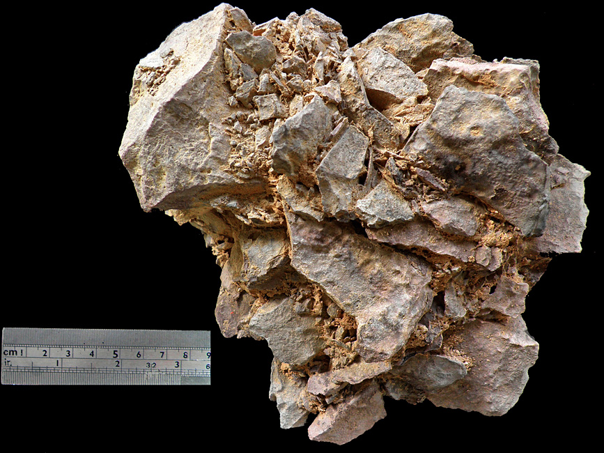
Five m² were excavated from a shallow concentration of waste on the summit, to a depth of 17–26cm. Chipping debris and flakes of different sizes dominate the waste. Dozens of unfinished bifacials that had been discarded at different stages of modification were sampled from the hill slopes (Figures 6 & 7) and in proximity to the excavation area. Unfinished tools were also recovered, including a nearly finished adze discovered at the bottom of the excavation .Several lumps of fused waste artefacts (Figure 8) were recorded around the knapping areas and on the slope. Whether this fusion is the result of chemical reactions related to the cement characteristic of the raw material or representing a natural pedological process remains to be investigated.
Adzes from the knapping mound.

Adze (drawn by P. Kaminski).

Dating and concluding remarks
A fused lump of waste artefacts from the hill slope close to the peak.

The site of Har-Parsa poses a challenge when trying to relate it to a specific period or a cultural phase, as sites in which these items were used are currently unknown. It is likely that the site was active during the Late Neolithic and Chalcolithic periods due to a relative abundance of roughouts with a plano-convex cross section that can be defined as adzes. These are much more common in the sixth and fifth millennia BC Pottery Neolithic–Chalcolithic sequence as compared to the Pre Pottery Neolithic period (Gilead et al. 1995; Reference BarkaiBarkai 2005; Reference HermonHermon 2008). Clearly additional research is needed to ascertain where and when these tools were used.
Acknowledgments
The research at Har-Parsa is supported by CARE Archaeological Foundation. We would like to thank Yevgeni Vapnik, Geology and Environmental Science Department at Ben-Gurion University of the Negev, and Yehoshua Kolodni, Geology Department of the Hebrew University of Jerusalem. Thanks are also due to Avi Burg and Yoav Avni, Geological Survey of Israel, and Danny Rosenberg, Institute of Archaeology at Haifa University. Finally, we are grateful to Isaac Gilead, Ben-Gurion Archaeology Division, for his support of this research and to Steve Rosen and Stephanie Lehrer for editorial help. The authors would like to thank all the volunteers of the Har Parsa project.