

Introduction
Flow stripes are sub-parallel surface topographic ridges or troughs with meter-scale relief, hundreds of meters to a few kilometers wide and tens to hundreds of kilometers long. They generally form in regimes of fast ice flow such as in outlet glaciers and ice streams and are often visible down-flow onto floating ice shelves (e.g. Reference Fahnestock, Scambos, Bindschadler and KvaranFahnestock and others, 2000; Reference Wu and JezekWu and Jezek, 2004; Reference Hulbe and FahnestockHulbe and Fahnestock, 2007). They generally first appear where accelerating ice flow narrows or down-flow from regions where entering tributaries create converging flow (see review by Reference BindschadlerBindschadler, 1998, and references therein). According to ice-flow model studies by Reference Gudmundsson, Raymond and BindschadlerGudmundsson and others (1998), they are also an expected consequence whenever velocity at the bed is large compared to shearing through the ice thickness, conditions typically found in the onset regions of ice-stream flow. Under these conditions, basal undulations are effectively transmitted to the surface where they are advected for long distances downstream. For example, flow stripes coincident with the origin of streaming flow on Kamb Ice Stream (KIS; formerly Ice Stream C), West Antarctica, continue for >200 km downstream (Fig. 1) into areas where flow today is less than a few tens of meters per year (Reference JoughinJoughin and others, 1999; Reference Price, Bindschadler, Hulbe and JoughinPrice and others, 2001).
MODIS imagery (Reference Scambos, Haran, Fahnestock, Painter and BohlanderScambos and others, 2007; T. Haran and others, http://nsidc.org/data/moa/) reveals sub-parallel surface flow stripes in areas of streaming flow on KIS.

Deformation of ice internal stratigraphy can result from several processes or a combination of processes producing strains within the ice, and an extensive literature exists on the subject (e.g. Reference Vaughan, Corr, Doake and WaddingtonVaughan and others, 1999; Reference SiegertSiegert and others, 2004, and references contained in these works). Ice-penetrating radar profiles depict internal reflectors within the ice, generally understood to be isochronous surfaces, and thus are very useful indicators of strains within the ice. Compressional (or extensional) strain in directions both transverse and longitudinal to the flow has been shown to produce folds of the internal stratigraphy depicted by ice-penetrating radar, especially in fast-moving ice streams (e.g. Reference Jacobel, Gades, Gottschling, Hodge and WrightJacobel and others, 1993; Reference Ng and ConwayNg and Conway, 2004; Reference Rippin, Siegert, Bamber, Vaughan and CorrRippin and others, 2006). Changing conditions at the bed, alternating regions of stick–slip, have been hypothesized as the cause of folds in the along-flow direction (e.g. Reference Whillans and JohnsenWhillans and Johnsen, 1983). Ground-based radar surveys provide well-resolved and detailed images of internal stratigraphy, particularly with studies carried out at low frequencies (1–5 MHz) because of the exceptional penetration of the radar at these frequencies and the direct coupling of the antennas with the ice (cf. Reference Jacobel and WelchJacobel and Welch, 2005).
The ability to infer strain history in the ice interior and at the surface from the deformation of internal stratigraphy and surface lineations is of fundamental importance for understanding ice-stream history and evolution. For example, flow stripes on the surface of the Ross Ice Shelf, West Antarctica, have been used to interpret changes in the outflow of the Siple Coast ice streams (Reference Hulbe and FahnestockHulbe and Fahnestock, 2007). Other studies have used a combination of surface lineations and the deformation of ice internal stratigraphy to interpret changes in the flow history of the ice streams (e.g. Reference Jacobel, Scambos, Raymond and GadesJacobel and others, 1996, Reference Jacobel, Scambos, Nereson and Raymond2000; Reference Catania, Conway, Raymond and ScambosCatania and others, 2005).
Ideas for the formation of flow stripes and the folding of internal layers have much in common (Reference Gudmundsson, Raymond and BindschadlerGudmundsson and others, 1998). This suggests they may share the same origin and therefore would be expected to match. If flow stripes are simply the surface manifestation of the internal folds below, they would both depict a common pattern of stresses in the ice-flow history. Likewise, if they differ in small ways but are basically the result of the same physical processes acting on the ice, we can interpret them similarly, with appropriate caveats when required. However, if they are produced by different mechanisms entirely, we could potentially learn something additional about the ice-flow history. Flow stripes are depicted well in satellite imagery where relatively easy access and widespread geographic coverage make them useful for large-scale studies. Folds in internal stratigraphy can, in principle, be imaged from airborne radar. In practice, ground-based radar provides the best data (reflector resolution and dynamic range) to interpret internal deformation in the kind of detail needed to reconstruct ice-flow history. These studies are more difficult to carry out and the spatial coverage is necessarily more limited. It is therefore important to understand possible differences in the mechanisms creating deformation at the ice surface, and within, that could confound interpretation.
Instances where satellite data depicting surface flow stripes are available together with ground-based radar extending over a substantial geographic area are infrequent. Thus our datasets for KIS provide an important opportunity to address the question of origins and morphology of these two kinds of features. In the case of KIS, folds in the internal stratigraphy that persist through the entire ice thickness with a wavelength of 1–2 km in the cross-flow direction have been traced previously for >200 km in the down-flow direction (Reference Ng and ConwayNg and Conway, 2004). The general shape and pattern of the folds persist largely unaltered, so that the same features are readily identified in cross-flow profiles at successive locations downstream. In this study, we have identified these same folds in the ice internal stratigraphy at two additional transect locations in our radar profiles and we compare the folds with moderate-resolution imaging spectroradiometer (MODIS) and RADARSAT satellite imagery and our surface global positioning system (GPS) measurements of KIS to examine the relationships between these surface and internal features of similar scale and orientation.
Methods
We traced a subset of nine surface flow stripes seen in both RADARSAT (K. Jezek and RAMP Product Team, http://nsidc.org/data/nsidc-0103.html) and MODIS satellite mosaics (Reference Scambos, Haran, Fahnestock, Painter and BohlanderScambos and others, 2007) of KIS (Fig. 2) starting from where they originate in the tributaries to the ‘sticky spot’, an area of near-stagnant flow in the trunk (Reference JoughinJoughin and others, 1999). We found that the flow stripes imaged by the two sensors are visually similar but differ slightly in detail in comparisons along their length. Flow stripes evolve in cross-sectional shape in complex ways (Reference Raup, Scambos and HaranRaup and others, 2005) and this, together with the fact that each satellite is sensitive to radiation at different wavelengths and from different back-scatter processes, likely accounts for the minor differences in visual appearance.
(a) Surface flow stripes from RADARSAT and MODIS imagery (blue curves) are shown relative to ground-penetrating radar cross-flow profiles and the locations of englacial folds identified by Reference Ng and ConwayNg and Conway (2004). Crosses indicating the location of englacial folds traceable from one profile to the next have the same color. (b) Detail of D and E profiles showing that the traces of englacial folds cross the path of surface flow stripes. Numerous crossings of the flow stripes over internal folds (dashed lines) indicate that surface flow stripes and subsurface folding features are not spatially correlated.

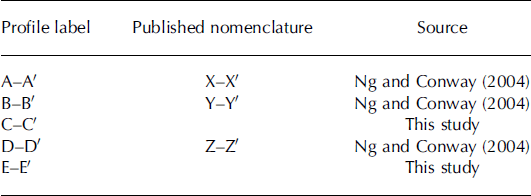
Reference Ng and ConwayNg and Conway (2004) highlighted 11 persistent folds seen in the internal layers of KIS in three radar profiles (our labels: A–A′, B–B′, D–D′; Table 1) shown in Figure 2, which cover a distance of approximately 200 km along-flow. We acquired two additional radar profiles (C–C′ and E–E′) in this region in 2004 and we identified the same folds in our data as Reference Ng and ConwayNg and Conway (2004). We have geolocated and projected these 11 folds onto the ice surface to investigate the correspondence between the cross-flow locations of surface and subsurface features along the length of the ice stream. Figure 2 shows the digitized pattern of flow stripes (blue lines) together with the locations of prominent folds in the internal layers (colored crosses represent folds matched between the profiles and grade in color in the cross-flow direction). A qualitative visual inspection (most notably in Fig. 2b) shows that while some of the folds in the internal layers coincide with flow stripes, many do not, and there is no consistent spatial relationship between the flow stripes and englacial folds from one profile to the next.
Naming conventions for radar profiles used in this study
To more quantitatively compare the pattern of folds in the radar subsurface data with the surface flow stripes seen in the MODIS and RADARSAT satellite imagery, we extracted the pixel brightness values coincident with the path of each radar profile. Flow stripes are revealed in satellite imagery as continuous linear traces of high and low pixel values that persist down-flow such that brightness values alternate high and low across flow. However, satellite imagery, especially RADARSAT, includes noisy ‘speckle’, so a single row of pixels across flow may not be representative of the brightness values characteristic of flow stripes in the region. To minimize the effects of local speckling and to better resolve the cross-flow trends of brightness in the vicinity of the radar profiles, we also extracted pixel values in swaths across the ice stream extending ±3 km up- and down-flow from each profile. An average of the along-flow pixels from these scenes yields a reflectance vector containing a more representative sampling of the flow stripes within the swath. We plotted this average reflectance vector at the location of each of our profiles, together with the digitized internal stratigraphy. The result from one of our profiles, C–C′, is shown in Figure 3.
Englacial stratigraphy (traced in yellow) from our C–C′ profile, with fold axes numbered based on the same features from Reference Ng and ConwayNg and Conway (2004). Fold axes are projected to the surface data of pixel brightness values from MODIS and RADARSAT, and surface slope and elevation from GPS. Note the generally poor correlation between the stratigraphic fold axes and each of the surface observations.

Analysis and Results
A close inspection of Figure 3 shows qualitatively that the pattern (phase, wavelength, and reflectance values) of flow stripes does not correspond with the pattern (phase and wavelength) of subsurface folds. This result is the same for both the RADARSAT and MODIS sensors and whether we consider a single row of pixel brightness values or a swath. The mismatch between internal folds and flow stripes is evident at each profile and also changes from one profile to the next. Our tracings of the flow stripes show that their position varies relative to the subsurface folds. The surface flow stripes generally remain sub-parallel to each other throughout the KIS trunk, occasionally but infrequently merging or splitting while the average separation decreases by a factor of two (Fig. 2). In contrast, the internal folds become more strongly compressed in the cross-flow dimension as the ice-stream trunk narrows such that their wavelength decreases from approximately 3 km at A–A′ to about 0.8 km at E–E′, 200 km downstream. This stronger transverse compressional strain within the ice leads to a dislocation between surface flow stripes and internal folds (Fig. 2). We found that subsurface folds cross flow stripes, sometimes over very short distances (Fig. 2b).
We have also performed a correlation analysis to look more quantitatively at the relationship between internal layer folds, pixel brightness values of flow stripes and GPS measurements of surface topography (Table 2). Looking first at a comparison of the amplitude pattern between internal layers at the same location, our results show that adjacent internal layers are strongly correlated with one another, yielding larger correlation coefficients than those between layers separated by greater ice thickness. This suggests that internal layers are deformed by the same process, but that the amplitude at different depths is controlled by varying effects of normal and shear strains experienced during formation or during flow down the length of the ice stream. The lack of deformation of the axial planes of the internal folds (e.g. Fig. 3) indicates little or no transverse shearing during flow down the ice stream. This result holds for all of the profiles of the ice-stream trunk in this study and is an important finding to which we return in the next section. Tilt and other deformation of the axial fold planes have been measured in other regions on KIS closer in proximity to strong flow deformations (e.g. near the sticky spot of Figs 1 and 2).
Correlation coefficients show the strong similarity of internal layers, but little correlation is observed between the internal layers and the satellite imagery, bed topography or ice surface. As expected, strong correlation or anticorrelation is observed between MODIS imagery and GPS surface slope

Comparing next the internal folds to the surface features confirms the visual results. The deformation pattern of folds in the internal layers yielded only very low and inconsistent correlation coefficients with pixel brightness values in MODIS and RADARSAT imagery at the same profile location (Table 2). Occasionally, individual peaks or troughs in the pixel brightness pattern coincide with a crest or trough in the radar folds, but there is no consistent pattern from one profile to the next, nor from fold to fold within one profile.
Finally, we have also derived measurements of surface topography from high-precision GPS data collected along the C–C′ and E–E′ profiles. From these elevation data we have calculated surface slopes and compared both the elevation and slope values with the satellite imagery and the deep radar profiles (Fig. 3; Table 2). As expected, there is strong correlation between MODIS pixel brightness values and surface slope (strong anticorrelation in one case because of the different look angle). But again, we see only weak and inconsistent correlations between the amplitude pattern of internal layers and surface elevation or surface slope, confirming the results from the imagery comparisons.
Interestingly, bedrock topography also shows poor correlation with internal layers (Table 2), suggesting that while internal layers may originate in bedrock undulations, the folding patterns have been advected tens to hundreds of km downstream to where they are imaged today.
It might be argued that the lack of correlation between the pattern of internal layer folds and flow stripes imaged by RADARSAT and MODIS is related to the physical processes by which energy is returned from the surface to the respective sensors. Both images are affected by satellite look angle (and sun illumination angle in the case of MODIS), and both look angle and illumination angle change along the curving flow of the ice stream. Also, RADARSAT detects both surface and volume scattering, so it is only partially a measure of surface topography. A possible interpretation of the poor correlation results might then be that the surface and internal features really are coincident but the apparent mismatch is an artifact due to the changing geometries and differences in scattering processes in the satellite imagery.
Some insight into the issue of characterizing surface topography with pixel brightness patterns from satellite imagery can be gained by comparing the MODIS to the RADARSAT images. A visual inspection reveals that both sensors depict the same flow stripes, following essentially identical paths. The human eye can trace these flow stripes easily by following brightness trends. But high correlation of the cross-flow variation in pixel brightness values from the two sensors at one location should not be expected, for the reasons cited above. In fact, we observe reasonably good numerical correlations between RADARSAT imagery and MODIS imagery, showing that they are relatively consistent in depicting surface flow stripes (Table 2). In contrast, there is very poor correlation between the patterns of MODIS or RADARSAT pixel brightness and our subsurface fold patterns.
The statistical comparisons together with visual inspection produce a compelling result. The two types of features evolve differently down-flow: flow stripes remain nearly parallel, with constant wavelength, while the subsurface folds decrease in spacing. The consequence, as we have shown, is that there are clear cases where flow stripes cross the trace of folds in the internal layers (Fig. 2b).
Discussion
The lack of correlation between the surface flow stripes and the internal stratigraphic folds is problematic because it seems that the same physical mechanisms should govern both processes (Reference Gudmundsson, Raymond and BindschadlerGudmundsson and others, 1998). As discussed in the introduction, flow stripes commonly originate in regions of converging flow where ice flux increases due to mass entering from tributaries. The added mass creates horizontal strains that produce folds in the cross-flow direction, and the rapid ice velocity advects these features downstream. In this case, the stresses should produce patterns of strain in the ice at depth similar to those on the surface, and there should be a close correspondence between the surface and deep fold patterns in the region of flow-stripe development. Differences between the two, as seen in this study, must then evolve from additional processes operating at the surface that do not affect ice internal stratigraphy. An alternative possibility is that the two sets of features are produced by entirely different mechanisms, perhaps even originating in different parts of the ice stream. For example, perhaps the internal folds form first in the catchment basin above KIS. We explore this possibility below.
One consequence of the common-origins-with-subsequent-modification hypothesis is that the pattern of flow stripes should become less similar to the pattern of internal layer folds farther downstream from the location of their origin. That is, if they are formed initially by the same stresses but surface topography evolves differently due to additional processes operating only at the surface, then greater differences should be seen further downstream. As noted above, we observe this divergence in our data where the average spacing between internal-layer folds decreases by more than a factor of three while flow stripes compress by only a factor of two. Yet even at our most upstream profile, there is poor correlation between the two patterns except for a similar average spacing. Following this hypothesis, the correlation between the surface topography and internal folds should be greatest at the onset of the flow stripes.
Unfortunately, no radar profiles exist directly upstream from the study area that correspond to the onset point of the surface flow stripes. However, we have a radar profile from the US International Trans-Antarctic Scientific Expedition (US-ITASE 2002) in the catchment area of KIS about 180 km upstream of the onset of flow stripes (Reference Jacobel and WelchJacobel and Welch, 2005). We projected the locations of the 11 subsurface folds of interest up-flow from Reference Ng and ConwayNg and Conway’s (2004) most upstream profile to the intersection of our ITASE data by following modern surface flow vectors based on the gradient of the interferometric synthetic aperture radar (InSAR) velocity dataset (Reference JoughinJoughin and others, 1999). The US-ITASE radar profile shows no indication of internal layer folds similar to those found in KIS. The subsurface features of interest very likely do not exist this far upstream on KIS because the folding processes that create the features (lateral convergence of locally fast ice flow) do not operate until the onset of fast ice flow, i.e. the same location where flow stripes begin.
To better understand the morphology of the subsurface features seen in the radar data, we examined how the fold amplitudes vary with depth. We used digitized internal layers in our radar data to measure the amplitude of folds by computing the difference between local minima and maxima. We then examined the amplitude as a function of depth below the ice surface at points of local minima. These measurements show that fold amplitude decreases from the bed toward the surface in an approximately linear relationship, suggesting that the stresses within the ice that created the folds decrease toward the surface. While the decreasing amplitude does not constrain the location of the origin of folding, it does suggest that the amplitudes of surface and internal folding are probably not abruptly discontinuous. However, the phase and wavelength discontinuity between the internal folds and surface flow stripes must take place in the near-surface interval. Radar data showing cross-flow fold patterns in the near-surface ice would thus be extremely helpful in detailing where and how the mismatch between surface features and internal folds takes place. Unfortunately, our radar is insensitive to returns within the uppermost 100 m of the ice, so we cannot determine whether the amplitudes of internal layer folds decrease to zero at some point below the surface. All that can be said from the data is that the locations of the fold axes at depth do not match the pattern of undulations on the ice surface.
The mismatch in phase and wavelength between flow stripes and internal folds strongly suggests that topographic features on the ice surface can be subject to processes that modify their morphology relative to the folded internal layers below. Reference Arcone, Spikes and HamiltonArcone and others (2005) studied the relationship between surface topography and shallow internal layers depicted in along-flow radar profiles at 400 MHz. They found that the pattern of folds in the firn (upper 60 m) was strongly influenced by variations in accumulation that in turn were related to surface topography. Differences between folds at depth and the surface topography evolved as layers were buried and advected downstream into different accumulation regimes.
Our situation is somewhat different, in that we are considering topography in the cross-flow direction, but the idea that surface topography influences accumulation and that those topographic influences can be advected downstream is important. We suggest that the pattern of surface flow stripes can evolve differently from the folds at depth because meteorological variables such as prevailing winds and the spatial pattern of snow accumulation act only at the surface. Once produced, flow-stripe topography on the surface is reinforced and modified by katabatic winds or storms and accumulation gradients that enable the topographic lineation to persist downstream. The surface processes tend to reinforce flow stripes more-or-less in the pattern in which they were formed, while the ice compresses laterally as mass enters from the margins. The ice at the surface also strains in response to changes in the flow (the average separation decreases somewhat), but surface processes tend to maintain the original flow-stripe pattern. The result is that the average separation of internal folds decreases more markedly than for the surface flow stripes, with the consequence that flow stripes eventually migrate with respect to underlying folds (Fig. 4). Also, we expect that flow stripes in regions with greater bedrock control on flow direction (e.g. Reference Melvold and RolstadMelvold and Rolstad, 2000), or where ice flow rates are higher than the stagnant KIS (e.g. Reference Merry and WhillansMerry and Whillans, 1993), would be less prone to lose correlation with englacial folds.
Cartoon map of an ice stream where the width narrows downstream. Folds A and B in the ice internal stratigraphy form due to lateral compression as the ice stream narrows. Fold C results from ice flow over a large bedrock bump located near the onset of sliding (Reference Gudmundsson, Raymond and BindschadlerGudmundsson and others, 1998). Surface flow stripes (a–c) develop at the location of fold formation and then propagate downstream with ice flow. The surface lineations are subsequently subjected to modification by aeolian processes, so the surface and englacial features may not be correlated in deep radar data.

Referring to the work of Reference Gudmundsson, Raymond and BindschadlerGudmundsson and others (1998), Reference Clark, Tulaczyk, Stokes and CanalsClark and others (2003) have discussed the possible relationship between mega-scale glacial lineations (MSGLs) observed in the Canadian Shield and elsewhere (thought to be indicative of paleo fast flow) and flow stripes on rapidly flowing ice today. They discuss the possibility that MSGLs may be enhanced and maintained by such surface topographic features. This would presumably require deformation of ice internal layers on the same horizontal scale as flow stripes and provide a common mechanism for creating the two types of features. This may indeed be the case, but it does not shed light on how the two sets of folds later become decoupled, and something like the surface processes we describe above are still required. We also point out that, as noted, we have no evidence for lineations in the bed topography of KIS, and the bed topography we observe is poorly correlated with the pattern of flow stripes (Table 2).
Hypotheses related to flow divergence or convergence of KIS that produce strains varying with depth might be posited as a way to cause a dislocation between folds at the surface and at depth. However, this mechanism would require the axes of internal folds to tilt from the vertical to one side or the other. As noted, analysis of all our profiles, as well as those of Reference Ng and ConwayNg and Conway (2004), shows that the axial fold planes remain essentially vertical (e.g. Fig. 3).
Conclusion
In this study, we see no correlation between the pattern of surface flow stripes and folds in the internal stratigraphy in KIS in our study site downstream from the onset of streaming ice flow. Satellite imagery, together with ground-based deep penetrating radar, and GPS profiles of surface topography, reveals a disparity between the spatial patterns of flow stripes and those of internal layers, at least to within about 100 m below the surface. While both types of features have similar spacing/separation in the furthest upstream profiles available, internal layer folds become compressed down-flow relative to flow stripes. This results in clear examples where flow stripes cross above folds in the internal layering.
While the possibility that both types of features are created by different mechanisms is not entirely ruled out, observations limit the origin of both to a region not more than 180 km above the study area, most probably near the onset of fast ice flow. Similarities in the scale of both types of features suggest a common origin. In this case, cross-flow profiles of surface topography and ice internal stratigraphy at the point of origin would be highly correlated. We argue that surface flow stripes are subject to additional surficial processes (wind transport and deposition of surface snow) that cause them to evolve differently downstream than folds in ice internal layers. Wind and snow deposition patterns clearly affect the evolution of ice surface features, while deep internal folds respond only to stresses within the ice. The result is that the two types of features become disassociated as they are advected downstream. Thus, the stratigraphic folds as mapped by radar represent the ice-flow history, while aeolian modification of the surface flow stripes seen in satellite imagery may deviate from the paleo or modern flow paths, with the deviation increasing with distance downstream. The degree of deviation is related to local ice flow and the rate of surface accumulation/transport processes.
In the case of KIS, folded internal stratigraphy reveals a more laterally compressive flow regime than might be envisioned based on the pattern of sub-parallel flow stripes at the surface. We conclude that, at least in this study, flow stripes are not simply a surface manifestation of deeper internal folds. While it seems probable that they form together, processes acting at the surface evidently cause flow stripes to evolve differently than the folds below.
The question of whether both types of features share a common origin could be resolved by acquiring a set of radar profiles at the location of the origin of flow stripes identified in satellite imagery. If the surface were relatively free of crevasses, this could be carried out by surface-based radar providing high-resolution depictions of the internal stratigraphy. In a like manner, resolving the question of where and precisely how the pattern of flow stripes and internal folds diverge could be answered by combining higher-frequency, shallow, radar with the results from a deep-penetrating radar in cross-flow profiles on an ice stream. Generalizing from Reference Arcone, Spikes and HamiltonArcone and others (2005) who traced shallow layers in the along-flow direction, we hypothesize that this dislocation results from a gradual change in fold wavelength and phase throughout the firn. The amplitude of the internal folds approaches that of the surface topography, where it is controlled primarily by surface processes.
Acknowledgements
We thank our colleagues from University of California, Santa Cruz for assistance in the field and acknowledge the support of those from Raytheon Polar Support Corporation. Development of the radar system software and assistance with the data processing was provided by several undergraduates in the Physics Department at St Olaf College. Very helpful reviews were given by F. Ng, whose paper co-authored with H. Conway was influential in motivating this work. Additional helpful comments were provided by T. Scambos and an anonymous reviewer. This work was supported by US National Science Foundation grant No. 0337567 to St Olaf College.


