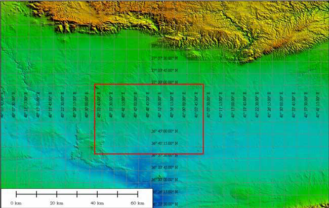
The Upper Khabur basin (Syria), with the area shown in greater detail outlined: Tell Brak (lower right corner of the red rectangle in the enlarged image) is already visible. (SRTM data in GlobalMapper).

A quiet revolution is taking place in the archaeology of landscapes in those regions where sites are large and long-lived: the classic area of settlement-archaeology based on the study of tells. The Arabic word tell (and its equivalents in other languages such as the Turkish höyük or the Greek magoula – both in variant spellings) signifies a settlement-mound using mud-based building techniques and occupied as a nucleated settlement for long periods of time. It symbolises a whole field of research in the Neolithic, Chalcolithic and Bronze Ages of the Near East and the Balkans and adjacent areas as far east as India, and moreover a whole way of doing archaeology, basic to the Old World tradition. Nowadays, it is realised that tell-sites were probably only one component of the settlement-system, and intensive survey has revealed less substantial flat sites which fill out the total picture. Nevertheless the classic stratigraphic excavations on which our whole picture of the Neolithic and Urban Revolutions is based are centred on such sites, which are vital to understanding the emergence of villages and towns in the heartlands of the development of complex societies.
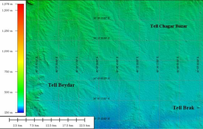
The area between Tell Beydar and Tell Brak, showing a regularly-spaced lattice of tell sites. This is approximately the area covered in Reference UrUr (2003), Figure 9. (SRTM data in GlobalMapper).

There is one major problem with this field of research: despite generations of mapping and field-survey, there is no systematic way of finding out where such sites are on the ground in an accurate and precise way. Individual areas have been admirably mapped, from Mallowan's pioneer (1937) work in the Khabur to Reference AdamsR.M. Adams' (1981) classic work in southern Mesopotamia; but it is still a huge problem to find accurate co-ordinates even for some of the best-known names in the archaeology of these long-investigated regions. Conflicting estimates are offered in well-known works of reference, and the latitude and longitude references traditionally added to the publication of dates in Radiocarbon are notoriously unreliable. The most comprehensive guide, the magnificent ASPRO (Atlas des Sites du Proche-Orient 14000-4500 av.J.-C.: Hours et al. 1994) only offers the precision of a 10 km grid-square for the 2729 sites it lists (http://www.mom.fr/ASPRO/ [URL no longer available, checked 2018]). The reason for this is not far to seek - expeditionary work in foreign lands concentrated on particular sites, and most countries restricted detailed topographic maps to military use. Old British army maps, or those of the other former colonial powers, provided the best guides - however inaccurate and outdated. At a time when declassified Soviet topographic maps (at 1:200,000, 1:100,000 and even 1:50,000 in some cases) are now widely available, however, and georeferenced satellite-imagery at 30m resolution (comparable to 1:100,000 maps) or even 15m or 10m imagery is freely available for many areas, and much more detailed imagery from commercial satellites such as Ikonos and QuickBird is available for purchase, this imprecision in our archaeological knowledge is becoming an embarrassment. For many key sites, our control of time is more precise than our control of space.
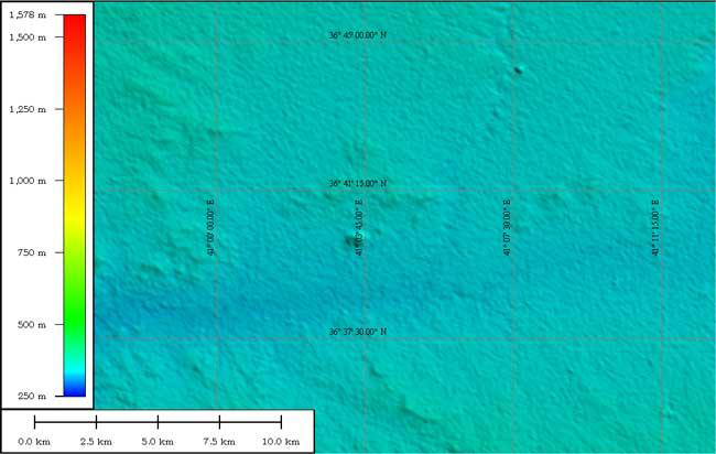
A 10km radius around Tell Brak, at the confluence of the Nahr Jaghjagh and the Wadi Radd (cf. http://oi.uchicago.edu/OI/AR/99-00/99-00_Jazira_fig5.html [URL no longer available, checked 2018]). (SRTM data in GlobalMapper).

Now, however, help is at hand. During an eleven-day mission in February 2000, Space Shuttle Endeavour carried a specially-modified radar system which obtained elevation data for the greater part of the globe, capable of generating the most complete high-resolution digital topographic database of Earth (see http://www2.jpl.nasa.gov/srtm/). This SRTM (Shuttle Radar Topography Mission) data-set was collected at 1 arc-second resolution, the equivalent of 30m on the ground, and this is routinely available for the continental United States (http://edcsns17.cr.usgs.gov/EarthExplorer/ [URL no longer available, checked 2018]). For areas outside the US, this information has been sampled at 3 arc-seconds (which is 1/1200th of a degree of latitude and longitude, or about 90 meters) and made available in preliminary form. While still containing gaps (mostly where complex topography with steep slopes created problems of interpretation), and with particular reflectance problems over bodies of water (making the definition of coastlines very ambiguous), this comprehensive Digital Elevation Model promises to provide a revolutionary tool for geographers and archaeologists working in areas where conventional maps are restricted or where persistent cloud-cover obscures conventional satellite imagery. For Near Eastern archaeologists, in particular, it offers a breathtaking prospect (I use the words advisedly) of actually seeing tells from space. The figures and captions tell their own story: these pimples on the Earth's surface are the precious repositories of many millennia of human existence at a critical period in our cultural development. Now we can see where they are. It will take a major collaborative effort to name and identify them, beyond spotting the most famous examples; but it offers the opportunity to interrogate an archaeological resource with a hitherto unparalleled degree of precision. "Bliss was it in that dawn to be alive..."...
Acknowledgements
Thanks to Jason Ur for his suggestions. Further imagery will be mounted on the ArchAtlas website.