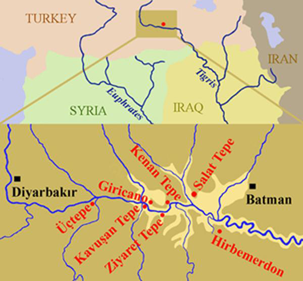
Salat Tepe is one of the ancient settlements within the area to be flooded by the Ilısu-Dam (Algaze et al. 1991: 213, fig. 2a, no. 56; Ökse 1999; 2004; Ökse and Alp 2002; in press). The site lies c. 5 km to the north of the Tigris, on the western bank of the Salat Stream (Figure 1).
The Building
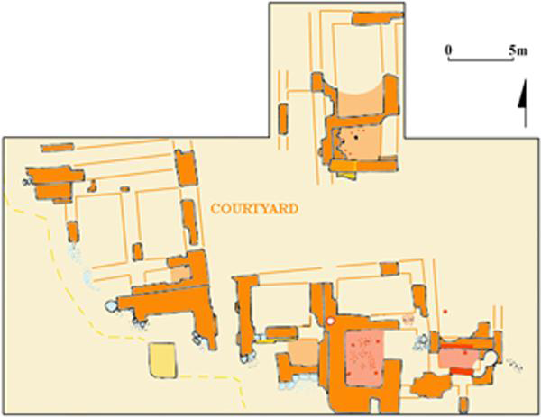
At the beginning of the second millennium BC the summit of the 17 m high Chalcolithic mound was levelled with clay fill and a platform was formed by paving with mud-brick. A floor was laid, of pebble from the river bed in the clay of the platform and a building with thick mud-brick walls with limestone block foundations was then constructed (Figure 2).
Location of the Middle Bronze Age sites on the Upper Tigris region.

Plan of the building at Salat Tepe.

The walls are built with standard mud-bricks of 35 x 35 x 8 cm. The outer walls are of 3-3.5 m mud-brick thick while the inner walls are of 2-2.5 m mud-brick thick; the walls have been exposed to a height of 1.65 m. Although the building is disturbed by erosion and later granaries, a suite of rectangular rooms encircling a large courtyard has been defined (Figure 2).
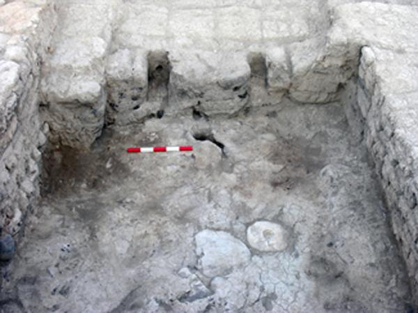
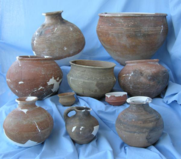
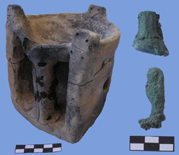
One of these rooms had two alcoves in the inner face of its western wall. Ten stone weights and pieces of carbonised wooden furniture were found on the floor (Figure 3), pointing to the prior existence of a weaving loom. The assemblage in this room (Figures 4-5) included ten vessels, an andiron, two basalt vessels, a grinding stone, one small bronze hoof and one bronze human leg, probably belonging to a rider figurine.
The room with loom weights on the mound summit.

Comparison and Dating
In the Upper Tigris Region there are several public buildings on high mound summits showing similar architectural features. These are at Üçtepe 11 (Özfirat 2006), the burned building at Ziyaret Tepe (Matney et al. 2004: 393), areas C2 and D4 in Kenan Tepe (Parker and Dodd 2003: 37-38), buildings A and C in Giricano (Reference SchachnerSchachner 2004: 511), Kavuşan Höyük III (Kozbe et al. 2004: 469) and Hirbo Merdan (Reference LaneriLaneri 2005). According to 14C analyses from Kenan Tepe and Salat Tepe, these buildings were in use within the nineteenth-sixteenth centuries BC.
All the buildings depict similar ceramic assemblages consisting mainly of the Red-Brown Wash Ware (Parker and Dodd 2003), Cooking-Pot Ware and the Standard Monochrome Ware dating to the first half of the second millennium BC. These contexts contain also painted vessels of Khabur-Ware dating to the Middle Bronze Age (Oates et al. 1997: 63, 68, 145-147) and a few sherds of Nuzi Painted Ware dating to the Late Bronze Age; the overlap between these wares occurs around the sixteenth century BC (Akkermans and Schwartz 2003: 309). Some sherds within these contexts belong to the second half of the third millennium BC. These are the Dark Rimmed Orange Bowls (Oates et al 2001: 161-162) and the medium grey, smoothed and burnished ware of Early Jezirah IIIb-V (Reference PrußPruß 2000: 196, 199; Reference LebeauLebeau 2000: 176-177, 188, Table V) as well as the Post-Akkadian Grey Burnished Ware of the Upper Khabur Region (Oates et al 2001: 65, 173).
Red-Brown Wash Ware from the room on the mound summit.

Discussion
All these buildings have thick mud-brick walls suggesting multi-stored buildings. One of the buildings at Giricano covers an area of c. 625 m2. At Salat Tepe 600 m2 of the building has been excavated which is about half of the building. The tablets collected in the building complex dating to the Middle Assyrian Period at Giricano depicted a Middle Assyrian dunnu, a rural fortified centre controlling the surrounding agricultural lands (Reference RadnerRadner 2004: 113 ff, 119, 138, Tab. 12), such as the dimtu of the Old Babylonian Period. These other sites might also have had a similar function, since the agricultural lands could be watched over from other monumental buildings and the products could most probably be stored and protected there. The distance between Üçtepe and Ziyarettepe located to the south of the Tigris Valley is c. 25 km; Kavuşan Höyük is 8-8.5 km to Ziyarettepe. The distance between Giricano and Kenan Tepe is 6.5 km, while the distance between Kenan Tepe and Salat Tepe is c. 20 km. Thus, all these buildings seem to have constituted large complexes constructed on hills watching over the fields, each by a tributary of the Tigris River, and in contact with each other.
Andiron and figurine pieces from the room on the mound summit.