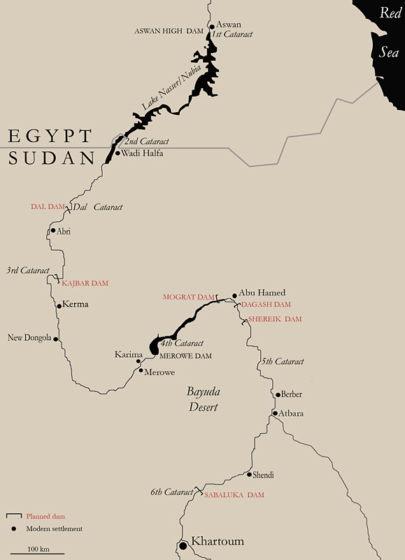
Map of northern Sudan showing the planned dams.

Introduction
The Middle Nile is the 1700km-long stretch of the River Nile between the confluence of the Blue and the White Niles at Khartoum and Aswan. It has already seen the building of two gigantic dams, the Aswan High Dam in Egypt and the Merowe Dam in Sudan, that forced many thousands from their homes, flooded the natural landscape and washed away all traces of the past. Sudan now intends to build six more dams on the Middle Nile (Figure 1).
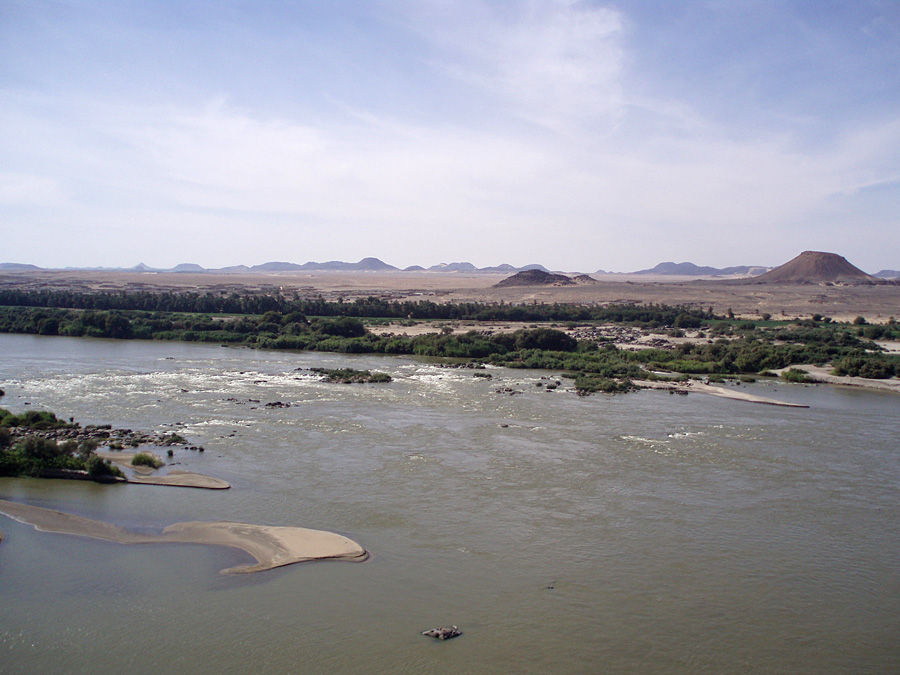
The http://preservethemiddlenile.wordpress.com European Committee for Preserving the Middle Nile is a group of Africanist archaeologists deeply concerned that the building of these dams will displace tens of thousands of people, damage the river's fragile ecosystem and destroy a heritage of vast importance — not only for local people, but for humanity as a whole. We believe that allowing the inhabitants of the Middle Nile Valley to remain where they are, leaving the environment undiminished and preserving the antiquities in place, is of great importance. Along with its http://preservethemiddlenile.wordpress.com/the-american-committee-for-nubian-heritage sister organisation in North America, the Committee seeks to engage governments, international agencies, activist organisations and individuals to oppose constructions that would transform the Middle Nile into a series of reservoirs with immense effects on its landscape, the people who live there and their cultural heritage (Figure 2).
The Nile at Kajbar where the next large dam on the Middle Nile is to be built.

Historical background
The building of dams on the Nile started at Aswan in southern Egypt in 1902. This dam was twice heightened before being replaced by the Aswan High Dam in 1971. In consequence, the Nubian communities living between the First and the Second Cataracts had to relocate in 1902, 1912, 1933 and 1963. In total, the Aswan dams displaced 70 000 people in Egypt and 50 000 people in Sudan, causing the 'Nubian Exodus' described by Reference DafallaDafalla (1975).
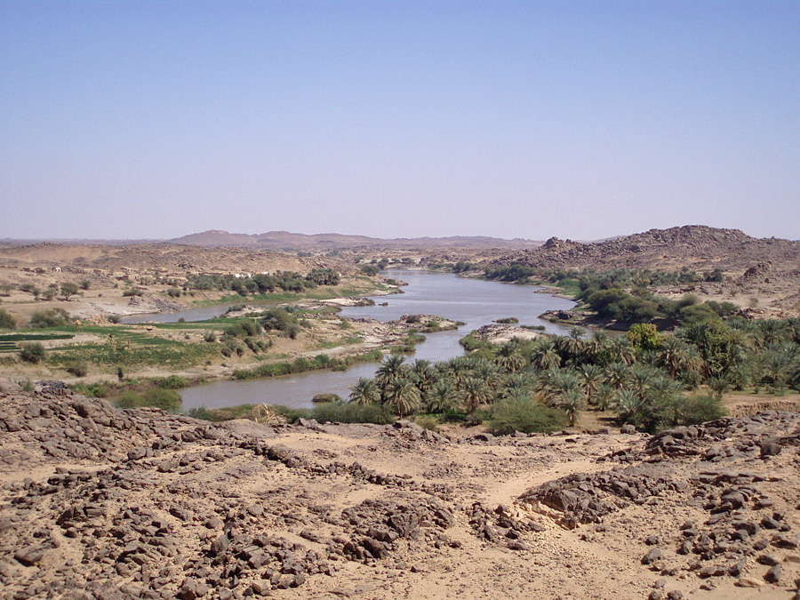
Sudan's current regime has long sought to build dams along the Middle Nile in order to generate electricity, one of its key development aims. Their implementation gained momentum when Sudan began exporting oil in 1999. The Merowe Dam, inaugurated in 2009 and built mainly with Chinese money and expertise, displaced around 70 000 people and flooded the entire heartland of the Manasir (Figure 3). An international salvage campaign was set up, but the archaeologists involved found themselves trapped between their professional obligations to save the past and their ethical responsibilities to support the local people opposing the dam (Reference Hafsaas-TsakosHafsaas-Tsakos 2011; Kleinitz & Näser 2011).
The landscape of the Fourth Cataract that was flooded when the gates of the Merowe Dam were closed.

More dams are now planned on the remaining cataracts of the Middle Nile at Dal, Kajbar, Mograt, Dagash, Shereik and Sabaloka (see map, Figure 1). In addition, a dam on the Upper Atbara River is currently under construction and the heightening of the Roseires Dam on the Blue Nile has been completed. Contracts have already been given to Chinese contractors for Kajbar, Shereik and Atbara, with Dal expected to follow shortly (Reference BosshardBosshard 2011).
By building dams in Sudan, foreign donors and companies close their eyes to the fact that Sudan's government ignores not just international standards on environmental considerations, human rights and resettlement procedures (Reference AskouriAskouri 2004: 57), but also overlooks the possibilities offered by alternative means of producing electricity, namely solar power, wind and the river's own flow.
The archaeology of the Middle Nile
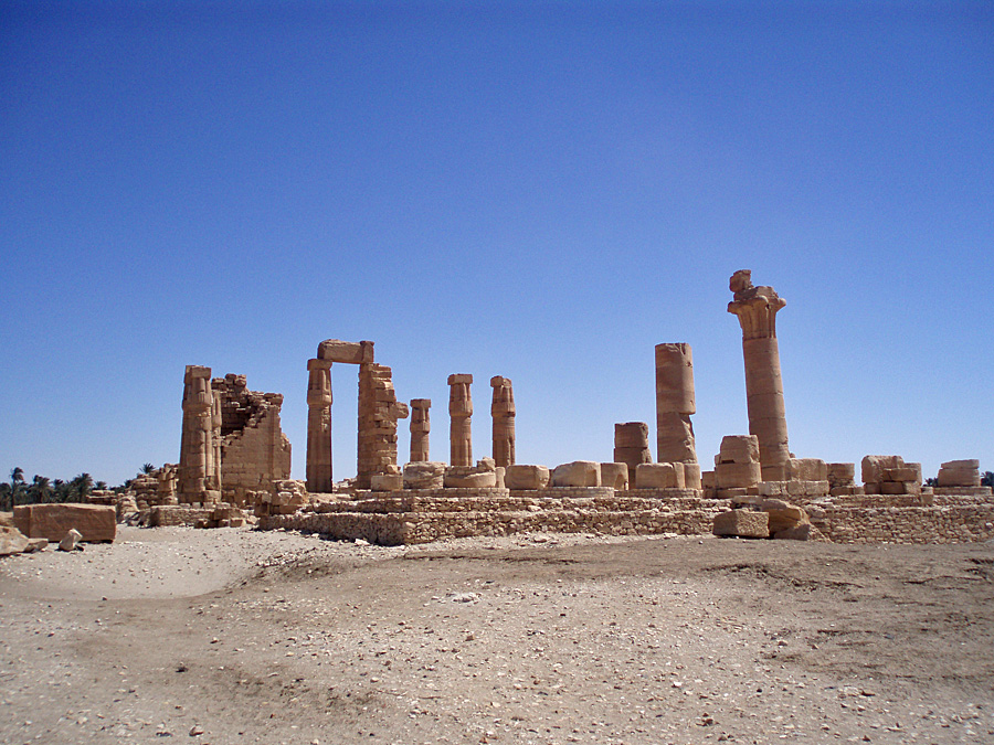
The Middle Nile Valley is tremendously rich in the remains of past human activities from all periods: the Palaeolithic when Homo erectus and then modern humans wandered out of Africa; the Mesolithic when sedentary pottery-using fisher-gatherer-hunters lived along the river; the Neolithic when herders of cattle domesticated in the desert to the west entered the river valley; the Bronze Age when the kingdom of Kush was established at Kerma and later the Egyptians incorporated the region into their empire (see Figure 4 showing the temple at Soleb, potentially threatened by the building of the Dal Dam); the Iron Age when kings buried in pyramids ruled first from Napata and then from Meroë medieval times (see Figure 5 showing the cathedral of Sai Island also threatened by the building of the Dal Dam) when multilingual Christians painted their churches with colourful murals; and the early Islamic era when local kinglets lived in fortified mud-brick houses (Reference EdwardsEdwards 2004).
The New Kingdom temple at Soleb, which will be flooded if the high option for the Dal Dam is built.

The still unexcavated medieval cathedral of Sai Island, which will be flooded if the Dal Dam is built.

In the wake of the international salvage campaign linked to the Aswan High Dam, UNESCO promoted the idea of a 'world heritage'. The lesson from the more recent archaeological salvage project at the Merowe Dam is one of responsibility to communicate with local people and respect their views. In our opinion, the best way to safeguard the cultural heritage of the Middle Nile is to preserve the river as it currently flows, thus simultaneously benefiting the natural landscape and the people who live there.