Introduction
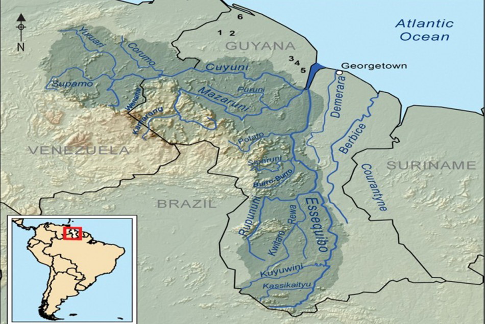
Map showing general location of major shell mounds in Guyana: 1) Barabina; 2) Hosororo Creek; 3) Piraka; 4) Kabakaburi; 5) Sirki; 6) Wyva Creek.
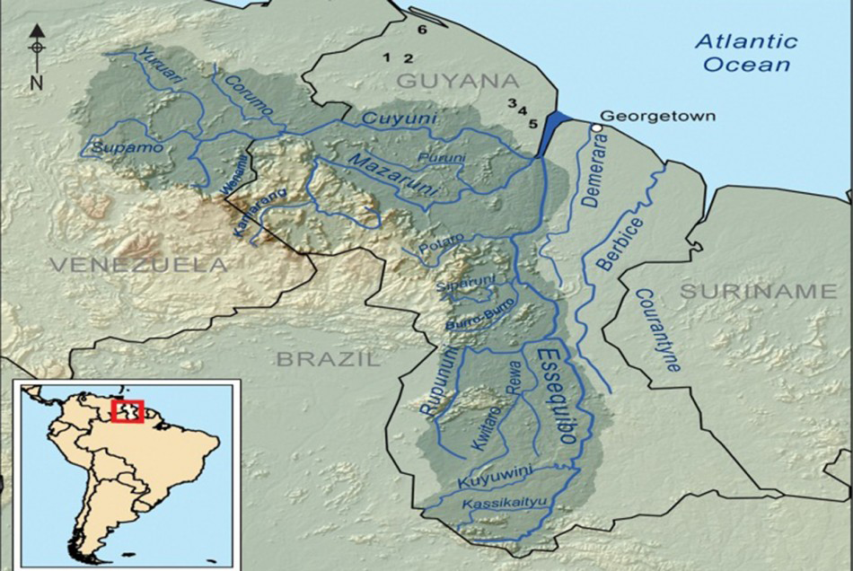
Unique within the Guianas, the coastal plain of north-western Guyana is characterised by a number of Early to Middle Holocene shell mounds (Reference Rostain, Silverman and IsbellRostain 2008; Figure 1). The mounds, formed of accumulated shell refuse, served as living areas and as places for burials. Common to the archaeological assemblages recovered from mounds are chipped- and ground-stone artefacts that form the basis of Evans and Meggers’ (1960) description of the so-called Alaka phase. Radiocarbon dates document pre-ceramic occupations of Alaka phase shell-midden deposits as early as c. 7300 BP (Reference PlewPlew 2005); some mounds, including Barabina (Reference WilliamsWilliams 2004), also contain early ceramic material. Although shell mounds are not found in adjacent Suriname and French Guiana, they are common in the southern Caribbean, where they date from as early as 6000 BP. Our project seeks to assess the breadth of diet and possible dietary deficiencies of the inhabitants of a shell mound at Siriki, and to examine whether burials occurred during occupation of the mound or following its abandonment.
The Siriki shell mound is located on Siriki Creek, around 6km up an estuary of the Pomeroon River (Figure 1). Siriki Creek and the Pomeroon River are situated on the Guyana coastal plain, which is generally flat and approximately 1.5m below sea level at high tide. Geologically, the plain is underlain by two formations—the Pleistocene Coropina Formation and the later Holocene Demerara Formation. It is characterised by large tracts of coastal mangrove swamp vegetation.
Early excavations were conducted by Brett in 1868, who reports digging five test pits of unknown size and recovering extensive shell refuse and human remains. Evans and Meggers (1960: 38), who visited the site during their survey of what was then British Guiana, reported the mound’s dimensions as 76m long by 27m wide and 6–8m high. The exact location of the mound was not re-established until it was recently revisited in March 2011 by a survey team from the Walter Roth Museum of Anthropology (Daggers et al. 2011). The maximum dimensions of the mound are currently 62m long, 36m wide and 5.2m in height.
Methods
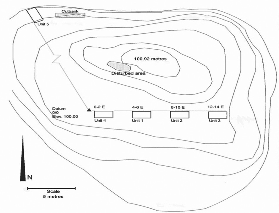
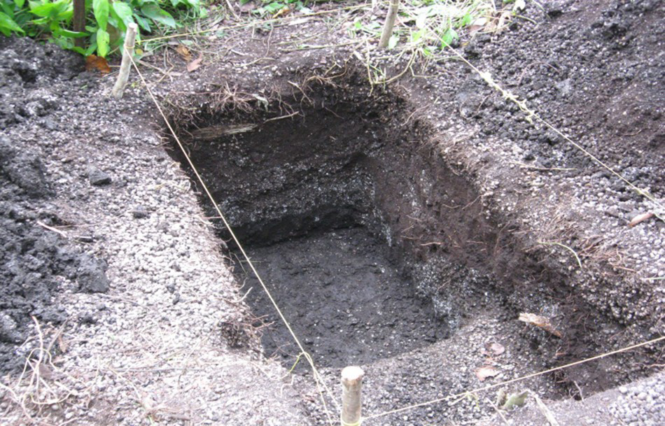
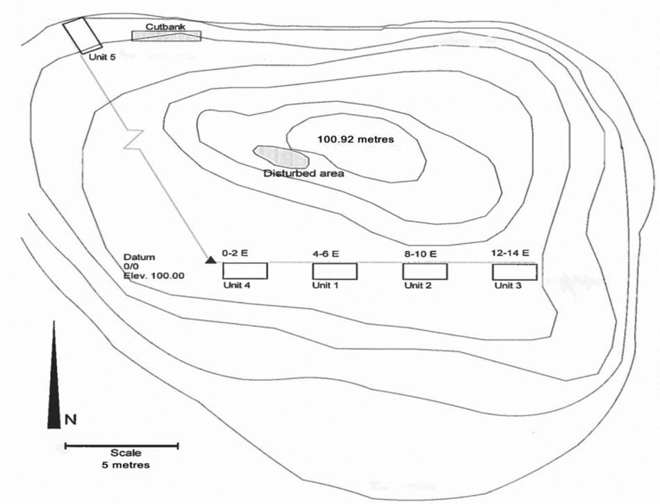
Four 1 × 2m units were excavated (Figures 2 &3), with a fifth unit placed at the north-east corner of the mound where partial remains of a human burial were exposed. Units were designated by coordinates from a datum point established atop the mound.
Plan map showing location of units at Siriki shell mound.
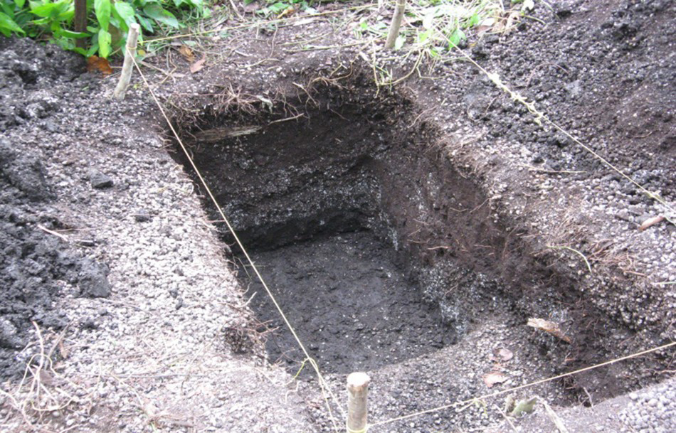
Sterile sediment visible at base of shell mound.
Results
The processing of shellfish—striped snail (Neritina zebra)—was the primary function of the site, but mammals and fish were also exploited. This indicates a broader diet than generally reported from other mounds. Of particular note is the presence of medium- to large-sized mammals, as well as fish. Remains of the latter include vertebrae that fall within a range of 5–20mm in diameter, with some up to 40mm. Growth rings on caudal vertebrae suggest fish in the range of 3–5 years of age with an unprocessed weight of 2–5kg or more. Crab (Ucides cordatus) remains were recovered from a single level at 0.6–0.8m below the surface. No other crab remains were noted, which suggests an isolated event or a seasonal use of the mound.
A number of rather non-descript features were excavated. These consisted of areas of dense refuse containing ash, fire-cracked rocks, faunal remains and sediment. It is unclear whether the presence of sediment associated with these areas forms the basal stratum of fire hearths or larger occupation surfaces. Seepage and percolation of water through the mound has resulted in hard, cemented layers of refuse, and the re-deposition of dissolved calcium carbonates has distorted the integrity of features.
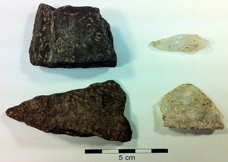
Alaka phase artefacts.
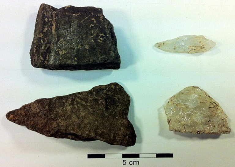
The material culture assemblage from Siriki dates to the pre-ceramic Alaka phase and, typically, demonstrates little wealth or diversity. Notably, a large number of quartz cores (n = 13) suggest some on-site lithic reduction. Modified flakes (n = 46) are the most common artefact type, although it is unclear whether they were used in the processing of shellfish or other animals (Figure 4).
The presence of stone bifaces (n = 4) and scrapers (n = 2) may, however, be taken to indicate the processing of other materials (Plew et al. 2012). Variability in the frequencies of artefacts by level and location across the mound suggest concentrations of greater activity.
Two radiocarbon dates have been obtained. One sample (Beta-309315), consisting of organic sediment, was collected from the base of the mound at a depth of 1.2–1.4m below datum. This sample returned a date of 4140+/-30 BP (2σ: cal BP 4820–4750 and cal BP 4730–4530). A second sample (Beta-307549), consisting of charred material from unit 4, nearer the mound surface at 0.4–0.6cm below datum, returned a date of 270+/-30 BP (2σ: cal BP 420–410 and cal BP 320–280). While the first date is well within the range for shell mounds (c. 7000–2500 BP), the second date of 270 BP is considerably more recent than expected. This date may reflect a late re-use of the shell mound, perhaps for habitation.
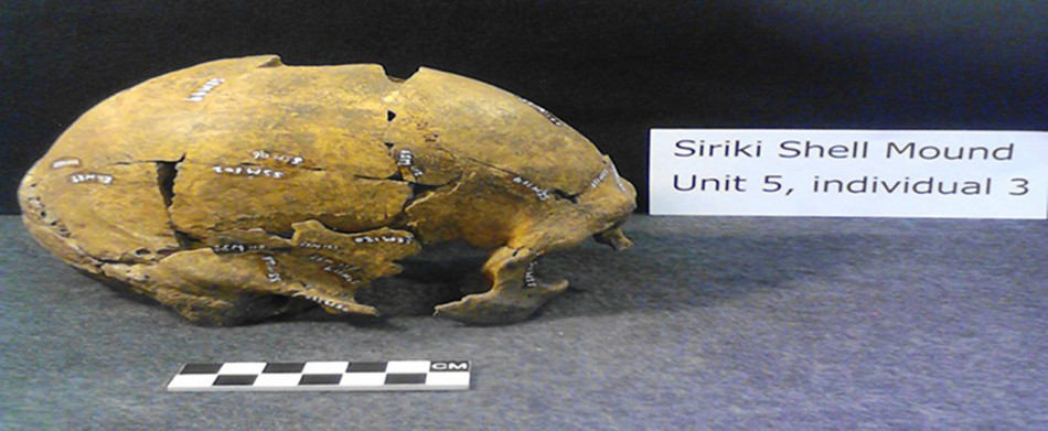
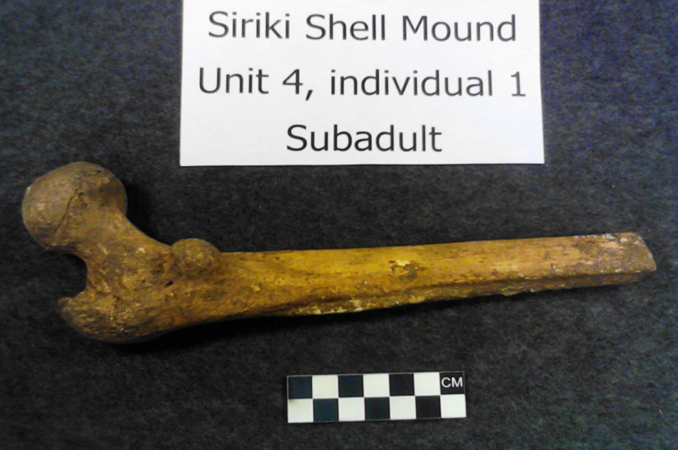
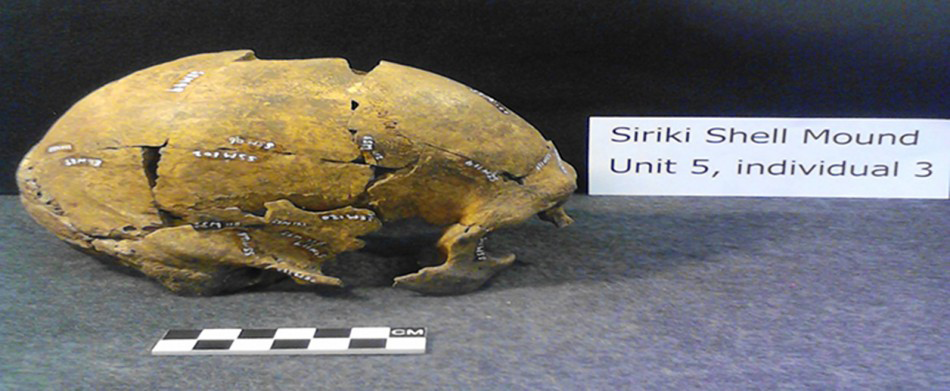
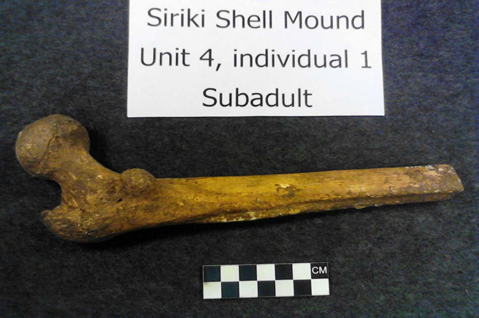
As well as the processing of shellfish and other fauna, excavation at Siriki has also produced evidence for burials. Although human remains have been reported from many shell mounds (see Evans & Meggers 1960; Reference WilliamsWilliams 2004; Reference PlewPlew 2005), few have been adequately analysed. Excavations at Siriki recovered partial skeletons, including teeth, representing nine individuals from different locations within the mound. The remains are highly fragmented (post-mortem), yet the bone preservation is generally good. There are no complete long bones that can be used for stature estimates. Morphological data allow age estimation on only two individuals—one a sub-adult from unit 4 and the other, a skeletally mature adult from unit 5 (Figures 5 & 6). Two additional sub-adults (units 1 & 3) have been identified on the basis of isolated teeth. Sex estimation has been possible only with the skull from unit 5. Very little evidence of pathologies has been noted, but the most complete skeleton (the third individual from unit 5) displayed evidence of biomechanical stress on five cervical vertebrae and an infection on the left clavicle, as well as ante-mortem trauma on a mid-shaft rib fragment that had a healed fracture callus. Radiographs provide no evidence of Harris lines, pathologies or infections (Streeter et al. 2012). No funerary items were associated with the burials.
Lateral view of skull of individual 3.
Sub-adult femur of individual 1.
Conclusion
Recent work suggests that, while the Guyanese shell mounds typically date to the Early to Middle Holocene, some mounds were reused during the very Late Holocene. In addition, it appears that there is greater variation in tool assemblages and breadth of diet than previously recognised. The faunal assemblage from Siriki indicates some reliance on mammals and fish, as well as shellfish, and the use of the site on a seasonal basis. Finally, analysis of human remains from the Siriki mound suggests that local populations may not have suffered from serious dietary deficiencies, as suggested by Reference WilliamsWilliams (2004). Even though much additional work remains to be done, it is already clear that the inhabitants of, and activities at, the shell mounds of north-west Guyana are more diverse than previously thought.