Introduction
Fifteen years of surveys and excavations carried out in the highland zone of the Pindus range have greatly improved our knowledge of the exploitation of the high altitudes of north-western Greece. Although greater attention has often been paid to the Middle Palaeolithic Levallois sites, workshops and chert outcrops discovered around the Vlah centre of Samarina (Efstratiou et al. 2006, 2011, 2014), the systematic investigations conducted along the watersheds that surround the aforementioned town, and the slopes of the Gurguliu and Bogdhanis Mountains, have led to the discovery of many sites and isolated finds of Late Palaeolithic, Mesolithic, Final Neolithic, Bronze and different historical ages.
This paper aims to illustrate the discovery of a few Late Palaeolithic and Early Mesolithic tools that, given the location of discovery, represent a unique case in the prehistory of this territory of western Macedonia.
Although Late Palaeolithic sites are well attested in neighbouring Epirus (Higgs & Vita-Finzi 1966; Reference AdamAdam 1989; Reference BaileyBailey 1997), nothing was known of their presence at high altitudes in the Pindus range until a few years ago. The Pindus discoveries help interpret the routes followed by Late Palaeolithic and Early Mesolithic hunters. They moved along the Samarina watersheds and across their saddles, midway between the lowlands of western Macedonia, east of the Pindos mountains, and Epirus, in the west, during different periods of the Late Pleistocene and Early Holocene, when the alpine pastures of the Pindus were already deglaciated (Boenzi et al. 1992; Hughes et al. 2006a, 2006b).
The sites
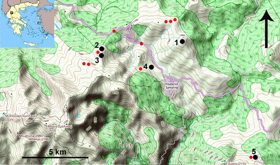
Distribution map of the Late Palaeolithic and Early Mesolithic finds of the Pindus range. Kirkuri (KRK: 1), Mount Bogdhanis’s upper slope (GRG-131: 2), top lago (3), small glacial basin north of Samarina (HCF-2: 4) and Vasilitsa (VSL-16, VSL-7δ: 5); the small red dots indicate probable Late Palaeolithic occurrences (drawing by R. Nisbet).
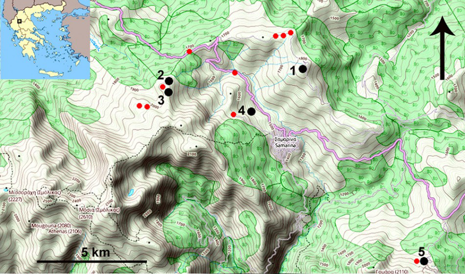
So far, at least five sites have yielded Late Palaeolithic, and (on one site) Early Mesolithic, implements (Figure 1), although a few more tools, mainly long end scrapers and cores, from other locations are probably to be attributed to the first of the above periods. Apart from Vasilitsa (Figure 1: 5), all the other finds are distributed around Samarina and along the northern slope of Mount Bogdhanis.
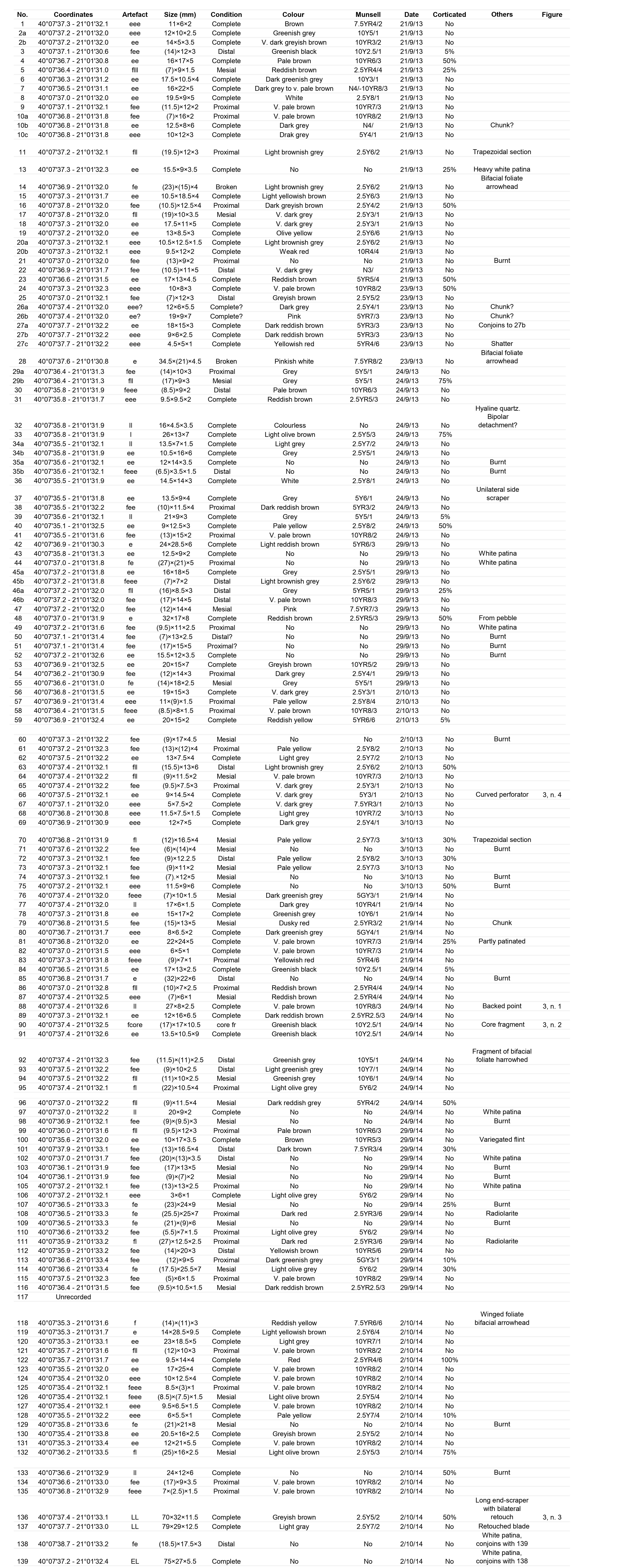
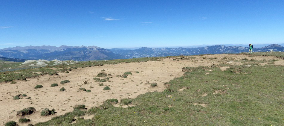
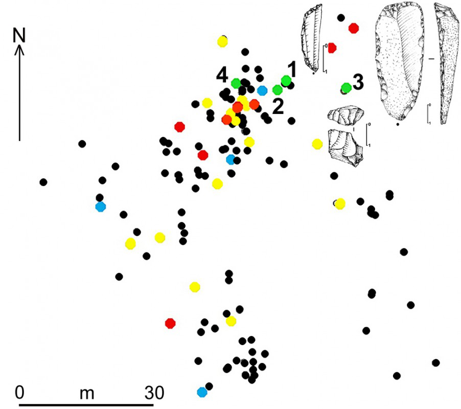
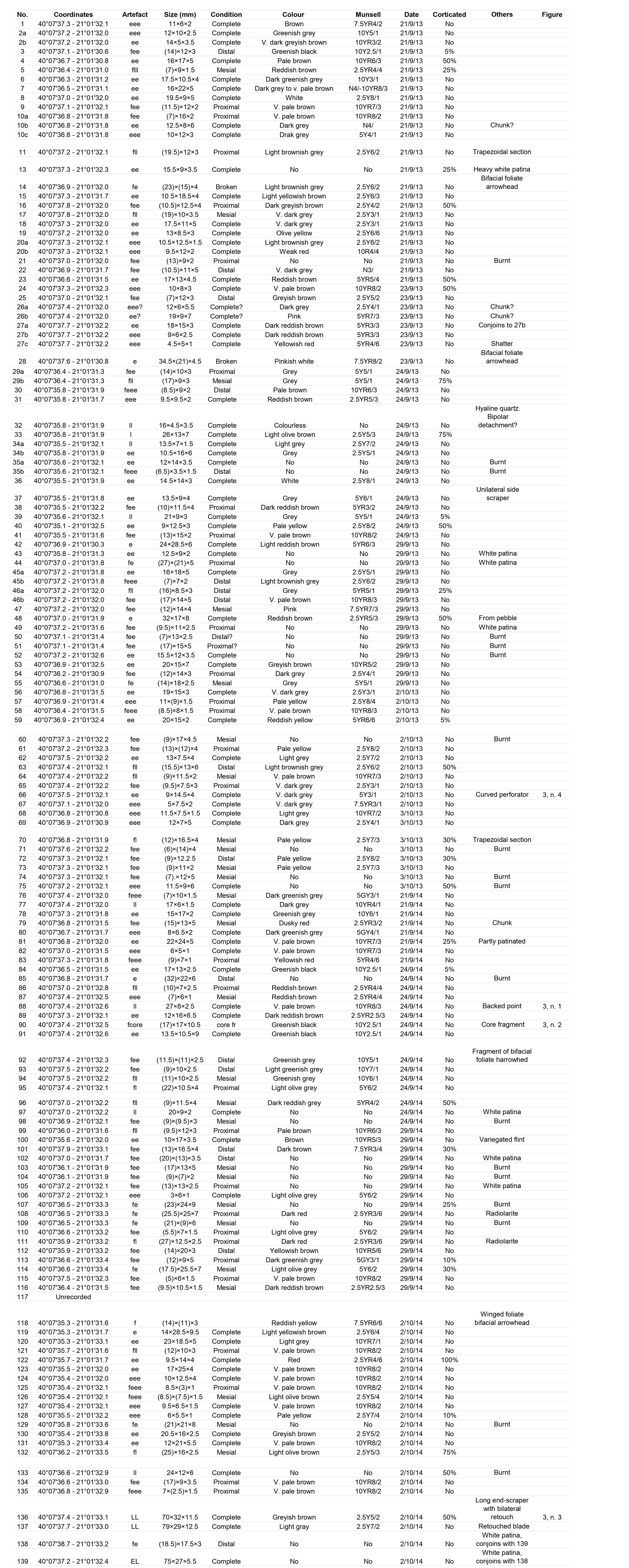
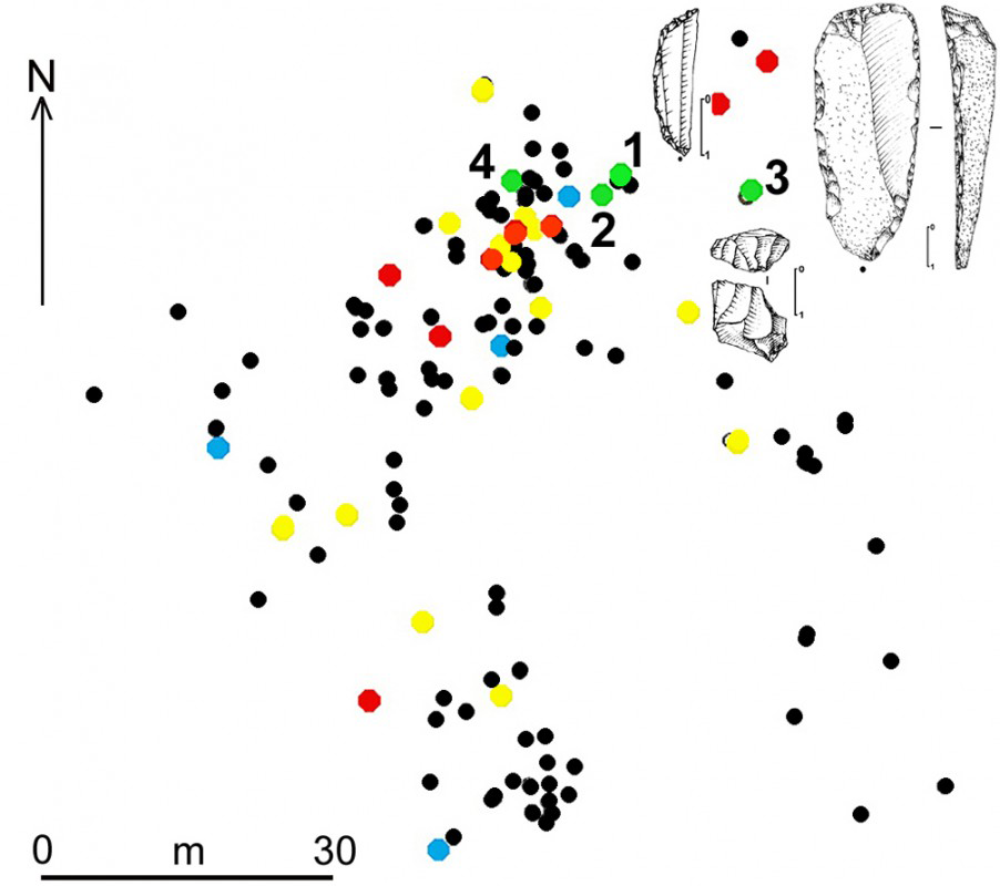
At present, the most important site is Mount Kirkuri (KRK: Figure 1: 1). Here, centuries of intensive pastoral activities have led to the erosion of the topmost, rounded surface of the summit (1860m), bringing to light a scatter of 147 chipped stone artefacts of different ages and cultural aspects, spanning from the Levallois Middle Palaeolithic to the Bronze Age (Table 1). All the lithics from Kirkuri (KRK: Figure 2) have been precisely mapped in 2013 and 2014. Among the Late Palaeolithic items, all made from exogenous flint, are the following: one microlithic-backed point (Figure 3: 1), one microbladelet core (Figure 3: 2), one long end scraper (Figure 3: 3), one curved bec, a few microbladelets and one shatter. These tools find close parallels in the chipped stone assemblages from Klithi (Reference Roubet and BaileyRoubet 1997a, 1997b), AMS dated between 16 250±170 BP (OxA-2327) and 13 640±100 BP (OxA-2331) (Gowlett et al. 1997: tab. 2.2).
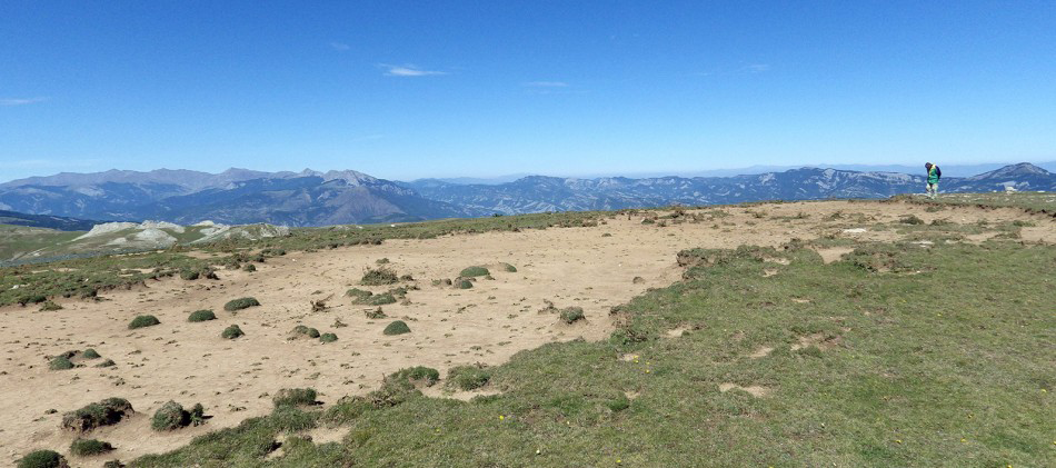
The eroded, rounded uppermost surface of Mount Kirkuri (KRK) from the south (photograph by P. Biagi).
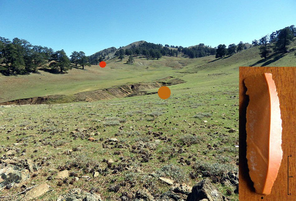
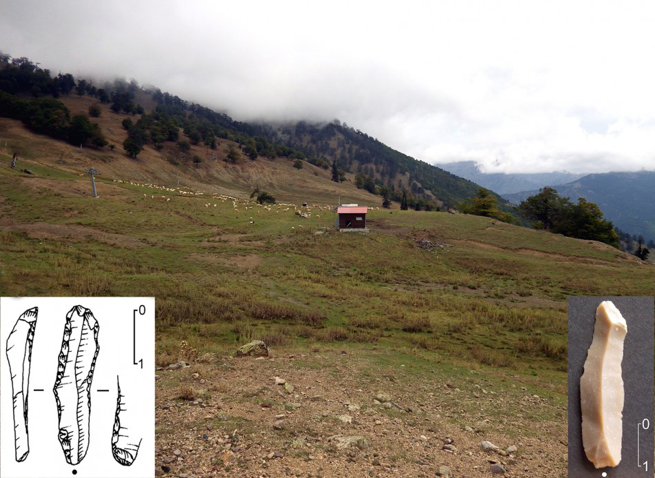
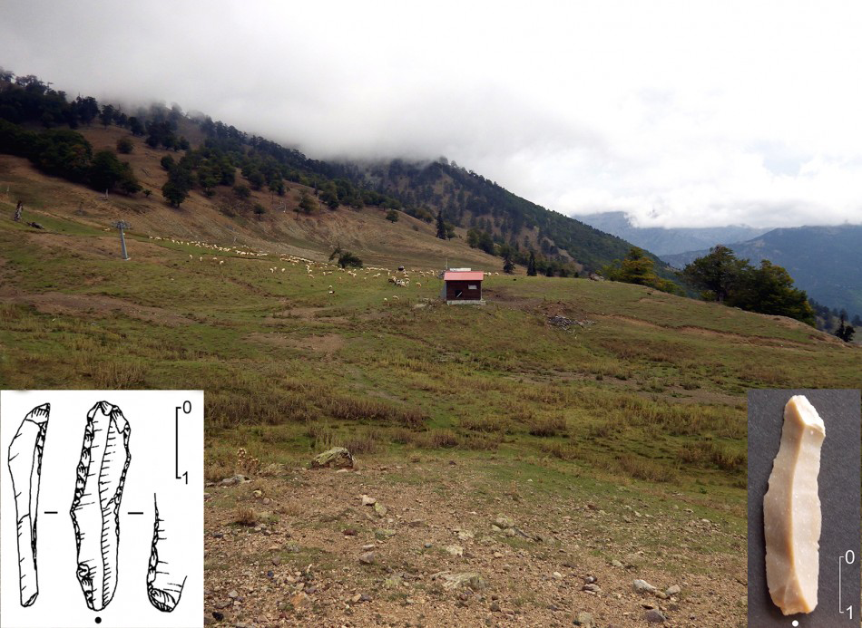
Unretouched bladelets of exogenous flint have also been recovered from two points along the northern, upper slopes of Mount Bogdhanis at 2013m (GRG-131) and at 2052m altitude (top lago) respectively (Figure 4). One truncated backed bladelet (VSL-16) and a few other unretouched bladelets of allochthonous flint were collected from different spots along the eastern upper slopes of Mount Vasilitsa (both VSL-16 and VSL-7δ), at altitudes of c. 1760m (Figure 5). The whole area is rich in chipped stone artefacts attributable mainly to the Levallois Middle Palaeolithic and the Bronze Age scattered around a dry basin of glacial origin. It is important to note that the VSL-16 backed bladelet closely resembles the backed-retouched specimens from Kastritsa in Epirus (Reference AdamAdam 1999: fig. 10.2).
Distribution map of the chipped stone artefacts at Kirkuri (KRK): backed point (1), microbladelet core (2), long end scraper (3), perforator (4); Middle Palaeolithic Levallois tools (red), Late Palaeolithic bladelets (yellow), Bronze Age arrowheads (blue), other artefacts (black) (map by R. Nisbet).
Findspot of two fragmented microbladelets along the northern slopes of Mount Bogdhanis at 2013m (GRG-131) and at 2052m altitude (top lago) respectively (photographs by P. Biagi).
General view of Vasilitsa (VSL) eastern upper slope, from which lithics of different ages have been recovered; the backed bladelet on the left is from VSL-16, the unretouched bladelet on the right from VSL-7δ (photographs and drawing by P. Biagi).
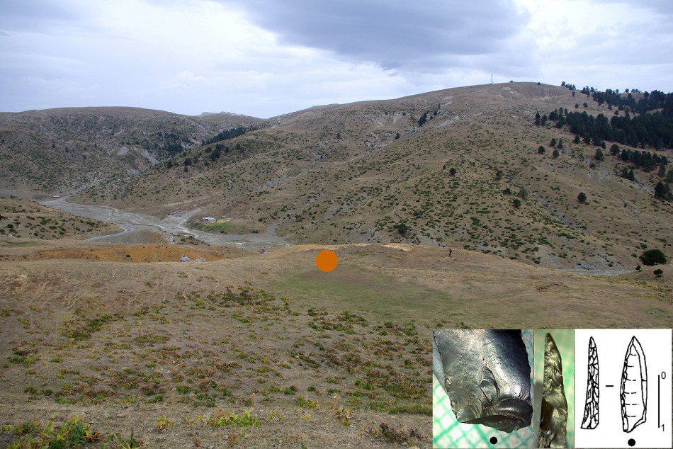
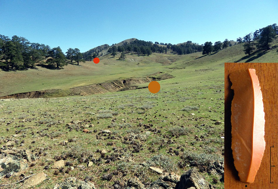
The small basin north of Samarina, photographed from the west; the orange dot marks the place where the microlithic backed point was recovered (HCF-2); Mount Kirkuri is in the background (photographs by P. Biagi and E. Starnini).
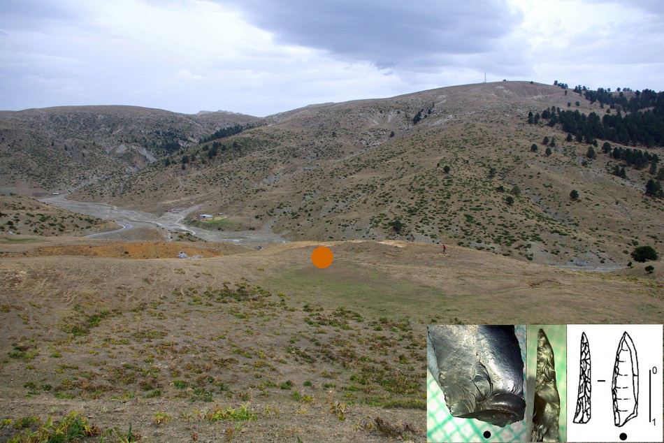
The recovery of a microbladelet-backed point of exogenous black flint, obtained by bipolar left retouch, is so far unique. The tool was collected from the surface of the northern shore of a small dry basin of glacial origin, located between the lowermost moraines, just to the north of Samarina, at an altitude of 1552m (HCF-2: Figure 6). This specimen is identical to a few other tools from Unit IV at Boïla rock-shelter in Epirus (Kotjabopoulou et al. 1999), radiocarbon-dated to the Preboreal period (RTA-3529: 9540±75 BP; Kotjabopoulou & Adam 2004). This discovery suggests that Early Mesolithic hunters reached the fringes of Mount Gurguliu around the beginning of the Holocene, possibly moving up from their Epirus base camps.
Discussion
The discovery of Late Palaeolithic and Early Mesolithic tools along watersheds that surround Samarina, and the slope of Mount Vasilitsa, improves our knowledge on the seasonal peopling of the high altitudes of the Pindus Mountains. They show that at the end of the Pleistocene, and the very beginning of the Holocene, groups of late hunter-gatherers moved across the favourable hunting landscapes of the alpine pastures above 1500m.
In contrast with the late Neanderthal bands that systematically exploited the abundant Samarina chert resources (Efstratiou et al. 2011), these hunter-gatherers carried with them good-quality flint nodules to produce their weapons. The presence of end scrapers and other tools, mainly bladelets, might indicate that they also performed other activities connected with hunting. Although the location of the allochthonous flint sources used for making the chipped stone tools recovered around Samarina is at present unknown, good-quality flint outcrops are known in the lowlands surrounding Lakes Ioannina and Kastorià. Future research will explore the exploitation of the above resources between the end of the Pleistocene and the Early Holocene in order to explain the provenance, and the movements of the Late Pleistocene and Early Holocene hunting communities of the Pindus Mountains.
Acknowledgements
The 2013 and 2014 fieldwork seasons were possible thanks to the financial support of the Departmental Archaeological Funds of Ca’ Foscari University, Venice. The authors are very grateful to the L’EPKA of Kozani and the Greek Ministry of Culture for granting the research permit to carry out the fieldwork. Special thanks are due to John Nandriş—who, in the 1970s, was the first to discover Palaeolithic tools in the region—for commenting on this paper.