
Buckinghamshire
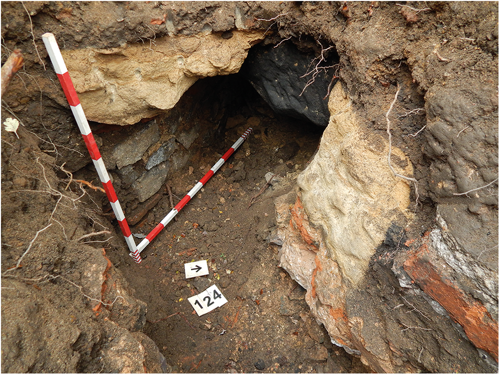
(1) Newton Longville (SP 8320 3220): excavation of six areas revealed a sequence of settlements spanning the middle–late Iron Age to Roman period. The site was located on higher ground between two streams and illustrates the shift and development of rural settlement within the immediate landscape, with multiple foci for activity seen within a relatively small area.
Four settlements appear to have been established during the Iron Age: one enclosed, one more open, a third which was established after 100 b.c and continued in use into the middle Roman period, and a fourth settlement which, despite being the largest, showed little surviving Iron Age material thanks to its continuation into the early Roman period and subsequent destruction of earlier features.
In the early Roman period, this largest enclosure featured a settlement focus to the north, a crop-processing area that may have been used for malting, and a cremation cemetery, mainly un-urned, to the south. All were later enclosed by a large enclosure that had several phases. Two smaller enclosed Roman settlements were predominantly early to early-middle Roman, one showing some activity from the late Iron Age prior to a clear later Roman expansion. A cast copper-alloy umbonate brooch, probably of British manufacture and dating to c. a.d. 100–250, was recovered from a boundary ditch within the other enclosure.
Clay extraction appears to have been a focus for activity at the site, with extensive clay quarrying identified both at the larger settlement, possibly focused in the later Roman period, and also at the two smaller enclosures. The potential to explore the relationship of this with the settlements is of particular interest as there appears to have been a negative correlation between resource extraction and domestic activity over the middle and late Roman periods. The settlement pattern overall also has significant potential to explore the chronological and spatial use of the landscape and interrelationships between different activity areas, and thus the overall social organisation of the site.
The artefact assemblage included 115 Roman coins, though most of these were unstratified. There was also one late Iron Age coin: a silver Iron Age unit of Andoco of the North Thames Region/Catuvellauni, dating from the late first century b.c.Footnote 67
(2) Olney, Warrington Road (SP 8895 5264): an excavation in 2022, exposing significant remains of Roman date, recorded the remains of a Roman building within a square enclosure, identified by geophysical survey. Further archaeological mitigation to the south identified two buildings and two other stone-built structures.
The first building measured c. 8 × 6 m within the site, continuing beyond excavation area, and was mainly identified via foundation trenches and robber cuts, with a small section of surviving in situ wall of limestone blocks. Flue tiles and voussoirs recovered from the evaluation phase in this zone may suggest the presence of a bathhouse. The two individual structures were similar in form, both rectangular cuts lined with stone and with stone bases. The first was 1 × 1.1 m and 0.4 m deep, with sides and base of limestone blocks. The second measured 1.35 × 1.40 m and was 0.46 m deep, with a limestone base and walls formed of vertical limestone slabs in a herringbone pattern overlaid by rougher limestone courses. Both were too shallow to be wells but may have acted as cisterns.
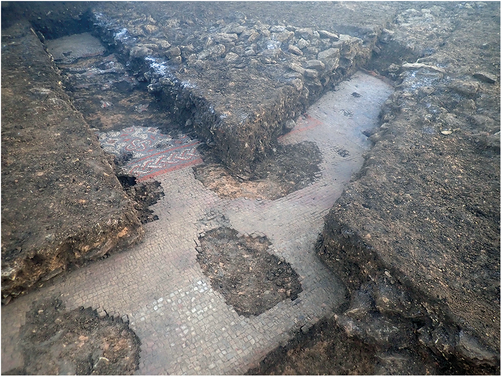
The final building was 20 m wide by at least 8 m long, continuing beyond the excavation area, and comprised at least three rooms with a central chamber and two ancillary rooms to the north-east and south-west. Walls were generally poorly preserved, but the central room (c. 6.5 × 6.6m) preserved the remains of a mosaic in its interior, which ran from wall to wall filling the width of the room, where excavated (Fig. 14). The preservation of the mosaic varied, with outer portions surviving better than within the central part of the room. Despite this, it was possible to discern its overall pattern and form. An outer border of blue-grey and cream tesserae enclosed a two-strand guilloche depicted in red and white tesserae with a blue-grey infill. Within the guilloche band was a series of swastika-peltae again outlined in red and white with a blue-grey infill. The central rectangular panel of the mosaic comprised a series of fans formed of white tesserae with a central sun-burst pattern contained within a diamond defined by red tesserae. The design is comparable to one observed at Great Staunton, Cambridgeshire, some 25 km north-east of the site, attributed to the Durobrivan or Midlands groups. It is likely that the Warrington Road mosaic can be attributed to the same.Footnote 68
Warrington Road Olney: the mosaic showing the well-preserved detailed border surrounded by plain tesserae.

Hertfordshire
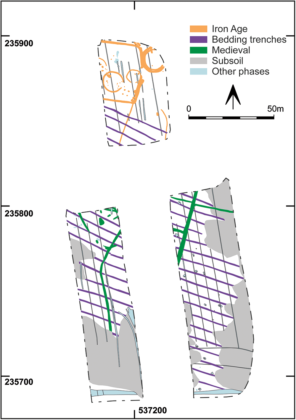
(1) Reed, Bush Road and Rokey Wood (TL 3720 3580): archaeological monitoring found an array of bedding trenches, typically interpreted as evidence of Roman vineyards after Wollaston. These have become relatively common in south-east England but only three Hertfordshire sites were recorded in a 2020 survey, all in the north-east of the county. The Reed examples were not definitively dated, but they were associated with a small, enclosed Iron Age roundhouse settlement (Fig. 15). The trenches avoided the settlement but post-dated an Iron Age field ditch, while also predating medieval boundary ditches. This supports the view that such bedding trenches were established in the late Iron Age or early Roman period, giving evidence of the introduction of viticulture to Britain.Footnote 69
Reed: Roman bedding trenches.

Northamptonshire
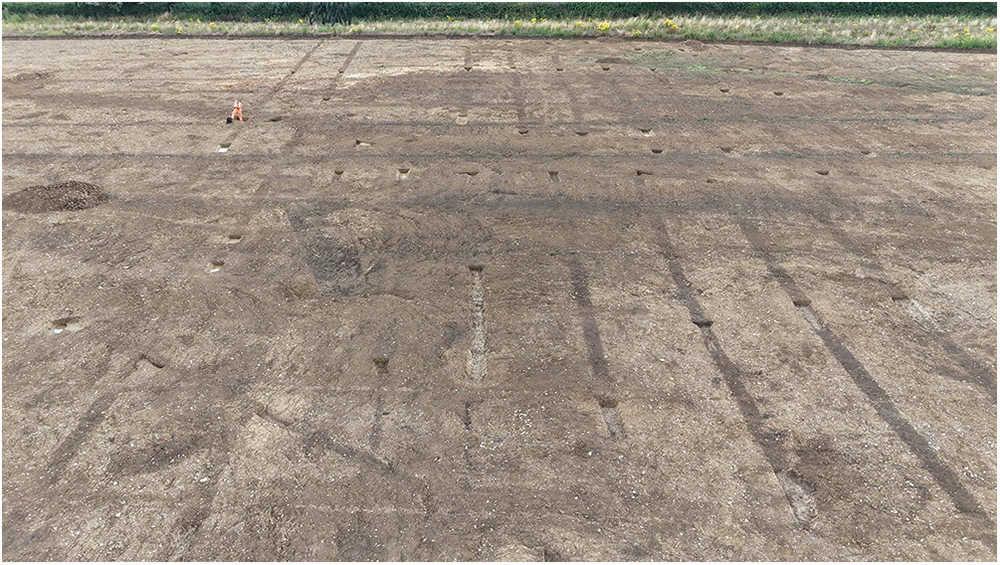
(1) Desborough, Land off Harborough Road (SP 7958 8470): an excavation following a geophysical survey and evaluation trenching revealed multi-period agricultural and settlement activity. Four main periods were identified covering Iron Age through to post-medieval periods. The most significant archaeological features were concentrated in the western half of Area 2 and relate to several Iron Age roundhouses, alongside a few enclosure ditches, some of which were re-cut and elaborated within the Roman period. Substantial evidence for a subsequent field system spanned both Area 1 and 2, comprising multiple north-east–south-west aligned parallel ditches, presumably cultivation trenches (Fig. 16). Each of these were of similar size, survived up to c. 40 m long, 0.7 m wide and 0.30 m deep, and were separated from each other by c. 4.00 m. The remains are undated but are provisionally dated to the Romano-British period and potentially represent pastinatio—cultivation bedding trenches potentially associated with Roman viticulture. Medieval and post-medieval activity was relatively limited in nature but may have included an isolated burial, possible enclosure ditches and evidence of ridge-and-furrow. A programme of analysis and publication is currently ongoing.Footnote 70
Desborough: Roman bedding trenches.

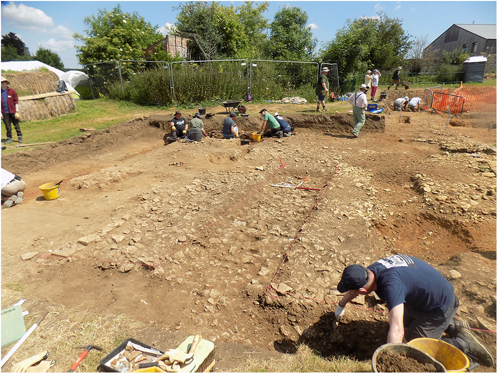
(2) Irchester, The Orchard, Chester House Estate (SP 91883 66776): an archaeological excavation was carried out on land of the former orchard at Chester House Estate from 2022 to 2024, within the Roman small town of Irchester. It forms part of a wider study into the Roman town and its environs, a collaborative archaeological project with the University of Leicester, School of Archaeology and Ancient History, the Chester House Estate, and University of Leicester Archaeological Services. The results of the excavation will help towards better informing the management of the site, and continue to develop its future as a sustainable heritage asset for the public.
The excavation lies within the eastern suburbs of the Roman small town of Irchester and has revealed significant results, consisting of a long sequence of Roman activity, from mid-late first-century Roman property boundaries, along with other extramural activity consisting of gravelled streets, several structures and associated activity of second- to fourth-century date (Fig. 17). In the later Roman period part of the site was set aside for an enclosed inhumation cemetery. Excavation has recorded 118 burials to date, many in a well-stratified sequence within a natural hollow in the underlying topography. The results are of regional and national significance, adding important new information and understanding of extra-mural activity at the Roman town of Irchester, along with insights into the population of Roman Irchester. It is anticipated to expand the excavation area and continue with another fieldwork season in summer 2025.Footnote 71
Irchester: Late Roman surfaces and features at Chester House Estate.

Leicestershire
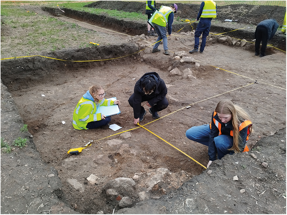
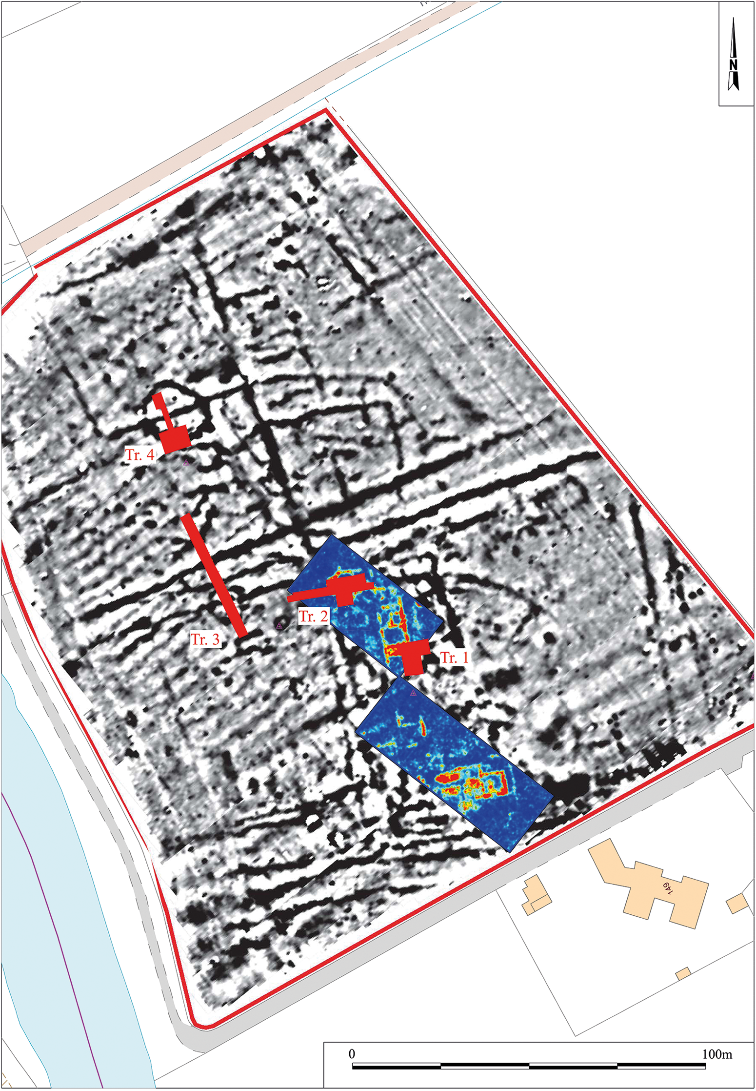
(1) Barrow upon Soar, Student Fieldschool (SK 566 185): an archaeological investigation serving as a training programme for undergraduate university students from University of Leicester was undertaken with ULAS in May 2024 (Fig. 18). Previous fieldwalking and metal detecting had yielded many Roman artefacts, including building material and tesserae, suggesting the presence of a villa site. This was confirmed in 2018 by aerial photography that revealed negative cropmarks of a winged villa building elongated approximately north–south, with an overall visible length measuring c. 75 m. The villa is divided into a complex array of rooms, with a long corridor extending along the eastern face, and wings from both north and south ends. The aerial photography also revealed a series of positive cropmarks relating to different phases of activity on the site, including a circular enclosure in the north-west corner of the field. A magnetic and GPR survey was undertaken across the site, both confirming and enhancing the existing cropmark data (Fig. 19). The magnetic survey identified a wide range of ditch and pit type anomalies, including features that appeared to predate the villa complex.
Students from University of Leicester recording a Roman villa, near to Barrow-upon-Soar.

Geophysical survey results, and trench locations, Roman villa complex at Barrow-upon-Soar.

Four trenches were positioned across the site, with the broad aim of evaluating the range of archaeology present on the site and assessing the current state of preservation within the villa complex. Two trenches were positioned over the villa. Trench 1 was located within its central section, which exposed two parallel north–south wall trenches (largely robbed of their stone) forming a corridor (or portico) along the eastern side of the building. The western robber trench was much wider and deeper than the eastern trench, suggesting it held a more substantial weight-bearing wall. Remnants of a mortar floor were located between the two robber trenches within the southern part of the trench, which overlaid a clay make-up layer. A mixed stone and soil layer was recorded to the east of the ‘portico’ robber trench that might represent the remains of an external yard surface, or at least a make-up for one. The western robber trench was connected to two parallel east–west robber trenches on its western side, that formed the sides of two separate rooms. The northern room contained a sunken floor, but neither room contained any surviving floor surfaces. Evidence of earlier ditch systems that predated the construction of the villa walls were noted within the sides of most of the sections excavated through the robber trenches.
Trench 2 was located within the north wing of the villa, at its western end. The exposed room contained a rectangular apse at its western extent and semi-circular apse on its southern side. Most of the walls had been robbed to below their foundation level. The western wall of the west apse survived as a stone foundation directly below the topsoil and measured c. 1.2 m wide. The wall trench contained large granite blocks that had been shifted from their original positions within the foundation. The blocks overlaid a more coherent foundation that consisted of smaller granite fragments that were pitched in nature. The upper foundation stones had been deliberately levelled to accommodate the later addition of a sub-circular apse that connected to the southern wall, adjacent to the recess. No floor levels survived within the room, but a couple of patches of sand against the northern wall may represent the remnants of floor make-up. The disuse layers did contain lots of tesserae, predominantly large stone and tile examples, suggesting the room originally contained a tessellated surface.
Trench 3 targeted a series of linear and curvilinear anomalies located to the west of the villa complex, relating to several different phases of occupation on the site. The remains of roundhouse, a field system predating the villa, a stone-lined pit and the villa enclosure itself were excavated within the trench. Within Trench 4, the southern entranceway of the circular enclosure was excavated. The two ditch terminals formed a very narrow entrance, measuring 1.2 m wide. The ditch itself measured 2.5 m wide, 1.1 m deep, and contained Middle to Late Iron Age pottery.Footnote 72
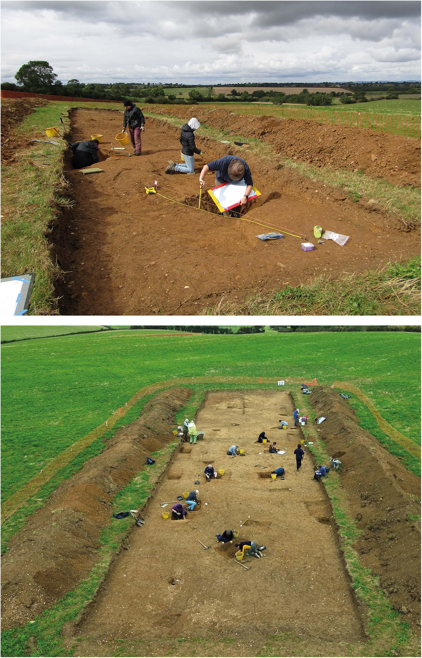
(2) Laughton, Student Fieldschool (SP 663 895): an archaeological investigation serving as a training programme for undergraduate university students from University of Leicester (and also involving local volunteers), was undertaken in the autumn of 2024 (Fig. 20). Earlier work had shown that the site contains a complex series of inter-connecting ditches, and other features, forming a Romano-British farmstead, over an area of c. 7.8 ha).Footnote 73
Laughton: a student training excavation. (Top) an Iron Age ditch being recorded; (bottom) a late Roman farmstead under investigation.

Two trenches were opened in this second fieldwork season. One trench revealed an apparent double-ditched enclosure previously identified on the geophysical survey. Excavation of the ditches produced Iron Age pottery, the first evidence of Iron Age features excavated on the site. The main part of the excavation was located to the immediate south of 2023’s trench, measuring c. 10 m × 40 m. The work revealed a series of intercutting enclosure ditches, indicating at least two separate phases of enclosure activity within the trench. Enclosure alignments mirrored those seen in Season 1 with many running broadly north-west to south-east across the trench. Pottery was recovered from the majority of excavated sections with some producing a variety of different mid- to late Roman vessels and fabrics. Several small pits were identified, some contained evidence of burnt stone and occupational debris. A corn-dryer was also evident, with significant scorching noted to the natural substrata in the flue area and charcoal deposits towards its base. This also produced a near-complete Roman greyware vessel. Other finds of note included a Neolithic arrowhead, four Roman coins, a bead and several iron objects.Footnote 74
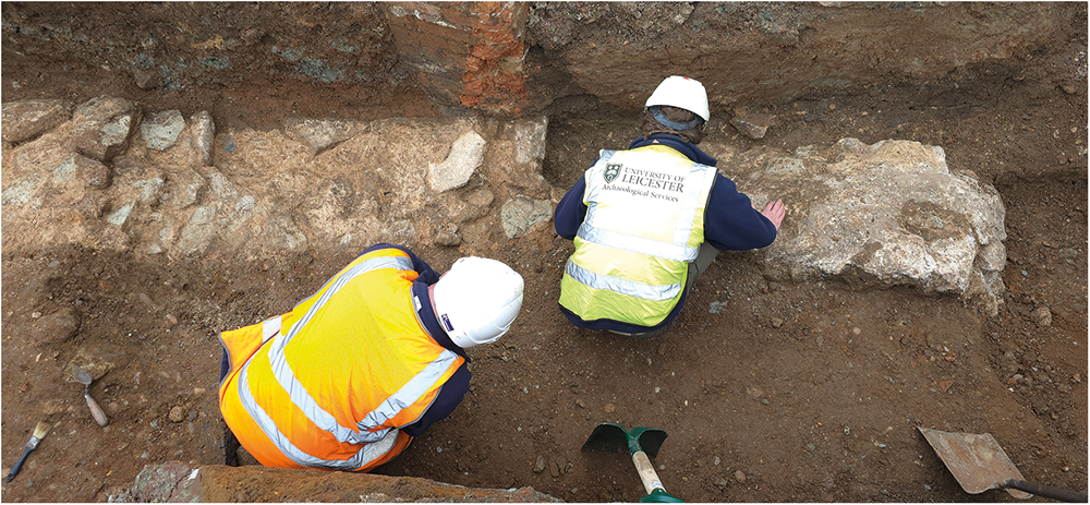
(3) Leicester, Duns Lane (SK 580 042): an archaeological watching brief was undertaken in November 2024, located to the west of the historic Roman and medieval town. Archaeological monitoring revealed a substantial wall of Dane Hills Sandstone and granodiorite build and likely Roman in date (Fig. 21), running broadly north–south, parallel with the Old River Soar. The wall, which appeared to have been heavily robbed during the medieval period, may represent a riverside boundary or retaining wall. Archaeological deposits were entirely absent west (riverside) of the wall, which appeared to have been constructed on river gravels, supporting the theory of the wall having functioned as a revetment to the river. The wall was flanked to the eastward (landward) side by a heavy gravel and pebble metalled surface which extended across the entirety of the stripped area and from which was recovered post-medieval pottery. The surface is likely to represent an early line of Duns Lane. The metalled surface sealed Roman pitting and, potentially, the construction trench for the Roman wall; the latter also appeared to have truncated an earlier east–west ditch. The survival of well-preserved Roman archaeology in a little-known area of the Roman extramural settlement was unexpected, and offers an intriguing glimpse of early Roman development along the river. Notably, it appears to demonstrate that the area was planned at an early date, involving construction of a substantial riverside wall which served to define domestic occupation.Footnote 75
Leicester: A Roman riverside wall, within the western Roman suburb.

Leicester: Roman stone drain at Jewry Wall Museum.

(4) Leicester, Jewry Wall (SK 581 045): an archaeological watching brief was undertaken to the rear of Jewry Wall Museum in December 2024. A Roman stone drain was re-discovered during the excavation (Fig. 22). This drain was first discovered and recorded in the 1790s, and again in the 1890s. The drain was seen again in the 1930s during the major excavations of the Roman bathhouse. It was uncertain if the drain survived following the construction of the museum in the 1960s; its discovery has now confirmed that it is indeed still there. The drain consisted of two parallel walls that comprised granite and Roman tile forming a narrow channel that was partially back-filled with a capping or lintel stone block placed on top. The stone drain structure was not dissimilar to the stone drains recorded elsewhere within the bathhouse. The drain continues to the north-west, downslope towards the river. The Roman stone drain was preserved in situ and the new service trench was diverted to the south.Footnote 76
(5) Leicester, St Nicholas Church (SK 582 045): an archaeological evaluation was carried out in September 2024 either side of the churchyard wall off St Nicholas Walk. The test pits in St Nicholas Walk revealed the churchyard wall to be built on shallow brick foundations. A concentration of mortar was found against the side of one test pit which resembled the edge of a robber trench. A rectangular column base associated with the Jewry Wall complex is projected to be in this location and the feature in the trench may represent the side of it. Small rectangular tiles were found disturbed within the test pits in St Nicholas Walk. These may have come from a Roman opus spicatum (herringbone) floor. The imprints of such a floor were recorded in the area during excavations in the late 1930s.Footnote 77
Warwickshire
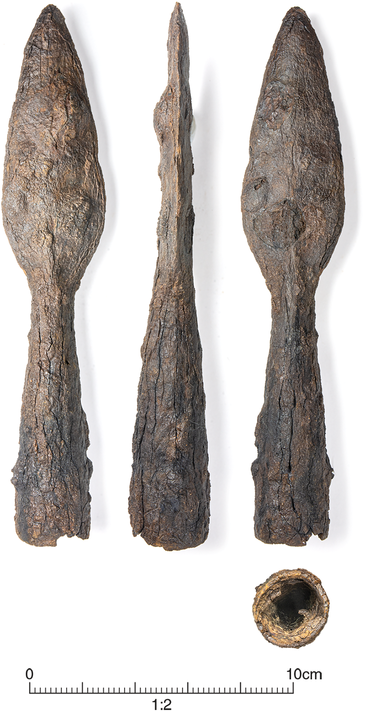
(1) Nuneaton (SP 3870 9057): excavations were undertaken in 2023 on the outskirts of Nuneaton. The principal discoveries were parts of two groups of enclosures; these were later prehistoric and early to mid- and also late Roman. One area contained a multi-phase pair of agricultural enclosures measuring c. 47 m by more than c. 73 m, separated by a c. 5.5 m wide trackway. One of the enclosures contained two successive hollows, potentially used as waterholes and accessed via several droveways. Middle Roman pits were recorded outside an enclosure, and a further enclosure was added to the west in the late Roman period, which was recut several times. Pottery was more frequent in this area; it is possible the western enclosure contained a domestic settlement. The area between the enclosures may have formed a trackway c. 4.8 m wide, whose end was metalled in the last phase of use of this area. Residues of metalworking of early Roman date were identified in one area, probably ironworking, with slag and charcoal indicating two possible smithing hearths. One notable find: a complete iron spearhead with a leaf-shaped blade of probable first-century a.d. date (Fig. 23). While this find is poorly contextualised, it is an important survival and no other easily identified examples are known from Warwickshire or Leicestershire.Footnote 78
Nuneaton: first-century a.d. spearhead with leaf-shaped blade.

Wychavon: corn-drier.

Worcestershire
(1) Wychavon, Wormington to Honeybourne (SP10724 43494): excavations at a 3-hectare site revealed extensive Roman and late Iron Age activity where previous archaeological work had identified a Roman agricultural settlement. The new excavation uncovered additional ditches, pits and enclosures, with the earliest features dating to the late Iron Age. These included drainage and boundary ditches likely overlaid by alluvium from nearby water sources. Activity intensified in the first to second centuries a.d., with the development of more enclosures. Notable features included a well-preserved corn-drier (Fig. 24), stone-lined ovens and hearths. Other pits likely served as extraction sites for clay and limestone. Although no buildings were definitively identified, a rectilinear pit arrangement may indicate a third–fourth-century post-built structure. Finds evidence suggests any related settlement peaked in the late second–third centuries and continued into the fourth century.Footnote 79
Supplementary material
For supplementary material for this article, please visit https://doi.org/10.1017/S0068113X25100548.


 Open access