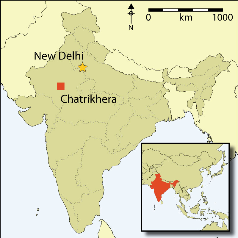
Chatrikhera, located on the Mewar Plain of south-east Rajasthan, India, is a unique site with evidence of extensive long-term occupation and deposits that date from the mid third millennium BC to the present day (Figure 1). Located on the margins of the Indus Civilisation and later polities, the Mewar Plain was often loosely integrated into the political formations that have extended across south Asia since early prehistory. The Chatrikhera Research Project (CHARP) seeks to examine the long-term sequence at the site through a programme that explores the changing role of Chatrikhera in the regional and interregional relationships that extended across the Indian subcontinent, connecting ancient south Asia to the wider world through extensive networks of exchange and interaction. The vast stretch of time represented at Chatrikhera allows the CHARP team to examine this change from the Chalcolithic Ahar Banas period (c. third–second millennia BC) through the subsequent Iron Age (c. second–first millennia BC), Early Historic (c. 600 BC–AD 600), and Middle Periods (c. AD 600–1300). The research setting, within a modern village, also allows us to examine the use of the past in the present, and to consider the adoption of sustainable research and conservation strategies involving collaboration with local communities (Reference Colwell-Chanthaphonh and FergusonColwell-Chanthaphonh & Ferguson 2008).
Map of India showing the location of Chatrikhera.

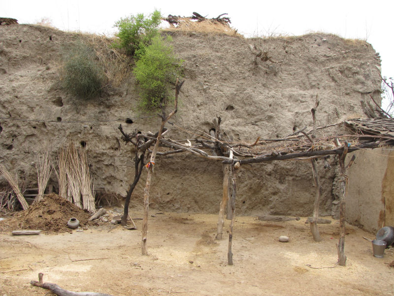
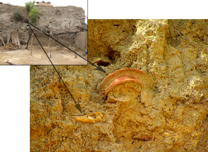
A preliminary season of research for CHARP was conducted during the summer of 2009. Several previous regional surveys reported the remains of an existing mound in the village of Chatrikhera, but this was the first intensive examination of the site itself (IAR 1957–58: 44–45; Reference MisraMisra 1967: 149; Reference HoojaHooja 1988: 163; Reference DasuguptaDasgupta 2006). Over time, parts of the mound have been encroached upon as village residents constructed buildings and expanded courtyards. This has exposed areas that resemble excavated profiles where in situ artefacts and features such as house floors, charcoal deposits and mud-brick are visible (Figures 2 & 3). An evaluation of the pottery and other artefacts visible in these profiles suggests that the top layers comprise a Middle Period occupation, while the thickest, middle layers represent the Iron Age and Early Historic periods. The cultural deposits continue under the present ground surface, making it difficult to determine the depth of the Ahar-Banas levels. However, the discovery of diagnostic ceramic wares and other small finds confirm that this earlier period is represented at the site; this makes Chatrikhera an ideal site at which to examine the full depositional sequence from the Chalcolithic onwards and to identify shifts in social processes and practices from the rise of localised early polities to incorporation in broader economic, political and social networks and polity formations.
Profile of northern deposit.

In situ ceramic and bone in profile of northern deposit.

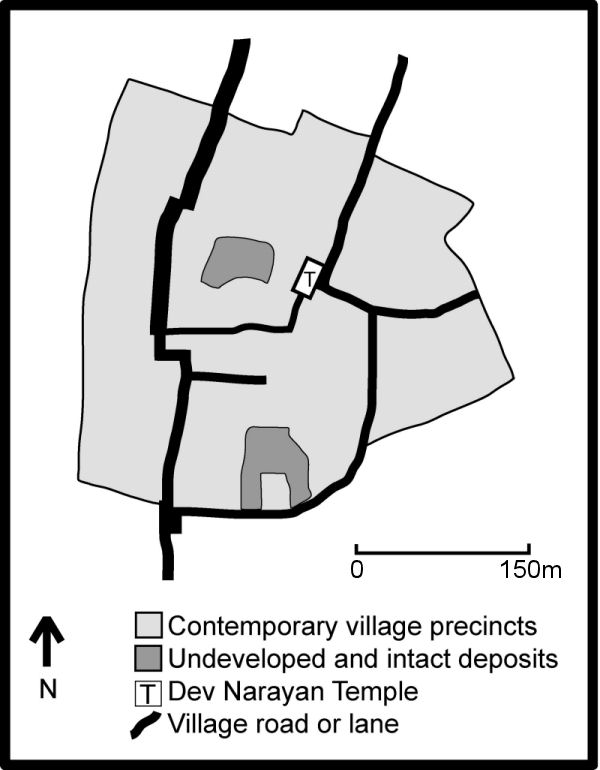
The research team documented two major intact deposits within the centre of the village. The northern intact deposit was previously reported as CHAT IV (Dasgupta 2006), and rises approximately 9m above the original ground surface with an approximate span of 15m N–S and 10m E–W. A second intact deposit was also identified at the southern end of the village, and rises approximately 7m above the original ground surface with an approximate span of 15m N–S and 25m E–W (Figure 4). Additional deposits remain under existing streets, temples and houses, and systematic survey of the agricultural fields surrounding the village indicates that the highest density of archaeological remains is concentrated towards the south-eastern end of the village.
Map of Chatrikhera showing locations of intact deposits.

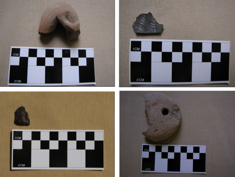
Three main areas of secondary deposition where villagers have dumped materials excavated from the mound were also identified by the CHARP team in 2009. In situ and displaced artefacts recovered from within the village and surrounding fields included diagnostic ceramics from the Ahar-Banas, Early Historic and Middle periods. In addition, animal figurines, other terracotta objects, ore/slag, a faience bead, and lithic remains such as a quartz sling ball, pounding stones, and a microblade core were also found (Figure 5).
Diagnostic artefacts recovered from secondary deposits.

Just as the archaeological mound has been transformed into contemporary courtyard walls, objects recovered from the mound have been incorporated into the daily life of the village. The CHARP team conducted 21 formal and dozens of informal interviews with residents and elicited a variety of different narratives about the creation and destruction of the mound. These interviews also shed light on collecting activities which favour perceived functionality or use-value present in artefacts that emerge from the mound with eroded material (Reference Raczek and SugandhiRaczek & Sugandhi 2010).
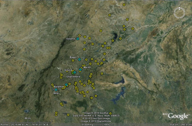
Plans for further work at Chatrikhera consist of documenting the full sequence of deposits represented at the site, and examining interregional organisation by comparing chronological shifts identified at Chatrikhera to other known sites within a 5km radius (Figure 6). Due to village growth and natural erosion, Chatrikhera's archaeological remains are being destroyed at a rapid rate. This project is therefore also considered a rescue endeavour.
Map of regional sites.

Acknowledgements
The authors would like to thank the Archaeological Survey of India, the American Institute of Indian Studies, the University of New Hampshire Center for the Humanities, the Rajasthan Vidyapeeth, and Deccan College for their support.