The project
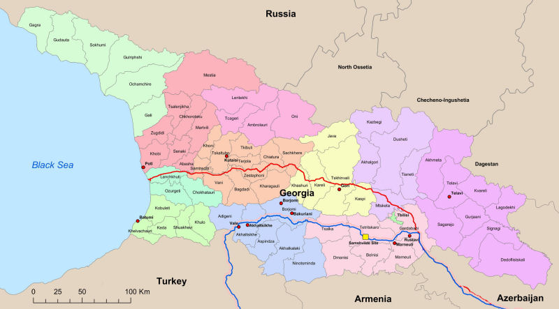
In the area where Azerbaijan, Georgia and Turkey meet a number of pipelines have been under construction, bringing oil to outlets in the Black Sea and the Mediterranean. Figure 1 shows three of these: the Western Route Export Pipeline (WREP, in red) and the Baku Tbilisi Ceyhan/South Caucasus pipelines (BTC/SCP, in blue and pink). Where it crosses Georgia, the AGT (Azerbaijan Georgia Turkey) pipelines company has been supporting and funding a large archaeology project since 2002, and a large number of sites of different period, type and function have been revealed. Archaeological features were revealed during the different stages of construction, including pre-construction surveys, preparation of the construction corridor and subsequent trenching for the pipe. A cultural heritage management plan and intervention strategy were developed to avoid, where possible, or otherwise mitigate, the impact of construction on archaeological sites. In some cases the pipeline was re-routedbut the primary result of the project has been the recording of sites along the 44m wide construction corridor.
Map showing the location and routes of the three major pipelines: the Western Route Export Pipeline WREP (red) and the Baku Tbilisi Ceyhan/South Caucasus Pipeline BTC/SCP (blue, pink). The location of the Samshvilde site is marked with a yellow square.

A number of key research themes were identifieded during the excavations, which related to questions important in Georgian archaeology and which have subsequently provided valuable historical insights into the Caucasian region. As an example, we present here a summary of one small parcel of land in south-eastern Georgia that revealed human activity in five separate cultural periods: Eneolithic (fourth millennium BC), Middle Bronze Age (the first half of the second millennium BC), Late Bronze Age (the beginning of the first millennium BC), Hellenistic (the third–first centuries BC) and medieval (fifth–sixth centuries AD).
Samshvilde case study
The Samshvilde site is located in the Tetritskaro region, Kvemo Kartli area, and is marked with a yellow square on Figure 1. Historically, Samshvilde is thought to be the site of a citadel serving the province of Kvemo Kartli. The majority of the region is mountainous with several rivers flanked by the Trialeti, Loki and Jvakheti ridges, although open plains occupy the central and southern areas (Reference KharadzeKharadze 2000). The land descends from around 1950m above sea level on the Bedeni plateau to around 270m asl at the Marneuli terrace. Due to its location, Kvemo Kartli has a variable climate and diverse flora and fauna, with both mixed hardwood and grassland. The geology is characterised by topsoil 10–20cm deep overlying subsoil of bedded clays, sands and gravels.
Initial cutting of the construction corridor (from KP76 to KP77) north of the present village of Samshvilde (980m asl) led to the identification of 22 archaeological features. Consequently the AGT pipelines company and Samshvilde archaeological teams undertook field evaluation and a project design was formulated, resulting in exploratory and data recovery excavations in February to June 2004. An area of 2400m2 was excavated, mainly by hand, and on completion the assemblages and records were analysed in the laboratory.
Results
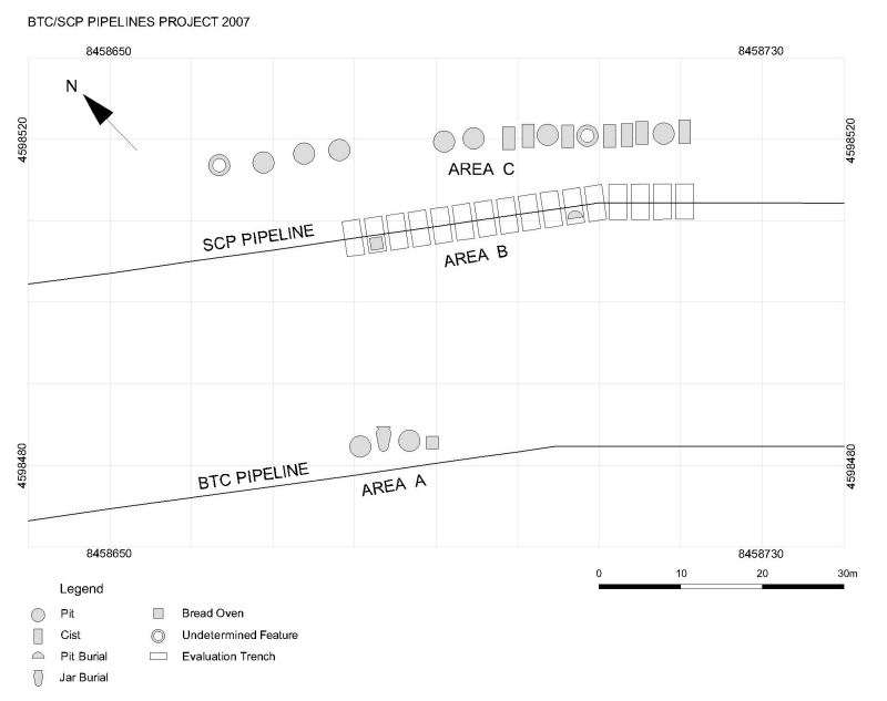
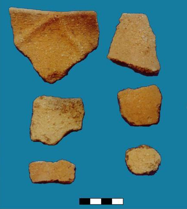
Identified features mainly took the form of pits, ovens and burials in cists with one jar burial (Figure 2). The earliest human activity was dated to the Eneolithic period, fourth millennium BC. The pottery (Figure 3) shows connections between the Eneolithic and Kura-Araxes cultures and supports the premise that Kvemo Kartli was one of the areas where the Kura-Araxes culture originated (Reference KuftinKuftin 1941; Reference Kiguradze, Sagona, Smith and RubinsonKiguradze & Sagona 2003; Reference DjaparidzeDjaparidze 2006). A number of pits were dated by their contents to the Eneolithic, Late Bronze Age and Hellenistic periods. The primary function of the pits is presumed to have been for the storage of cereals. However, potsherds, animal bones, ashes and charcoal were also recovered during the excavations suggesting that the pits may also have had a ritual function. If this is so, the evidence may represent a continuity of ritual practice over a considerable period of time.
Samshvilde site plan (drawing by Inga Esvanjia).

Samshvilde Eneolithic pottery.

There were also similarities in the ovens between the Late Bronze Age and the Hellenistic period. Interpreted as bread ovens, they were constructed of the same building materials and had similar shapes. Again this proposes demographic and cultural continuity over many centuries.
Acknowledgements
The authors wish to give special thanks to the AGT Pipelines Project for their kind help and assistance.