Background
The rapid pace of development in information technologies is radically changing the ways in which archaeologists carry out their research. Geographic Information Systems (GIS) software and digital recording methods have had a substantial impact in archaeology over the past decade (Reference AldenderferAldenderfer & Maschner 1996; Reference FriedmanFriedman et al. 2003; Reference LevyLevy & Smith 2007). Along with powerful GIS tools for recording and analysing spatial data, archaeologists have also benefited from the visualisation capabilities of 3D modelling programs (Reference GillingsGillings & Goodrick 1996; Reference ForteForte & Siliotti 1997; Reference TerrasTerras 1999), bringing the field one step closer to the 'virtual archaeology' envisioned in Reference ReillyReilly's (1990) seminal article.
Google SketchUp is a powerful modelling program with an intuitive and user-friendly interface that is available for free download from Google. Models created in SketchUp can be integrated in a variety of presentations, from screenshot images to be used as illustrations in reports and publications to interactive reconstructions that users can experience in Google Earth, Second Life, or other virtual-reality environments. Three-dimensional visualisations produced with this method can also aid researchers in data analysis, as spatial patterns of structures or artefacts can be easily viewed and manipulated in the models.
Google SketchUp and the CISA3 Project
The potential for applying Google SketchUp to archaeological visualisations is being explored by the authors in a collaborative project with the Center of Interdisciplinary Science for Art, Architecture and Archaeology (CISA3) at the University of California, San Diego. The initial aim of the project has been to develop a method for modelling archaeological buildings and landscapes in SketchUp starting with survey and excavation data. The long-term goals include the creation of a 'virtual city' for the Maya archaeological site of Chichén Itzá, Yucatán, Mexico, where Braswell and Volta will be conducting research over the next four years. The integration of SketchUp models and GIS data into a web-based interactive research environment is also being investigated.
Chichén Itzá: building a virtual Maya city
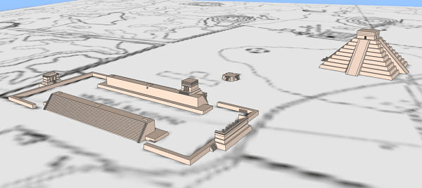
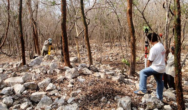
The CISA3 Virtual Maya Cities project has the goal of modelling an entire ancient city: Chichén Itzá, one of the largest and most powerful centres in the Maya region of northern Yucatán, Mexico, during the Terminal Classic period (AD 800-1050/1100). Over the next few years, an international team of archaeologists led by director Rafael Cobos of the Autonomous University of Yucatán and including Braswell and Volta will conduct extensive mapping and excavations at Chichén Itzá, a UNESCO World Heritage site. The results of this research will be incorporated into a digital model of the site (Figure 1) which will allow viewers to explore the ruins virtually. This is especially important in light of the huge impact that tourism is having on the site. Thanks to the inclusion of substantial survey data (Figure 2), the model will represent Chichén Itzá as the large and complex urban settlement it was, and not as just an empty ceremonial core that tourists visit today (Reference MagnoniMagnoni et al. 2007). By exploring alternative ways of allowing the public to experience Chichén Itzá, it is hoped that the project will have an educational effect while contributing to the preservation of the site.
Screenshot of a Google SketchUp model of structures 2D1 (Great Ballcourt), 2D3 (Platform of the Eagles), and 2D5 (Castillo) at Chichén Itzá, superimposed on the Carnegie Institution's map of the site.

UCSD graduate student Misha Miller-Sisson (at the total station) with workers Vicente Caamal Martínez (right) and Ubaldo Cen Uc surveying a residential group in the south-western periphery of the site during the 2009 field season.

In preparation for the spring 2009 fieldwork at Chichén Itzá, SketchUp models were created of the structures included in the portion of the site surveyed by the Carnegie Institution of Washington, D.C., at the beginning of the twentieth century. The reconstructions were based on the general plan of the site published by the Carnegie project (Reference RuppertRuppert 1952; Reference TozzerTozzer 1957), as well as more recent survey and excavation reports (Reference LincolnLincoln 1990; Reference CobosCobos 2003) and photographs of the buildings.
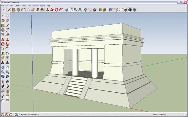
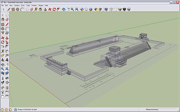
Three-dimensional models can be created based on survey data and building plans by simply tracing the structure outlines in SketchUp and then extruding sections of the drawing according to the heights recorded in the profile (Figure 3). For more complex architecture, such as that of the Great Ballcourt (Figure 4), photos from multiple angles can be used to fill in the details that are not included in structure plans and profiles.
SketchUp model of the North Temple of the Great Ballcourt based on reports and modern photographs.

SketchUp model of the Great Ballcourt in 'x-ray' mode superimposed on a plan of the building.

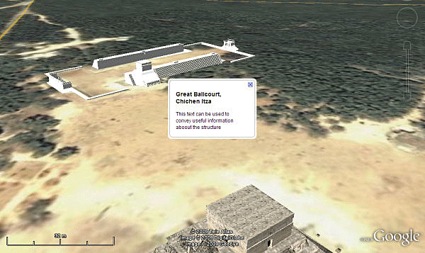
The results of new excavations in the site centre and surveys in the periphery will be added to the model as work proceeds. In addition to its ease of use, one of the main advantages of Google SketchUp is that models created with the program can include as little or as much details as wished, thus allowing for the incorporation of fine-grained reconstructions of excavated buildings alongside more hypothetical renderings based on survey data. In addition, by linking the site database with the models, useful information can be displayed through Google Earth 'balloons' (Figure 5), allowing researchers to explain the fieldwork, post updates, or include any other type of content they desire.
Screenshot of SketchUp model of the Great Ballcourt imported into Google Earth.

Acknowledgements
We would like to thank Dr. Rafael Cobos and the Instituto Nacional de Antropología e Historia (INAH) of Mexico for supporting our project.