


Introduction
In the preceding decades, a range of new perspectives on Andean archaeology and anthropology have focused on an alternative view of the process of the Inka expansion. Particular attention has been put forward for the southern Andes, where ‘the Inka confronted an environmental and social context quite different from what they had found in their advance into Qullasuyu [the Southern quarter of the empire]’ as suggested by Salazar et al. Reference Salazar, Berenguer, Castro, Hayashida, Parcero-Oubiña, Troncoso, Hayashida, Troncoso and Salazar2022 (see also Hayashida et al. Reference Hayashida, Troncoso and Salazar2022 for a recent general overview of this large area). On top of the more traditional views focused on the military, political and economic imperial strategies, these new approaches have begun to explore other dimensions and mechanisms involved in the Inka expansion. For instance, the relevance of some ‘subtler’ mechanisms has been argued in the legitimation of the new positions of power, such as the role of ritual violence (e.g. Acuto Reference Acuto, Zaranquin and Acuto1999; Garrido et al. Reference Garrido, Ratto, Morales, de Stéfano, Aranda and Luna2022; Nielsen & Walkers Reference Nielsen, Walkers, Zaranquin and Acuto1999), feasting and commensal politics (e.g. Bray Reference Bray2003; Dillehay Reference Dillehay2003), or the transmission or imposition of symbols through iconography and morphology in ceramics and architectural ornamentation (e.g. Martínez C. Reference Martínez C. and Zubieta2022a; Páez & Giovannetti Reference Páez and Giovannetti2008). These, and other approaches, are allowing for a more comprehensive view of this historical process both at the global level of the whole empire (Tawantinsuyu) (e.g. D'Altroy Reference D'Altroy2015) and in particular with reference to the southern Andes (Hayashida et al. Reference Hayashida, Troncoso and Salazar2022).
One particular theme is the analysis of the processes of symbolic appropriation of the landscape by the Inkas. For instance, Acuto (Reference Acuto2005; Reference Acuto2012) referred to the construction of ‘landscapes of spectacle and control’ to account for the effort made by the Inkas towards negotiating or imposing a new worldview over local groups through the manipulation of spatial relations of things in the landscape. Such approaches have been mostly based on analysis of the relation between landscape and architecture, although more subtle forms of material culture have also been considered, such as rock art (e.g. Acuto et al. Reference Acuto, Troncoso and Ferrari2012). In effect, rock art has been linked to the deployment of imperial strategies for the annexation of this area in the southern Andes and for the negotiation of relations between the Inka empire and local groups (Berenguer et al. Reference Berenguer, Cabello B. and Artigas S.C.2007; Hernández Llosas Reference Hernández Llosas2006; Leibowicz et al. Reference Leibowicz, Ferrari, Jacob and Acuto2015; Sepúlveda Reference Sepúlveda2004; Troncoso Reference Troncoso2004; Reference Troncoso2019). Representations of chiefs, or curacas, wearing unku (robes) and headdresses and bearing different objects representative of power and authority are among the most characteristic motifs of rock art in this period (Aschero Reference Aschero, Podestá and de Hoyos2000), together with geometric designs and standardized depictions of camelids (Acuto et al. Reference Acuto, Troncoso and Ferrari2012; Aschero Reference Aschero, Podestá and de Hoyos2000; Berenguer et al. Reference Berenguer, Cabello B. and Artigas S.C.2007; Hernández Llosas Reference Hernández Llosas2006; Podestá et al. Reference Podestá, Rolandi, Santoni, Re, Falchi, Torres and Romero2013; Sepúlveda Reference Sepúlveda2004; Reference Sepúlveda, González and Bray2008; Troncoso Reference Troncoso2004; Reference Troncoso, Alconini and Covey2018). However, it must be noted that most of them had already been used in the late pre-Inka period (the so-called Periodo de Desarrollos Regionales—hereafter PDR).
This view of rock art as an active agent in the shaping of social action is common to many geographical and chronological contexts. Rock art has been conceptualized as one of the basic material means to build and shape memories, traditions and different forms of cultural knowledge (e.g. Zubieta Reference Zubieta2022). Compared to other forms of materiality, such as urban planning or architecture, it can be more spontaneous and related to individual, small-scale engagements, similarly to other forms of materiality such as textiles or objects. But rock art is also durable; it can preserve much longer than more ephemeral elements, such as textiles or body ornamentation, and holds a permanent association with specific places, something that objects do not. This allows a lasting signification of certain places that might reveal a continued use of those places over many centuries (Alves Reference Alves and Zubieta2022; Martínez C. Reference Martínez C., Hayashida, Troncoso and Salazar2022b). In that respect, it is often privileged evidence for understanding how the space is appropriated and signified (Dudognon & Sepúlveda Reference Dudognon and Sepúlveda2018).
A common approach to rock art is understanding it within the landscape, as an element that orders and gives meaning to the relation between humans and the landscape: the spatial location and arrangement of rock art is an essential part of its meaning and in how it communicates messages (Bradley Reference Bradley1997; Bradley et al. Reference Bradley, Criado-Boado and Fábregas Valcarce1995; Valdez-Tullett Reference Valdez-Tullett2019). In the last years, digital technologies have provided new tools to explore this, thanks to their capacities for modelling and simulation (Wienhold & Robinson Reference Wienhold, Robinson, David and McNiven2017). Visibility and mobility analyses have been particularly successful, as long as these are the two basic forms of human interaction with the landscape (Llobera Reference Llobera2012) and engagement with rock art (Fairén-Jiménez Reference Fairén-Jiménez2007). The current availability of digital data produced with very high accuracy and resolution is eventually allowing a digital approach to human experience and perception (Barnett et al. Reference Barnett, Valdez-Tullett, Bjerketvedt, Frodsham and Sharpe2022), overcoming a most critical limitation (Llobera Reference Llobera2012). However, digital approaches at such detailed, human-centred scales are still uncommon in general, and in South America in particular. Here existing analyses rely mostly on examining the relation between rock art and the landscape at wider scales, ‘between blocks of rock art and regional site distribution patterns’ (Troncoso et al. Reference Troncoso, Armstrong, Basile, David and McNiven2018), iconography being the most typical tool for understanding it at more local scales.
This paper will illustrate how the Inka manipulation of the spatial relations might have operated at very local scales, in sites of very little monumentality and relevance. It will do so through the analysis of a small and relatively simple site, Villavil 2, where rock art was the most obvious mechanism used for the materialization of messages, the construction of a sense of place and the appropriation of the space during the PDR and Inka periods. It is precisely this local and barely monumental quality that makes the site so interesting. As will be demonstrated below, our analysis suggests that Villavil 2 reproduces, on a modest scale, wider patterns and trends of the use of space as a mechanism for the negotiation of social relations and the legitimation of forms of dominion in Inka times. Our analysis is largely based on digitally modelling the spatial relations of the different elements that compose the site and the surrounding landscape, and the potential interaction between people and those elements from a situated, human perspective. This implies using data collected at a highly detailed spatial scale and relying on a combination of standard GIS tools with other resources not frequently used in archaeology so far. In this respect, the paper also aims at inspiring similar approaches elsewhere.
To begin with, a brief description is provided of the regional archaeological context and the site itself, followed by an outline of our objectives and hypotheses. Subsequently, a detailed presentation is provided of the data and methods used in the analysis, making special reference to the use of digital modelling tools. Finally, the results are discussed and some concluding remarks offered.
The archaeological background of the Hualfín Valley
Villavil 2 is located in the Hualfín Valley in the province of Catamarca. Human occupation here has been traced back as far as c. 200 bc. As was the case elsewhere in the Andean region, it was, for a long period of time, occupied by peasant groups distributed mainly around water sources and terrain suitable for cultivation and animal husbandry (González Reference González1955; Sempé Reference Sempé1999; Sempé et al. Reference Sempé, Salceda and Maffia2005). Around ad 900–1000, with the beginning of the PDR, strong regional or local differences began to emerge in the area, significant demographic growth took place and the population became concentrated in larger settlements with different functional spaces. It was during this time that the first fortified settlements (pukaras) have been documented, located in elevated, poorly accessible places. These settlements are characterized by stone architecture, with perimeter walls enclosing and defending dense networks of constructions which in some cases, it is supposed, housed large concentrations of people (Raffino & Cigliano Reference Raffino and Cigliano1973; Sempé Reference Sempé1999). More recent studies have suggested that most of these communities would have adhered to more isolated and dispersed forms of living in settlements, with a low density of occupation and with no deep social inequalities. Settlements of this kind have been documented in the southern part of the valley in places such as El Molino, Palo Blanco and Loma de Ichanga, among others (Balesta et al. Reference Balesta, Zagorodny and Wynveldt2011). It was only after ad 1000–1200 that, along with significant climatic changes, conflict emerged among local communities within and beyond the Hualfín valley, concerning access to and control of resources. It was during this period that pukaras were first built, such as in Loma de Los Antiguos de Azampay (Wynveldt Reference Wynveldt2009) (Fig. 1).
Location of Villavil 2 (black star) in the context of the Hualfín Valley and surrounding areas. Black dots are Inka sites, while grey squares are local sites. (Data from Williams Reference Williams2000; Wynveldt et al. Reference Wynveldt, Flores, Iucci and Lorenzo2016.)

The traditional chronology for incorporation of this area into the Inka empire is c. ad 1430. This led to a substantial change in local settlement and the construction of different imperial facilities along the main Inka road that crosses the valley (Lynch & Parcero-Oubiña Reference Lynch and Parcero-Oubiña2017; Moralejo & Gobbo Reference Moralejo and Gobbo2015; Raffino et al. Reference Raffino, Moralejo and Gobbo2012). Among them, the site of Hualfín Inka stands out as an administrative, economic and ceremonial centre in the region (Lynch et al. Reference Lynch, Giovannetti and Páez2013). Certain characteristic Inka constructions can be found here, including a large main square or haukaypata with an ushnu (ceremonial platform) and a kallanka (a large, roofed building). Around the square, settlement compounds, storage facilities (qollqas) and patios have been documented. Abundant pottery has been found in these areas corresponding both to late local and Inka styles. The site's construction has been interpreted in terms of a powerful mechanism for cultural and symbolic dominion through a combination of architecture and spatial location in a key confluence of communication and exchange routes. Although local settlements have been found in the valley, the Inka site was founded in a new location, a few kilometres to the east of the areas in which human occupation had developed in the pre-Inka period, almost exclusively on the western bank of the Hualfín river (Lynch Reference Lynch2013). This spatial segregation has been interpreted as an intentional mechanism to establish an asymmetrical relationship between the administrative realm of the Inka and the landscapes of daily activities of the local communities. This was reinforced by the meticulous planning of the layout of the architectural features in Hualfín Inka (Lynch & Giovannetti Reference Lynch and Giovannetti2018). Similar mechanisms, involving spatial locations, architecture and even rock art, have been documented in other parts of the wider region of the southern Andes (Acuto Reference Acuto, Zaranquin and Acuto1999; Reference Acuto2005; Reference Acuto2012; Acuto et al. Reference Acuto, Troncoso and Ferrari2012; Leibowicz et al. Reference Leibowicz, Ferrari, Jacob and Acuto2015; Nielsen & Walkers Reference Nielsen, Walkers, Zaranquin and Acuto1999; Troncoso Reference Troncoso2004).
The site of Villavil 2
Villavil 2 is located in the foothills of the Sierras de Hualfín, at 1,880 m.a.s.l. (Fig. 1). It was first documented in 2015 and was, at that time, the first site with rock art registered in this area (Lynch Reference Lynch2015; Lynch & Giovannetti Reference Lynch and Giovannetti2018). It occupies an uncommon topographic location at the top of a vertical cliff, which is extremely difficult to access, ending in a dead-end gorge, where different remains of ancient activity are visible on the ground (Fig. 2). Its scenic location, in a prominent and dominant position, is one of the most remarkable characteristics of the site. As mentioned above, the site is difficult to reach, with the only way of gaining access being literally to climb a near-vertical rock wall.
Map of the site and identification of its main elements.

The point of access to the site is occupied by a narrow promontory where some large rocky outcrops have been carved with different designs (Figs 2 & 3). Some reddish-coloured sandstone blocks are covered with a black layer on the surfaces with the engraved motifs. The iconography had preliminarily been associated to the PDR and Inka periods, which was confirmed by our study, as will be seen in the following section, although modern motifs are also visible on a few rocks (Lynch Reference Lynch2015; Lynch & Lynch Reference Lynch and Lynch2018).
Distribution of the 11 engraved rocks in Villavil 2.

There is a total of nine rocks with carvings on the promontory located at the entrance to the site, with another two located further down the hill, at the bottom of the promontory (Fig. 3). Although different in size and volumetric complexity, all but one are large boulders with the rock art carved on their vertical sides or, occasionally, on the top. The only exception is a panel located on a flat rock at the very edge of the promontory (no. 7).
Behind this narrow promontory with rock art, there is a dead-end gorge, in which the subtle remains of some constructions are visible. These buildings are difficult to distinguish on the ground due to their poor state of preservation. However, an aerial view (Lynch et al. Reference Lynch, Parcero-Oubiña and Fábrega-Álvarez2020) has provided a more complete picture (as summarized in Figure 2). These constructions are lined up along a pathway crossing this sector, with most of them located around large boulders that stand out in flatter, sandy areas. Some of these boulders have multiple mortars carved on their tops (Fig. 4).
Aerial view of part of the inner sector of Villavil 2 showing part of the pathway, the remains of one construction (bottom centre) and two boulders with multiple mortars on their tops.

Abundant fragments of pottery and lithic material are also clearly visible on the ground. A detailed sampling survey indicated that the vast majority of the pottery corresponds to the PDR and Inka periods, with some fragments belonging to the Formative period. However, there was a complete absence of remains dating from the Middle period (Lynch et al. Reference Lynch, Parcero-Oubiña and Fábrega-Álvarez2020). Test-pit excavation in this sector has provided evidence of commensalism (Lynch & Giovannetti Reference Lynch and Giovannetti2018). This, together with the numerous mortars, would suggest that the area was used for the production and consumption of large quantities of food and drink in the context of special seasonal events. In any case, the site does not show evidence of a typical settlement area, an aspect which is reinforced by the fact that the site is extremely isolated and difficult to access.
Objectives and hypothesis
The present study attempts to understand why this particular place was selected as a likely focus of ceremonial activity. This also implies an understanding of why rock art was employed as part of such practices. The analysis focuses on exploring the spatial connections between the different material elements involved in the layout of the site: the rock art, the local and regional topography and the existence of different geographical features that may have possessed particular significance in the past. As is well known, most of what is considered natural today was regarded in the late Prehispanic world view as wak'as (non-human actants), which played a central role in people's lives and everyday activity (e.g. Bray Reference Bray2015), in the development of mechanisms for political control (Acuto Reference Acuto2005; Reference Acuto2012) and, more generally, in the shaping of specific ‘historical cosmopolitics’ (Troncoso Reference Troncoso2019).
On this basis, the working hypothesis of this paper is that the arrangement of the site is related to the establishment of significant spatial connections between the different elements of which it is composed (topography, rocks, art, etc.) and between these and the surrounding landscape. One particular aspect of this hypothesis is that if the site was created or modified during the period of Inka rule, then it could be expected that certain traces of the practices of the creation of ‘landscapes of domination’, identified in similar sites elsewhere (e.g. Acuto et al. Reference Acuto, Troncoso and Ferrari2012), would be found. What distinguishes the approach taken here is that the main focus is on a quantitative spatial analysis rather than on the analysis of iconography or on a more descriptive landscape characterization.
Materials and methods
Considering the objectives outlined above, a detailed field documentation of the site at different scales was a primary necessity. In particular, three complementary scales were required:
• The location of the site within the landscape.
• The location of rocks at the site.
• The location of the panels and motifs on the rocks.
Due to the scarcity of vegetation in the area and the difficulties imposed by the harsh topography, UAV-based photogrammetry was considered to be the best choice for documenting the site as a whole (Figs 2 & 3). The details of this documentation process have been described elsewhere (Lynch et al. Reference Lynch, Parcero-Oubiña and Fábrega-Álvarez2020). All of the rocks containing carved panels were documented using ground-based photogrammetry.Footnote 1 In parallel, a written description of all the rock-art motifs was carried out. For the purpose of documentation, the wide variety of motifs found at the site was organized into three main groups: animals, human figures and geometric designs (in addition to some unidentified motifs) (Fig. 5). The results are shown in Table 1.
Close-up images of some motifs (rocks nos 4, 5, 9 and 10). Colours have been saturated to improve visibility.

Rock-art motifs identified at Villavil 2.

Estimation of the period of each motif is based on the knowledge available (Aschero Reference Aschero, Podestá and de Hoyos2000; Aschero et al. Reference Aschero, Martel, López Campeny, Sepúlveda, Chacama and Briones2009; Basile & Ratto Reference Basile and Ratto2011; Berenguer et al. Reference Berenguer, Cabello B. and Artigas S.C.2007; Gallardo et al. Reference Gallardo, Sinclaire, Silva, Berenguer and Gallardo1999; Hernández Llosas Reference Hernández Llosas2001; Reference Hernández Llosas2006; López Campeny & Martel Reference López Campeny and Martel2014; Martel et al. Reference Martel, Rodríguez Curletto and del Bel2012, among others). Some motifs are considered characteristic of specific periods, while others (e.g. camelids, sketched human figures) were used over long spans of time, from the Early Formative to Inka times. Even taking this uncertainty into account, it seems clear that most of the rock art at the site corresponds to the PDR and Inka periods. This coincides closely with the results of the collection of material culture at the site (Lynch et al. Reference Lynch, Parcero-Oubiña and Fábrega-Álvarez2020), with most of the fragments of objects documented belonging to the PDR or Inka periods and only a few from the Formative and no materials at all from the Middle period.
Continuity in rock-art motifs is especially frequent between the PDR and the Inka periods, meaning that there are many motifs which cannot be attributed with certainty to either period. There is no general agreement about which specific designs can be assigned to Inka times, although there is a trend to more rectilinear shapes, instead of circular, for instance in the camelids, and a more common depiction of unkus (robes) with geometric designs, and humans wearing headdresses (Hernandez Llosas Reference Hernández Llosas2006; Troncoso Reference Troncoso2004). There is one particular rock, no. 7, with an iconography that stands out from the rest in the site (cf. Figs 5 and 6): here, rectangular shapes dominate, including motifs that are rare in the rest of the site (such as spirals) or that only appear here, such as the so-called ‘concentric squares’ (Álvarez Larrain et al. Reference Álvarez Larrain, Cabrera and Carbonelli2011). They have been interpreted as a representation of humans wearing unkus, and in this region would have developed only after the Inka conquest (Álvarez Larrain Reference Álvarez Larrain2012; see also Zárate Bernardi et al. Reference Zárate Bernardi, Mundt and Marsh2020). Other motifs in the same rock, such as rectangular spirals, can also be assigned to Inka times, according to the same source. This rock (no. 7) is also unique in its shape as it is the only panel located on a flat outcrop, rather than on large boulders. Furthermore, as shall be seen in more detail in the following section, its location at the very end of the promontory and almost at the edge of the cliff is also unique (Fig. 6).
Rock no. 7, a flat panel located almost at the edge of the promontory (top) and visualization of the engravings. (3D model processed as proposed in Mark & Billo Reference Mark and Billo2021.)

In addition to documenting the rock art, the fieldwork also made it possible to produce some other materials that were subsequently used in the analysis of the site. Since most of the analyses were based on digital modelling, and in order to make reproducibility possible, we will briefly describe the main datasets and tools used. Paramount among them is the Digital Surface Model produced with UAV-based photogrammetry, which made it possible to perform digital analyses, the results of which will be shown in the next section. The DSM has a spatial resolution of 6 cm (plus an orthoimage of 1.5 cm). The georeferencing accuracy of the model is 9.2 cm (RMSE), with 22 Ground Control Points measured via total station (Lynch et al. Reference Lynch, Parcero-Oubiña and Fábrega-Álvarez2020). In order to improve processing efficiency, this DSM was resampled to 20 cm.
The analysis of the patterns of potential movement across the site were performed with Omniscape (McRae et al. Reference McRae, Popper and Jones2016). Omnsicape is built on Circuitscape, a tool that implements Circuit Theory modelling to digitally model potential movement between different locations in a region (McRae et al. Reference McRae, Dickson, Keitt and Shah2008). It works by borrowing algorithms from electronic circuit theory, where movement is analysed as electrical current and friction as electrical resistance. Circuitscape has been used in archaeology in the past as an alternative to the widespread Least Cost Paths, since it produces an overview of connectivity beyond optimality and specific locations (Howey Reference Howey2011; McLean & Rubio-Campillo Reference McLean and Rubio-Campillo2022). In turn, OmniscapeFootnote 2 (McRae et al. Reference McRae, Popper and Jones2016) expands on this by offering a unique approach to connectivity modelling, enabling the sources, destinations and intensity of movement (modelled as electrical current) to be informed by continuous spatial data. This means that connectivity is calculated not between specific discrete locations in a region, but rather between all locations. The results can be considered as a map of the natural affordances for (human) mobility within a specific region (under the criteria chosen to quantify terrain resistance to human movement). In this case, movement costs were quantified using the metabolic curve defined by Llobera and Sluckin (Reference Llobera and Sluckin2007). To the best of our knowledge, this is the first archaeological use of Omniscape.Footnote 3
Visibility modelling was carried out with more standard GIS tools (ArcGIS 10.4). The Digital Elevation Model (DEM) of choice for calculating regional visibility was the ALOS-Palsar DEM, with a spatial resolution of 12.5 m. Local visibility analysis was performed with the original photogrammetry-based 6 cm DEM. Visual perception of the rock-art panels was estimated taking into consideration visual angles and distances: a flat angle of 45 degrees was taken to be the threshold for optimal perception (Bornaetxea & Marchesini Reference Bornaetxea and Marchesini2022). Although some promising tests were carried out with the recently developed r.survey tool (Bornaetxea & Marchesini Reference Bornaetxea and Marchesini2022), all the calculations were finally made in ArcGIS, combining basic viewshed, aspect and slope analyses. The maximum distance for visual perception of the art was set at 15 m, in accordance with Ogburn (Reference Ogburn2006) for an average size of 25 cm for the engravings.
Results
At first glance, the site has nothing of particular relevance when compared with other nearby locations. As shall be seen in the following paragraphs, visibility is not a remarkable characteristic of this site: it is not widely visible from the surrounding area and neither is the visibility from the site itself particularly broad. Indeed, the site only stands out thanks to one defining characteristic: at the bottom of the cliffs that separate the site from the surrounding flat valley there is a water spring emanating from a cave (Fig. 7). This is not common in such an arid area and, in the absence of any other obvious singularity, is the best candidate for explaining the selection of this harsh topographic location. Although, in the present day, the amount of water is not very high, visits to the site have suggested that water flows from this point throughout the year. The photograph shown in Figure 7 was taken in October 2017; October is at the end of the dry season, which lasts from May to September, with most rain falling between December and April. Rainfall in this region has been quite constant in the last 60 years, albeit with a slight downward trend.Footnote 4 Palaeoecological studies suggest that conditions in the last 600 years, although fluctuating, were generally wetter than they are today (Meléndez et al. Reference Meléndez, Kulemeyer, Lupo, Quesada and Korstanje2018). This, in principle, supports the likely existence of this water source during the occupation and use of the site.
Aerial view of the site: promontory with rock art (centre right, where standing people provide a scale), ‘circus’ with occupation remains (rear left) and water source emanating at the bottom of the cliffs (centre left). This photograph was taken in October 2017 at the end of the dry season.

As described above, the promontory where the rock art was carved is the only point of access to the whole site, in particular the ‘circus’ where occupation remains have been found. This is clearly visible if the way in which the topography of the site restricts the possibilities of access is observed (Fig. 8): there is a barrier of cliffs with gradients of more than 70 degrees, which completely restricts access to the site to a small area located just north of the promontory (as proved by our experience in the field: see Figure 2).
Extreme gradients limit points of access to the site.

Examination of the distribution of art on the rocks shows some recurrent trends: art was not engraved on just any available place, but only on some specific panels. Indeed, the rock art seems to have been used to reinforce this liminal character further, since the motifs carved onto the rocks most closely located to the point of access of the site are facing the direction of access (Fig. 9). The two rocks located at the bottom of the promontory (nos 10 and 11) were carved on the vertical panels oriented to the southeast, signalling to any potential visitor the direction that had to be taken to climb up the slope and access the site. Located at the entrance to the promontory, rock no. 8 was engraved on its upper face, visible from the only possible access which is located just above it.
Distribution of engravings on the surface of the rocks and route of access to the site.

In the present day, carvings are only (or mostly) visible on the vertical faces of the remaining rocks (nos 1 –6 and no. 9), oriented to the northeast (the direction of access). Some occasional motifs exist on panels oriented towards other directions, but these are much less frequent. A cautionary note is necessary here since some of the rocks (particularly nos 2, 3 and 6) show severe exfoliation on parts of their surface, thus representing a significant source of bias (Figs 5 & 13, below). However, the case of rock no. 9 is of particular interest due to its good overall state of preservation and the fact that it was carved only on its northeastern side, facing the point of access. This would suggest that this may have also been the case with the other rocks.
With that preservation caveat in mind, there is also an apparent spatial trend in the distribution of the diversity and density of motifs (Fig. 10). Rocks located in peripheral areas of the promontory (nos 10, 11 and 7) have only a few carved motifs. In contrast, rocks nos 1, 4, 5 and 9 stand out as they include animals, humans and geometric designs and contain more than 10 different motifs (Table 1) and, in some cases (nos 1 and 4), more than 40 carvings. In the present day, rocks 2, 3 and 6 show a lower density and diversity. However, as mentioned above, these three rocks are more eroded than the rest and thus they may have lost part of the original art. In any case, measuring the correlation between the size of the rocks and the intensity of carving proves that the selection of the largest boulders was not a factor in the explanation of the uneven distribution of rock art in the site, even without taking rocks nos 2, 3 and 6 into consideration (Table 2).
Diversity (left) and density (right) of motifs.

Measurement of the correlation (or absence thereof) between rock size and the diversity or density of carvings (area of panels and volume of rocks was measured with the photogrammetric 3D models).

Rock no. 7 is also unique for two other reasons. Firstly, it is spatially segregated from the other rocks, occupying a peripheral position outside of the area of circulation. This fact, which is clear when visiting the site, becomes even more evident if the patterns of potential movement across the site are digitally modelled using Omniscape, as described in the previous section (Fig. 11). There are a few points of high attraction to movement (at the bottom of the promontory and at the entrance to the north) that coincide with the presence of engraved rocks (nos 8, 10 and 11). We believe that this is highly significant as it would suggest that these rocks were selected as markers for accessing the site because they are located in the most relevant positions as far as access is concerned. Once on top of the promontory, potential mobility is much less channelled, although it decreases the further to the east one moves, where rock no. 7 is located.
Connectivity map of the rock-art area in Villavil 2.

In fact, the isolation of rock no. 7 is even greater than it may appear. The data obtained in the connectivity analysis reveal that, if the absolutely impracticable terrain with slopes over 70 degrees is excluded, this is the most disconnected point of the entire study area (Fig. 12). Connectivity at this point is as low as it is at the top of the large rock boulders. Thus, the most relevant characteristic of the location of rock no. 7 is its isolation.
Connectivity map of the rock-art area in Villavil 2 excluding slopes above 70 degrees (white areas).

In addition to being located in an isolated position, rock no. 7 has a second distinctive quality: it is the only panel carved on a flat surface at ground level, rather than on a large voluminous boulder (Fig. 6). This implies some interesting differences concerning the way in which the performative act of engagement with these motifs was carried out. All other panels operate as canvases that enclose the field of vision: when looking at them, most of the field of vision is filled by the vertical face of the rock where the motifs are carved, hindering the visibility of the wider landscape around. Furthermore, in most cases, the background is not the open landscape to the east but the vertical cliffs to the southwest and west, which further reinforces the impression of an enclosed and limited field of vision (see Figure 9). Facing the art implies turning one's back on the surrounding landscape. Where this is not the case (rocks nos 4 and 5), the local topography and the rocks themselves block the visual range available (Fig. 13).
Most of the rock art is engraved on vertical faces that must be viewed by turning one's back on the surrounding landscape (rocks nos 4 and 6, top). Where this is not the case, the local topography and the rocks themselves enclose the visual range (rock no. 4, bottom).

However, in the case of rock no. 7 the field of vision is completely open to the surrounding landscape: the viewer must look slightly downwards to see the motifs, although visibility is unhindered in all directions when standing next to it (Fig. 14). This creates a completely different experience in terms of perception: in this case, facing the art implies facing the wider landscape, the field of vision is wide open and the cliffs are behind the viewer.
Field of vision standing next to rock no. 7: the motifs carved on the rock (bottom right) and the wider landscape are visible at the same time.
In order to illustrate further the distinctive visual characteristics of the panels, digital visibility analyses were carried out. The availability of a high-resolution DEM made it possible to analyse visibility on an extremely detailed scale, focusing on the perception of the panels with art and not merely on the visibility of the topography. As described in the previous section, this analysis is based not only on calculating straightforward viewsheds, but it also accounts for the distance and angles of visual incidence that determine the actual possibilities of perceiving the motifs. This is a relevant point, as shown in Figure 15: the art is located on rocks that are mostly bulky and prominent, easily visible from many places, although when angles and distances that allow the perception of the motifs are taken into consideration, the picture changes significantly.
Comparison of areas in which rocks with art are visible (left) and in which the actual art is perceived (right). Rocks in red are the focus of visibility in each map, yellow are other rocks.

This analysis provides empirical support for the impressions perceived when visiting the site in the present day. The motifs on the rocks located at the bottom of the promontory are only visible when ascending the slope, signalling the point and direction of access to the site. As mentioned above, once on the promontory, the rock art is mostly visible with a south to southwest orientation, which implies greatly restricting the field of vision. This creates a small, enclosed space of interaction for a limited amount of people to gather simultaneously and engage together with the rock art. However, as has been shown above, the location of rock no. 7 is quite the opposite: engaging with it implies opening oneself up completely to the surrounding landscape. Both the flat area at the bottom of the promontory and the places visible in the far distance (see below) become part of the visual field. Most significantly, this is the only part of the promontory from which the source of the water spring, which it has been argued here is the only landscape feature that makes this particular location unique, becomes visible (Fig. 16).
Areas from which the source of the water spring (black polygon) is visible. The only part of the promontory with a direct line of sight is the location of rock no. 7.

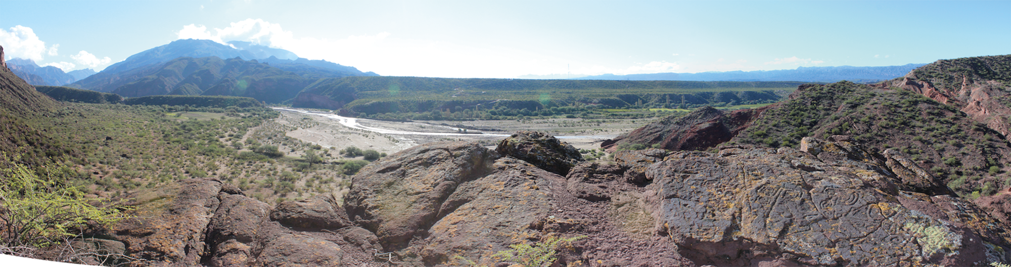
When facing rock no. 7 the surrounding landscape is widely visible. As has already been stated, Villavil 2 is not located at a particularly visible spot in the landscape. In fact, the viewshed available from the site is rather limited (Fig. 17), consisting mostly of the immediate valley below and the summits of some mountain ranges in the middle and far distance. Villavil 2 is spatially and visually segregated from the contemporaneous settlements in the area, both from the PDR and the Inka period. The supposed route of the Inka road is also out of the visual range available, despite being located only a short distance from the site. However, it seems significant that the snow-capped summits of Nevados de Aconquija are visible from the site in the far distance. This mountain played a significant symbolic role, at least in Inka times, as proven by the discovery there of the remains of a ceremonial site, La Ciudacita (Hyslop & Schobinger Reference Hyslop and Schobinger1991; Moyano & Díaz Reference Moyano and Díaz2015). It has been even suggested that maintaining a visual connection with this mountain may have been instrumental in the layout of the Inka roads in this area (Lynch & Parcero-Oubiña Reference Lynch and Parcero-Oubiña2017).
Regional viewshed (pink areas) from the rock-art promontory in Villavil 2. The location of local and Inka sites and the supposed layout of the Inka road are marked.

In summary, rock no. 7 stands out as remarkably different from the other engraved rocks at the site. Some of these differences are formal: flat rock versus large voluminous boulders, different motifs (that can be safely assigned to Inka times) which are absent or very scarce anywhere else at the site.Footnote 5 However, there are also significant differences in the spatial location of this rock and in how this relates with a different connection with the surrounding landscape. It is located in a segregated location which is poorly connected with the rest of the site, albeit with ample visibility towards the surrounding landscape and, in particular, towards two relevant features: the water spring at the bottom of the cliffs and the snow-capped mountains in the distance. In contrast with the enclosed and circumscribed spaces around all the other rocks, this is an open space, making it possible to engage both with the landscape and with a larger number of people who would be gathered at the bottom of the promontory.
Discussion and conclusions
Despite being a small, inconspicuous site with no monumental features, Villavil 2 stands out in the local context for being one of the few rock-art sites known to date. The ample chronology of both the rock-art motifs and the materials found on the surface of the site suggest that this place was used over an extremely long period of time, at least between the Formative and the Inka periods. However, there is clear evidence that this site was mostly frequented in later times, between the PDR and the Inka periods. The quality of the evidence found at the site strongly suggests that this was a place for occasional use, most likely for the gathering of local people for certain special, ceremonial occasions. The small and local scale of the site is, to our view, an especially interesting point. Sites of a ceremonial nature are well known in this area, as elsewhere in the southern Andes. Not far from this site can be found the impressive site of El Shincal de Quimivil, one of the most relevant Inka sites in the whole Qullasuyu (the southern quarter of the empire), with a highly complex interplay between architecture and landscape that created a sophisticated scenery for the development of different political and symbolic ceremonies (Giovannetti & Páez Reference Giovannetti and Páez2020; Lynch et al. Reference Lynch, Giovannetti and Páez2013; Moralejo et al. Reference Moralejo, Gobbo and Couso2020). El Shincal is in parallel with other sites in the southern Andean region as good examples of Inka mechanisms to create ‘landscapes of inequality, spectacle and control’ (Acuto Reference Acuto2012; Acuto & Leibowicz Reference Acuto, Leibowicz, Alconini and Covey2018).
Even closer to Villavil 2, the site of Hualfín Inka is yet another good example (Lynch Reference Lynch2013; Lynch et al. Reference Lynch, Giovannetti and Páez2013). As has previously been mentioned, this smaller administrative and ceremonial site was built on a previously unoccupied spot, which was spatially segregated from the local population across the Hualfín river. On a smaller scale than that of El Shincal, Hualfín Inka reproduces a similar logic of appropriating the landscape through the establishment of a series of visual connections with some relevant topographic features. On the one hand, Hualfín Inka is located at a physical and experiential distance from local settlements. On the other hand, it acted as a point of connection, a mediator between the local and the wider landscape.
In many ways, the rock art at Villavil 2 can be seen in a similar light. As has been shown, some of the rock art in the site is located in places where it acted as a mechanism to signify access to the site and the patterns of movement to enter it. Once on top of the promontory, most motifs were engraved on the vertical faces of large boulders, creating small-scale spaces in which the only possibilities for engagement are within an ‘intimate spatial sphere’ (Wheatley Reference Wheatley, Paliou, Lieberwirth, Polla and Wheatley2014): the distances at which the rock art can be perceived create visually enclosed and concealed spaces. Only a limited number of people could gather together around them, which implies that engagement with the art must have been carried out on an individual or small-group scale. However, there is one particular rock (no. 7), the location and relationship with the surrounding topography of which is remarkably different. This rock, with its singular set of designs, is not only neatly segregated from the other art, but is also found in a position that creates a completely different relationship with the surrounding landscape. In sharp contrast with the intimate experience facilitated by all the other engravings, the perception of these motifs, on a flat surface almost at ground level, is simultaneous with the perception of all the surrounding landscape. This includes a direct visual connection with the water spring located at the bottom of the cliffs, a singular landscape feature that may have played an instrumental role in the selection of this spot for the development of the site (as documented elsewhere in the Andes: Kosiba Reference Kosiba and Bray2015). Although the area next to the rock is small and only provides space for a limited number of standing people, all of the flat area below can also be viewed from this place. This factor may have enabled engagement with a large number of people gathered at the bottom of the promontory. While this is somewhat speculative, there is yet another relevant characteristic of the position of rock no. 7: observing it allows a visual connection to be established with the high, snow-capped mountains located in the distance, among them Nevados de Aconquija, where remains of Inka architecture with a significant symbolic and ceremonial role have been found (Hyslop & Schobinger Reference Hyslop and Schobinger1991; Moyano & Díaz Reference Moyano and Díaz2015). This particular visual connection between specific rock-art motifs and prominent mountains has been documented elsewhere in northwestern Argentina (Leibowicz et al. Reference Leibowicz, Ferrari, Jacob and Acuto2015).
All of this makes it possible to interpret Villavil 2 as a small-scale example of the same spatial logic that is visible in the landscape throughout this region. Inka materiality (sites or architectural features in some cases, rock-art motifs in Villavil 2) establishes connections with similar pre-existing elements that combine interaction and separation: physical closeness, measured in plane distance, coexists with subtle forms of segregation of the newly created elements (e.g. the site of Hualfín Inka, rock no. 7). Furthermore, these new elements exhibit a radically different relationship with the surrounding landscape, fitting convincingly into the category of interfaces with certain significant geographical features of the landscape. As has been argued for the area west of the Andes,
it was through those practices that a political framework was built and reproduced that placed the Inka state as a mediator between local communities and the wak'as (Berenguer & Salazar Reference Berenguer and Salazar2017), keeping in that way a relation of difference and asymmetry with the local communities involved. (Troncoso et al. Reference Troncoso, Salazar, Parcero-Oubiña, Hayashida, Fábrega-Álvarez and Larach2019, our translation)
It is also significant that, besides the rock art, the site seems to have been used as a place for gatherings and ceremonial occasions, which links with another essential mechanism used by the Inkas, and the whole Andean area in general, for negotiating power and hegemony: commensalism and feasting (Dillehay Reference Dillehay2003; Jennings & Bowser Reference Jennings and Bowser2008).
If this analysis is correct, Villavil 2 could be interpreted as a component of a landscape that, on different scales, materializes similar mechanisms for the creation of specific engagements between humans and all other beings populating the wider landscape. The metaphor of a fractal landscape encapsulates the idea that one same structuring principle permeates the spatial relations at different scales. Although the materialization of that idea may change significantly from place to place and across different scales, and archaeologically some are more evident or detectable than others, it makes sense to think of that kind of self-similarity in different scales and spheres because, in the end, ‘people in the past thought about their world at different scales too’ (Whitridge Reference Whitridge2016).
Acknowledgements
We wish to express our gratitude to Emiliano Bentivenga and Milagros Ríos Malán, who participated in the fieldwork supporting both the mapping and the survey tasks. Txomin Bornaetxea was kind enough to assist us in the practical use of the r.survey tool. English was edited by Paul Lacey. We also thank the two anonymous reviewers and the journal editors for their constructive suggestions.


 Open access