
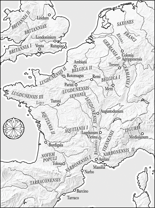
Map 1
Political map of Gaul in the late fourth century ce adapted from CAH XIII (eds. A Cameron and P. Garnsey), pp. 18–19.
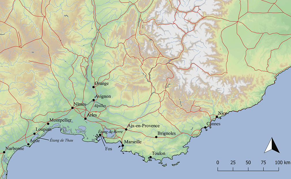
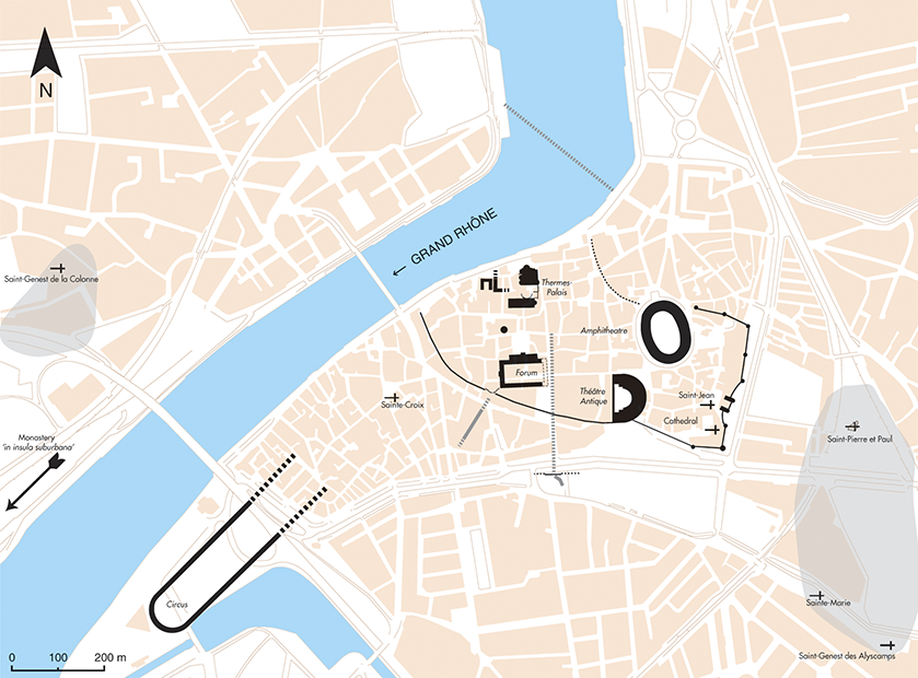
Map 2
Arles and environs (E. Intagliata).
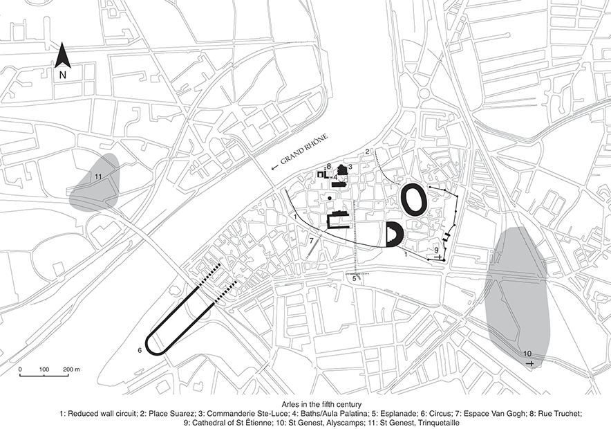
Map 3
Plan of Arles in the fifth century (M. Heijmans, Centre national de la recherche scientifique (CNRS)).
Map 4
Plan of Arles in the sixth century (M. Heijmans, Centre national de la recherche scientifique (CNRS)).
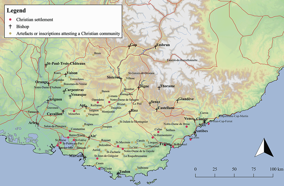
Map 5
The region with Christian sites and centres highlighted (E. Intagliata).
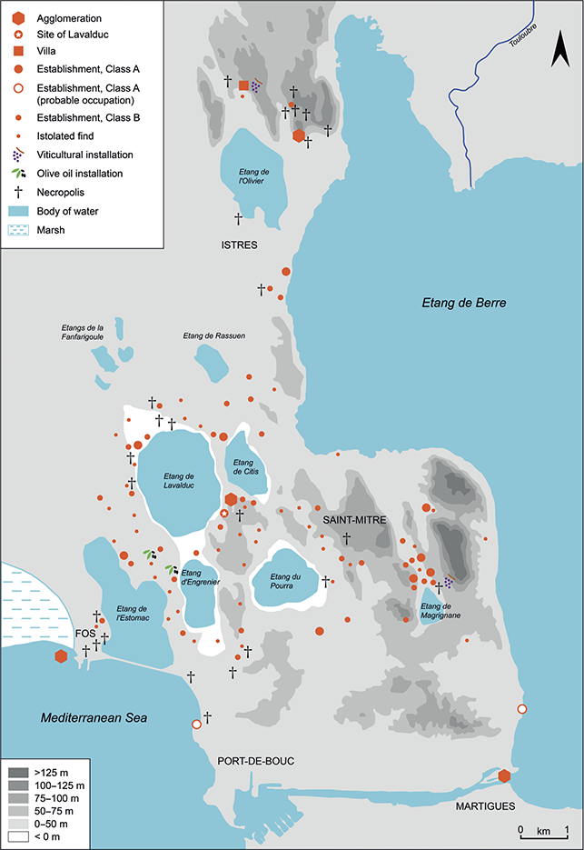
Map 6
The environs of the Étang de Berre in the fifth and sixth centuries ce


 Open access