Introduction
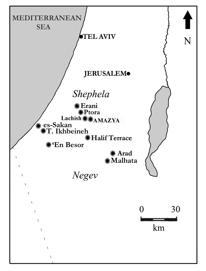
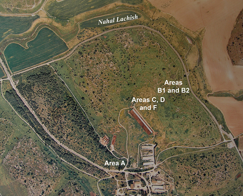
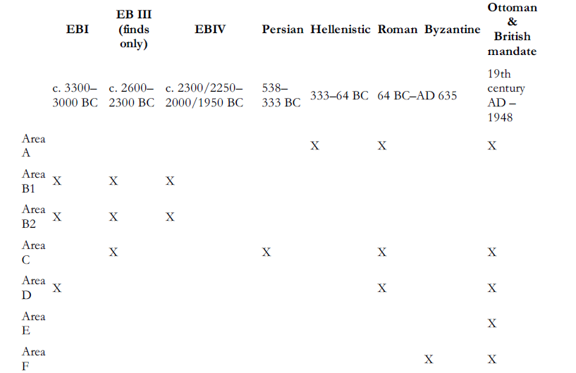
In 2010 and 2011 two extended seasons of salvage excavations were conducted by the Israel Antiquities Authority at Amaziya (Duweimeh) on the left bank of Nahal Lachish, c. 9km east–south-east of Tel Lachish (Figure 1). Located on a hill in the southern Shephela (the upland plateau adjacent to the Judean Incline), its summit is c. 390m asl, c. 60m above the surrounding valleys. Excavations of in various areas (Figure 2) show that the site was occupied in phases ranging from the Early Bronze Age (EB) I to the Ottoman and British mandate periods detailed in Table 1.
Location map.

Location of excavated areas.


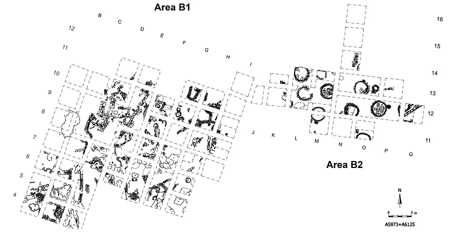
Plan of areas B1 and B2.

Excavation, structures and assemblages
Although architectural remains of the Early Bronze Age are restricted to Areas B1 and B2 (Figure 3), pottery from that era, including finds dated to EB III, was also found in Areas C and D. In Areas B1 and B2, low down on the northern slope of the site, two major functional units were unearthed in a large exposure: a domestic area with house foundations and adjacent installations (Area B1) and a nearby large-scale complex of subterranean, circular silos (Area B2).
A group of several rectilinear rooms and small, round, stone-lined silos as well as a corridor leading to a natural cave complex of several cavities linked by narrow passages were exposed in an area of c. 1250m² in Area B1. Major phases of occupation of this area are EB I and EB IV. The presence of rock-cut installations and grinding stones suggest it was used for olive oil production and processing of grain and/or storage in EB I and IV.
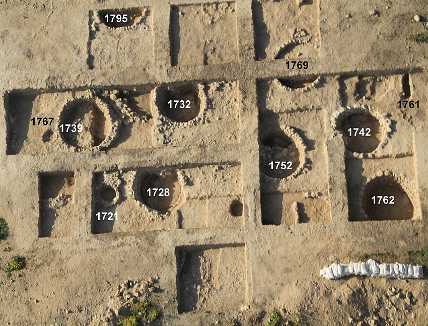
Aerial view of area B2.

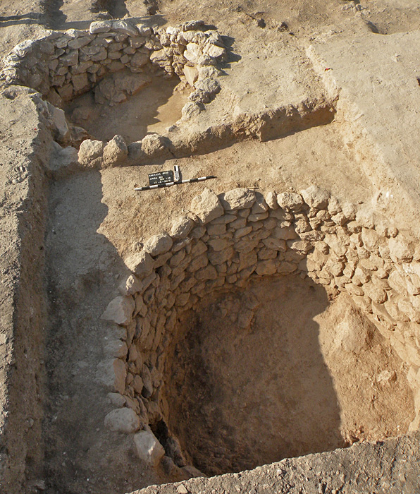
Of particular interest is a complex of large subterranean silos, i.e. deep circular, stone-lined pits found in the adjacent Area B2 (Figures 4–5). The 11 or more units excavated over c. 500m² in this area reveal that this zone was located near, but deliberately set apart from, the EB I residential sector of Area B1, from which it was separated by an open area c. 10m wide. Lacking direct dating evidence, the complex is ascribed to the same period because it yielded an overwhelming mass of material of that period. Such a date seems consistent with evidence from another late EB I occupation at the Halif Terrace site (Site 301), where similar installations, albeit constructed of mudbrick and stone, were encountered (Reference DesselDessel 2009: 24, 35). At both sites the silos appear to have been arranged in rows aligned with the topography of their respective slopes. At Amaziya a main and earlier phase of silos was identified, with large silos averaging 3m in their preserved uppermost courses. Later silos, with maximal diameters ranging from 0.9 to 1.1m, were considerably smaller. The reconstructed average depths of the larger silos are between 1.8 and 2m.
Detail of silos, Locus 1762 (foreground) and Locus 1742 (background).

All silos were constructed of natural field stones laid in successive courses with no evidence of any mortar or plaster. Soil found between the stones seems to be of the matrix into which the silos were cut and there is no indication of any attempt at additional coating of the interiors of these pits. Similarly, the bases of the silos were of the natural rendzina or, in some instances, limestone bedrock. It is likely that additional silos remain buried just outside the eastern, southern and northern boundaries of Area B2.
The function of these structures is believed to be grain storage and hence they are called 'silos' although, to date, no direct evidence for such a function could be discerned from associated finds. A study of soil samples from these pits will, we hope, produce phytoliths that may support our interpretation.
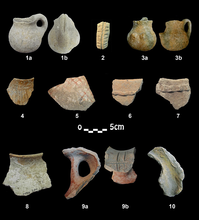
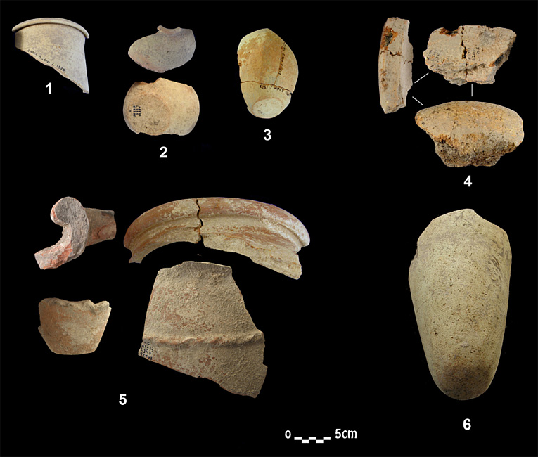
Most of the assemblage associated with fills in Areas B1 and B2 (Figure 6) can be assigned to two phases of EB I, the later one correlated with the end of Dynasty 0 in Egypt and related to an Egyptian colony at Tell es-Sakan and other sites (Reference Braun and ChlodnickiBraun 2004, 2011). That correlation is strengthened by a small but highly significant assemblage (Figure 7) of imported Egyptian pottery and other Egyptian-style vessels, which could be either imported or of local manufacture. Flint items associated with this settlement include typical 'Canaanean' blades and tabular scrapers. Pottery of EB IV is well represented mainly in Area B1.
Local pottery of EB I. 1a–b: juglet. 2: handle. 3a–b: small juglet with conical protuberances. 4: small jar of 'basket style'. 5: sherd with red crosshatched lines. 6–7: hole-mouth jars. 8: lime-coated jar. 9a–b: handle and 'cup' for placement of a dipper juglet of a storage jar. 10: ledge handle.

Egyptian pottery of the EB I. 1: cylinder vessel. 2: small bottles. 3: lentoid-shaped bottle. 4: baking bowls. 5: 'wine jars'. 6: 'beer jar'.

Discussion
If the stone-lined pits in Area B2 are indeed silos, then they show activity on a scale not previously perceived in the archaeological record of the late fourth millennium, which, to our knowledge, has hitherto yielded evidence for storage facilities arranged around domestic units only. Our complex must be associated with an economic system that dealt with significant surpluses, suggesting an accumulation of wealth, with possible implications for the beginnings of some form of hierarchical social structure.
We do not know whether stored foodstuffs from Amaziya and Halif Terrace were redistributed among a specific population or were utilised to finance local, south Levantine elites, but the silos' storage capabilities are likely to exceed the needs of these sites' inhabitants. Thus, we suspect the existence of a polity exercising some sort of regional control over Amaziya and other rural sites in the area. Such an arrangement does not seem to be unique, as there may have been a similar type of communal activity at Halif Terrace at the same time. That in turn suggests that the southern Shephela was then a fertile, grain-producing region whose yield was not only consumed by its own communities, but supplied to others beyond its borders.
Alternatively, if the large-scale silo complex was not associated with a local political entity, it could be related to an Egyptian colony perhaps engaged in economic activity with local populations in its eastern and southern hinterlands. A mutual association between the sites of Amaziya, Tel Erani (Brandl 1989; Kempinski & Gilead 1991), Halif Terrace (Reference DesselDessel 2009) and Small Tel Malhata (Amiran & van den Brink 2001) among others is attested by quantities of Egyptian or Egyptian-type materials, which link them with a probable Egyptian colony in the last quarter of the fourth millennium BC.
Acknowledgments
The authors wish to thank Alex Fraiberg, Vladic Lipshitz, Ilan Peretz (field supervisors), Anna Filin, Amir Weitzman and Svetlana Talis (field assistants) for their invaluable help in the field. They are also indebted to Omry Barzilai for his work on the flint assemblage, to David Eitam for his work on the agricultural installations, and to Avi Hajian, Mark Cummin, Sharon Gal, Yaakov Shmidov, Mendel Kahan and Boris Antin for their work in surveying and drawing plans and sections. Thanks are also due to Yasser Alamor for his administrative abilities and to workers from Rahat, Qiryat Gat and Sderot. Photographs and illustrations are by courtesy of the Israel Antiquities Authority.