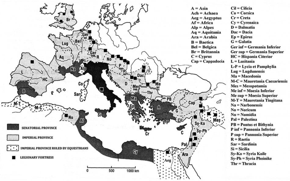
Map of the Roman Empire, including the Roman provinces and legionary fortresses (after M. Bărbulescu—coordinator, Atlas-dicționar al Daciei romane, Cluj-Napoca, 2005, map I).

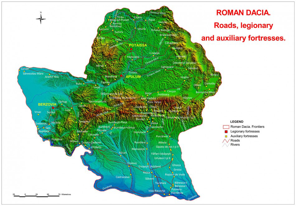
Following military campaigns north of the Danube River in AD 101–102 and 105–106, the Emperor Trajan consolidated the conquered territory as the new province of Dacia (Figures 1 & 2). Rich in gold, silver, timber and salt, the province was organised under the direct supervision of Trajan and his topographer, Balbus (Reference FodoreanFodorean 2006: 88). While Trajan oversaw a massive colonisation project, Balbus organised the military infrastructure, including roads, forts and the frontier (limes).
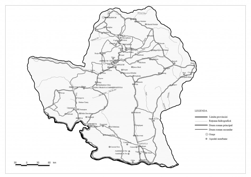
As a consequence of Roman colonisation, a large number of new rural sites were established, although only a small number of these settlements are visible today (Figure 3; Reference Oltean, Hanson and HaynesOltean 2004). The National Archaeological Record of Romania database lists 14 813 sites, of which 2819 are dated to the Roman period. Additional Roman sites are documented in regional gazetteers (e.g. Crişan et al. 1992). Around 90 per cent of all these reported sites take the form of surface scatters of pottery or building materials. The descriptions of the locations of these sites are, however, in many cases limited from a cartographic perspective (e.g. ‘within the territory of …’, ‘close to the …’).
Map of the forts and roads of Roman Dacia.

Map of the rural settlements in Roman Dacia (after M. Bărbulescu—coordinator, Atlas-dicționar al Daciei romane, Cluj-Napoca, 2005, map XIII).

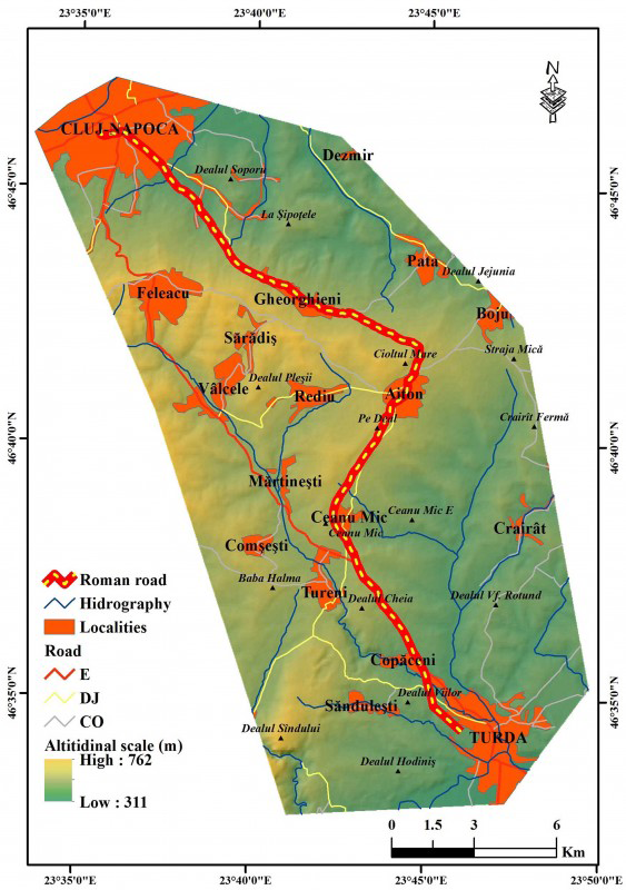
Digital Elevation Model with the route of the imperial Roman road from Potaissa to Napoca.

The ‘Digital mapping of the archaeological sites in Dacia Porolissensis’ project (November 2013–October 2014) aimed to identify and map the course of one of the province’s main Roman roads and the rural settlement associated with it. The road departed from the Danube, crossing the region of Banat via two branches: the western route, from Lederata to Tibiscum, and the eastern route from Dierna to Tibiscum. From Tibiscum, where the two branches met, the road continued along the valley of the Bistra River, through the narrow corridor of the Iron Gates, to Ulpia Traiana Sarmizegetusa. From here, the road continued north, towards Apulum, Potaissa, Napoca, ending at Porolissum. Construction of the road began in AD 101–102 and was probably completed by AD 110; an inscribed milestone from Aiton dates to AD 108 (Figure 4; Reference FodoreanFodorean 2013: 34).
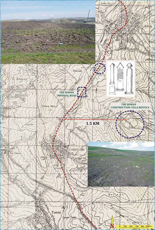
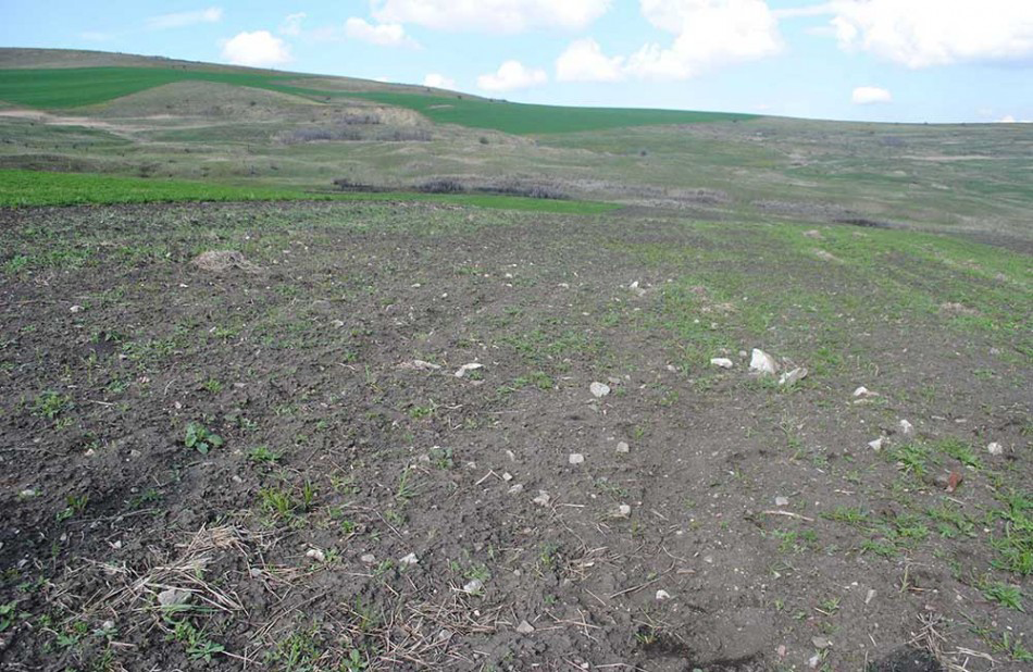
During spring 2014, field surveys were undertaken to the north-east of the village of Ceanu Mic. Google Earth imagery clearly indicates three areas where traces of Roman construction are still visible. Around 2km north-east of the village, and 1500m from the Roman road (23°44’12.05” E; 46°39’17.32” N), the project identified a surface scatter of abundant Roman pottery, tile and stone extending across an area of c. 70 × 80m (Figures 5 & 6). Around 100m to the south-east, another scatter of material extends across an area of c. 140 × 30m. The third area, close to the Pârâu La Rupturi stream, produced large quantities of stone, tile and pottery extending for a distance of c. 100m. A repeat survey in October 2014 found stone and tile were still abundantly visible on the ground surface.
The newly discovered villa rustica and the section of Roman road identified in 2014.

Surface scatter of stone, brick, tile and ceramics, revealing the existence of several large Roman buildings (villae rusticae).

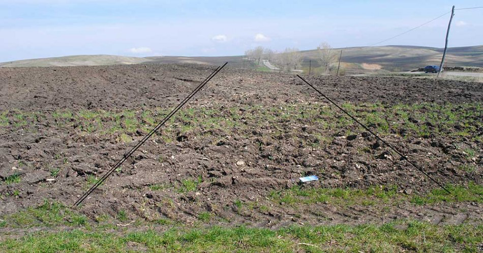
Surface scatter of small stones indicating the course of the Roman road outside the village of Ceanu Mic.

Further work in March 2014 has identified traces of the Roman road in a ploughed field around 1600m north-east of the Pârâul Cheii stream (23°43’24.36” E; 46°39’58.47” N; Figure 7). The course of the road, around 4m in width and 150m in length, is visible on the field surface as an area of small pebbles.
The project has accurately mapped the route of one the most important roads in Dacia and identified a substantial new villa rustica (a countryside villa). These results add a new site to the map of Transylvania, continuing the work undertaken over the last decade to identify new sites using aerial prospection (Czajlik et al. 2011: 7–17; Berecki et al. 2013: 87–109; Czajlik et al. 2014: 459–83; Reference OlteanOltean 2007; Oltean & Hanson 2007: 113–37). As in other European countries, although with fewer resources, Romanian specialists are working to create a comprehensive digital database (using an ArcGIS platform) to catalogue all known archaeological sites (Fodorean et al. 2013: 37–55).
Our project’s results add to the archaeological map of Romania, and of Europe, identifying the cultural inheritance that is so threatened by agriculture and development. Our main task is to preserve this archaeological patrimony in the face of the dramatic changes to the landscape that threaten it with destruction.
Acknowledgements
These results stem from the research project ‘Digital mapping of the archaeological sites in Dacia Porolissensis’, grant GTC 34034/01.11.2013–30.10.2014, financially supported by the Babeş-Bolyai University.