Introduction
Around AD 1000, the southern Brazilian highlands witnessed a convergence of phenomena: climatic change, the abrupt expansion of Araucaria forest and the appearance of large pit-houses and monumental mound and enclosure complexes, which signal fundamental socio-political and ideological change amongst southern proto-Jê (SPJ) groups (Reference Iriarte and FradleyIriarte et al. 2013). These developments raise intriguing questions regarding the relationships between people, vegetation and climate over the last 2000 years (Reference Iriarte and BehlingIriarte & Behling 2007).
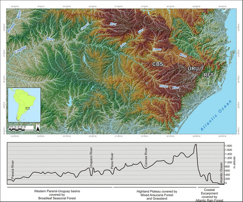
Regional map of Santa Catarina, highlighting the main areas of archaeological excavation and palaeoecological core sites (RFT, URU and CBS).

SPJ groups began to spread around 2000 BP, occupying extensive and ecologically diverse landscapes from the Atlantic coast to the Parana River (Reference Noelli, Funari, Zarankin and StovelNoelli 2005) (Figure 1). These groups practised a mixed economy, combining hunting, fishing and gathering—including the collection of the pinhão (Araucaria angustifolia seed)—with the cultivation of domesticated plants, such as maize. Archaeologically, they are characterised by diagnostic, thin-walled ceramics, pit-houses, rock art and collective burials in rock shelters.
The research project outlined here aims to understand the social, economic and ideological characteristics of the SPJ, using integrated palaeoecological and archaeological techniques to assess their interaction with the landscape and vegetation over the last approximately 4000 years. In this article, we report on the results of our initial investigations.
Archaeological fieldwork
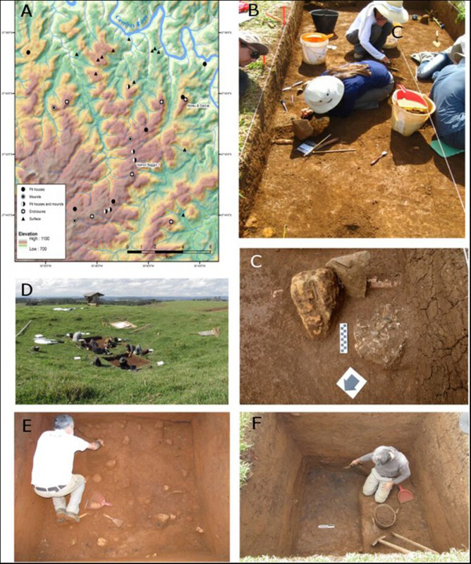
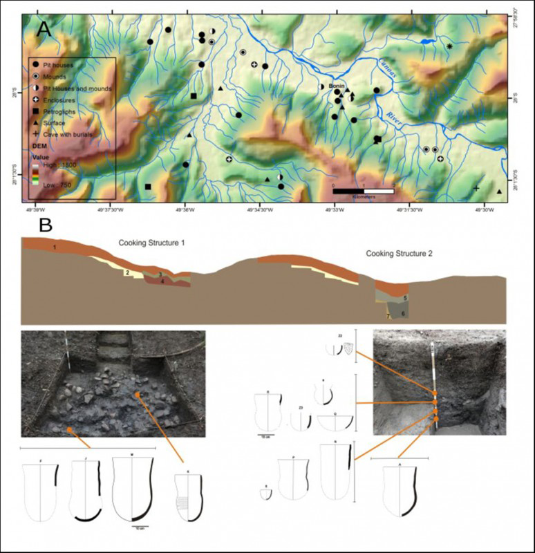
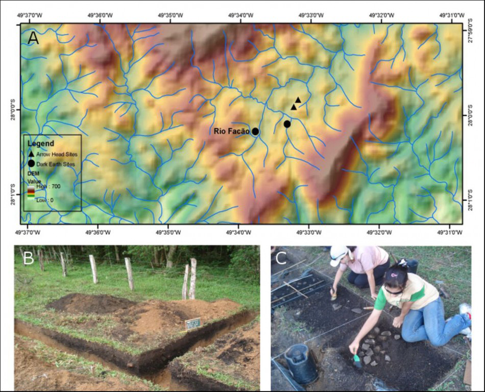
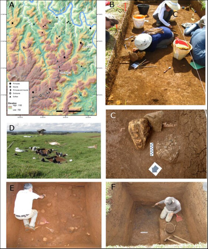
Three study areas, all in the state of Santa Catarina, Brazil, were selected in order to encompass the variability of SPJ groups: Campo Belo do Sul (CBS), Urubici (URU) and Rio Fortuna (RFT) (Figure 1). Stratigraphic excavations were conducted with the aim of recovering palaeobotanical samples to understand behavioural choices in plant use and wider environmental reconstruction. Survey and excavation in the CBS region recorded 32 archaeological sites (Figure 2a). Here, excavation at Abreu and Garcia (Figure 2b & c), a mound-and-enclosure complex on a prominent plateau, and at Valmor Baggio 1 (Figure 2d–f), a hilltop pit-house village, suggest community organisation at a plateau and regional level, and the appropriation of the landscape for reinforcing social hierarchy and ceremony. Sixteen secondary cremation deposits at Abreu and Garcia revealed a developed mortuary practice that includes conspicuous ceremony. At Valmor Baggio 1, samples were recovered from a complex occupation sequence of 12 floors; archaeobotanical analysis and radiocarbon dating of this material provides an unparalleled dataset in the region. In the URU region, research conducted between 2009 and 2013 included mapping and extensive excavation (Reference CortelettiCorteletti 2012; Reference Corteletti, Dickau, Deblasis and IriarteCorteletti et al. 2015). Survey identified 90 archaeological sites, the majority of which are located in the Canoas River Valley, often close to the confluences of tributaries with the main river (Figure 3a). Occupation dates from AD 300–1700. The analyses of starch grains and phytoliths from ceramic fragments reveal the use of domesticated plants and an unexpected level of sedentism (Figure 3b). Survey and excavation in the RFT region were performed between 2007 and 2008 (Figure 4a). A total of 47 anthropogenic dark earth sites (Figure 4b) and several lithic scatters (including arrowheads) were found densely clustered in the landscape (Reference Farias, Rosa and RampazzoFarias et al. 2009).
A) Map of CBS and study sites; B) excavation of Abreu and Garcia funerary mound; C) secondary cremated deposit recovered at Abreu and Garcia; D) early stage of the excavations of oversized pit house at VB1; E) excavation of floor 3 at VB1; F) sequence of burnt floors exposed at VB1.
A) Map detailing Canoas River Valley and settlement in URU region; B) stratigraphical profile, excavated areas and rebuilt vessels from Bonin site, URU.

A) Map of RFT region highlighting the main study site; B) opening trenches of Rio Facão dark earth spot, RFT; C) combustion structure of the dark earth spot.

Environmental reconstruction fieldwork
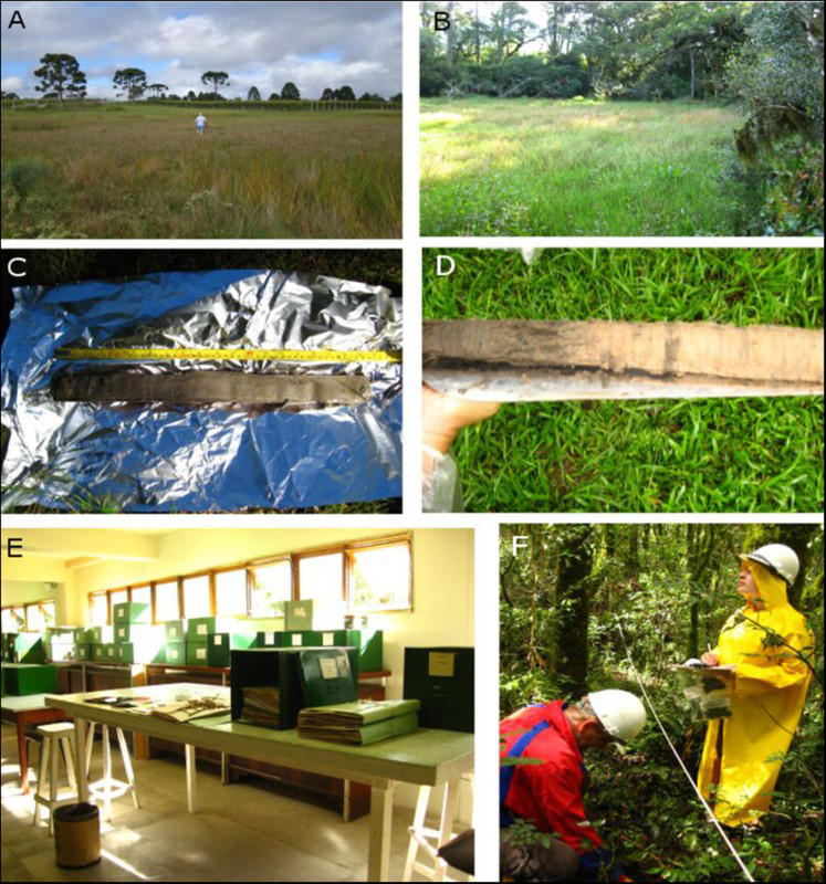
Palaeoecological study: A) Abreu and Garcia bog, CBS; B) Bonin bog, URU; C) organic core sediments from Bonin site; D) organic and sand core sediments from RFT; E) Herbarium of Curitiba Municipality, Paraná; F) moss pollsters collection, CBS.

Multi-proxy analysis of sediments (i.e. physical, chemical, pollen and macroscopic charcoal) will be used to reconstruct vegetation, fire and environment history, thereby facilitating the assessment of human and climatic impacts on vegetational change during the emergence and florescence of the SPJ. A total of 86m of sediment cores have been obtained from 25 bog sites across the three regions (Figure 5a–d). As the aim of the palaeoenvironmental reconstruction is to account for potential vegetation and land-use change associated with SPJ settlements, the cores were obtained as close as possible (100–1000m) from known archaeological sites.
To assist interpretation, samples of extant vegetation have been collected in order to create a reference database for pollen (Figure 5e). Moss pollsters from 19 Araucaria forest plots in the CBS area (Figure 5f) and four in the RFT area provide data on pollen rain in the current forest.
Integrating disciplines and final remarks
Interdisciplinary research has the potential to deepen understanding of past cultures. The integration of archaeological investigation with archaeobotany and palaeoenvironmental reconstruction provides an insight into cultural behaviour and environmental change, including land management, agriculture, forest use, lifestyles and ritual practices.
By targeting a range of architectural complexes for intensive archaeological and palaeoecological research across the region, we will be able to look at SPJ groups, and the changes they experienced, at both the local and macro-regional scales.
Project website: http://jelandscapes.exeter.ac.uk/ (accessed 08 December 2015).
Acknowledgements
AHRC-UK, FAPESP-BR and CAPES-BR funders; Lauri Schorn and Alyne Ruggiero of FURB; Álvaro Costa and Marcelo Cunha for field assistance; Tadeo Motta, Osmar Ribas, Cordeiro, Eraldo Barboza, Roman Ríos, Laércio Brochier, Tatiana C. Fernandes and Adriana Teixeira from Curitiba; Anderson Tognoli and Tiago Attore of USP; Jessica Cardoso of GRUPEP-UNISUL; land owners; contract workers; and student volunteers.