Introduction
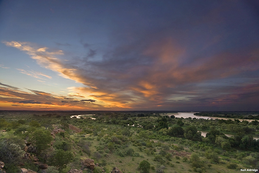
The Shashe-Limpopo confluence viewed from the Mapungubwe National Park.

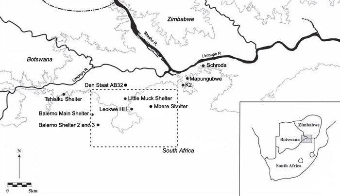
In northern South Africa, the sequence of occupation could be summarised as follows: foragers lived in isolation during the early and middle Holocene (Van Doornum 2005) and, around AD 900, Iron Age farming people moved into the region (Figure 1) and settled in close proximity to forager camps. The farmers hunted elephants to trade their ivory for cloth and glass beads imported from the Indian Ocean coast (Reference MitchellMitchell 2002). Around AD 1000, a new community of farmers appeared and set up the major farming centre known as K2 and later, around AD 1220, Mapungubwe, southern Africa's first urban centre and capital of its earliest state (Reference HuffmanHuffman 2007). As the Iron Age cultural sequence of the region changed, so did that of the foragers: at the end of the Mapungubwe phase, in c. AD 1300, foragers disappear completely from the archaeological record (Reference Van DoornumVan Doornum 2008; see Figure 2 for site locations).
The Mapungubwe landscape. The square indicates the approximate survey zone (adapted from Reference Van DoornumVan Doornum 2008).

Survey in the Mapungubwe landscape
Earlier work on the Later Stone Age in the region established a five phase cultural model (Van Doornum 2005). It has been argued that the differences between phases reflect the changing Iron Age sequence and the way in which foragers interacted with different farmers (Hall & Smith 2000; Reference Van DoornumVan Doornum 2008), but this rests on studying rockshelter occupations only. Therefore, an archaeological survey was conducted in an area of 160km² on and around the sandstone hills of the Mapungubwe landscape (Reference ForssmanForssman 2010). Surface scatters of lithics from both rockshelters and open air sites were analysed using Reference Van DoornumVan Doornum's (2008) typology. Typological cross-referencing against her dated sequence permitted comparison of rockshelter and open air assemblages.

Analysis
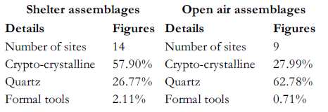
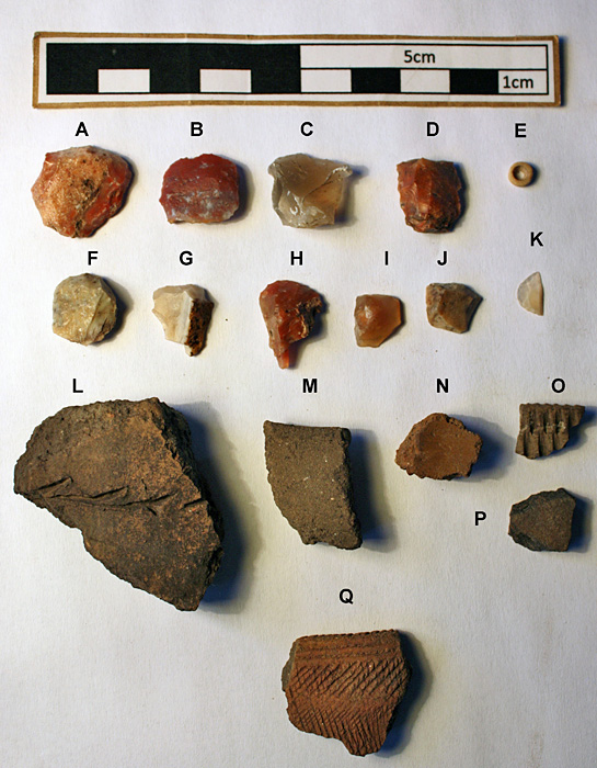
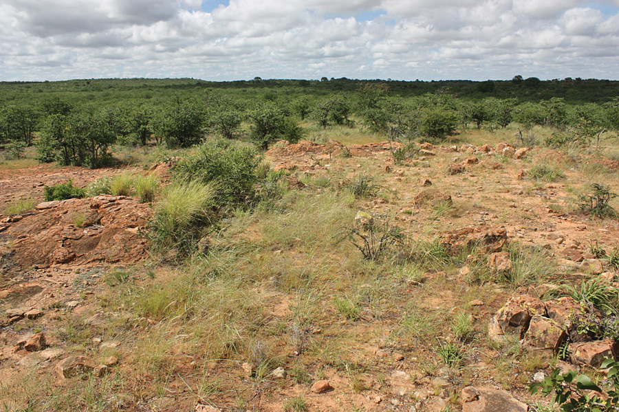
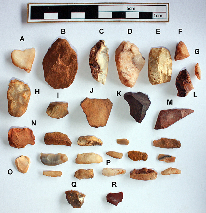
Analysis (Table 1) showed that two lithic assemblage types are present in the Mapungubwe cultural landscape (Reference ForssmanForssman 2010). One is dominated by crypto-crystalline materials (CCS) and is found mostly in rockshelters, it has a high incidence and great variety of formal tools, such as scrapers, backed microliths, segments and adzes (Figure 3 & 4), and compares well with Reference Van DoornumVan Doornum's (2008) assemblages from other rockshelters in the same area. The second assemblage type is dominated by quartz, lacks formal tools and comes only from open air contexts (Figure 5 & 6). Such quartz-dominated assemblages have not been found in any rockshelter excavation but have been found in farmer rain-control sites dating to AD 10001220 (Schoeman 2006). While this suggests that these open air sites date to the same period as the farmer occupation, it must be remembered that sites used for different functions often produce different artefact assemblages and cannot be directly compared (Reference BarhamBarham 1992).
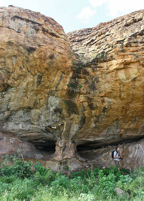
Little Muck Rock Shelter excavated by Hall and Smith (2000).

CCS assemblage from the shelter site 152: A-D & F-J, scrapers; E, ostrich eggshell bead; K, segment; L, Zhizo or Leokwe ceramic; M-N & P, ceramics; O & Q Bambata ceramics.

A typical open air site on the Mapungubwe landscape.

Quartz assemblage from open air site 66: A, Q, end scraper; B-G, L, lozenge chunks; H, K, irregular core; I, single platform core; J, flake; M, miscellaneously retouched pieces; N, radial core; O, battered piece; P, unretouched bladelets; R, utilised flake.

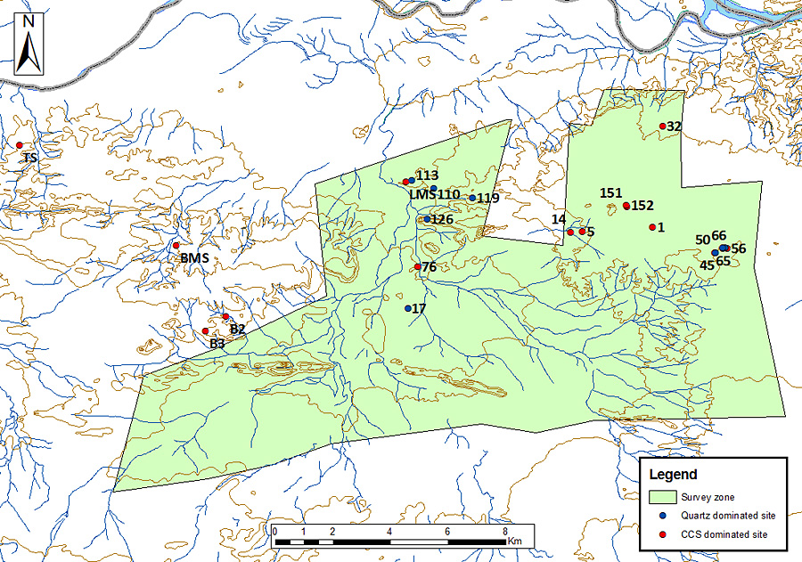
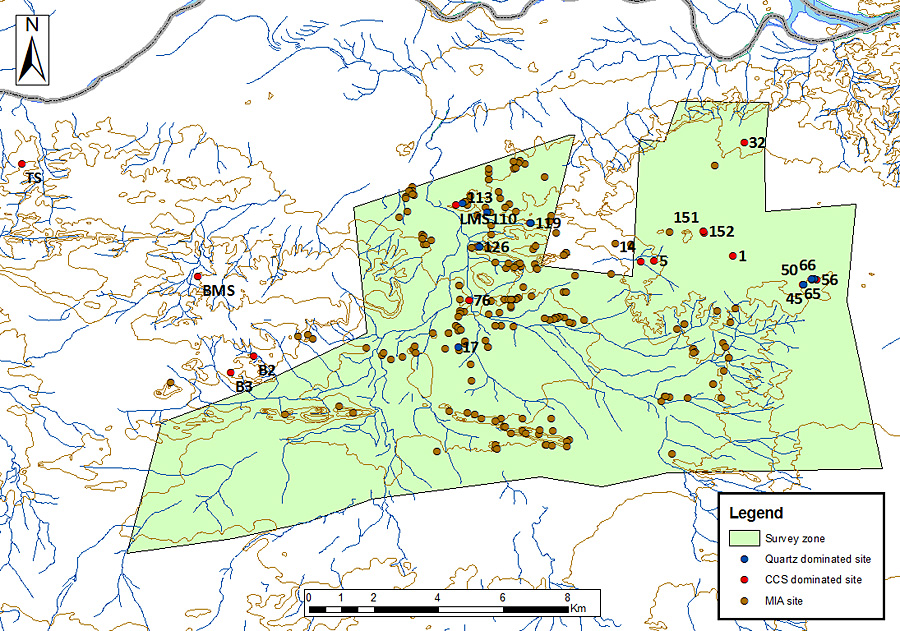
Comparison of site locations shows that rockshelter and open air sites have different distribution patterns. The CCS-dominated assemblages are broadly distributed across the landscape, whilst the quartz-dominated open air assemblages are concentrated in one area. It seems that these two assemblage types are not reliant on one another nor are they mutually exclusive: in some instances they appear alongside each other, but in other areas they are some distance apart. This suggests that the differences in the lithic assemblages of each site type are not necessarily governed by different environmental conditions nor by access to raw material since the variation of such factors between some sites is negligible (Figure 7). However, the quartz-dominated assemblages are located in the same general area as most local Iron Age settlements, suggesting that they may be linked in some way (Figure 8).
Shelter and open air assemblages.

Shelter and open air assemblages relative to Middle Iron Age settlements.

Conclusion
There are two major assemblage types on the Mapungubwe landscape: shelter and open air assemblages. It cannot yet be said what their temporal relationship is, but, on the available evidence, it seems possible that differences in the forager toolkits may be due to their interactions with farmers. It is also possible that, at times, foragers changed their settlement pattern in order to live alongside or within farmer settlements but returned to their traditional lifestyle during other periods (e.g. Reference Moore, Green and PerlmanMoore 1985; Reference WadleyWadley 1989). In such cases, forager toolkits may have changed to fit their new activities (e.g. Reference WadleyWadley 1989; Reference Sadr and KentSadr 2002), reflected by the more expedient use of quartz.
This research is part of an on-going project that seeks to understand the role these foragers played in the development of the Mapungubwe state, a unique occurrence in hunter-gatherer prehistory. The project offers a rare opportunity to undertake a trans-national study between South Africa, Botswana and Zimbabwe across the Shashe and Limpopo Rivers. It aims to correlate changes in the local foraging culture with the arrival and spread of farming communities and the changing environment in order to achieve a better understanding of the role that foragers played in the farming economy in the region. It also seeks to explain the relationship between rockshelter and open air sites by focusing on settlement pattern and site utilisation. As previous research has shown, if we are to understand these patterns, we need to consider the archaeology of the entire region in both rockshelter and at open air sites.
Acknowledgements
I thank Karim Sadr, Peter Mitchell and Joel le Baron for their help and the Paleontological Scientific Trust and National Research Foundation for sponsorship.