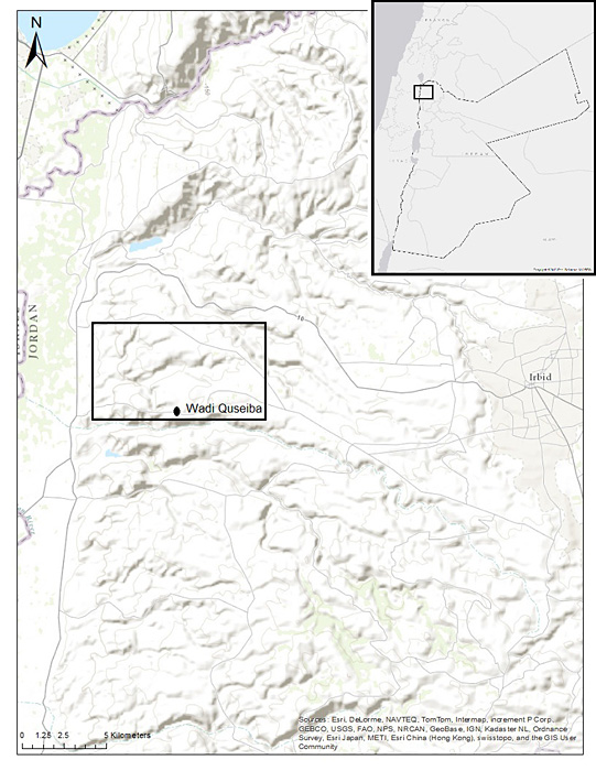
Location of Wadi Quseiba in north-western Jordan.

The aim of this paper is to outline an experimental survey technique carried out by a team from the University of Toronto. For five weeks in April and May 2012, crew members surveyed part of Wadi Quseiba's drainage basin east of the Jordan Valley, and west of the modern city of Irbid. The goals of the survey were twofold: to search for late prehistoric (Epipalaeolithic, Neolithic and Chalcolithic) sites, and to test an innovative approach to surveying a large territory with limited resources.
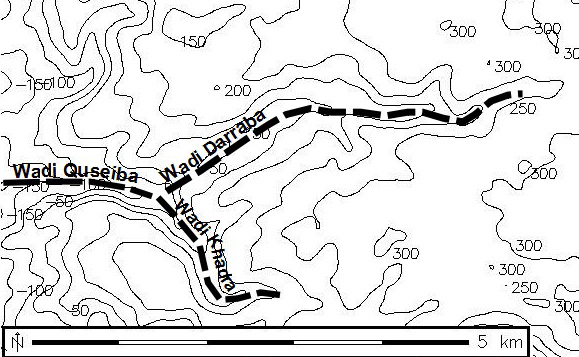
Wadi Quseiba's (Figures 1 & 2) main canyon borders the Jordan Valley, and collects runoff from two main tributaries that drain the eastern plateau, Wadi Darraba and Wadi Khadra. All three channels were surveyed in the 2012 pilot investigation. During survey, cooler, drier conditions predominated on the plateau, while hotter, more humid conditions prevailed near the Jordan Valley, where the wadi channel drops to about 200m below sea level. Winter rains not only charge these channels with runoff, leading to erosive downcutting, but also allow cereal agriculture on the lowest terraces at the western end of the drainage. Here there are also springs that would once have provided a perennial water source. In the upper portions of the drainage are found olive groves, shrubby pastures that are remnants of degraded oak forests, and very restricted areas of oak woodland. Seasonal and spatial variations in ground cover have major effects on surface visibility and the feasibility of archaeological fieldwalking survey. Our survey began after the rainy season had ended, but early enough that many crops had not yet been harvested. Consequently, survey was largely restricted to portions of the drainage where crop cover was absent or harvest had just taken place. Almost none of Wadi Quseiba has been previously surveyed, other than a single day of survey on horseback by Nelson Glueck in 1947 (Reference GlueckGlueck 1951: 18485) which recorded three sites (Tell Abu el-Hussein, Ras Abu Lofeh and Mendah), none of them prehistoric.
Three drainage channels surveyed during the 2012 season, including the main Wadi Quseiba drainage channel and its tributaries, Wadi Darraba and Wadi Khadra.

The overarching goal of this survey was to experiment with ways to maximise our probability of discovering 'target' archaeological materialsin this case, late prehistoric onesboth by using a predictive model, and by employing Bayesian optimal-allocation algorithms. To facilitate this goal, the survey recording system was fully digital.
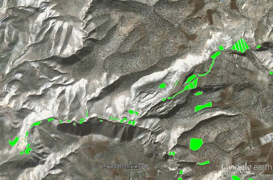
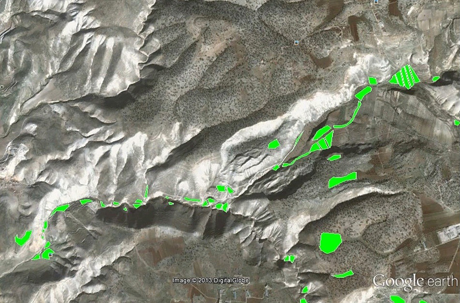
Many archaeological predictive models target landscape features, the distribution of water sources, and other factors thought to have influenced ancient landscape use in order to predict where undiscovered materials might be found (Wescott & Brandon 2000; Wheatley & Gillings 2002: 15763; Reference Verhagen and VerhagenVerhagen 2009). Conversely, our approach is based on the premise that, in a highly dissected environment like Wadi Quseiba, only small portions of the late prehistoric land surface survive, as wadi downcutting has completely removed much of it. Additionally, even the surviving portions are often buried by later deposits, typically colluvium from the adjacent slopes. Consequently, we used satellite imagery and GIS to identify areas of erosion and sediment accretion, development and modern farming, with the goal of flagging those modern landscape features that have the highest probability of being exposed remnants of the early Holocene land surface. The influence of poor visibility (especially crop cover) and some more traditional modelling parameters, such as the presence of springs, were then added to the model as well. The result is the identification of individual areas with high probability of containing remnant material that has survived destruction. These areas are termed 'polygons' (Figure 3) and each is assigned a non-zero prior probability of containing target archaeological resources that have a reasonable chance of discovery. This predictive model was revised daily as survey results prompted us to update these probabilities.
GoogleEarth image displaying individually selected polygons with high probabilities of containing remnant materials ( Google).
Next we allocated our survey resourcesthe total length of transect we could expect to walk in a work-day with our six to eight crew membersin a way that would maximise our probability of discovering late prehistoric material. For this we experimented with a classic Bayesian allocation algorithm (Reference KoopmanKoopman 1980: 149; Reference BanningBanning 2002: 14951) but, when we encountered some computational difficulties, we opted for the simpler, but suboptimal, method of prioritising polygons within each of three survey strata by their probability densities. We then modified the order of survey priorities each day, always visiting the highest-ranking polygon first.
Within each targeted polygon, we walked a series of numbered transects. We estimated the effective sweep-width (Banning et al. 2011) of these transects by running a series of calibration transects across fields and meadows taken as representative of the conditions we would encounter during survey. These varied in vegetation cover, stoniness and other visibility factors, and were relatively devoid of artefacts prior to our 'seeding' them with potsherds and lithics in known locations. By doing this we were able to estimate the area effectively swept in square metres for each polygon. We thus had grounds, in the event that we found no prehistoric material, for calculating a revised (or posterior) probability that the polygon contained detectable prehistoric artefacts given that we did not find any. This revised probability was entered into the predictive model at the end of the day and a new list of prioritised polygons was generated for the following day. In the event that the survey did find a cluster of late prehistoric material in a polygon, we identified a 'site' and required no further survey of that polygon. Discovering material in a predicted area was termed a 'success'.
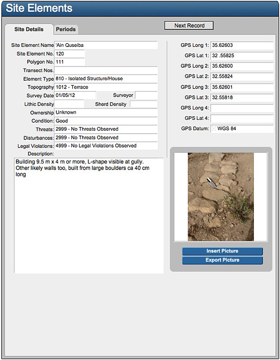
Example of FilemakerGo digital recording sheet used in the field.

This system was aided by our use of a completely digital recording system, where each pair of surveyors carried an Apple iPad with onboard GPS and camera, and 'apps' that included the FilemakerGo database (Figure 4). Several distinct forms set up in Filemaker allowed us to record the characteristics of each survey transect segment, including a photograph entered directly into the database record, description of vegetation cover, agricultural impacts, time of day, estimated sweep width and GPS coordinates of the start and end point of each segment. The transect form also had 'counter' buttons for sherds and lithics which allowed us to easily quantify artefact densities. Other forms in the database allowed us to record characteristics of sites' GPS waypoints, surveyor calibration runs, pottery descriptions and summaries of lithic samples. Each day the iPads were synchronised into a master FilemakerPro database, the results used to update the predictive model, and the complete database re-downloaded to the iPads so that each survey team had the complete database at their disposal while in the field.
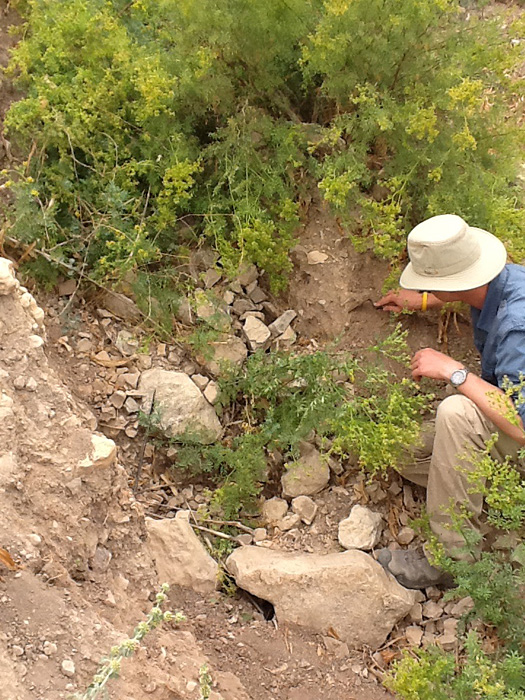
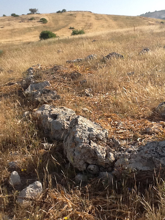
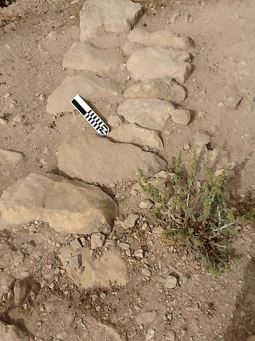
Overall, the experiment with new approaches to survey led to the discovery of several certain and candidate Neolithic and Chalcolithic sites, as well as a variety of both earlier (Palaeolithic) and later (especially Bronze and Iron Age) sites (Figure 5). Where significant architectural features were apparent, sites were defined on this basis. Otherwise, sites were defined as areas where the densities of surface artefacts were significantly higher than their surroundings. Most exciting was the discovery of a probable Yarmoukian (Pottery Neolithic) hamlet or farmstead on a rather remote stream terrace in Wadi Quseiba's main canyon. The survey also detected candidate sites for both Pre-Pottery Neolithic B and the Wadi Rabah (Pottery Neolithic) periods, although these will require testing by excavation to confirm the identifications (Figure 6 & 7).
Crew member investigating a possible Palaeolithic find.

Potential Pre-Pottery Neolithic B wall.

Stone feature located in western-most section of Wadi Quseiba.

While we cannot be certain that these sites would not have been discovered with more conventional methods, it is promising that we were able to locate so many with a very small crew and in a very short time by allocating our efforts as we did. At the very least, we avoided wasteful expenditures of effort on highly eroded or very recent landforms where there was no possibility of finding the kinds of sites that were of interest, opening the door to a more fruitful engagement with the fragmentary record of early Holocene settlement and land use.