Introduction
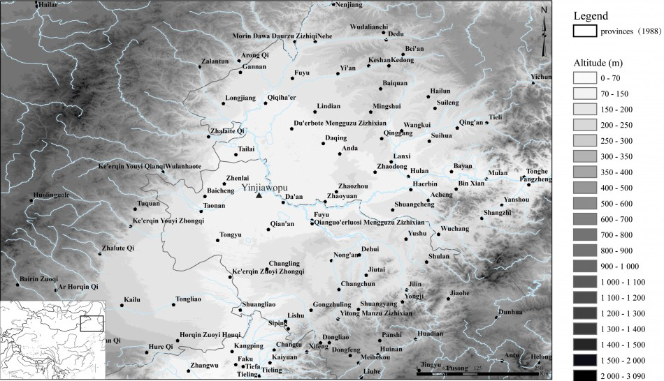
The heart of the Manchuria Plain is currently undergoing a dramatic desertification process. The environment is a patchwork of alkaline soil, cultivation zones and ancient marshes and lakes. Research on its past is vital for understanding both the ancient exploitation of marginal environments and the practices that are shaping the modern landscape (Figure 1).
Map of the Manchuria Plain, showing the location of the Yinjiawopu site.

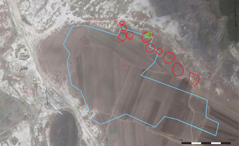
Satellite photograph of Yinjiawopu, with the site boundaries determined by the survey shown in blue, the mounds measured with RTK in red, and the excavated area shown in green (© Pauline Sebillaud & Xiaoxi Liu).
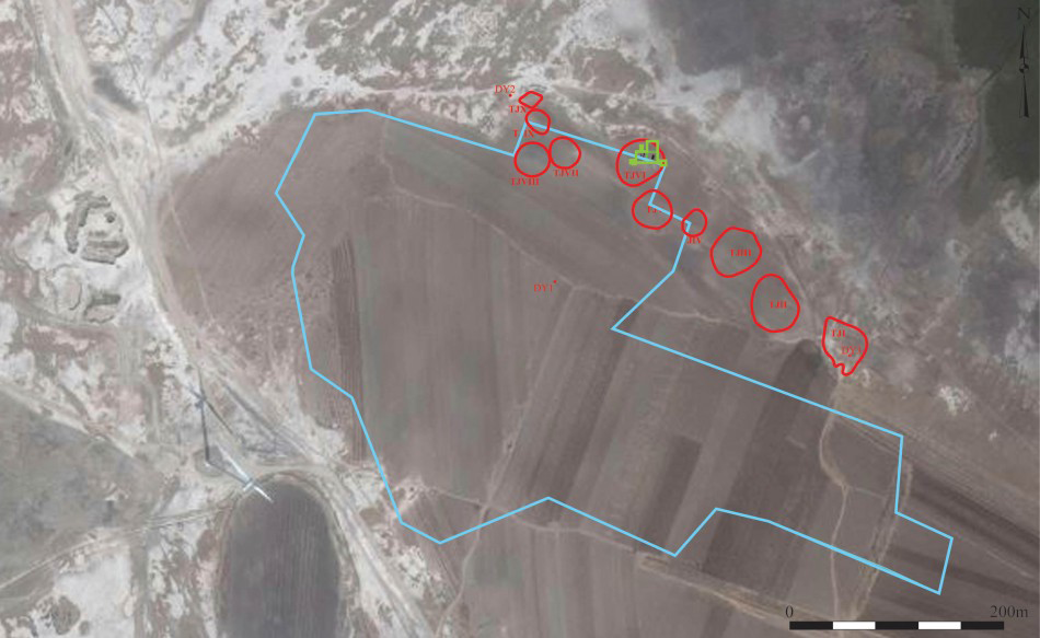
During 2012, a systematic regional survey in Da’an Municipality, Jilin Province, as part of an archaeological project around the Houtaomuga site (Wang et al. 2013), located a large quantity of Liao–Jin period (ninth–thirteenth century AD) sherds on the surface associated with mounds that constitute topographical anomalies in the flat landscape of Da’an (Figure 1). The site, Yinjiawopu, was once located on a peninsula in the estuary of an ancient river as it entered Xinhuang Lake, now the border between the cultivated land and alkaline soil zones (Figure 2). This region is composed of calcic chernozems, black aeolian sediments on thick layers of fine clay, which are characteristic of a dry continental climate with very cold winters and hot summers (FAOUN 2006).
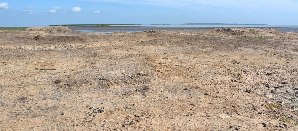
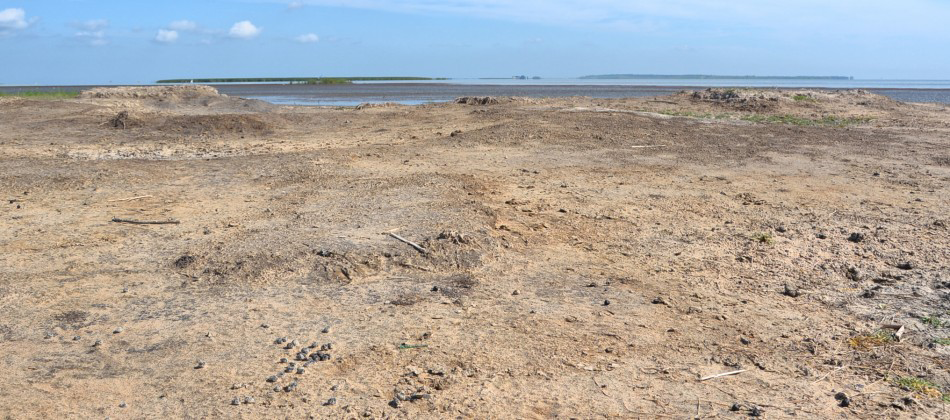
Today, the area surrounds a shallow body of water and as such has a high water table; it is also subject to evaporation and dramatic erosion. Thus, the soluble salts in the soil rise by capillary action and accumulate on the surface. Although salinisation is a dangerous desertification process, people still choose to settle in this region (Figure 3).
The salt production workshop
Saline soil surface (© Pauline Sebillaud & Xiaoxi Liu).
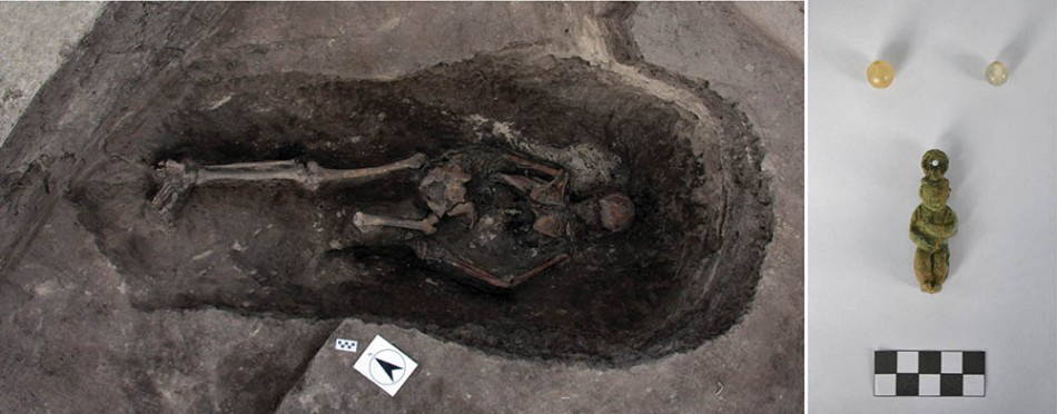
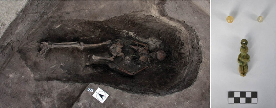
In 2014, an area of 300m² was excavated on Mound 6, revealing: one burial, two hearths, two channels, three water tank pits, fifteen refuse pits and five leaching pits. Stratigraphically, the most recent feature is the simple shaft-pit burial of a man in a prone position (Figure 4). The bronze figurine discovered around his neck is characteristic of the Jin Dynasty (twelfth–thirteenth century AD). This provides a terminus ante quem for the chronology of all of the other excavated features that are best interpreted as a salt production workshop.
Burial n.1 and ornaments (© Pauline Sebillaud & Xiaoxi Liu).
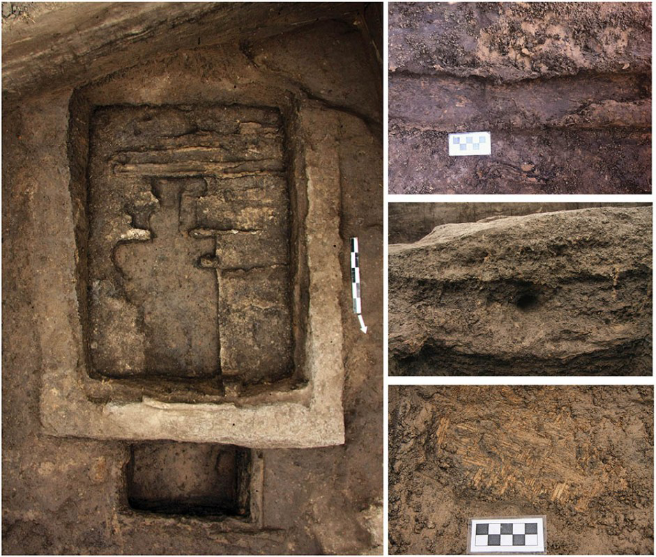
Leaching pit n.1 with accompanying views of the detail (© Pauline Sebillaud & Xiaoxi Liu)

Five leaching pits (LK1–5) share the same basic elements: a rectangular semi-subterranean pit built and lined with impermeable clay; wooden sticks laid across the bottom provide support for a filter comprised of a pierced wooden board, reeds and charcoal; a channel running through the centre of this shallow pit drains into a deeper rectangular one; the opening of this latter pit is protected by a wooden frame and is lined with wooden boards on the sides and a mat at the base (Figure 5). This rectangular pit receives brine from the filtration process, which is later boiled to obtain salt.
Two channels (20–40 cm wide) were discovered in connection with these pits, as well as a number of pits square in plan with rounded corners used as water tanks. Wooden boards placed on the ground between the leaching pit and the water tanks served as a platform for workers to stand on.
The profile of the associated mound (Figure 6) contains a sequence of discrete soil dumps. The saline soil, once filtered through a leaching pit, was thrown to the side, forming an accumulation of fine clay mixed with tiny charcoal particles and a very small quantity of brick, tile and pottery fragments. Refuse pits were subsequently dug into the mound.
Profile of mound n.6 (© Pauline Sebillaud & Xiaoxi Liu)

Discussion
The fragmentation ratio of the ceramic material recovered in the excavated features and mounds suggests that large containers used in the salt production process were rendered more friable by their prolonged contact with brine. The Tiangong kaiwu (Reference SongSong 1637), a Chinese encyclopaedia from the seventeenth century, and the Aobotu (Reference ToraTora 1993), a treaty of the fourteenth century on the boiling of seawater, describe leaching pits and other features similar to those excavated at Yinjiawopu. An ethnographical comparison with the filtration techniques of salty sand used by people in Niger (Gouletquer et al. 1994) or Benin (Reference DelbosDelbos 2008) supports the identification of the Yinjiawopu site as a salt production workshop. Distinct from the drilling of salt-water wells in Sichuan (Reference FladFlad 2011) and sea-salt production in Shandong (Reference WangWang 2012), the salt at Yinjiawopu was obtained by scraping saline soil from the surface, which was then washed and filtered, and the brine boiled. We hope that future excavations will provide evidence for the large hearths used for heating the brine. Further, all the conditions at the site are ideal for the organisation of an experimental archaeology project to investigate each step of the salt production process.
Acknowledgements
As part of the Houtaomuga project, the authors express their gratitude to the Research Center for Chinese Frontier Archaeology at Jilin University and to the Jilin Province Archaeological Institute for their financial and scientific support.