Introduction
During 2009 excavations by the Bergen Museum, University of Bergen, occasioned by the construction of a new highway between Bergen and Oslo in western Norway, revealed a multifaceted Viking Age site with excellent preservation conditions. Full publication of this unusual site is planned for 2012.
The site
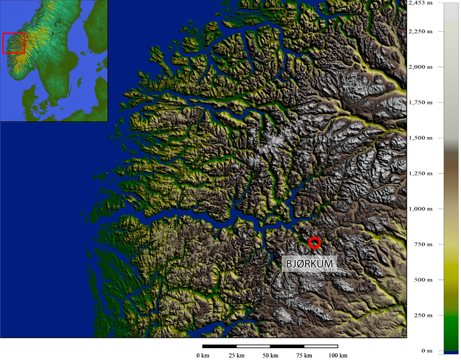
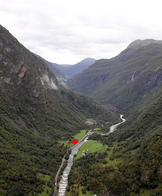
Bjørkum lies in the Lærdal valley, southeast of the Sognefjord, around 20km upstream from the river's confluence with the fjord. The site is located close to the riverbank at 130m asl and is surrounded by steep mountains on both sides (Figures 1 and 2). No prehistoric activity was recorded here prior to excavation. The latter encountered activity spread over c. 2000m², i.e. more or less all of the land available for cultivation.
Location of Bjørkum (map: © Gill, Bergen Museum).

Aerial view of Bjørkum in its landscape setting (photograph: © Bergen Museum).

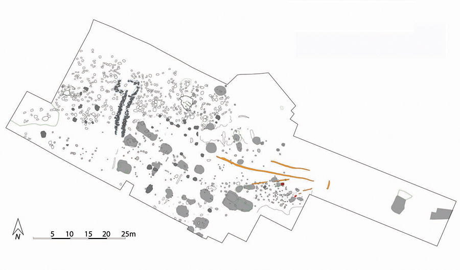
Site plan (plan: © Gill, Bergen Museum).

About 60 radiocarbon dates have been obtained from the site, ranging from the early Late Iron Age to Late Viking times. The dates could be grouped in two main phases: a few dates fell between AD 950 and 1050, while the establishment and main phase were within AD 700850. Though there was no settlement activity before the Late Iron Age, palaeobotanical data indicate cultivation in the area from the transition between the Late Neolithic and the Early Bronze Age.
The site plan (Figure 3) shows no strict overall plan or spatial organisation of buildings and activity areas. Of nine house structures, eight were small two- or three-aisled long houses; none had evidence for internal divisions and only two had fireplaces. A few other post-built features may represent sheds, while some could be interpreted as the footprint of lighter, possibly tent-like structures. The most striking features are thirteen sunken-floored buildings (SFBs or Grubenhäuser). This is by far the largest concentration of Iron Age 'pit houses' in Norway, although the number is small compared to sites in Denmark and southern Sweden. Many of the southern Scandinavian 'pit houses' can be interpreted as permanent and solid structures but at Bjørkum the impression given is one of lighter and less permanent structures.
There were numerous larger outdoor hearths as well as cooking pits between the houses. Cooking pits are generally rare in Viking age farm sites (Reference Diinhoff, Gustafson, Heibreen and MartensDiinhoff 2005). Preparation of food in cooking pits is often interpreted in light of the seydir, or ritual cooking of meat at the pagan feast known as the blót. The cooking pits can also be regarded as indications of feasting and the sharing of food to maintain and strengthen social bonds (Reference Olsen, Bergsvik and EngevikOlsen 2005: 349).
Subsistence, economy and production
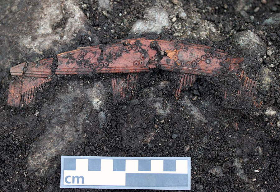
Antler comb in situ (Reference AmbrosianiAmbrosiani 1981 Type A) (photograph: © Bergen Museum).

At Bjørkum, the preservation of animal bone was excellent, resulting in the most complete and probably the largest eco-factual material from a single Viking Age site in Norway (see Barrett et al. 2007). It consists of large numbers of bones of sheep, goat, cattle, pig, horse, and deer as well as abundant fish bones including salmon (probably caught in the Lærdal river), cod and herring (pers. comm. A.K. Hufthammer). Charred cereal grains were also found, but a complete lack of steatite cooking vessels could indicate that plants did not make up a substantial part of the food consumed on site. The abundance of animal bones suggests that a surprisingly large part of the subsistence was based on meat and fish.
The artefacts recovered numbered about 1500 objects, consisting of everyday utensils, quern stones, whetstones, tools used in craft production (knives, needles, spindle whorls and loom weights) as well as personal belongings such as fragments of dress ornaments and beads. A smithy attests to the productions of small iron tools (i.e. prefabricated knives and/or small bars). There are also indications of non-ferrous work. Of particular interest are fragments of cut reindeer antler, as well as smaller debris, which were found at several locations on site, though no specific workshop or activity areas for antler working were identified. All stages of the production chain are represented, from blanks for tooth plates and connection plates to smaller worked fragments. Three virtually complete combs were found, all within the range of Reference AmbrosianiAmbrosiani's (1981) type A combs (Figure 4). Bjørkum is thus, to our knowledge, the first site in western Norway to produce evidence for prehistoric comb production. Moreover, this comb production is only known from a few other sites in Norway and seems to be more or less completely absent from the assemblages of the only Viking Age town in Norway, Kaupang in south-eastern Norway (Barrett et. al. 2007).
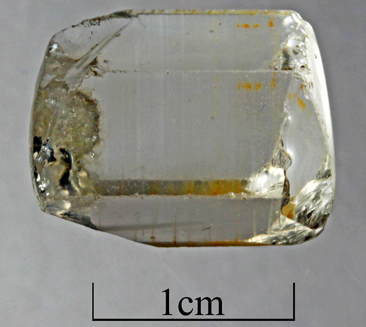
Partly perforated and partly ground rock crystal bead (photograph: © Bergen Museum).

Connections
The finds reflects a large variety of production activities: some raw materials were available locally, others can be linked to social networks beyond the immediate region. Their acquisition links Bjørkum to paths and networks stretching into the immediate outfield and further into the mountain regions, as shown for example by an unfinished rock crystal bead (Figure 5).
Spindle whorls and loom weights can probably be related to summer mountain farms (shielings) and can be taken as indicative of the increased importance of secondary products and wool production during the Viking Age (Bjørgo 2005; Reference SolbergSolberg 2000: 273). The manufacture of combs must be understood in relation to local networks encompassing the inland mountain areas: indeed the alpine areas north-west and south-east of Bjørkum are dotted with structures related to seasonal reindeer hunting from prehistoric times onwards, increasing markedly during the Late Iron Age and showing a peak in density in late Viking and medieval times (Reference SolbergSolberg 2000: 275).
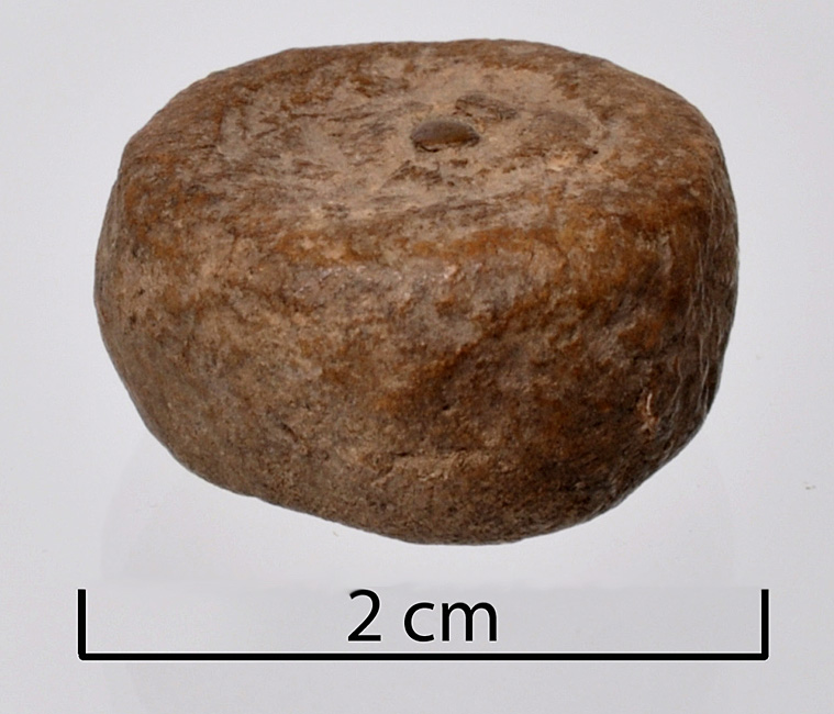
Cylindrical lead weight from Bjørkum (photograph: © Bergen Museum).

Discussion and conclusion
To address the importance and function of Bjørkum it is essential to understand the site within its geographical location related to natural resources as well as in its wider socio-political context. In the wider world, Inner Sogn represents a border area between the eastern and western landscapes of southern Norway while at a local level the geographical position of Bjørkum can be related to a number of historical paths and trails, making up complex networks linking mountain regions and inner coastal areas (see Reference HougenHougen 1944).
Viking Age Bjørkum does not easily fit the description of what can be expected of farmsteads, households or everyday activities. Based on a variety of data a complex picture emerges of a site directed towards seasonal gatherings, feasting and ritual activities as well as small-scale craft production, including craft specialisation and barter (Figure 6). The latter is documented by a lead weight, otherwise only known from the Viking Age emporium of Kaupang and from grave finds (see Reference Pedersen and SkrePedersen 2007:134). The site therefore provides new insights into the social and economic aspects of rural Late Iron Age Norway as well as into the networks at play in wider areas of northern Europe.