Introduction
Coastal landscapes, past and present, are unique spaces subject to intense evolution and change. At present, sea-level rise is one visible effect of climate change, and human activity is also threatening much coastal and island territory on a global scale. In this context, the vulnerability of coastal heritage is increasingly coming into focus, particularly in areas such as the European and American Atlantic façades, where the combined results of sea-level rise, coastal environment dynamics and human activity are significantly altering the coastline.
In Europe, Scottish archaeologists were among the first to warn of the threat to this heritage (Reference AshmoreAshmore 1994). In 1997, English Heritage initiated the Rapid Coastal Zone Assessment Surveys (RCZAS; English Heritage 1997). In the west of France, current estimates indicate that more than 2500 archaeological sites are severely threatened (Daire et al. 2012: 169). In America, several research initiatives have dealt with the problem of coastal archaeological site erosion on both theoretical and practical levels; several authors have highlighted the fact that natural and cultural heritage conservation approaches aim to achieve very similar outcomes (e.g. Brum et al. 2011: 155–57; Reeder et al. 2012: 187–88). The need for a better understanding of this heritage, its setting and its vulnerability is thus becoming increasingly urgent (cf. Reference ErlandsonErlandson 2008).
Monitoring change
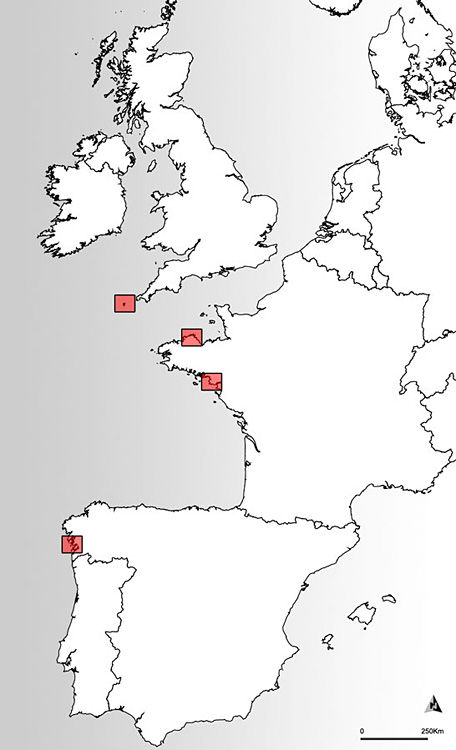
Location map of study areas.

The eSCOPES Project (Evolving spaces: coastal landscapes of the Neolithic in the European Land's Ends, Marie Curie-IEF, PI E. López-Romero) is the result of previous research experience on coastal and island archaeology and on coastal heritage vulnerability. The project aims to contribute to the understanding of human dynamics in the coastal landscape from the Middle Neolithic to the Early Bronze Age in Atlantic Europe (c. 4500–2200 BC) through trans-regional analysis of the archaeological evidence and study of the variables affecting the vulnerability of the coast.
The project, initiated in May 2013 and running until April 2015, uses close-range photogrammetric techniques ('structure from motion', e.g. Doneus et al. 2011) as a cost-effective solution to record, model and monitor both minor and major changes in the architecture of selected case studies in a number of areas of the European Atlantic façade (Figure 1).
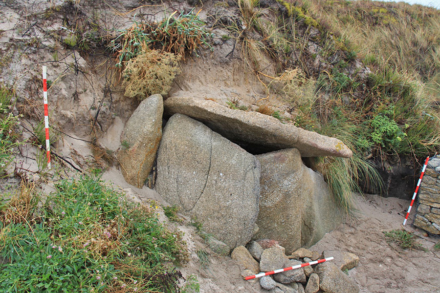
There are two objectives to this procedure. First, to provide a detailed three-dimensional record of the selected case studies in order to safeguard the potential for architectural analysis even in the event of severe damage or destruction (Figure 2). Second, to evaluate the suitability of close-range photogrammetry techniques for the assessment of coastal site erosion on relatively complex architecture. In addition, the outputs (photographic series, 3D models, difference grids) will constitute powerful tools for decision-making processes to inform best practice in managing coastal heritage.
Megalithic chamber in Guidoiro Areoso (Galicia, Spain).

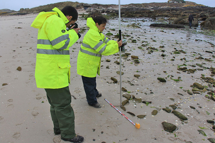
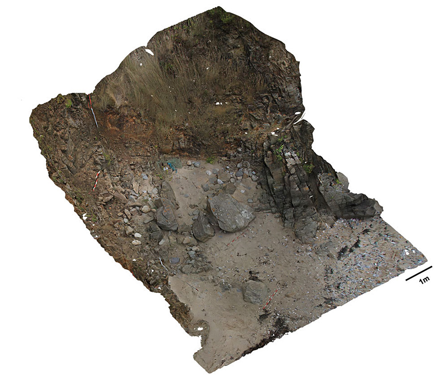
The initial fieldwork campaign took place in September 2013. Six archaeological sites (two megalithic monuments in Brittany, western France, and four on an islet in Galicia, north-western Spain) located in different environmental settings and with different structural characteristics were recorded with extensive photographic documentation (in the range of 1000–1200 photographs for each site in the 2013 campaign). Several palaeosols and structures associated with, or in close proximity to, the sites have also been documented (Figure 3). Two reflex cameras (Nikon D300 coupled with a GPS receiver and Canon EOS 700D) and a compact camera (Canon G10) were used. The record was then integrated through Agisoft Photoscan software to obtain an initial set of Digital Surface Models (DSM; Figures 4 & 5).
Documenting intertidal structures in Guidoiro Areoso (Galicia, Spain).

Le Lomer (Brittany, France); preliminary 3D photomosaic of the eroding cliff showing remains of the megalithic monument.

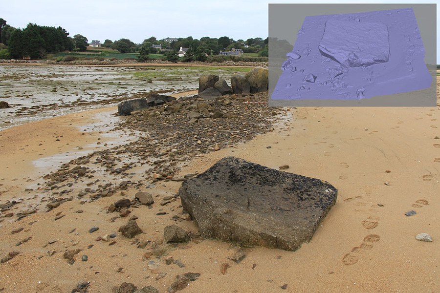
Coalen (Brittany, France); 3D Digital Surface Model of a fallen orthostat.

A second and third campaign of recording will be undertaken at the same sites in March and September 2014 to provide a snapshot of the changes in operation over six- and twelve-month timescales. Topographic reference points, established during the 2013 field campaign in the vicinity of each site with the help of a total station (Leica TCRP1203) and Differential Geographical Positioning System (DGPS, Leica GPS1200), combined with a series of control point measurements, will permit the accurate comparison of the DSMs for each site. Further research in 2014 will integrate the vulnerability analysis of megalithic monuments on the Scilly archipelago in south-western Britain.
Discussion
The extreme vulnerability of areas of the coastal archaeological record must be urgently acknowledged. The necessity of finding solutions, both to understand erosion processes and to preserve the scientific information inherent in the sites, is equally immediate. Due to the location of some sites (accessibility, limitations imposed by tidal regimes, etc.), the use of close-range photogrammetry provides a cost-effective solution to achieve these objectives.
Though complementary to terrestrial laser scanning (3D-TLS, e.g. Lim et al. 2005), in the context of this project, photogrammetry has three main advantages over that technique: it is considerably cheaper, it substantially reduces the amount of heavy equipment necessary for fieldwork, and the modelling is generated from photographs (which, in addition to their inherent scientific value, can be used to perform realistic mapping of the resulting 3D models).
When integrated into the workflow of ongoing risk and vulnerability assessment protocols (e.g. Daire et al. 2012; Reference Dawson, Daire, Dupont, Baudry, Billard, Large, Lespez, Normand and ScarreDawson 2013) this perspective will provide both qualitative and quantitative data to stimulate preventive measures as well as support for decision-making strategies concerning coastal archaeological heritage.
Acknowledgements
The eSCOPES Project is funded by the European Commission (Marie Curie-IEF). The authors would like to thank Chris Scarre (Durham University), Felipe Criado-Boado (Institute of Heritage Sciences, Incipit, CSIC) and X.I. Vilaseco Vázquez (Servizo de Arqueoloxía, Xunta de Galicia) for their support, and Loïc Langouet (AMARAI, France) for facilitating additional photographic equipment.