Digging under the volcano
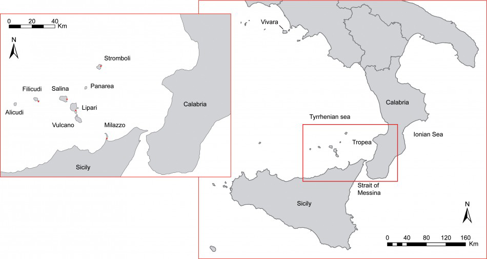
Stromboli is a stratovolcano that rises about 3km from the sea floor to an elevation of 924m asl, forming the north-easternmost island of the Aeolian Archipelago in the Tyrrhenian Sea (Figure 1). The island is famous for its persistent volcanic activity, which began in its present form between the third and seventh centuries AD (Vezzoli et al. 2014).
The Aeolian Archipelago, showing the location of Stromboli.

The emergent part of the volcano was created in four main periods of activity during the last 100 kyr: Palaeostromboli, Vancori, Neostromboli and Recent Stromboli. Archaeological evidence from various parts of the island indicates a human presence on Stromboli since the Late Neolithic/Chalcolithic periods (Bernabò Brea & Cavalier 1968).
The focus of the current project is a Bronze Age village at San Vincenzo, in the north-eastern part of the island. The terrace upon which the village was built is mainly represented by a scoriaceous lava flow belonging to the last phase of Neostromboli. Preliminary palaeomagnetic dating of the volcanic bedrock at the excavation site indicates an age of 6.2 ka, which is well constrained by the fact that the ‘Secche di Lazzaro Pyroclastics’, which locally cover the scoriaceous lavas, are considered to have been deposited at ≤6 ka (Calvari et al. 2011).
Eruptions at Stromboli seem to have resumed only in the Graeco-Roman period. The San Bartolo lava flows are palaeomagnetically dated to between 360 BC and AD 7, indicating a break in eruptions of the volcano during the Holocene, which might have coincided with the development of the Bronze Age occupation.
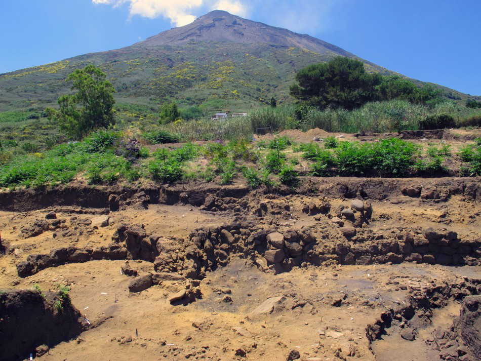
San Vincenzo was partially excavated in the 1980s and reopened by the current team in 2009 (Levi et al. 2011). It was specifically the volcanic environment that inspired the interdisciplinary strategy of the project (Figure 2).
The site of San Vincenzo, with the volcano behind.

The Bronze Age settlement
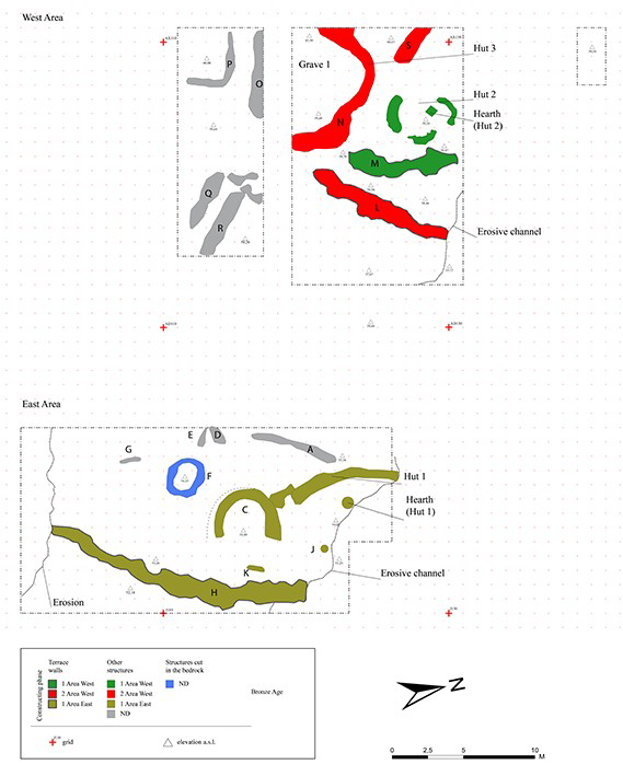
Bronze Age main structural remains at San Vincenzo

The Bronze Age site belongs to the Capo Graziano facies (Early to Middle Bronze Age 1–2; 2300–1400 BC) and is located on a steep-sided plateau, a large orographic unit, about 6ha in extent and 40–100m asl. It provides remarkable visual (perhaps also actual) control of the southern Tyrrhenian Sea. The excavation area, comprising c. 600m2 (Figure 3), is located on an irregular sloping surface, which influenced the topographical organisation of the dwellings on huge, stone-walled terraces.
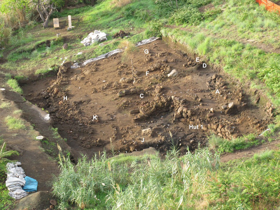
In the eastern area (Figure 4) a large terrace wall (H) sustains an area containing various structures. A concentration of vessels has been found close to a smaller wall (K). The terrace is occupied by two main structures: the small, oval-shaped Hut C and the larger Hut 1. On the floor of Hut 1 there is a large circular hearth made of flat stones and sherds. A similar smaller hearth is located a little farther to the east (J).
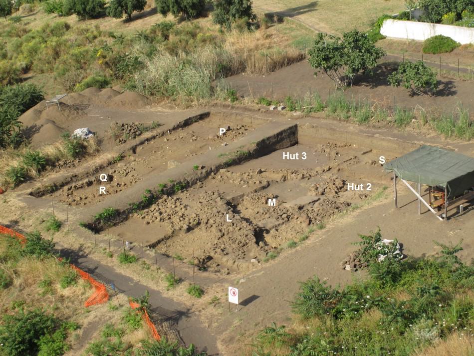
In the western area (Figure 5), it is possible to recognise two main building phases, marked by the use of two different terrace walls. The earlier terrace (M) is associated with the small Hut 2, of sub-circular plan with a quadrangular hearth outlined with slabs of lava stone set vertically into the ground. The latter terrace (L) is associated with Hut 3, built with massive walls and forming the largest oval structure discovered. In the southern part of the site, there are several structures under investigation: a square hut (P), built immediately on the bedrock, and large, straight walls (Q, R) perpendicular to the terrace system (L, M).
Area East: aerial view from the north-east.

Area West: aerial view from the north-east.

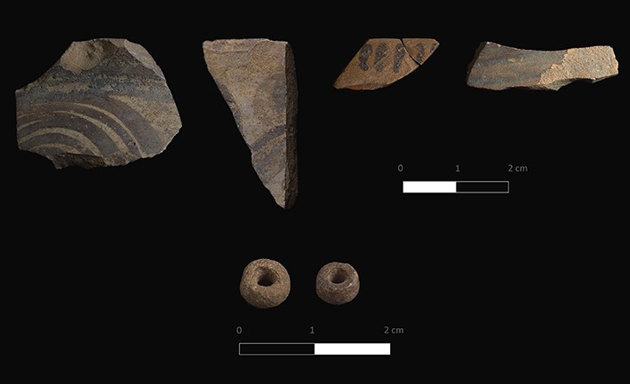
Handmade burnished pottery was locally produced and imported (Brunelli et al. 2013). Several Late Helladic I–II imports from the Aegean (seventeenth to fifteenth centuries BC) are also attested (Figure 6). Radiocarbon estimations derived from 20 stratigraphic contexts across the village have provided a range of dates between 2290–1475 cal BC (95.4% probability), attesting to long occupation.
Mycenaean pottery and beads (LH I–II).

To summarise, the stratigraphical, radiometric and typological data indicate the extended habitation of the village. This forms a different occupational model compared to the other islands of the Aeolian Archipelago. For example, at Lipari and Filicudi (Martinelli et al. 2010) the earliest villages were positioned in coastal and lower locations (Diana and Filo Braccio), subsequently moving to more defensible sites (Acropolis and Montagnola) with the appearance of the Mycenaeans in the central Mediterranean. The San Vincenzo village therefore contributes to a more varied Bronze Age settlement history of the Aeolian Islands.