Introduction
Stone-built game traps, known also as 'kites', are ancient large-scale structures, conspicuous on arid and steppe landscapes in south-west Asia. Thousands of such structures have been documented, extending from Yemen and Saudi Arabia in the south through the deserts of the Levant and as far north as the Ararat Depression in Armenia. They have been recognised for over 80 years (e.g. Reference MaitlandMaitland 1927; Reference ReesRees 1929), and many new examples are discovered every year (e.g. Reference KennedyKennedy 2012). All kites share a common basic design: two long walls (arms) converge from a wide opening to a narrow bottle-neck, which leads to a trapping enclosure. Most functional interpretations involve the capture of animals, mainly for consumption purposes (reviewed in Nadel et al. 2010; Bar-Oz & Nadel in press).
Current knowledge holds that kites were mostly used during the fifth to third millennia BC, at least in the southern Levant (e.g. Zeder et al. in press). The variety of kite types is very wide in terms of general form and dimensions, suggesting that not all kites were constructed for the same function or during the same period (e.g. Bar-Oz & Nadel in press).
The Armenian kites
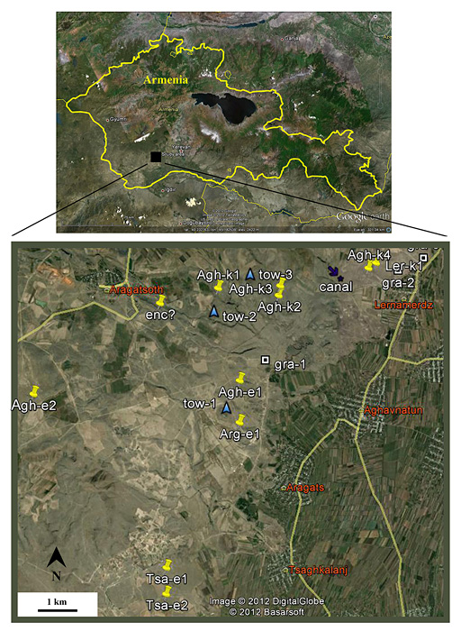
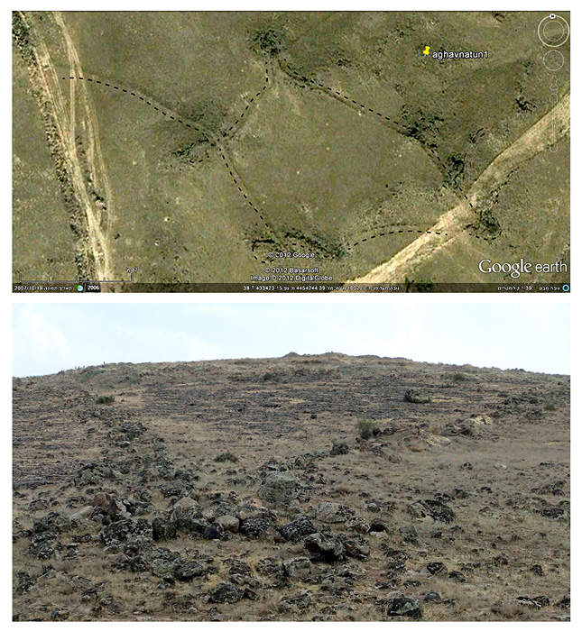
Currently, the northernmost-known manifestation of kites in south-west Asia is in Armenia, in the north-western fringes of the Ararat Depression (Figure 1). We defined a study area of 10 x 8km for the first stage of our ongoing long-term project, where the kites are located within an exceptionally rich archaeological context (Figure 2). Using Google Earth images combined with ground reconnaissance of the landscape, we found at least six V-shaped kites and four large enclosure kites in close proximity.
Top: map of Armenia, with location of study area. Bottom: Google Earth image of the study area (10 x 8 km) ( Google). Yellow pins represent kites; blue triangles represent 'towers'; tumuli and petroglyphs are abundant and not marked here; red names for local villages. Note the proximity of the endangered archaeological sites to the ever-growing villages and their adjacent fields.

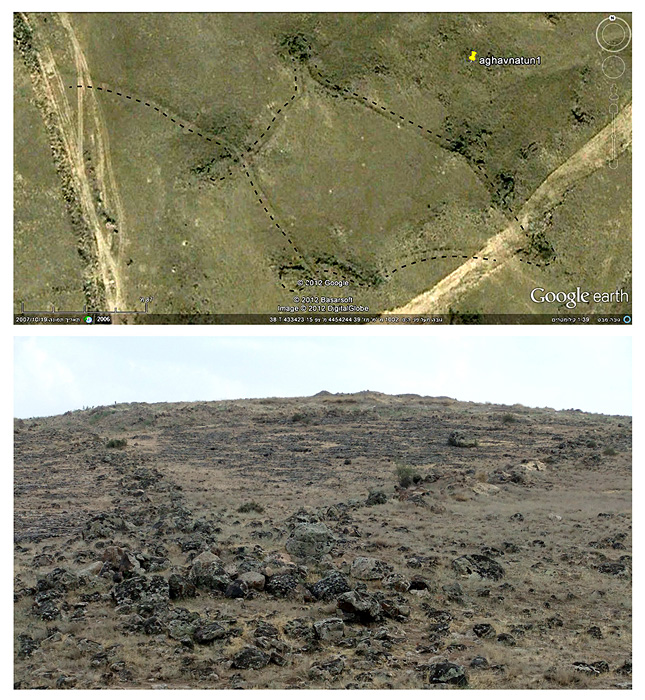
Top: Google Earth image of the head of an enclosure kite (200m long, enhanced with a dashed line) ( Google). Bottom: a V-shaped kite as seen from ground level, the head at bottom of photo.
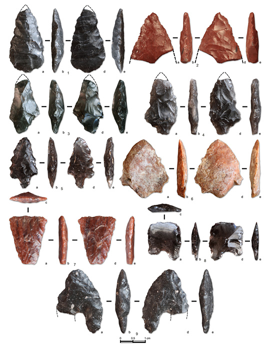
Arrow heads of obsidian and flint found during preliminary surveys of kites and sites in the study area (end of fifth to third millennia BC).
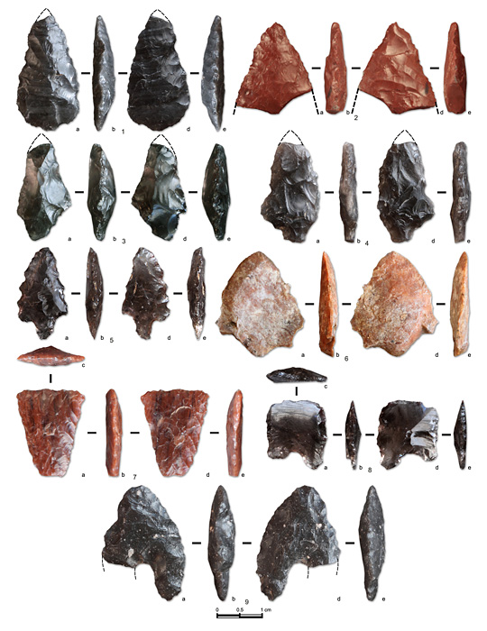
In contrast to the scarcity of material remains within the desert kites further south, the heads of the Armenian kites contain thick anthropogenic deposits and there are many surface finds, including Bronze Age through to Iron Age (third to first millennia BC) pottery sherds and obsidian arrowheads (late third to first millennia BC; Figure 3). Some of the large Armenian enclosure kites have annexed small V-shaped kites with a deep pit at their apex. Similar combinations are scarcely known in other places and none has ever been excavated. We plan to excavate some of these unique complexes in order to shed new light on their date and function.
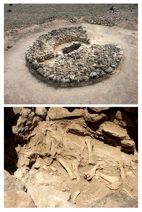
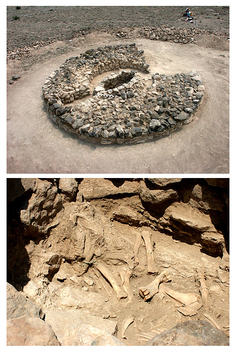
There is also a variety of additional sites adjacent to the kites, of which the most conspicuous and common are tumuli and massive stone-built structures ('towers'). Some of the tumuli were recently excavated under the direction of one of the authors (B.G.), exposing a ritual burial of an equid in one tumulus (Figure 4), and burials of oxen and sheep/goats in others (no human bones were recovered; Petrosyan & Muradyan 2012). The apparent association of kites and animal burials beneath tumuli is noteworthy and likely to represent the economic and symbolic importance of certain animal species for past local communities.
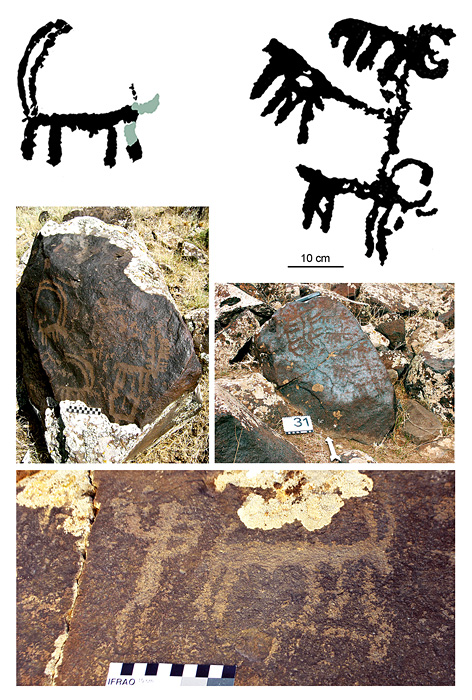
Particularly important for the project are the petroglyphs, of which several hundred have already been recorded by one of the authors (A.K.) within and near the kites, as well as within tumuli (Khechoyan et al. 2007). The common theme is animals, especially goats, deer and pairs of oxen pulling ploughs (Figure 5). The observed scenes reflect the duality of both hunting and farming activities.
Excavated tumulus with a ritual burial of an equid in the study area (Aghavnatun, Tomb 72, c. eighth to sixth centuries BC). Top: general view; bottom: the equid remains.
Examples of petroglyphs in the study area (VoskehatLernamerdz); top-right and middle-right: petroglyphs of pairs of oxen pulling ploughs; top-left and middle-left: petroglyphs of goats and deer; bottom: man hunting with a bow.

The north-western fringes of the Ararat Depression hold great potential for better understanding the phenomenon of kites within their cultural-historical context. Our preliminary observations present the first case study in south-west Asia where two types of kites, ritual animal burials and animal petroglyphs are all closely associated. Our project will also contribute to the protection of many of these remarkable Armenian kites, since they are not yet recognised as archaeological sites and are under immediate threat of destruction.