Introduction
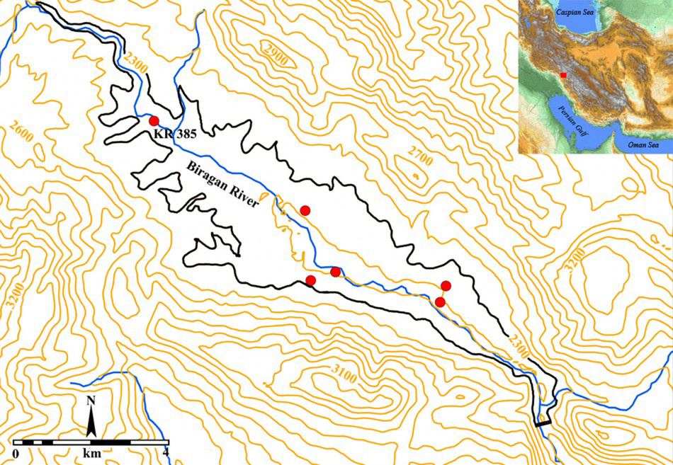
Map showing the area of Kouhrang Dam reservoir and the sites excavated during the second season (2013).

Since the 1930s, numerous cemeteries dating from the Chalcolithic through to the Iron Age have been discovered and excavated in the Zagros Mountains of western Iran (e.g. Reference Vanden BergheVanden Berghe 1976; Reference SchmidtSchmidt et al. 1989). As the region has long been inhabited by nomadic pastoralists, archaeologists ascribed these cemeteries to ancient nomadic populations, and recent work has emphasised the role of these peoples in socio-political developments in the Zagros (e.g. Reference ZagarellZagarell 1982; Reference AlizadehAlizadeh 2006). During the last decade, new fieldwork projects have been conducted at several sites in the Zagros that corroborate the proposition regarding the prevalence of a nomadic way of life in this region from at least the fifth millennium BC (e.g. Reference Esmaiili JelodarEsmaiili Jelodar 2008; Reference Shirazi, Norouzi, Heidary and KhoeiShirazi et al. 2015). One of the main areas in which such nomadic sites have been excavated over the last decade is Kouhrang, in the heart of the Bakhtiari highlands in the south-central Zagros. This area forms the traditional summer encampment of the Bakhtiari nomads (with autumn and winter spent in lowland Khuzestan in south-west Iran).
This article discusses one of the 11 nomadic sites that have been excavated during a rescue project behind Kouhrang Dam 3. The first season of salvage excavations in 2008 focused on five sites behind the dam, revealing evidence of the nomadic activities spanning from the fifth millennium BC to the mid-Islamic period (Reference Esmaiili JelodarEsmaiili Jelodar 2008). The second phase of fieldwork was directed by the author in December 2013, during which a further six sites were excavated (Figure 1; Reference AzadiAzadi 2014).
Site KR 385
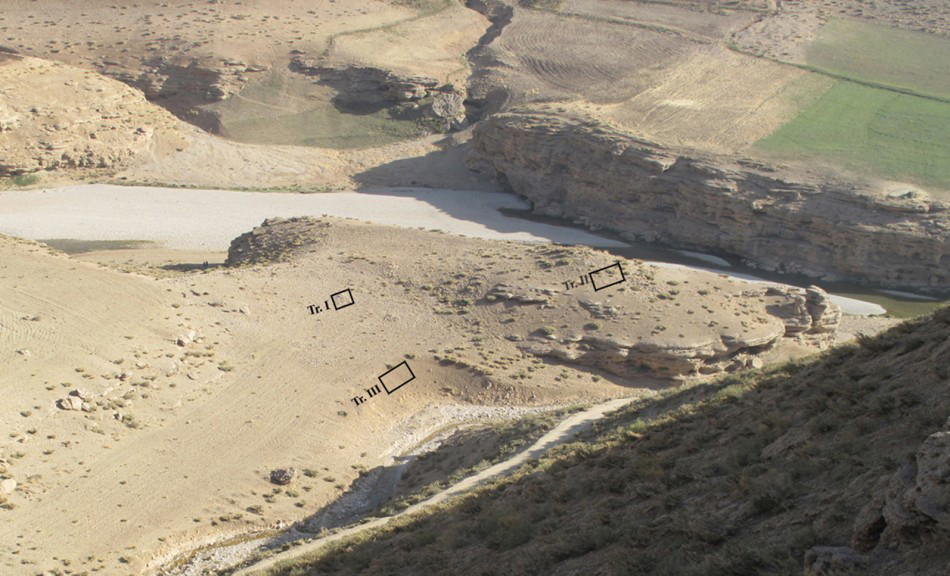
General view of KR 385 and the location of the trenches.

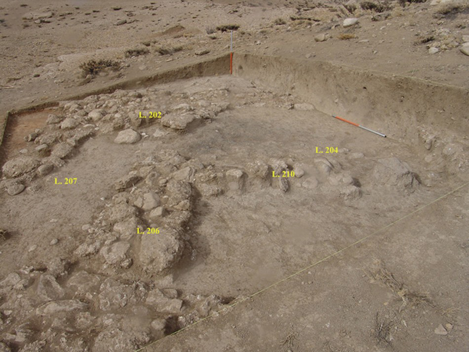
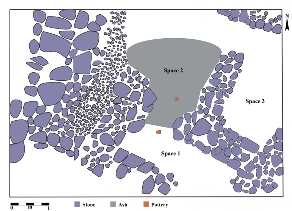
The site under consideration was located during survey work and catalogued as KR 385. It was initially interpreted as a group of stone-heap graves of the historical period (Reference RoustaeiRoustaei 2010). The site, located at 2260m asl, covers c. 500m2 on a conglomerate terrace of the Biregan River, on which the dam is under construction (Figure 2). Two trenches were excavated on the higher part of the site, where alignments of semi-buried boulders had been interpreted as the remains of ancient structures. Trench 1, measuring 5 × 5m, revealed no traces of any archaeological features or deposits. Trench 2 was opened at the highest part of the site, some 25m to the east of trench 1. It was initially 2 × 2m in size but enlarged to 5 × 7m as more architectural remains were revealed. The structures, located just below the surface, consisted of partially preserved stone walls, up to 0.35m in height, of unmortared river cobbles and boulders (Figure 3). The exposed walls, 0.3–0.5m in width, intersect to form at least three spaces within the trench. No traces of mudbrick or roofing material were detected, but thin, ashy deposits within these architectural spaces were scattered with sherds of pottery and splinters of animal bone (Figure 4).
Stone architecture revealed in trench 2.

Plan of the architectural spaces excavated in trench 2.

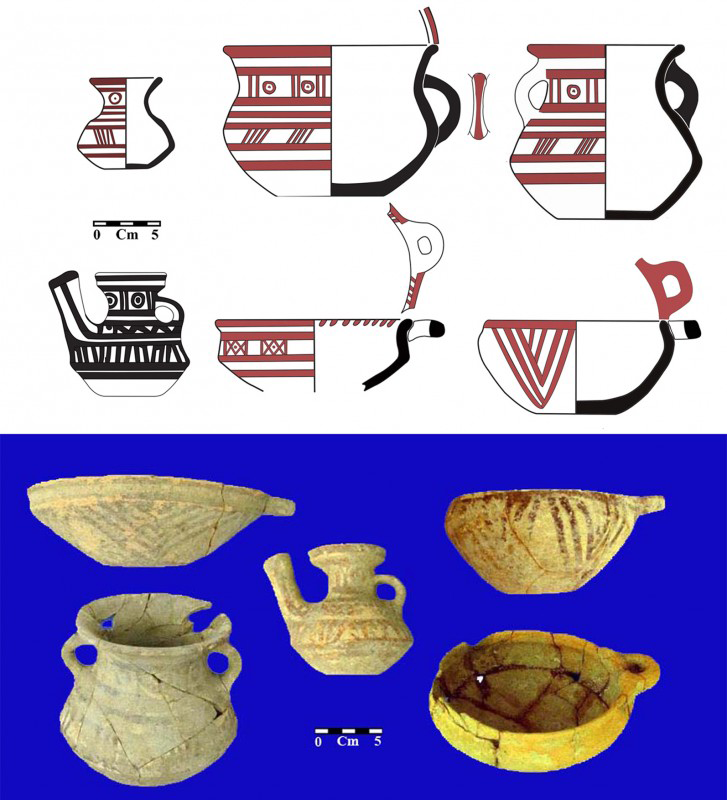
During the course of the fieldwork, clandestine digging some 15m south of trench 1 partly destroyed two graves located nearly 2m below the gravel debris on the slope (Figure 2). Consequently, a new 5 × 7m trench was excavated (trench 3) to investigate the illegally dug pits and to uncover the burials fully. The two burials were identical: interred in a flexed position, accompanied by similar pottery vessels and each interred with an animal, perhaps a young goat, placed near the knees. The graves were simple pits dug into the loose slope debris of the conglomerate terrace. The close similarities between the ceramic vessels from the settlement (trench 2) and those of the burials (trench 3) strongly suggest that these two areas were in contemporaneous use (Figure 5).
Painted pottery vessels from the burials in trench 3.

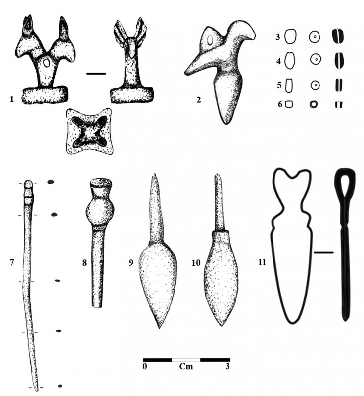
A selection of the finds from the settlement and the graves; bronze artefacts: 1, 2, 6, 7, 9 & 11; agate artefacts: 3, 4 & 5; iron artefacts: 8 & 10.

Each burial produced seven plain and painted pottery vessels that are almost identical, both in their forms and decorative motifs. In total, nine metal objects (six bronze and three iron) were also recovered (Figure 6). These include a decorative pendant/seal, an arrowhead, a pin and a bead. Ceramic comparisons with excavated assemblages from the Central Zagros (e.g. Reference YoungYoung & Levine 1974: figs 47.9 & 49.4; Reference GoffGoff 1976: fig. 10.15) suggest a Late Bronze/Early Iron Age date for KR 385.
Conclusion
The small size of the site, its elevation, its position (on a gravel terrace) and the nature of its archaeological deposits—as well as the absence of any mounded sites indicative of permanent, year-round occupation within a 30km radius—leave no doubt that KR 385 represents a high-altitude site occupied by seasonal pastoralists. As such, it presents a rare example of the archaeological excavation of a Late Bronze/Early Iron Age nomadic site in the Zagros Mountains.
Acknowledgements
I would like to thank Kourosh Roustaei for his instructive comments on initial drafts of the paper, and Mojgan Riahi, then the head of Cultural Heritage Office of Chahar Mahal-o-Bakhtiari Province, for her encouragement and support.