


Description of the Glacier
Blue Glacier is a temperate alpine glacier originating on the north-east flank of Mount Olympus. Two separate accumulation zones, the cirque and the snowdome, discharge through ice falls into the valley tongue, the lower glacier. All of the cirque accumulation flows to the lower glacier via an ice fall divided into two sections of unequal width by a nunatak. An ice divide on the snowdome separates the Blue Glacier drainage basin from ice flowing westward to the avalanche-fed valley tongue of Black Glacier. Surface ice flow appears to divide between the two glaciers at the topographic crest; in the following mass budget analysis this crest is assumed to represent the upper boundary of Blue Glacier in the snowdome area. Bore-hole evidence suggests the bedrock crest may not coincide with the surface crest, and thus the distribution of ice flow at depth in this area is presently open to conjecture (Figs. 1 and 2).

Fig. 1. Oblique aerial photograph of Blue Glacier from the north-north-east.

Fig. 2. Topographic sketch map of Blue Glacier, showing present outing, 1815 and 1900 outing, lines of profiles in Figure 3, location of bore holes and principal glacier features
Figure 3 presents vertical cross-sections of ice depth along a longitudinal profile and selected transverse profiles. This longitudinal profile coincides with flow lines in the upper and lower parts but not over a 1 km. reach below the ice fall (dashed line in Figure 2). Total horizontal length of this profile is 3.9 km., while the distance from the terminus to head of the cirque is 4.2 km. Map area of the Blue Glacier active ice is 4.3 km.2; this figure has been used in the following mass budget computations. Ice depths in the accumulation zone have been determined by electro-thermal drilling (Reference LaChapelleLaChapelle, 1963) which reached presumed bedrock at depths and locations indicated in Figure 2. Ice depths for the lower glacier are based on recently re-interpreted data from a 1957 seismic survey by Allen (personal communication), and on a gravity survey in 1960 and 1961 by Reference CorbatóCorbató (1965). The seismic survey occupied 18 stations below the 1,625 m. contour on the glacier surface, while the gravity survey occupied 146 stations below approximately 1,675 m. Independently determined bedrock configurations from the two surveys are in good, though not perfect, agreement. The author’s profiles in Figure 3 interpolate the differences.

Fig. 3. Longitudinal and transverse profiles of Blue Glacier. Dashed lines in the longitudinal profile indicate the approximate 1815 and 1900 surface levels
These numerous ice depth data accumulated since 1957 allow an estimate of total glacier volume and subglacial topography. A total of 17 transverse ice depth profiles (including those in Figure 3) have been constructed from existing bore-hole, seismic and gravity information. Known bedrock surface slopes at the glacier margins are also considered in approximating these profiles. From these data, the total volume of Blue Glacier is estimated to be 5.7 × 10⁸m.3. Firn density distribution and depth to impervious ice (about 15 m. on the snowdome, 25 m. in the cirque) have been deduced from thermal drill performance, leading to mean densities for profiles in the accumulation zone which vary from 0.80 to 0.87 g. cm.−3. Assuming mean density of the lower glacier to be 0.90 g. cm.−3, the total water volume is 5.0 × 10⁸ m.3 and the overall mean glacier density is 0.88 g. cm.−3. Mean depth of the entire glacier is 133 m., that of the lower glacier is 147 m. and that of the cirque–snowdome 85 m. The lower glacier encompasses 65 per cent of the glacier volume and 66 per cent of the mass, while 25 per cent of the volume is in the accumulation zone and the remaining 10 per cent in the ice falls.
The vertical gradient of net mass budget at the firn limit has been defined as the “energy of glaciation” (Reference ShumskiyShumskiy, 1946) and the “activity index” (Reference MeierMeier, 1962). This concept has been extended to accumulation and ablation zones by Reference LaChapelleLaChapelle (1962) and to the ablation zone (“ablation gradient”) by Reference HaefeliHaefeli (1962). The net budget gradient of the Blue Glacier ablation zone (lower glacier) is 10 mm. m.−1, a figure derived from the two years (1959 and 1960) when the glacier was closest to mass equilibrium (Fig. 4). This value, based on a more thorough data analysis, is larger than the 8 mm. m.−1 previously reported for these two seasons (Reference LaChapelleLaChapelle, 1962). Variations in snow deposition make the gradient for the accumulation zone more difficult to determine, especially when accumulation is averaged across the entire glacier. It has an apparent mean value around 7 to 8 mm. m.−1 in an equilibrium year. Present firn limit on Blue Glacier is a zone centred on an altitude of 1,725 m., just below the foot of the ice falls.

Fig. 4. Plot of annual ice ablation as a function of altitude for 1959 and1960, both years of near-equilibrium mass budget. Slope of the curve is the net budget gradient
Accumulation zone center-line flow velocities in summer range from about 20 m. yr.−1 at the heads of the snowdome and cirque to 60–80 m. yr.−1 just above the ice falls. Annual mean of center-line flow velocities is 50 m. yr.−1 just below the firn limit, diminishing to 20 m. yr.−1 or less near the terminus (from a paper on surface-velocity and surface strain-rate data from lower Blue Glacier to be published by M. F. Meier, C. R. Allen, W. B. Kamb and R. P. Sharp). Maximum ice-fall velocities reach 300 m. yr.−1 or more (summer values) but these flow vectors shift direction erratically.
The Mass Budget
In the following discussion, all values of volume (m.3) or specific budgets (m.) are in terms of water equivalent unless otherwise stated. Thc terminology of Reference MeierMeier (1962) is adopted wherever applicable.
Two principal quantities may be used to determine the net amount of ice a glacier gains or loses each year. These are the amount of annual snow accumulation remaining at the end of the ablation season, and the amount of ice wastage below the snow line during the ablation season. In addition, there is a transient quantity of water which is added each year as snow and removed as melt water. To specify the annual mass budget completely by including this transient mass, both the accumulation total and residual accumulation must be measured. Ideally, this should be done by winter snowfall measurements, but this is often impractical and, except for one season, such measurements have not been made on Blue Glacier. Instead, snow ablation has been measured throughout the ablation season and this observed loss added to residual accumulation to obtain the total value. This method introduces an error by failing to account for possible periods of ablation during the accumulation season. Such periods are known to occur on Blue Glacier each year, especially in the late autumn, and the total mass is thus consistently underestimated. Another error is introduced in the accumulation total when settlement around ablation stakes causes snow ablation to be overestimated in terms of water loss (Reference LaChapelleLaChapelle, 1959). These two errors have opposite signs and tend to cancel.
Mount Olympus, the first prominent peak encountered by storm systems crossing the Washington coast, is often exposed to winter winds reaching 40 to 45 m. sec.−1 or higher. Wind-drifting of snow is strong (though not as strong as might be expected in these circumstances—see discussion in the next section), and snow accumulation is uneven. Distribution of deposited snow also varies from year to year in the accumulation zone, while it remains more consistent on the lower glacier, where wind action is less violent. Residual snow depths in autumn must therefore be widely sampled, normally at 100 or more points. A hand-driven sectional 8 m. probe of high-temper steel tubing, equipped with a conical point 1.2 cm. in diameter, is used to sample snow depths. It has been shown (Reference LaChapelleLaChapelle, 1954) that a maritime snow cover following the first ablation season undergoes a marked increase in ram resistance caused by winter refreezing of interstitial melt water. Such a probe readily detects this increase, for in practice it can be driven through the current snow cover but not into last year’s firn. Snow thickness observations on crevasse walls serve to check the probed depths wherever possible.
During the 1958 summer melt season 50 ablation stakes were distributed over the surface of Blue Glacier. Unlike accumulation, snow wastage rates were found to be remarkably uniform over large areas of the glacier, the only significant variation being a gradual decrease with altitude. A similar condition was found for ice wastage below the snow line. Even on the lower glacier, surrounded by mountain walls, there was little cross-glacier variation of wastage rate except at the extreme margins. Subsequent wastage records each year have utilized a single line of stakes distributed to sample appropriate altitude intervals up the center of the lower glacier and the cirque. Additional stakes sample wastage in the snowdome area. While surface wastage rates do not vary widely over adjacent parts of the glacier, the total ice ablation is strongly dependent on length of exposure after retreat of the snow line. Thus the transient snow-line position must be recorded frequently by sketches and photographs.
Annual accumulation each year is determined by plotting observed water equivalent depths on a map, drawing lines of equal water accumulation and measuring the total volume by planimetry.
Annual ice ablation is determined in two ways. First, lines of equal water-equivalent ice wastage for the end of the ablation season are plotted with the aid of wastage observations and snow-line positions. Total volume of ablation is then determined by planimetry. Secondly, total ice ablation rate at selected times throughout the summer is computed from exposed ice areas and short-interval mean ice wastage rates at those times, and then plotted as a function of time. The total ice ablation is the area under the plotted curve.
From snow areas and snow water-equivalent wastage rates, the total amount of snow ablation is calculated by the second method used for ice ablation.
The curve showing cumulative ice ablation is obtained by plotting the area under the ice ablation rate curve as a function of time. A similar curve for residual accumulation is obtained by subtracting the area under the snow ablation rate curve from total accumulation. The difference between them in the mass balance (Meier’s cumulative budget total), whose value at the end of the budget year is the net mass budget. The curves intersect if the budget is negative. Such curves for each budget year 1958 through 1963 have been plotted in Figure 5. (Annual Blue Glacier mass budgets for the budget years (October to October) 1956 through 1963 are summarized in Table I.)

Fig. 5. Blue Glacier mass balance curves for 1958 through 1963, showing residual snow accumulation, cumulative ice melt and mass balance as a function of lime

Errors in the mass budget observations are difficult to estimate. One of the most likely sources of error is the lack of knowledge about accumulation-ablation processes in the ice falls. Though physically above the firn limit, this zone has a chaotic broken character which increases surface area exposed to ablation. On the other hand, excess winter snow accumulates in the depressions and crevasses. For the present study, the ice falls are assumed to be zones of slight accumulation consonant with their position immediately above the firn limit, but the validity of this assumption is uncertain. Also, there is a strong subjective element introduced in drawing contours of equal accumulation or ablation, for this depends on the observer’s judgment and acquaintance with physical details of the glacier surface, as well as on the position of a number of isolated points on a map. Presumably, discerning judgment in this respect increases accuracy over that for lines of equal water depth drawn solely in regard to measured points, but the magnitude of increase is difficult to judge. Reference HubleyHubley (1957) has estimated the overall errors in computing the Blue Glacier budget as ± 18 per cent in the accumulation zone and ±10 per cent in the ablation zone. In the present view, the above uncertainties preclude specifying the errors so precisely, but Hubley’s values are adopted as a reasonable order of magnitude. When the difference between accumulation and ablation is small (the glacier is near equilibrium), then the calculated magnitude of this difference may be grossly in error, and even of the wrong sign. Data presented in Table I should be regarded as approximations only.
Consider the mass budget features illustrated by the curves in Figure 5:
-
There is a very large annual mass accumulation, ranging from 12 to 16 × 106 m.3 over the years of records, and equivalent to average depth of water (specific apparent accumulation) of 2.8 to 3.7 m. added to the glacier surface each year.
-
A large part of this accumulation is removed each year as snow melt. The mass thus removed substantially exceeds that removed as ice melt, the ratio of the two ranging from 1.6 (1958) to 4.2 (1962).
-
Half or more of the ice melt occurs after mid-August and in most cases during September and October.
-
Except in 1958, equilibrium condition (curve intersection) in mass deficit years is not passed until October. An early (September) termination of the ablation season will almost always find Blue Glacier in a state of mass budget surplus in the present climate.
The annual mass budget is the difference between ice melt and residual snow accumulation, two quantities seen in this instance as relatively small compared with the total transient ice mass each year. On Blue Glacier the residual snow accumulation in turn is the difference between large accumulation and large snow melt. The mass budget in the present glacier configuration and climate is thus rather sensitive to small changes in the large quantities involved, a sensitivity which is further enhanced by the interrelationship among these quantities. The effect of increased snow melt (and its corollary, increased ice melt) is clear from the unusual season of 1958, when normal winter precipitation fell but in which the summer ablation season began a month early, in May instead of June, leading to a very large mass deficit.
Present and Past Climate
The Blue Glacier climate is mild and extremely wet. Precipitation in the Olympic Mountains is the highest in the conterminous United States, about 80 per cent of that which reaches Blue Glacier falling as snow. Table II lists observed annual precipitation, both the mean for the entire glacier (from mass budget records) and that measured at a single point at the Snowdome micrometeorological site. The rainfall estimates are based on the measured ratio of rain to snowfall in 1957–58, when about 20 per cent of the precipitation fell as rain. Total mean precipitation estimate for the glacier is probably low, for this includes lower elevations where more than 20 per cent would be expected to fall as rain.
Table II Blue Glacier Precipitation Summary; September to September (in m. water)

Seasonal climate variations for the one complete year of observation (1957–58) and the relation of these to climate of nearby lowland stations are given in Figure 6. Records at the latter indicate the period of observation was slightly below normal in precipitation and unusually warm. The Blue Glacier records are obtained at the Snowdome research station, 2,020 m. a.s.l.

Fig. 6. Blue Glacier 1957–58 climate and its relation to the lowland stations at Forks and Tatoosh Island
The U.S. Weather Bureau maintains a first-order weather station at Tatoosh Island, 102 airline kilometers north-west of Blue Glacier. Daily radiosonde flights from this station identify the freezing level in the atmosphere adjacent to the Olympic Mountains. These data for 1959–63 are summarized as monthly means in Figure 7.

Fig. 7. Mean monthly fieezing levels for 1959–63 over Tatoosh Island, Washington. Open circles indicate the mean freezing levels for storm periods only
Normal winter weather on Mount Olympus is stormy with few clear periods. In summer the static North Pacific High often brings long uninterrupted periods of fair weather to the Olympic Mountains, though the coastal lowlands may frequently be exposed to fog and drizzle. Unsettled summer weather usually brings rain to the glacier in July but occasionally snow on the upper glacier in August.
Energy exchange involved in summer melt on Blue GIacier has been studied at length and the results previously communicated (Reference LaChapelleLaChapelle, 1959, Reference LaChapelle1960, Reference LaChapclle1961; Reference Giddings and LaChapelleGiddings and LaChapelle, 1961). In summary, solar radiation is the dominant (about 60 per cent) source of heat to the summer snow surface which accounts for almost all the melt, long-wave radiation cooling during fair weather providing a sink for most of the heat available from other sources. In the autumn solar radiation rapidly diminishes in importance, being replaced by sensible and latent heat transfer during warm storms as the principal source of melt, while radiation cooling predominates during fair weather. Dry, cold weather by late September can lead to a net daily radiation deficit in the accumulation zone, accompanied by frost penetration into the firn of 0.5 m. or more. Radiation in winter, both long- and short-wave, plays a minor part in the glacier energy balance, the dominant feature being accretion of mass at sub-freezing temperatures during the persistent storms, with fog, rime and high winds. Periods of both heavy accumulation and strong melting from solar radiation can be expected by late spring.
A peculiar feature of the Blue Glacier climate is the unusually high density of newly fallen winter snow (Reference LaChapelleLaChapelle, 1957). This ranges from 0.15 to 0.30 g. cm.−3 and during midwinter months averages 0.25 g. cm.−3, a much larger value than the 0.07 to 0.10 g. cm.−3, commonly found in alpine winter snow covers. This high density is attributed to a preponderance of needle-type snow crystals originating in shallow cloud layers at near-freezing temperatures. Stability of this dense new snow in the face of high winds, together with the cementing effect of frequent riming, probably has an influence on the glacier mass budget. Fluffier low-density snow would likely be swept away in large quantities from higher elevations by the gale-force winds prevailing here in winter.
High-quality climatological records, continuous since 1893, are available from the Tatoosh Island Weather Bureau station. These have been used to plot temperature and precipitation trends, since the turn of the century, in Figure 8.

Fig. 8. Tatoosh Island ten-year running means of annual temperatures and precipitation. The brackets indicate a period of resurgent glacier activity in western Washington
Glacier Variations and their Relation to Climate
Recent Blue Glacier variations have been interpreted by Reference HeusserHeusser (1957) from botanical evidence. He concluded that the glacier reached a maximum stand about 1650, at which time it coalesced with White Glacier to occupy the present Glacier Creek Valley. A second and similar maximum occurred about 1815, after which the glacier retreated rapidly for nearly a century. During the first decade of the twentieth century the terminus maintained a fixed stand, then again retreated rapidly until 1953. Since this date the terminus has been very nearly stationary, a slight advance having occurred in 1955 (Fig. 9). Reference DaveyDavey (1962), from a comparison of topographic maps compiled from aerial photography in 1939, 1952 and 1957, showed that the glacier had a strongly negative mass budget from 1939 to 1952, although there was a slight gain in the upper part at this time. From 1952 to 1957 the glacier gained substantially more mass than it lost in the previous 13 yr. (net specific budget of 8.5 m. of water vs.−2.9 m.).

Fig. 9. Blue Glacier terminus variations since 1650 (after Neusser)
The short cessation of retreat after 1900 and that after 1953 both correspond to mean temperature minima at Tatoosh Island, while the intervening period was marked by rapid retreat and slightly warmer conditions. A precipitation maximum just prior to the first retreat cessation may have caused it, though the temperature change alone will be shown sufficient to account for the cessation.
Botanical and topographic evidence, together with an old photograph taken about 1900, make it possible approximately to reconstruct the 1900 outline and surface profile of Blue Glacier; these are indicated in Figures 2 and 3. Assuming the same annual accumulation and net budget gradient as today, it is possible to calculate the change in annual ablation which would lead to an equilibrium stand for the 1900 profile. Surprisingly, this change can be accomplished by lowering the firn limit altitude (i.e. shifting the curve in Figure 4 to the left) only 50 m., a figure consistent with the recorded climate variation of mean temperature. The 1900 Blue Glacier tongue extending 400 m. lower into the valley than today had much less influence then on the mass budget character than a surface level rise of 30 to 50 m. in the rest of the ablation zone. This high sensitivity to small climatic changes is a feature necessarily common to all glaciers with a high activity index and gentle surface gradient below the firn limit. A small shift in surface altitude causes a marked change in net budget over an extensive part of the ablation zone, overriding that due to change in total area.
The nature of the present-day climate control of the Blue Glacier mass budget has already been reported (Reference LaChapelleLaChapelle, 1960) and these conclusions are briefly reviewed here.
On any glacier there exists a marked interrelationship between the accumulation and ablation processes which establish the annual mass budget. A deep snow accumulation, for instance, not only adds an extra amount of mass but also inhibits ice melt by blanketing the ablation zone late into the summer. A long ablation season not only removes extra mass by melt but also limits the length of the accumulation season and inhibits mass accretion. On Blue Glacier a large mass surplus accumulates each winter, much of which is removed by strong summer melt. Mean mid-winter accumulation and mid-summer melt rates are both about 2.5 cm. of water per day, while total accumulation and length of ablation season are both largely determined by spring and fall weather conditions. The critical periods on Blue Glacier are approximately 1 May to 15 June and 1–31 October. The reason for this is that upper air freezing levels fluctuate annually around the glacier altitude as a consequence of its relatively low altitude, and the most rapid fluctuations occur during the critical periods mentioned above (Fig. 8). Alpine glaciers at higher altitudes normally receive most of their precipitation as snow, except in mid-summer. This is not the case with Blue Glacier, for rain and snow frequently alternate in spring and fall, and rain occasionally may fall even in mid-winter. In short, Blue Glacier experiences a large surplus of precipitation but a varying amount of snowfall which depends critically on whether snow or rain falls during spring and autumn storms.
Under present conditions the freezing levels are relatively low in May, with precipitation normally as snow. In some recent seasons April and May precipitation has, in fact, largely made the difference between near-equilibrium and Iarge deficit mass budgets following relatively dry winters. A warm May accompanied by early onset of melt instead of accumulation leads to a large mass deficit, as in 1958. September freezing levels are high, leading to substantial melt at a time when most of the ablation zone ice surface is exposed. By early October freezing levels have dropped sharply, most of the precipitation falling again as snow by October or early November. Mean freezing levels during the autumn storms are considerably lower than the monthly means, in contrast to spring. Snowfalls blanketing the whole glacier have been observed as early as the first week in September, but such termination or severe inhibition of the melt season usually does not occur until October. When autumn storms bring rain instead of snow, melt is greater than that in fair weather because convection-condensation replaces a weak radiation regime. The Blue Glacier mass regime today is thus critically controlled by freezing level of the spring and fall storms. This relationship is especially important on the lower glacier (ablation zone), because extra snow accumulation here instead of rain clearly reduces the annual ice melt, a reduction effected by transient snow which itself adds nothing to the mass budget accumulation term. These conclusions concerning the climatological factors which dominate the Blue Glacier mass budget—plentiful winter precipitation, importance of spring and autumn weather, and sensitivity to temperature as reflected by freezing levels—are essentially the same as those reached by Reference AhlmannAhlmann (1940) for Styggedalbreen in Norway.
The amplitude of the periodic mass fluctuation illustrated by the curve of total glacier mass vs. time in Figure 10 is termed the annual mass turnover. Barring seasons of anomalous ablation or accumulation, this amplitude is approximately represented by the sum of annual snow and ice melts, a quantity which may be determined hydrologically through stream discharge measurements as well as by ablation measurements on the glacier. The dimensionless instability index is now defined as the annual mass turnover per unit glacier mass. It is conveniently expressed in specific budget terms:
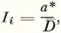
where
-
a* = specific mass turnover (Meiers’s apparent ablation),
-
D = specific mass (mean water-equivalent depth) of the glacier.

Fig. 10. Total mass of Blue Glacier as a function of time for 1958 through 1963
The larger the value of I i , the more potentially unstable is a glacier in its reaction to climatic fluctuations, for any perturbation in a*, and thus in net mass budget, will represent a larger percentage change in the total glacier size. An extreme example of instability is that of small glacierets which form in response to minor climatic changes and whose lives span only a few years (I i = 1). At the opposite extreme are polar ice sheets (I i = 10−4). Blue Glacier, with I i = 0.03 lying idway between these extremes, is unlikely to experience a drastic percentage change in mass during climatic fluctuations measured in decades but is one whose life cycle can readily fall into a time-scale of centuries. Present annual energy input to Blue Glacier is-sufficient to remove it entirely in one-third of a century if mass accretion were to cease completely.
Finally, response of Blue Glacier to present climate is also shown in Figure 10. Note that the maxima in the curve of annual mass fluctuations can be connected by a straight line, in spite of annual differences in the fluctuation magnitude. This line has a slope of +2 × 10⁶ m.3 of water per year, or, in specific mass budget terms, +0.15 m. yr.−1. Blue Glacier is slightly out of equilibrium with the present climate and tending to grow by about 0.4 per cent per year.


