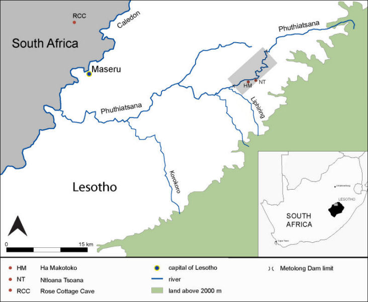
Africa has many dams, but only rarely has systematic archaeological research been undertaken ahead of construction or with meaningful support from donors or contractors (Reference AraziArazi 2009). Changing priorities on the part of the World Bank, a key funder of such projects and of work aimed at mitigating their environmental impact, and growing capacity in heritage matters on the part of government agencies make Lesotho's Metolong Dam an exception to this generalisation. Intended to impound water for domestic and industrial use in and around Lesotho's capital, Maseru, the Metolong dam will flood a 14km stretch of the Phuthiatsana River (Figure 1).
Map of the Phuthiatsana Valley, Lesotho.

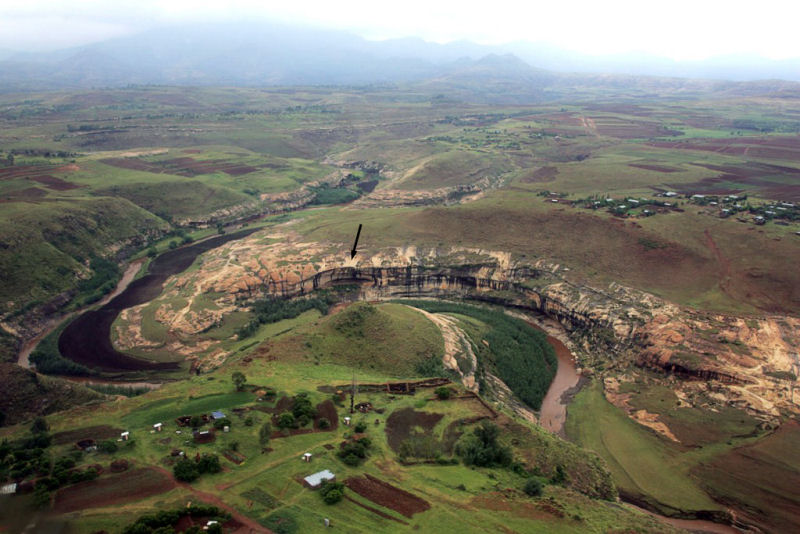
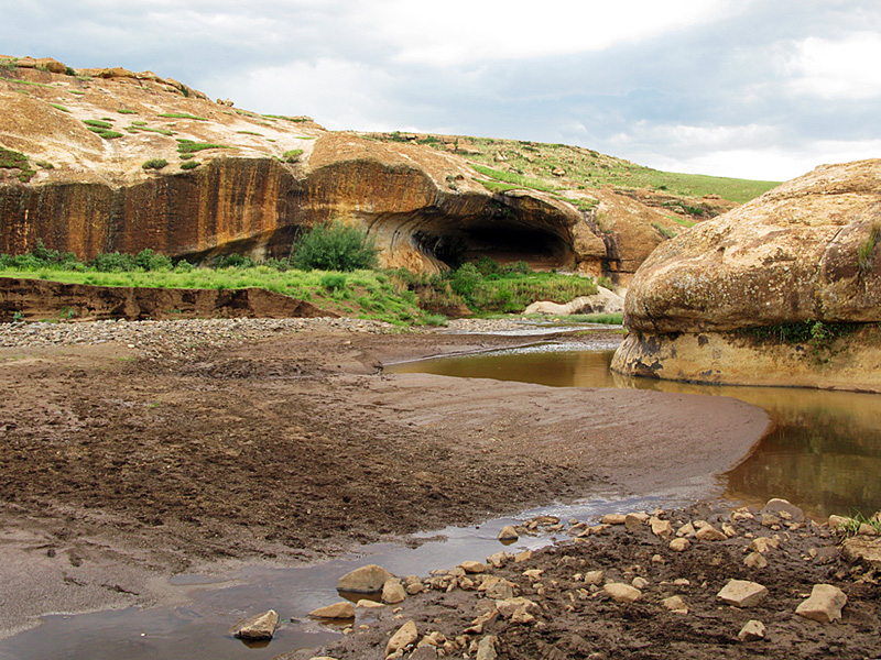
In 2008 the World Bank and the Metolong Authority asked us to assess the archaeological resources of the threatened area (Figure 2) and develop recommendations for building sustainable cultural resource management in Lesotho, a choice informed by Mitchell's earlier work there and previous discussions about the dam's probable impact. Fieldwork plus examination of existing records, including those of Smits' (1983) Analysis of Rock Art in Lesotho (ARAL) project, which surveyed here in 1979, confirmed the area's richness during preliminary investigations in 2008-2009. All 27 rock art sites located by Smits were revisited and their current state of preservation assessed. In addition, 23 previously unknown open-air stone artefact scatters were documented. Three painted sites contain archaeological deposits, including two large rock-shelters (Ntloana Tsoana and Ha Makotoko) tested in 1989 and known to span the Pleistocene/Holocene transition (Reference MitchellMitchell 1993). Additionally, Ntloana Tsoana (Figure 3) preserves Middle Stone Age (MSA) assemblages of Howiesons Poort and post-Howiesons Poort affiliation extending back to 59 kya (Reference Jacobs, Roberts, Galbraith, Barré, Deacon, Mackay, Mitchell, Vogelsang and WadleyJacobs et al. 2008). Both sites are of sub-continental importance. Ntloana Tsoana is the only MSA sequence in western Lesotho and — except for nearby Rose Cottage Cave — the broader South African interior. Moreover, the juxtaposition of two sites a mere 2km apart offers unique possibilities for examining cultural responses to environmental change c. 12-8 kya at the local level. Preliminary testing of smaller shelters confirmed that at least one (2927BD17), 2km upstream from Ntloana Tsoana also preserves deposits of this age. Several MSA artefact scatters and another of possible early Holocene age also have potential for further study.
View of the Phuthiatsana Valley from near Ha Makotoko.

Ntloana Tsoana.

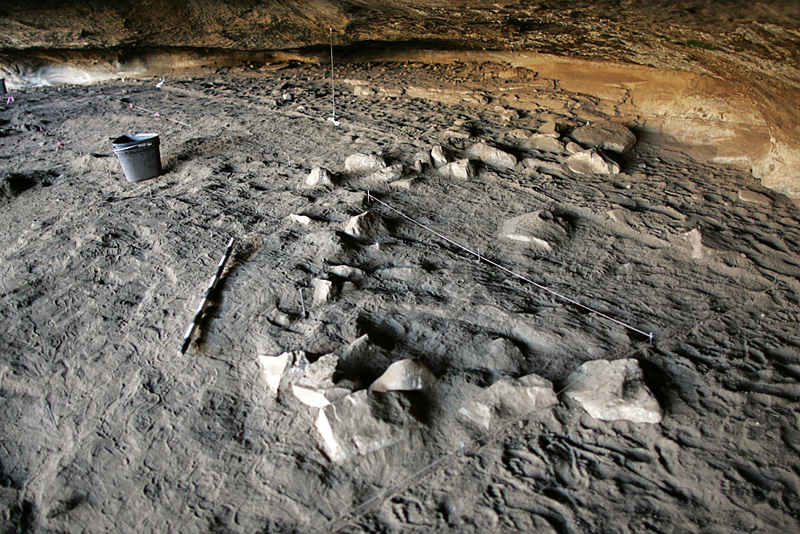
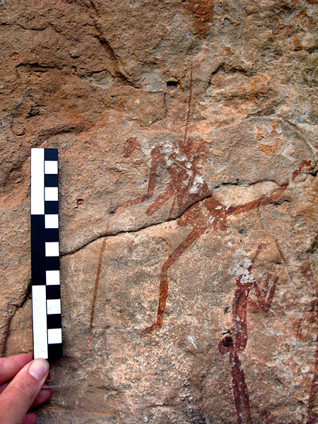
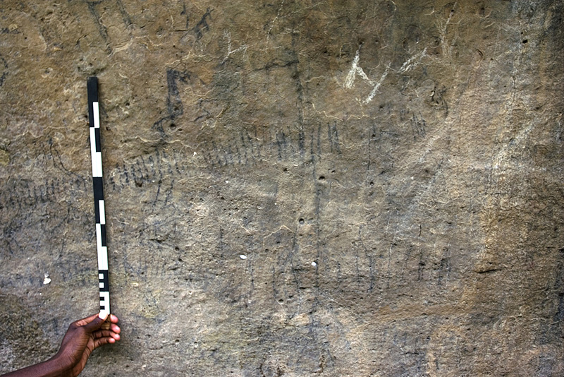
Since October 2009 Arthur has been directing further fieldwork to mitigate the dam's impact. Phase 2 of our research involves substantial excavations at both Ntloana Tsoana and Ha Makotoko, plus additional work at already identified smaller shelters and open-air scatters. Preliminary results indicate that both major sites also preserve more recent archaeology (Figure 4), as well as having hitherto unsuspected potential for examining the spatial patterning of activities across very fine-grained deposits. Subsequent work will involve comprehensive tracing and photography of all rock art sites, as well as the removal of selected panels for permanent conservation and display. As expected, most paintings are of Bushman origin (Figure 5), but we have also identified images that derive from Sotho, or possibly even nineteenth-century Korana raider, traditions. The former include paintings likely to be related to male initiation schools that still use at least two of the local rock-shelters (Figure 6). This underlines the importance of extending current investigations to include a broader assessment of the Metolong landscape's historical and cultural significance to local communities.
Stone circle, uppermost levels, Ha Makotoko.

Bushman painting.

Sotho painting related to male initiation.

Phase 3 of the project, scheduled for the latter half of 2010, will thus involve a team from the National University of Lesotho (NUL) undertaking an extensive survey of the beliefs, values and practices of communities living in the area. We also noted stone walling and Sotho pottery at many rock-shelters during initial surveys and identified two stonewalled settlements, abandoned during a period of village consolidation led by the British colonial administration in the 1950s and 1960s. One village, Ha Makoanyane, is located in the dam infrastructural zone but, following our Phase 1 survey, plans have now been altered to ensure its preservation. Additional funds have been secured to undertake a more detailed investigation of the village, as midden deposits should offer a rare insight into the archaeology of a late nineteenth-/early twentieth-century southern African rural community.
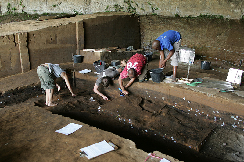
In contrast to earlier projects in Lesotho, we have made strong efforts to involve local communities and build capacity in archaeology and cultural heritage from the very start. This will continue into the post-excavation phase, in part through collaboration with Dr Moleboheng Mohapi, archaeologist at NUL, whose students have used our fieldwork as a training opportunity (Figure 7). At the same time, our team combines both foreign and Basotho nationals, the latter all trained in archaeology for the first time. We hope that their experience will feed into the creation of a functioning national museum in Lesotho and the successful implementation of recommendations made for the development of a heritage centre at Metolong. At the same time, school visits, radio, television and press coverage, and circulation of English/Sesotho newsletters are developing greater awareness of cultural heritage issues among a broader public.
Basotho students excavating at Ntloana Tsoana.

Acknowledgements
We thank the Metolong Authority and the World Bank for their financial support, Lesotho's Department of Culture, all local chiefs and communities and everyone who has participated in our fieldwork, particularly Jessica Meyer who took the photographs.