Introduction
In its broadest sense, pastoralism is related to various strategies of animal management for human benefit (Reference GilbertGilbert 1975: 53). From Neolithic times through to the introduction of modern agricultural techniques, pastoralism has been an integral part of the Middle Eastern economy (Reference AbdiAbdi 2003: 395), and, from the second half of the twentieth century, archaeologists have started their discussions on the prehistory of nomadic pastoralist groups by looking specifically to Iran. Moreover, these groups have been implicated in significant socio-political developments; most recently, for example, Potts (2014: 7) has observed that “it has been suggested that a diachronic analysis of the archaeology and history of the south-western and south-central Iranian plateau suggests the important role of the region’s mobile pastoralists in state formation”. Pastoral nomadic societies always needed sedentary agro-urban societies for their efficient functioning through exchange mechanisms (Reference Khazanov and SzuchmanKhazanov 2009: 120).
In his studies on the Baharvand, a Lurs tribe, Frank Reference HoleHole (2009) notes that such nomadic people may pitch their tents to define a central space in which animals are gathered for protection. For archaeologists, this presents a significant problem in terms of identifying such pastoralists and nomads. Sometimes, however, the Lurs people also built stone sheepfolds to protect their animals, pitching their tents alongside (Reference GilbertGilbert, 1983; Reference Hole, Thrane and ThuesenHole, 2004: 107). The current paper presents evidence of a Chalcolithic nomadic campsite with a number of such stone structures.
Geographical setting
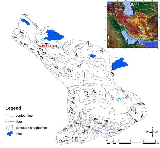
The Chogha Khor region, with an area of c. 115km2, is located south-east of Shahr-e Kord, the capital of Chahar Mahal and Bakhtiyari province in the highland Zagros (Figure 1). There is a large lake and grazing land that provide ideal resources for Bakhtiyari nomads from May through to October. Its location facilitates connections not only to the Khuzestan Plain but also to the Central Iranian Plateau. Fertile intermontane valleys of this area are suitable for a combined subsistence economy, that is, both agriculture and pastoralism (Nissen & Reference ZagarellZagarell 1975; Reference ZagarellZagarell 1975, 1982: 8; Reference AmbraseysAmbraseys 1979). The environmental and geological features of the Zagros Mountains have imposed the choice of winter and summer pastures and migratory routes. As Alizadeh (2004: 78) notes
Location of Saki Abad in the highland Zagros, Iran.

Until recently the two major mobile pastoralist tribal confederations in south-western and south-central Iran were Qashqa-ii and the Bakhtiyari. Their socio-economic and political structures are the best examples of multi-resource nomadism, allowing for a high degree of economic and social complexity and diversity.
The Saki Abad site
Although there has been archaeological work in the wider region, including Allan Zagarell’s survey programme in the south-eastern part of Lordegan, which traced sites dating from the Neolithic through to the Iron Age (Nissen & Reference ZagarellZagarell 1975), the Chogha Khor region has not previously been studied archaeologically. The site at Saki Abad is the first to be excavated in this region.
During the construction of a tunnel for transferring water to the Chogha Khor Lake, the remains of stone structures, pottery and burnt deposits were discovered near Saki Abad. Most of the site was removed by mechanical machinery, leaving only a small part (40 × 10m) undisturbed. The site is situated at 31° 55’ 27” N, 50° 53’53” E and lies 2280m above sea level. It is located alongside the Overgan to Boldaji road, about 150m to the west of Saki Abad village.
Excavations
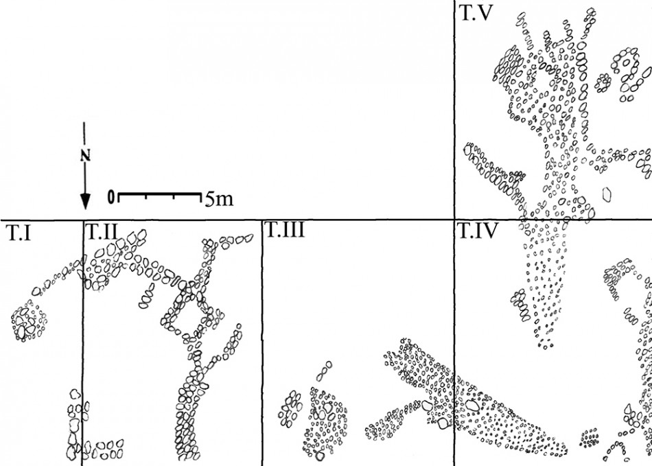
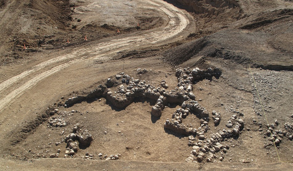
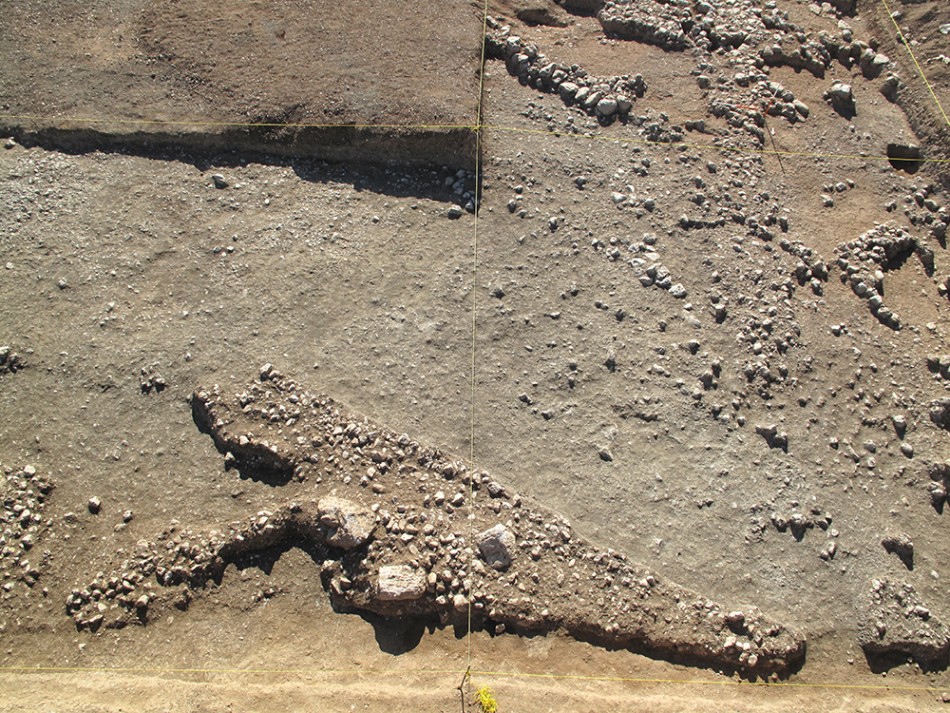
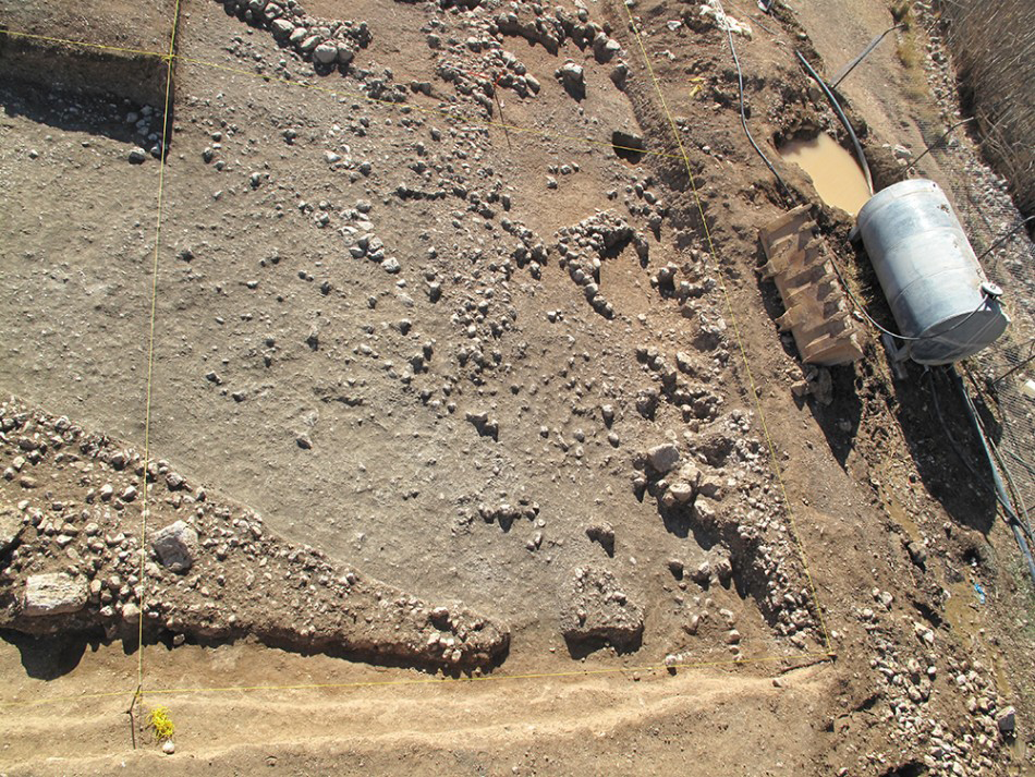
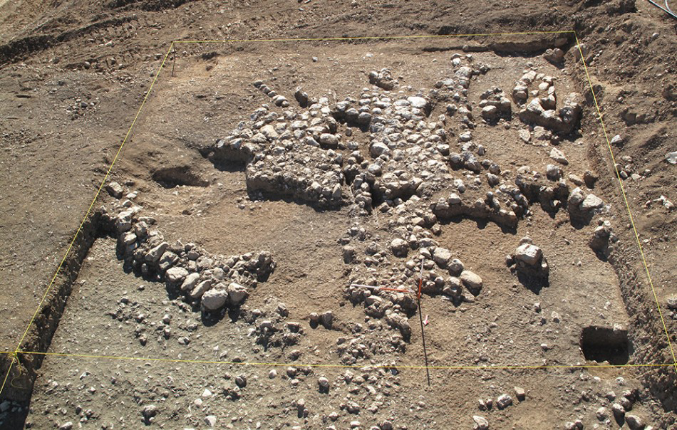
Five trenches, measuring 10 × 10m, were opened (Figure 2), revealing a number of stone structures. In Trenches I and II a thick semi-circular stonewall, ending with a rectangular room, with other stonewalls and a round stone bench were found (Figure 3). In Trench III the remains of a stone structure were identified, aligned north-west/south-east, probably defining two enclosed spaces, with surfaces paved with small cobblestones (Figure 4). In the centre of Trench IV we identified architectural features separating two further spaces (Figure 5). Finally, in Trench V we identified further stone structures and a rubbish deposit, although the area had been disturbed and in some places destroyed by the bulldozer. In this area, we also located ashy layers but no associated hearths or ovens were identified (Figure 6). It would appear that nomadic peoples reoccupied the structures identified across the five trenches on several occasions, and traces of the final occupation are visible through some reorganisation of the architecture.
Plan of excavated trenches at Saki Abad site (NB north is to the bottom of the plan).

Trenches I and II showing architectural remains.

View of Trench III.

View of Trench IV.

Trench V showing architectural remains.

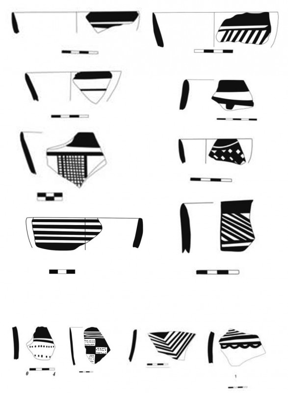
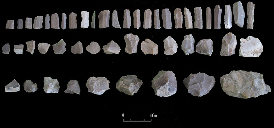
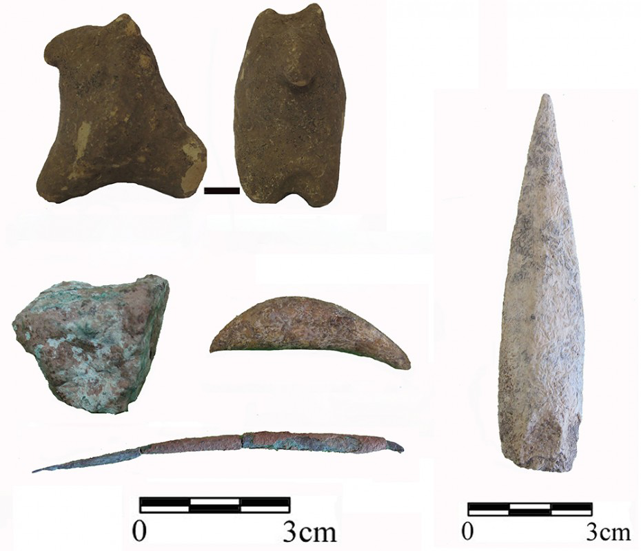
The pottery, especially with dotted decoration (Figure 7) is contemporary with late Susiana Plain and Farrokh and Bayat phase pottery in Dehloran. In Fars, this style is developed in the Middle Fars 1 period (Bakun B2) and continued to the late Fars (Bakun A) in the late fifth millennium BC. The emergence and vast geographical distribution of this ceramic style is known to be related to nomadic communities in south and south-western Iran (Reference AlizadehAlizadeh 2006: 20; 2009: 133). Other finds, some 519 flint and limestone tools, were recovered, including 15 microliths, 153 blades, 186 chipped pieces, 56 cores and many waste flakes, an animal figurine (Figure 8) and a few copper tools (Figure 9).
Pottery samples from Saki Abad.

Stone tools.

Miscellaneous objects.

Conclusion
The emergence of pastoral nomadism was central to the spread of food-producing economies in the arid and semi-arid zones of the Near East. Pastoralism in the Zagros Mountains is attested from, at the latest, the early Chalcolithic period (Reference PottsPotts 2014: 20). In the Khan Mirza Plain, near Chogha Khor, the increase in both the number and size of sites suggests that pastoral peoples started to proliferate during the middle and late Chalcolithic (Reference ZagarellZagarell 1989). Their architectural styles are comparable to houses and sheepfolds in the Bakhtiyari region today (Reference PottsPotts 2014: 20). At Saki Abad, the remains of a prehistoric pastoralists’ settlement are indicated by examples of just such scattered stone structures and associated material culture.