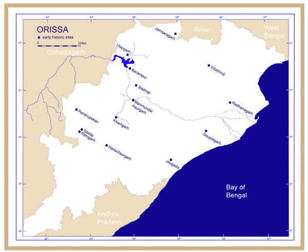
Archaeological sites mentioned in Orissa (map: P. Yule).

Off the time-worn track trodden by countless archaeologists, in the east of mother India lies a second little-known India. Until recently, the huge expanse of Bengal, Bihar and Orissa was the concern of but a few local archaeologists. My search for a field of research less extensively worked than the Harappa culture brought me to what Walter Reference FairservisFairservis (1971) in his survey book once described as 'uncivilised India'. In 1982 I visited Orissa in search of prehistoric mining and metal-working, and in pioneer days took the first 14C samples there. Since then, this region (Figure 1) has proven thankful indeed for research, including that dealing with monumental ancient architecture. Otherwise, most of its archaeological research centres on the splendid medieval religious architecture and sculpture.
The systematic study of Dieter Reference SchlingloffSchlingloff (1969) synthesises authoritatively the textual, art historical and archaeological descriptions of fortifications, especially Sanskrit and less so Prakrit ones, many of which have escaped notice. Wooden fortifications have not survived, although their existence is proven in ancient texts and can be inferred historically. The introduction of the global positioning system (GPS) and Ground Penetrating Radar (GPR) have brought about a quiet revolution for surveyors.
Mud forts find common mention in South Asian literature as anonymous topographic features, but who has ever seen one documented in an archaeological publication? Only rarely are they mentioned in detail in historic documents. Those in Chhattisgarh and western Orissa lie within the realm of the mysterious medieval kingdom of Daksina Kosala (see Figure 6 below for an illustration of a mud fort mapped recently).
A bilateral research project, funded by the German Research Society (DFG), united the Universities of Kiel and Utkal in Bhubaneshwar. Our research strategy, which began in 2000, aims to document as far as is possible the archaeological terra incognita that is western Orissa. The sites documented there were to be compared with those on the eastern coast. Although today the coastal zone dominates the back country economically and culturally, was this so in antiquity? There are reasons to question this status quo in ancient times.
Plan of the early historic fortress at Narla, Dist. Kalahandi (plan: P. Pahlen).

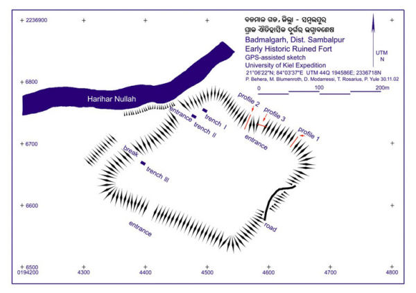
Iron Age fort at Badmalgarh, Dist. Sambalpur (plan: P. Behera et al.).

Our team recorded one Iron Age fort (Figure 2) (ably excavated by Dr Pradeep Behera of Sambalpur University), but most of the surviving 20 belong or appear to date to historic periods (e.g. Narla, Dist. Kalahandi, Figure 3). Presumably, many, especially in centres, succumbed long ago to population pressure. Such sites are simply listed in obscure publications without defining characteristics such as size, state of preservation and date. Nowadays in India, as land prices skyrocket, ancient sites are increasingly endangered by developers and squatters. We witnessed one such occurrence in 2003, while awaiting permission to excavate in Sandohel, Dist. Nuaparha (Nuapada): this site, the only known Iron Age tomb site in Orissa, was being exploited to obtain clay for the production of bricks. Even historic monuments under federal protection, such as Sisupalgarh, Dist. Khurda (Figure 4) are flagrantly being built on illicitly. Should the substance of a given ancient monument become damaged, neither documentation nor photographs exist to help later generations. Without these, the site are inaccessible both to tourists and experts, which effectively prevents any real discussion of dating, history or importance.
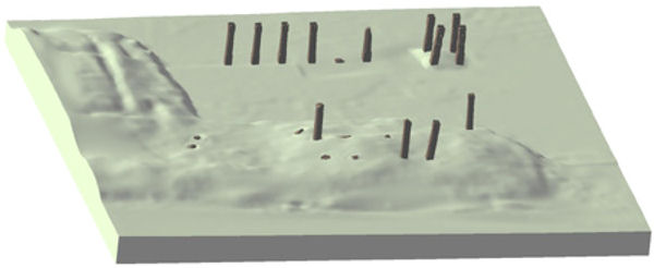
Column complex known in Oriya as shola khamba in the Mauryan (and later) fortress Sisupalgarh, Dist. Khurda, recorded by means of a laser scanner. View to the north (graphic: M. Bordas Vicent).

Our new documentation of Sisupalgarh (Figure 4) also serves as a basis for computer animations of the site (Reference YuleYule 2006), a first for Orissa. No excavation took place, this being carried out by R.K. Mohanty of Deccan College (Pune, India) with American colleagues from the University of California (Smith 2005; Mohanty et al. 2007).
The most striking site is the famous and capacious fortress at Sisupalgarh on the edge of Bhubaneshwar. By means of GPR, the northern edge of the moat seems clear on the southern flank of Sisupalgarh. Farmers gradually expand their fields around the site and gradually nibble away at most of the eight mighty protruding ancient gateways. In its midst as well as in the adjacent Mohabboi Sasan mud fort we documented a large-scale land grab by developers and passed our data on to state and federal authorities.
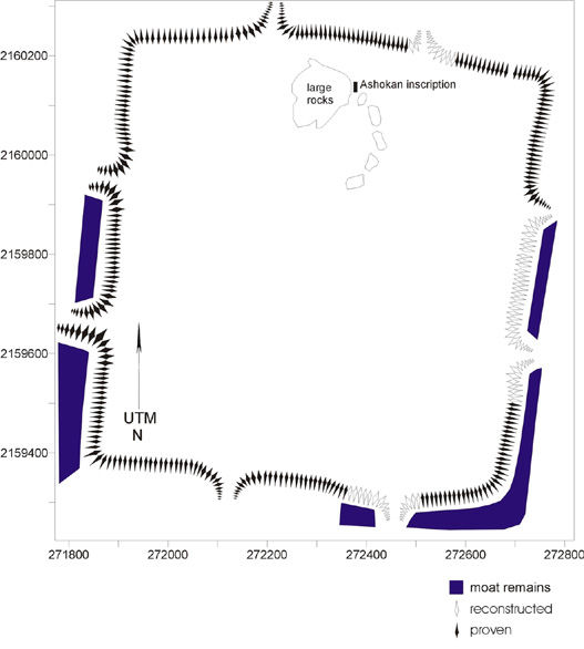
The archaeologist disconcertedly observes how the sites are destroyed as a result of not being recognised as valuable and thus receiving no protection, for example tragically in Jaugada, ancient Samapa (Figure 5). In a few brief years some of our photographs have already become historic. This makes the recording and mapping of vulnerable sites, for example mud forts (Figure 6) all the more pressing, as is addressing the problem of preservation, a study that a group based in Heidelberg and Leipzig has taken up. The protection of India's cultural heritage poses a task of Herculean dimensions and deserves the attention of responsible professionals including that of foreigners.
Plan of the Mauryan period fortress at Jaugada/Samapa, Dist. Ganjam, documented for the first time. It is noted for the occurrence of an edict of Ashoka (plan: P.Yule).

Subrecent mud fort at Bargawar, Dist. Janjgir Champa, Chhattisgarh. Mud forts were mapped for the first time in this state near the border with Orissa (plan: C. Borchert).

Acknowledgements
Thanks go to the Archaeological Survey of India, the State Archaeology Orissa, Raipur, Sambalpur and Utkal Universities for work permits. Support in kind and expert advice came again from The Institute for Spatial Information and Surveying Technology (i3mainz) of the University of Applied Sciences in Mainz. The DFG financed our work. Images are credited in the captions to the figures.