Introduction
The Iron Age in Europe was a period of tremendous cultural dynamism, during which the values and constructs of urbanised Mediterranean civilisations clashed with alternative webs of identity in ‘barbarian’ temperate Europe. Until recently, archaeologists and ancient historians have tended to view the cultural identities of Iron Age Europeans as essentially monolithic (Romans, Greeks, Celts, Illyrians etc.). Dominant narratives have been concerned with the supposed origins and spread of peoples, such as ‘the Celts’ (e.g. Reference CollisCollis 2003), and their subsequent ‘Hellenisation’ or ‘Romanisation’ through encounters with neighbouring societies. Yet there is little to suggest that collective identity in this period was exclusively or predominantly ethnic, national or even tribal. Instead, we need to examine the impact of cultural encounters at the more local level of the individual, kin-group or lineage, exploring identity as a more dynamic, layered construct.
ENTRANS
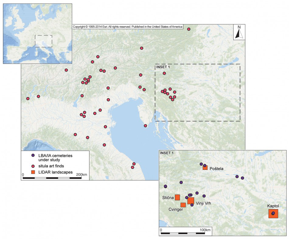
Location map of study area (produced by R. Kershaw and courtesy of Esri).

The ENTRANS Project (Encounters and Transformations in Iron Age Europe), funded by HERA and the European Commission and running from 2013–2016, has been developed in response to these concerns. ENTRANS is a collaboration between the universities of Bradford, Zagreb and Ljubljana and the Institute for the Protection of Cultural Heritage of Slovenia, with affiliate partners including the Archaeological Museum of Zagreb, the National Museum of Slovenia, the City Museum of Ljubljana, the Dolenjska Museum, the Regional Museum of Maribor, the Institute for Archaeology in Zagreb, the Centre for Prehistoric Research in Croatia and the University of Cork. This brief report sets out the agenda of the project.
Context
The East Alpine region, including parts of northern Italy, Slovenia, Croatia and Austria, formed a major locus for cultural encounters throughout much of pre- and proto-history (Figure 1). In particular, the North Balkans (including Slovenia and Croatia) occupy a key gateway east of the Alps, which otherwise formed a formidable barrier to socio-economic interaction. ENTRANS aims to examine the nature and impact of cultural encounters on the construction and negotiation of identities in this area during the Early Iron Age.
Communities in the East Alpine region occupied nodal points on complex routeways, along which flowed trade goods, linguistic forms, migrant groups, cultural values and political and religious ideas. In this highly fluid social world, new social and cultural identities were materialised through a range of media, of which ENTRANS examines three: art, mortuary practice and landscape. These three are linked by a common focus on the body and embodied experience.
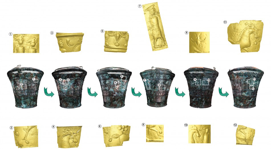
Situla 2 from Grave IV/3, Kandija, Novo Mesto (digital images produced by A. Evans and R. Kershaw, and reproduced courtesy of the Fragmented Heritage Project, University of Bradford and the Dolenjska Museum).

Art, landscape and the body
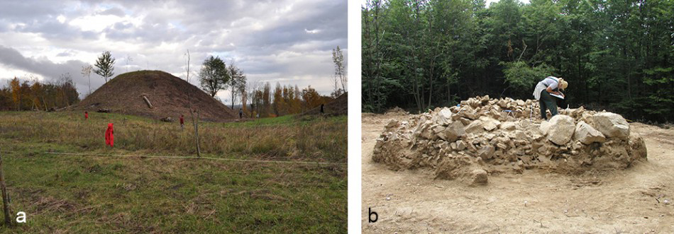
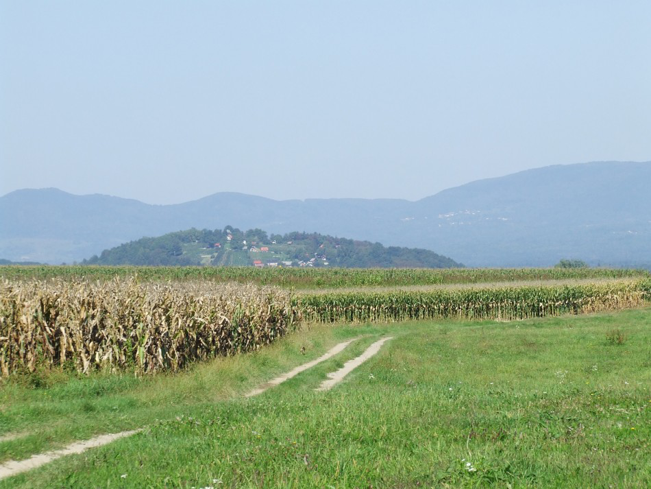
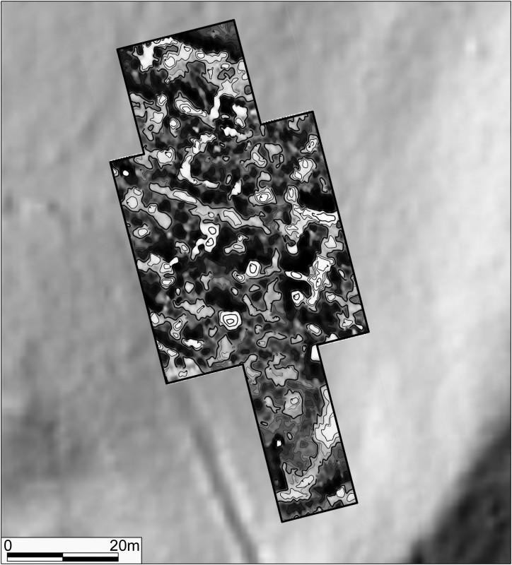
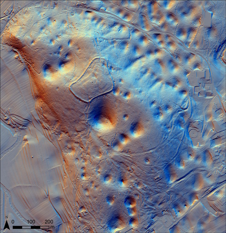
The artistic tradition known as ‘situla art’ comprises elaborate metalwork decorated with complex figural scenes that draw on Etruscan technologies and hybridised iconography (Figure 2). A key focus of situla art is the human body, carefully constructed in relation to posture, clothing, gesture and expression. A programme of digitisation underpinning technological and iconographic analysis as part of ENTRANS is exploring the role of the depicted body in the creation and maintenance of Iron Age identities. Attitudes to the body can equally be addressed through treatments of the dead, which underwent significant change during the Early Iron Age (e.g. Reference PotrebicaPotrebica 2009; Črešnar & Thomas 2012), including new forms of funerary performance, greater monumentality of burial mounds and new bodily treatments (Figure 3). Explorations of funerary practice as part of ENTRANS include excavation and geophysical survey, as well as extensive osteoarchaeological and stable isotope analysis. New, culturally mediated landscapes also appeared, in which religious, funerary, domestic and economic activities were drawn together within circumscribed areas (e.g. Reference MasonMason 2008), where movement and experience were carefully choreographed (Figure 4). Lidar mapping and geophysical survey as part of ENTRANS have begun to reveal corridors of movement both within settlements (Figure 5) and through the wider landscape (Figure 6), enabling detailed reconstructions of landscape perception and inhabitation (Mlekuž & Črešnar 2014). The key task for ENTRANS will be the integration of these analytical strands to enable new understandings of the changing social worlds of the Early Iron Age in the region.
Burial mounds in the region are often of considerable size and would have contained numerous burials. The examples shown are at: a) Kravljak; and b) (under excavation) at Kaptol, Croatia (photographs: H. Potrebica).

The hillfort at Kučar, Slovenia, sits within a concentration of Early Iron Age burial mounds, many of them marking the edges of routeways: this view is taken from an area of potentially contemporary lowland settlement at Griblje (photograph: I. Armit).

Magnetometer data from the Kaptol hillfort in the Požega Valley, Croatia, showing indications of internal buildings arranged along well-defined roadways (images by B. Mušič, University of Ljubljana).

Lidar imagery from the surroundings of the Cvinger hillfort, near Dolenjske Toplice, showing a range of hollow-ways to the south of the settlement, uniting at its flanked entrance (processed by D. Mlekuž, University of Ljubljana).

Acknowledgements
ENTRANS has received funding from the European Union’s Seventh Framework Programme for research, technological development and demonstration under grant agreement no. 291827. The project is financially supported by the HERA Joint Research Programme (http://www.heranet.info), which is co-funded by AHRC, AKA, BMBF via PT-DLR, DASTI, ETAG, FCT, FNR, FNRS, FWF, FWO, HAZU, IRC, LMT, MHEST, NWO, NCN, RANNÍS, RCN, VR and The European Community FP7 2007–2013, under the socio-economic sciences and humanities programme.