

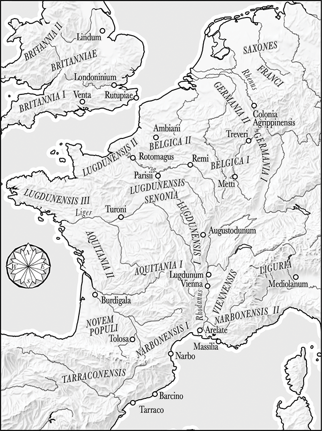
Map 1 Political map of Gaul in the late fourth century ce adapted from CAH XIII (eds. A Cameron and P. Garnsey), pp. 18–19.
Map 2 Arles and environs (E. Intagliata).
Sources: Natural Earth, Shuttle Radar Topography Mission (SRTM), Digital Atlas of Roman and Medieval Civilisations (DARMC).
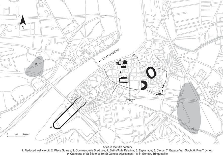
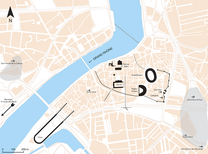
Map 3 Plan of Arles in the fifth century (M. Heijmans, Centre national de la recherche scientifique (CNRS)).
Map 4 Plan of Arles in the sixth century (M. Heijmans, Centre national de la recherche scientifique (CNRS)).
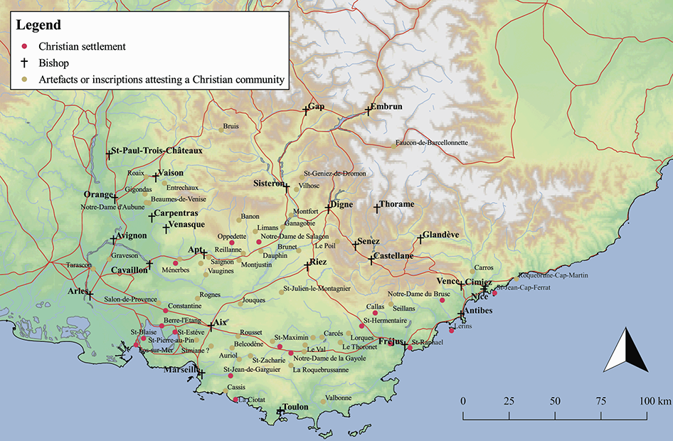
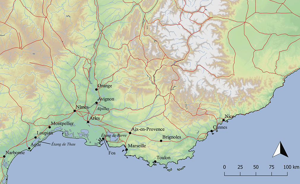
Map 5 The region with Christian sites and centres highlighted (E. Intagliata).
After Reference CodouCodou 2005, fig. 5: 86.
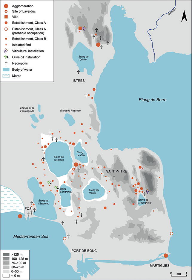
Map 6 The environs of the Étang de Berre in the fifth and sixth centuries ce
(reproduced from De la Gaule méditerranéenne à la Gaule centrale: Paysages et peuplements à l’Âge du Fer et à l’époque romaine. Archéologie et paléoenvironnement des campagnes de Provence et d’Auvergne. Mémoire d’habilitation à diriger les recherches, Aix-en-Provence, Université de Provence, 2004: 295 p., 46 fig.)


 Open access