We use cookies to distinguish you from other users and to provide you with a better experience on our websites. Close this message to accept cookies or find out how to manage your cookie settings.
To save content items to your account,
please confirm that you agree to abide by our usage policies.
If this is the first time you use this feature, you will be asked to authorise Cambridge Core to connect with your account.
Find out more about saving content to .
To save content items to your Kindle, first ensure no-reply@cambridge.org
is added to your Approved Personal Document E-mail List under your Personal Document Settings
on the Manage Your Content and Devices page of your Amazon account. Then enter the ‘name’ part
of your Kindle email address below.
Find out more about saving to your Kindle.
Note you can select to save to either the @free.kindle.com or @kindle.com variations.
‘@free.kindle.com’ emails are free but can only be saved to your device when it is connected to wi-fi.
‘@kindle.com’ emails can be delivered even when you are not connected to wi-fi, but note that service fees apply.
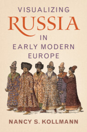
In early modern Europe, the emergence and development of print culture proved a powerful new method for producing and disseminating knowledge of Russia through visual means. By examining the images of Russia found in travel accounts, pamphlets, maps and costume books, this study demonstrates how the visual shaped a dual understanding of these lands: Russia and Russians were portrayed as familiar, but the steppe and forest frontiers were seen as forbidding and exotic. As these images were reproduced and plagiarized in new formats, so too were their meanings – the idea of Russia was one which constantly shifted across genres, usages, and audiences. Nancy Kollmann examines the techniques harnessed by artists and publishers to suggest the authenticity of their publications, and explores in turn how these complex depictions of Russia contributed to Europeans' understanding of themselves.
Chapter 7 explores the explosion of visual sources about Russia in the second half of the sixteenth century. Most notorious of them were the illustrated pamphlets about Ivan the Terrible’s attack on Livonia during the Baltic wars of the 1560s, where Ivan and his army were often depicted as hated Turks. An entirely different image of Muscovy was projected in costume books of the time, where the “typical dress” of Muscovite men and women resembled that of other Europeans, even if it was somewhat fanciful for lack of eyewitness knowledge. Finally, late sixteenth-century maps of Muscovy provide some illustration as well, often repurposing images from Herberstein’s account and costume books.
Chapter 6 further examines the Jenkinson map, remarkable far more for its voluminous illustration than its cartography, which adds little that is new and renders Jenkinson’s route into Central Asia inaccurately. The map includes dozens of small illustrations, explained by almost thirty captions in cartouches, producing a map that informed Muscovy Company merchants of societies they would encounter on the route. The chapter concludes with three images of Central Asian exotica, added to the map for no more obvious purpose than entertainment.
Chapter 9 focuses in on the 100 plus illustrations in Olearius’s 1656 edition. It explores visual precedents for illustrated books (including illustrated Bibles and psalters) in his time, but finds none so copiously illustrated, with illustrations carefully keyed to the text. The chapter analyzes how Olearius curated his illustrations, packing them with scenes, costumes and architecture as mentioned in the adjacent text. Olearius strove for eyewitness representation, and yet elements of trope and borrowed images inevitably crept in to such a large engraving project. The chapter undertakes a careful analysis of the sources of his image of the embassy’s audience with Tsar Aleksei Mikhailovich, linking his imagery with borrowed templates from the famous de Bry family of engravers. The chapter concludes by exploring how the illustrations complement Olearius’s textual argument about the European, Russian and Persian civilizations.
Chapter 1 explores why the sixteenth century was called “ocularcentric,” that is, how imagery came to be considered an authentic representation of truth. Contemporaries recognized a variety of kinds of imagery, some understood to be realistic representations, others as fabulous. It outlines the burgeoning of printed materials – books, maps, pamphlets – in the very first centuries after Gutenberg, focusing on early modern Europeans’ curiosity about describing their world, not only overseas discoveries but “chorographies” of European lands as well. All of this invited illustration, not always well regulated for accuracy. The chapter concludes by exploring how publishers designed early printed books and visual images.
The Conclusion explores the many subsequent images of Olearius’ work as an illustration of how visuality changed in the second half of the seventeenth century, marking a fitting end to our study of how the visual was first introduced into print culture. It concludes with reflections on visual culture in Muscovy of this same era, and the lack of crossfertilization between Russian and European visual art.
Chapter 5 introduces the reader to the map of 1562 and 1566 attributed to Anthony Jenkinson, a merchant and envoy of the joint stock Muscovy Company. The Company had been founded in 1555 in London to capitalize on the unexpected landing of a British explorers in Muscovy’s hinterlands and quickly won trade monopolies with Russia; the chapter introduces the cast of characters (cartographer, engraver, publisher) in the Muscovy Company who collaborated in producing a map based on Jenkinson’s report of his travels through Russia to Persia in 1557 and 1561.
Chapter 4 explores how Sigismund von Herberstein used the visual in his travel account. Working with an accomplished engraver from Nuremberg, Augustin Hirschvogel, Herberstein devised relatively few illustrations for his account. But they were carefully linked to his text and proved widely influential. His portrait of Vasilii III shows evidence of Hirschvogel’s Habsburg portraits done in Nuremberg, but reflects Herberstein’s acquaintance with the Grand Prince. Perhaps most important was Herberstein’s map (1546), considered for the next few decades the most accurate map of Muscovy. The chapter then explores the imagery that Herberstein added in subsequent editions and concludes by tracking how his text, map and imagery traveled into new, sometimes pirated, editions and locations after his death in 1566.
Chapter 8 introduces Adam Olearius, resident scholar at the court of Schleswig-Holstein in the first half of the seventeenth century. His account of travels through Russia to Persia, published first in 1647 and revised and enlarged for an edition of 1656, supplanted Herberstein and continued to be the most influential resource on Russia for a century. This chapter explores how Olearius designed his copiously illustrated book and how he conducted his research, personally visiting sites, collecting material objects and interviewing anyone and everyone in the many languages he mastered. It concludes by analyzing his lengthy travel account as a “Baroque novel” and a morality tale.
Chapter 2 explores Europeans’ first exposures to Muscovy from the late fifteenth century, focusing initially on the Italian humanist Paolo Giovio. His 1525 account of Muscovy was based on interviewing Russian diplomats; Giovio also commissioned a portrait of Grand Prince Vasilii III which became a template for such works thereafter. The chapter proceeds to Maciej Miechowita’s influential account of the Rus’ lands, Muscovy and forest and steppe frontiers; Miechowita established stereotypes of Russia (as familiar if less civilized than contemporary Europe) and the forest and steppe as exotic and barbaric. It concludes with analysis of the earliest maps of Muscovy, by Martin Waldseemüller, Olaus Magnus and Anton Wied.