


Background
Since 2020, historians, geoinformatics scientists and geoarchaeologists within the Interdisciplinary Working Group on Conflict Landscapes (https://www.konfliktlandschaften.uni-osnabrueck.de/idee.html) at Osnabrück University have worked on a research project that combines the concepts of layered landscapes (Saunders Reference Saunders2002; Saunders et al. Reference Saunders2013), GIS-based analyses concerning transformation processes of historical sites, remote sensing and (geo-)archaeological materiality (Saunders Reference Saunders2002; Rass & Lohmeier Reference Rass and Lohmeier2011; Saunders et al. Reference Saunders2013; Passmore et al. Reference Passmore, Harrison and Tunwell2014; Stichelbaut & Cowley Reference Stichelbaut and Cowley2016; Opitz & Herrmann Reference Opitz and Herrmann2018; Stele et al. Reference Stele, Schwickert and Rass2021). We examine traces of the historical ‘conflict landscape’ (Woodward Reference Woodward2014; Stichelbaut & Cowley Reference Stichelbaut and Cowley2016) of the Huertgen Forest in western Germany to detect and document anthropogenic and environmental transformations.
The campaign of the Huertgen Forest formed part of the advance of the US Army into Germany from September 1944 to February 1945. Nevertheless, its events were mostly disregarded by post-war research due to the focus on seemingly more prominent battles, such as the ‘Battle of the Bulge’. The ‘Battle of the Huertgen Forest’, however, is noted today for its comprehensive attrition of the units, the severe casualties and the wrong estimations of leading military personnel concerning the battle's main objectives (Miller Reference Miller1995). In this study, our research area is delimited to the Kall Trail, a critical site within the campaign that connects the villages Vossenack and Kommerscheidt across a steep gorge (Figure 1). During the campaign in November 1944, the Kall Trail served as the US Army's main supply route, but it presented significant logistical challenges due to the valley's difficult terrain. Thus, the Trail became well known in historical narratives.
The course of the Kall Trail, from Vossenack to Kommerscheidt, and location of the research area (basemap by: OpenStreetMap; figure by M. Storch).

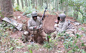
Until now, many dugout positions—presumably of the 28th Infantry Division—are still detectable along the Trail. Consequently, it is frequently targeted by looters who dig for historical artefacts, thereby damaging the sites extensively. Moreover, re-enactors ‘replay’ ground combat by occupying historical field positions, transforming them for their re-enactments, as well as digging new foxholes (Figure 2; Fings & Möller Reference Fings and Möller2016; Wöltering Reference Wöltering, Fings and Möller2016). In causing severe damage to the archaeological evidence, new layers of landscape (Saunders Reference Saunders2002; Saunders et al. Reference Saunders2013; Passmore et al. Reference Passmore, Harrison and Tunwell2014) are created, which are often mistakenly considered to be historical. Similar transformations and looting activity on former battlefields have been subject to previous scientific research and, thus, questions persist on how to approach the problem of ‘disappearing’ historical sites (e.g. Kok Reference Kok2006).
Dugout position transformed by re-enactors at the ‘International Huertgenwald Marsch’, 2016 (photograph by F. Möller).

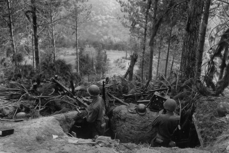
A notable example of these transformation processes is a pit on the west side of the Kall Trail that may have originally been a foxhole associated with the conflict but has been massively transformed by re-enactors and natural erosion (Figures 2, 3 & 4). Re-enactors have presumably copied a mistakenly ascribed photograph (Schultz Reference Schultz1949; see https://alchetron.com/cdn/battle-of-hrtgen-forest-06382017-f5b0-480e-9e91-2410c3518fd-resize-750.jpeg) to the Huertgen Forest campaign—but which actually shows part of a US operation in Grezzano, Italy (1944)—to create a replica dugout position. Figures 3 and 4 show the extent of the pit's transformation regarding its changing depth and appearance, and the pace of natural overgrowth. Today, its surrounding area is also heavily transformed due to extensive deforestation and uprooting caused by storms and bark-beetle infestations in 2020.
Pit considered to be a foxhole on the Kall Trail, February 2020 (photograph by M. Adam).

Same pit as shown in Figure 3, March 2021 (photograph by M. Adam).

Consequently, several fake combat positions have appeared and have become accessible for tourists ‘experiencing’ the battlefield. The juxtaposition of presumably authentic historical traces and modern practices creates an ambiguous scenery that is rarely reflected upon critically. These layered transformations thus contribute to inconsistent narratives on historical events (Möller Reference Möller2016; Stele et al. Reference Stele, Schwickert and Rass2021) that miss reliable evidence, leading to inaccurate interpretations of discovered artefacts and features. Such intentionally and environmentally caused transformations destroy these unique ground monuments irretrievably.
Hence, we intend to develop a systematic, non-invasive approach to detect and document the traces of war and recent transformations as interwoven processes, using remote sensing lidar (light detection and ranging) (corresponding to Van der Schriek & Beex Reference Van der Schriek and Beex2018).
Methodical approach
Our approach in August 2020 was based on analyses of georeferenced historical disposition overlays and military aerial reconnaissance photographs. We also used intelligence reports of the US Army (NARA), pointclouds from terrestrial lidar, Digital Terrain Models (DTM) derived from governmental airborne laser scanning (ALS) and performed systematic ground truthing. The ALS data (point density of approximately 10 points/m2) was acquired in April 2016 by plane (GEOportal.NRW 2020). The data, however, were insufficiently accurate to determine whether the supposed foxhole (Figures 3 & 4)—which has also been documented at least since 2016 (Figure 2; also see the arrows in Figure 5)—or other suspected anomalies in its proximity were extant during ALS data acquisition.
Discrepancy in level of detail derived from (a) airborne-lidar (ALS) and (b) UAV-lidar (data and figure by M. Storch).

To address this problem, we developed our approach in August 2020 and March 2021 using high-resolution Unmanned Aerial Vehicle (UAV)-lidar, with a RIEGL miniVUX-1UAV laser scanner mounted on a DJI Matrice 600 drone. Its spatial resolution (100 points/m2) is 10 times higher than that generated from ALS. Figure 5 shows the sky-view factor visualisation derived from both lidar point clouds (purple dot in Figure 1). Detectable ground anomalies such as the transformed foxhole (Figures 3 & 4) and other supposed dugout positions and pits deriving from uprooted trees—all of which were confirmed by ground truthing—proved to be clearly visible in the detailed UAV-lidar data (see Figure 5).
The combination of high-resolution UAV-lidar with on-site verification enables us to identify, document and analyse systematically the specific terrain anomalies of this Second World War battlefield. This approach will facilitate future interdisciplinary analyses of diverse ‘conflicted’ landscapes, enabling the more efficient data acquisition and higher temporal and spatial resolution that is required to validate interpretations of historical traces and transformation processes. Accordingly, we hope to raise awareness of this important ground monument and heritage site, and to prevent it from further destruction due to thoughtless utilisation or exploitation.
Acknowledgements
We thank Andreas Stele and Thomas Jarmer for their thoughts and suggestions, and Frank Möller, Achim Konejung and Rouven Meidlinger for providing photographs and information on looting activity. We also thank Ian Spurgeon and the DPAA (Defense POW/MIA Accounting Agency) for allowing us access to historical sources.
Funding statement
Financial funding and institutional framing: Landesverband Rheinland (LVR).


 Open access