


Introduction
The Darb Zubaydah (DZ) is a Hajj pilgrimage road stretching from Kufa in Iraq to Mecca in Saudi Arabia (Al-Rashid Reference Al-Rashid1977; Peterson Reference Petersen1994). As part of the ‘Endangered Archaeology in the Middle East and North Africa’ project (EAMENA), a remote sensing survey of the Iraqi section of this tentative World Heritage Site was carried out. Two previously unlocated DZ waystations, al-Qadisiyyah and al-’Udhayb, were identified during this survey (Figure 1). These historic sites are best known from texts describing one of the most famous battles of the early Islamic conquests.
Location of the al-Qadisiyyah survey area in south-western Iraq (MODIS imagery courtesy of NASA, figure by W.M Deadman).

Historical context
In AD 636/637 the Arab Muslims and the Sasanian Empire fought a battle between the fertile Mesopotamian floodplain and the desert. It proved decisive for the Islamic conquest of Mesopotamia, Persia and beyond, and thus holds huge cultural significance in the Arab world. There is a rich body of historical sources relevant to the Battle of al-Qadisiyyah (Yusuf Reference Yusuf1945; Lewental Reference Lewental2011), but six pieces of evidence are key to locating it (Table 1).
References in historical texts to the location of al-Qadisiyyah and their comparison with evidence from the DZ survey.

al-Qadisiyyah survey
The DZ survey was carried out using Google Earth and Bing Maps aerial imagery. Systematic examination of the area between the last known DZ waystation and Kufa revealed a 10km double ‘wall’ feature (possibly a canal) linking a square fortress on the desert fringe and a large settlement associated with a linear fortification system on the edge of the floodplain (Figure 2). Following this discovery, high-resolution KH9 Hexagon satellite imagery of the area was acquired and examined (Figure 3); captured in 1973, these images show the area prior to much modern agricultural and urban development (Hammer et al. Reference Hammer, FitzPatrick and Ur2022). A rapid ground verification survey was also carried out, photographing the main features of each site and recording the presence of any associated pottery, and historical texts were consulted.
Features recorded during the survey (Sentinel-2 imagery courtesy of the European Space Agency, figure by W.M Deadman).

1973 KH9 imagery of the main features discovered (courtesy of the United States Geological Survey, figure by W.M Deadman).

On the western end of the ‘wall’, a fortress with three square defences is likely to be al-’Udhayb (Figure 3). The innermost structure is approximately 30 × 30m with round corner towers. The surrounding wall is 90 × 90m, and the outer earthen defences are almost 160m wide and 10m thick. A smaller structure (25 × 18m) and more ephemeral building remains are visible on the opposite bank of a wadi.
The eastern 6km of the ‘wall’ has largely been damaged by modern agriculture, but the entire 10km length is visible on the KH9 imagery. The earth ‘walls’ are 5–10m wide and set 40–50m apart, narrowing to less than 20m at the western end. Where they terminate, the western line is picked up by an artificial water channel which runs to within 350m of al-’Udhayb. The eastern end appears to terminate at a small wadi channel, less than 1km from a large settlement almost immediately south of Ain al-Hasan that is tentatively identified as al-Qadisiyyah (Figure 3). Abandoned field systems lie on both sides of the ‘wall’.
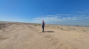
The wall enclosing al-Qadisiyyah is intersected by the remains of a large trench that runs parallel to the edge of the floodplain for over 8km, with the settlement located centrally. The trench is over 10m wide with a spoil rampart on the north-eastern side. Clear, albeit eroded, stretches survive today (Figure 4). The remains of two 30 × 30m watchtowers can be observed along the trench, each lying between al-Qadisiyyah and either terminus.
View looking north along the trench and rampart (photograph by J. Jotheri).

A large square fortification lies on the eastern side of the trench, equidistant between al-Qadisiyyah and the southern watchtower. This probable fortress is approximately 180 × 180m, with long rectilinear block features and a 50 × 40m structure visible inside. This and the al-’Udhayb fortress are morphologically comparable to Sasanian forts from other frontiers (Lawrence & Wilkinson Reference Lawrence, Wilkinson and Sauer2017). More ephemeral rectilinear features on a different alignment survive to the east.
The ground survey observed pottery consistent with a Sasanian/Early Islamic assemblage at each of these sites, but further archaeological investigation is needed to confirm their date.
Locating the battlefield
The agreement between textual references to the locations of al-Qadisiyyah and al-’Ubaydh and the archaeological evidence aerial images is remarkable (Table 1). The historical data may also locate the battlefield; Al-Tabari records that the Sasanian and Arab battlelines were drawn respectively on the bank of a river/stream and “at the wall of Qudays, with the moat/canal behind” (Friedmann Reference Friedmann1992: 89). ‘Qudays’ was probably a fortress (Lewental Reference Lewental2011: 138–40), from which the Arab general commanded his forces (Friedmann Reference Friedmann1992: 27) and for which the square fortification on the eastern side of the trench, or even al-Qadisiyyah, is an excellent candidate. Either places the battlefield between the trench and the palaeochannel (Figure 5).
Probable location of the battle of al-Qadisiyyah (Bing imagery © 2024 Microsoft, figure by W.M Deadman).

Components of a potential Sasanian frontier fortification system have previously been identified in this area, which may include the Khandaq Shapur/Nahr al-Alqamy and a string of forts/waystations, stretching along the desert frontier (Howard-Johnstone Reference Howard-Johnstone, Bernheimer and Silverstein2012; Lawrence & Wilkinson Reference Lawrence, Wilkinson and Sauer2017; Morley Reference Morley and Sauer2017: 273; de Gruchy et al. Reference de Gruchy2021). Detailed field survey of al-Qadisiyyah and al-’Udhayb, and wider remote sensing and geospatial analysis, are planned to further investigate this historic Sasanian/Islamic landscape.
Acknowledgements
Thanks to Ahmed Shubber and Yaser Hamood Hwaat (State Board for Antiquities and Heritage) for their assistance and collaboration, and to Dan Lawrence and Graham Philip for their helpful comments.
Funding statement
EAMENA is funded by the Arcadia Fund.


 Open access