




Introduction
The origins and development of urbanism in Europe during the first half of the first millennium BC have been the focus of an unresolved archaeological debate since the early twentieth century. Broadly speaking, the emergence in Iron Age temperate Europe of large, fortified settlements with regular infrastructure and monumental architecture has been interpreted as the result either of a diffusion of ideas originating in the Aegean and the Levant or as the result of local, independent developments (Kimmig Reference Kimmig, Otto and Hermann1969). The ‘ancient Greek city’ is often seen as the earliest example of urbanism in Europe and was for a long time regarded as the blueprint of urbanisation across Europe.
In this article, I argue that the existence of widespread urbanism on the Greek mainland during the Early Iron Age (c. 1050–500 BC) is questionable and, as a consequence, so is the diffusionist model of the spread of cities from the Aegean into temperate Europe. Using the central Greek region of Thessaly as a case study, I argue that Early Iron Age village communities in Greece chose to organise their defence externally through a network of hilltop refuge sites rather than through settlement nucleation. It was only in the Hellenistic period (c. 310–150 BC) that widespread urbanisation commenced as part of an extensive political programme of imperial control. My argument is that mainland Greece of the Archaic (c. 700–480 BC) and Classical periods (c. 480–310 BC) cannot have served as an urban role model as there is little archaeological evidence to support the wider existence of cities in the region at this time. The urban mega-sites—‘princely seats’ (or Fürstensitze)—of late Hallstatt-period (c. 700–450 BC) temperate Europe appear not only to have formed independently of any Greek model, but also developed urban characteristics centuries before the main phase of urbanisation in mainland Greece.
Cities and urbanism
The challenges of defining what constitutes a ‘city’ are often addressed in the scholarship of ancient Mediterranean urbanism (e.g. Morgan & Coulton Reference Morgan, Coulton and Hansen1997; Osborne Reference Osborne, Osborne and Cunliffe2005: 5–8; Zuiderhoek Reference Zuiderhoek2017: 4, 8). The fluidity of the word and its many culture-specific connotations, however, appear to make scholars reluctant to specify what exactly they understand by the term (Wallace-Hadrill Reference Wallace-Hadrill, Rich and Wallace-Hadrill1991; Hansen Reference Hansen and Hansen1997; Kõiv Reference Kõiv, Kämmerer and Rogge2013: 153; Dimova et al. Reference Dimova, Gleba, Marín-Aguilera, Gleba, Marín-Aguilera and Dimova2021). Yet this has not limited the use of the word. Indeed, discussions of undefined ‘cities’ and ‘towns’ in the Early Iron Age Mediterranean world are common and urbanism is regarded as one of the main cultural characteristics of the period. Consequently, and because so many familiar historical developments occurred at famous ‘cities’ such as Athens, Corinth and Thebes, it is difficult to remove either the term or the concept of the ‘city’ from the study of ancient Greece. The term ‘city’ is often used interchangeably in scholarly literature with ‘polis’ (pl. poleis), a word that carried several meanings in antiquity. Originally, polis implied a stronghold but over the centuries it gradually came to denote ‘citadel’, ‘a community of citizens’ and ‘urban settlement’—sometimes simultaneously (Hansen & Nielsen Reference Hansen and Nielsen2004: 39–46). Research on the ‘ancient Greek city’ is so strongly tied to research on the polis that it is difficult to find a study that claims to be concerned with the former that is not also a study of the latter. As the origins of the poleis (as communities) have been traced back to the Early Iron Age, the beginnings of Greek urbanism have been located in the same period by inference. There is remarkably little archaeological evidence, however, to support the existence of large urban settlements in Greece at this time, a fact that is acknowledged even by those scholars advocating for an early development of urbanism. As one study observes (Morgan & Coulton Reference Morgan, Coulton and Hansen1997: 128), important Archaic poleis such as Sparta, Corinth and Argos display few characteristics that reflect the urban criteria and definitions suggested by Weber (Reference Weber, Martindale and Neuwirth1966), Childe (Reference Childe1950) and others. Addressing this conundrum, scholars have concluded that generalised criteria or definitions—“check-lists of urbanism”—have little relevance to the study of the polis and that ancient cities need to be studied on a more functional basis (i.e. focusing on activities at a site instead of on their features) in order to understand their origins and development (e.g. Osborne Reference Osborne, Osborne and Cunliffe2005: 8; Dimova et al. Reference Dimova, Gleba, Marín-Aguilera, Gleba, Marín-Aguilera and Dimova2021: 2).
Such terminological problems are less evident in the study of the ‘cities’ of Early Iron Age temperate Europe, not least because indigenous or emic vocabularies have not been preserved. As a result, scholarly terminology is consciously technical or etic with no aspiration to historical authenticity. The temperate European urban sites constitute a heterogeneous group, the most prolific of which being the so-called ‘princely seats’ a type of mega-site of the late Hallstatt culture (Collis Reference Collis, Fernández-Götz, Wendling and Winger2014: 17; Fernández-Götz & Grömer Reference Fernández-Götz, Grömer, Gleba, Marín-Aguilera and Dimova2021). On the basis of their large size, layout and infrastructural organisation, they have traditionally been considered to be emulations of Greek urban sites (Kimmig Reference Kimmig, Otto and Hermann1969), but more recent research has argued that they represented an independent development (e.g. Collis Reference Collis, Fernández-Götz, Wendling and Winger2014; Fernández-Götz Reference Fernández-Götz, Zamboni, Fernández-Götz and Metzner-Nebelsick2020: 31; Moore & Fernández-Götz Reference Moore and Fernández-Götz2022: 103–4). Unlike the discussion on ancient Greece, scholars employing archaeological definitions of urbanism tend to agree that the ‘princely seats’ display several of the ‘checklist’ hallmarks of what could be regarded as ‘urban’. As exemplified by the Heuneburg site, ‘princely seats’ could be truly substantial, covering 100ha of ground, with extensive fortifications and regularised street-layout and an estimated population in the thousands (Fernandez-Götz & Grömer Reference Fernández-Götz, Grömer, Gleba, Marín-Aguilera and Dimova2021: 329–31).
Recent discussions on urban developments in temperate Europe have progressed further than those on mainland Greece, which still suffers from a theoretical misconception. The central scholarly issue—that it is difficult to define cities and urbanism without excluding other important communities—constitutes a fallacy. Just as with typologies for pottery styles, burial customs or architectural elements, ‘urbanism’ and ‘city’ are theoretical concepts that require careful definition (Smith Reference Smith2020; contra Osborne Reference Osborne, Osborne and Cunliffe2005: 7). Cities and urbanism are not observable settlement qualities corresponding to ancient terminology. Nor was the term polis ever intended as a descriptive archaeological term (cf. Morris Reference Morris and Storey2006: 32; Osborne Reference Osborne2009: 348), which explains why attempts at identifying ‘polis towns’ through archaeological criteria are unsuccessful (Morgan & Coulton Reference Morgan, Coulton and Hansen1997). Instead, we need to be clearer about what we regard ‘a city’ to be, and to be ready to accept that historically and politically important centres might not qualify as such.
As well as the descriptive checklists of Weber and Childe, there are many other scholarly approaches to defining cities. Functionalist approaches (such as cities being defined by their cultural or administrative functions), for example, have also been advocated (Trigger Reference Trigger, Ucko, Tringham and Dimbleby1972; Fox Reference Fox1977) but as these require historical or literary data often unavailable to the archaeologist, they have found less ready application in the study of ancient societies. In this article, I employ the approach of Smith (Reference Smith, Fernández-Götz and Krause2016) as it seeks to identify early cities using a polythetic set of attributes that serve prescriptively without being limited by over-rigid definitions. Smith's approach is also beneficial in that it provides an explicitly theoretical tool, precisely what is required in the case of ancient Greek urbanism.
Ancient Greek ‘cities’ and Western Thessalian hillforts
The development of urbanism in ancient Greece has traditionally been seen as following a linear and uniform trajectory, with ‘cities’ first appearing in the transition period between the Late Bronze Age and the Early Iron Age, culminating and then declining in the broader Hellenistic period (Glotz Reference Glotz1929; Wycherley Reference Wycherley1962; Winter Reference Winter1971; Collis Reference Collis, Fernández-Götz, Wendling and Winger2014: 16). The results of an extensive compilation in the 1990s–2000s of the archaeological and literary evidence for poleis in the Archaic and Classical periods (Hansen & Nielsen Reference Hansen and Nielsen2004) appeared to support this trajectory. The current scholarly consensus is essentially that urbanised communities had become the norm in the Greek world by the fifth century BC (Morris Reference Morris and Storey2006; Crielaard Reference Crielaard, Raaflaub and van Wees2009; Zuiderhoek Reference Zuiderhoek2017: 32; Woolf Reference Woolf2020: 188).
As outlined above, however, this narrative of urban development suffers from a lack of definitions. Employing Smith's (Reference Smith, Fernández-Götz and Krause2016) argument for the identification of early cities, an assessment of the archaeological evidence from the Greek mainland shows little direct evidence for widespread urbanism before the late fourth century BC. In contrast, there is ample evidence supporting the presence of scattered village communities across this region during the Archaic and Classical periods. This is largely ignored in scholarship. Indeed, the evidence from Corinth (Tzonou Reference Tzonou, Gleba, Marín-Aguilera and Dimova2021), Athens (Osborne Reference Osborne, Gleba, Marín-Aguilera and Dimova2021) and, most famously, Sparta (Cavanagh Reference Cavanagh and Powell2018), suggests that even the most influential Archaic-period centres might not have been urbanised, consisting instead of village clusters. It is only towards the end of the Archaic period (c. 480 BC) that evidence of settlement nucleation can be recognised at these and a handful of other sites (Kõiv Reference Kõiv, Kämmerer and Rogge2013: 164). The extent of this nucleation is poorly studied and addressed, with few published excavations directly supporting densely settled environments (Morris Reference Morris and Storey2006: 40). Most arguments for urban sites in the Archaic period instead depend on indirect evidence such as the locations of cemeteries (Cavanagh Reference Cavanagh and Powell2018: 67–8). Historical and epigraphic evidence for political organisation without indications of extensive settlement nucleation can be found in most regions of the Greek mainland, sometimes resulting in federal structures (Morgan Reference Morgan2003); it is only from the start of the Hellenistic period that any tendencies towards urbanisation can be discerned.
In practice, because early developments at the large centres of mainland Greece are often obscured by the archaeological strata of later chronological periods, the key to understanding the situation in the Early Iron Age must consequently be sought at sites elsewhere, such as Western Thessaly (Figure 1). In contrast to the more mountainous landscape of other parts of Greece, this region is centred on a vast plain, extending approximately 80km from north-west to south-east.
Western Thessaly within modern Greece with sites mentioned in the text: 1) Plateia Rachi; 2) Vlochos; 3) Chtouri; 4) Xylades (map by author).

As is the case elsewhere in Greece, research on the earliest historical periods in this region has focused on Homeric toponyms, traditionally seen as indicative of ‘cities’, often by means of the back projection of the later Hellenistic settlement distribution onto earlier centuries (Kirsten Reference Kirsten1950; Decourt Reference Decourt1990: 162–74; Helly Reference Helly1995: 80–96). The physical existence of these literary ‘cities’ has been questioned (Morgan Reference Morgan2003: 17, 71) and the archaeological record offers little to support the argument that there was any urban development in the region prior to the late fourth century BC (Rönnlund Reference Rönnlund2023: 19–25). A lack of urban sites does not imply an absence of complex societies, however. Textual sources and archaeological evidence indicate that Archaic and Classical Thessaly was a flourishing region, well-integrated in the Greek world and benefiting from an abundance of pastures and arable land (cf. Aston Reference Aston2024). Named political communities (often assumed to represent poleis) are attested from the late sixth century BC and issued coins from the early fifth century onwards, indicating the existence of local political organisation (Rönnlund Reference Rönnlund2023: 35).
Evidence for settlement dating from the Early Iron Age through to Classical period has only become clear in the past two decades as a result of rescue excavations and subsequent reassessments of older excavations. Much of this research was prompted by the finds from the site of Kalathia, where road construction revealed a large village inhabited from the seventh to the mid-fourth century BC (Karagiannopoulos Reference Karagiannopoulos2018: 115–22). Other contemporaneous settlements have been identified at locations including Metamorfosi (Tsiouka et al. Reference Tsiouka, Kokonaki and Koutsofiti2023), Petrino (Hatziangelakis Reference Hatziangelakis and Tsagaraki2007: 32), Ermitsi (Nikolaou Reference Nikolaou1997: 235; Hatziangelakis Reference Hatziangelakis and Tsagaraki2007: 41–2), Orfana (Rondiri Reference Rondiri1998), Chtouri (Karapanou Reference Karapanou2020: 1450), Farsala (Karapanou Reference Karapanou2011: 542–3) and Neo Monastiri (Frousou Reference Frousou and Gegle2008). Sites such as these reveal that settlement during the Archaic and early Classical periods comprised of dispersed villages but no urban sites, as I argue to be the case elsewhere in Greece. During these periods, important sanctuaries were often located far from villages and functioned as the principal foci of political interaction and, in the later Classical period, for the display of written decrees (Morgan Reference Morgan2003: 76).
Among the numerous ancient hilltop fortifications in Western Thessaly, a number of sites stand out because of their overall plan and architecture. The most distinctive characteristics of these sites are their enceintes of rough polygonal masonry and an absence of adjoined towers, contrasting with the finely executed masonry walls and numerous towers of the fortified sites of the third century BC in Thessaly and Greece generally. The walls of these enceintes follow the contour line to enclose a hilltop resulting in a sinuous plan with no sharp corners. The enclosed areas vary in size from just under 1ha to more than 21ha, largely determined by the size of the chosen hilltop. The number of such hillforts known in this region is currently 30 (Figure 1), though it is likely that further examples will be identified. In contrast with the typical scheme of late Classical and Hellenistic fortifications, the ramparts of these earlier sites appear not to have enclosed any areas of habitation. There are no reported traces of contemporaneous settlement within the ramparts, nor are they surrounded by burial grounds. Notably, these sites have no access to sources of fresh water and they occupy exposed locations in the landscape. Taken together, these observations challenge the view that these sites constituted the fortified ‘upper cities’ of larger unfortified ‘lower cities’ during the Archaic period (Kirsten Reference Kirsten1950: 288–9; Winter Reference Winter1971: 6; Marzolff Reference Marzolff1994: 256). Indeed, there is no archaeological evidence supporting the existence of any contemporaneous urban settlements either within or even close by these hillforts.
Western Thessalian hillforts: case studies
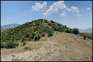
Four examples of ancient hilltop enclosures typify this category of sites (see Figures 1 & 2). The hilltop site of Plateia Rachi (Dafi & Rönnlund Reference Dafi, Rönnlund and Ainianin press) dominates a fertile valley enclosing the summit of a ridge 1.2km north-west of the modern-day village of Zarkos (Figure 3). The latter is the site of the Hellenistic urban site of Phaÿttos. The hilltop site and the later city are therefore separated by the width of the valley. The extant walls of the Plateia Rachi enceinte comprise rough polygonal masonry. The limited quantities of associated collapsed rubble are insufficient to project a wall of any great height, so it can be suggested that the stone wall formed a base originally topped with a mud-brick superstructure (Figure 4).
The earliest phases of the fortified sites of Plateia Rachi, Vlochos, Chtouri and Xylades. Arrows mark approximate locations of gates. Curve equidistance 10m (plan sketches by author after plans and descriptions in: Béquignon (Reference Béquignon1932: 122–91); Decourt (Reference Decourt1990: 191–6); Karachalios et al. (Reference Karachalios, Karapanou and Noula2018: fig. 15); Vaïopoulou et al. (Reference Vaïopoulou2020: fig. 18); Dafi & Rönnlund (Reference Dafi, Rönnlund and Ainianin press); and Greek army maps and aerial photographs).

The ridge of Plateia Rachi at Zarkos from north-west (©Hellenic Ministry of Culture and the Hellenic Organization for the Development of Cultural Resources; panoramic photograph by author).

Fortification wall on the ridge of Plateia Rachi (©Hellenic Ministry of Culture and the Hellenic Organization for the Development of Cultural Resources; photograph by author).

There are no freshwater sources on the ridge and the springs at its foot are not perennial. Within the enceinte, there are no ceramic materials visible on the surface nor any architectural remains of habitation. Based on the overall plan and form of the fortifications (cf. Lang Reference Lang1996: 26–32; Frederiksen Reference Frederiksen2011: 91–9), the site most probably dates to the Archaic period.
Some 12km south of Plateia Rachi is the hill of Stroggylovouni at Vlochos, a large limestone dome on the plain (see Figures 1 & 5) well known for the large late Classical and Hellenistic city below its southern slopes. The earliest traces of activity at the site, however, relate to a 11ha fortification on the hilltop enclosed by a substantial 1.3km-long wall (Vaïopoulou et al. Reference Vaïopoulou2020: 28–32). Surface survey of the hilltop has recovered virtually no ceramic material. Stylistically, the fortifications can be dated to the Archaic period. There are no freshwater sources on the hill nor on its slopes. The wall is constructed of uncoursed, roughly hewn polygonal masonry approximately 3m in width and preserved in places to more than 2.5m in height (Figure 6). As at Plateia Rachi, it is believed that wall was topped by a now lost mudbrick superstructure (Vaïopoulou et al. Reference Vaïopoulou2020: 32). Two monumental terraced roads, up to 5m in width, lead up the lower slopes to two large gates through the hilltop fortifications; these suggest the site was used for the evacuation of a large population of people and, probably, also of livestock (Vaïopoulou et al. Reference Vaïopoulou2020: 32–4). Recent fieldwork at the site has produced no evidence of any settlement contemporaneous with the fortifications on the hilltop.
The hill of Stroggylovouni at Vlochos, as seen from south (©Hellenic Ministry of Culture and the Hellenic Organization for the Development of Cultural Resources; photograph by author).

Fortification wall on the hill of Stroggylovouni at Vlochos (©Hellenic Ministry of Culture and the Hellenic Organization for the Development of Cultural Resources; photograph by author).

The largest hillfort in the region, encompassing 21ha, lies on the low hill of Chtouri (see Figures 1, 2 & 7), 10km north-west of Farsala. There are no water sources within the enclosed area but a copious spring emerges at the foot of the hill. The walls of large polygonal masonry are approximately 3m wide (Figure 8). With the exception of the area immediately around a Hellenistic fortlet on the summit of the hill, there is very little surface ceramic material on the hilltop and excavations and surveys have yielded no settlement remains within the enceinte (Béquignon Reference Béquignon1932: 124–5; Decourt Reference Decourt1990: 102). Approximately 200m west of the hill, a sizeable sub-Mycenaean to Archaic-period settlement and a small sanctuary have been excavated on a low ridge above the plain separated from Chtouri by a marshy area (Béquignon Reference Béquignon1932: 139–48). A Geometric to early Archaic-period settlement as well as a section of a possible fortification wall have been located some 500m further from the hill, indicating the presence of a fortified village at the location (Karapanou Reference Karapanou2020: 1450).
The hill of Chtouri from the north-west (©Hellenic Ministry of Culture and the Hellenic Organization for the Development of Cultural Resources; panoramic photograph by author).

Fortification wall on the hill of Chtouri (©Hellenic Ministry of Culture and the Hellenic Organization for the Development of Cultural Resources; photograph by author).

The final of the four hilltop sites presented here is a fortification on the hill of Kastro at the village of Xylades, 12km east of Farsala (Figures 1, 2 & 9). Prior to agricultural work in the second half of the nineteenth century, a wall enclosed the entire hilltop; approximately half of the wall circuit has now been lost to the bulldozers. The extant though poorly preserved half of the enclosing wall follows the contour in a long curve and comprises large polygonal masonry (Decourt Reference Decourt1990: 191–2; Figure 10). There are two gates, entering the fortified area to the north and south. The extent of the area originally enclosed must have been more than 18ha but, apart from a small Hellenistic-period walled enclosure—possibly a sanctuary—at the highest point, there are no surface remains of settlement activity on the hill. Instead, abundant surface pottery in the fields to the east suggests that there was a Classical-period settlement immediately below the hill (Decourt Reference Decourt1990: 194–5).
The hill of Kastro (centre) at Xylades from north, the river Enipeas in the foreground (©Hellenic Ministry of Culture and the Hellenic Organization for the Development of Cultural Resources; photograph by author).

Fortification wall on the hill of Kastro at Xylades (©Hellenic Ministry of Culture and the Hellenic Organization for the Development of Cultural Resources; photograph by author).

Exactly when these four hilltop sites fell out of use is unclear, but there is nothing to indicate that they were adapted in response to developments in Classical- and Hellenistic-period siege warfare. Plateia Rachi appears to have been fully abandoned, and the large intra-mural spaces at Chtouri and Xylades were used only for small isolated non-settlement fortification installations. It is only Vlochos that went on to form the akropolis of a city some two centuries later—but the new urban fortifications did not utilise the old enclosure wall, nor was the hilltop used for any extensive habitation (Vaïopoulou et al. Reference Vaïopoulou2020: 22–3).
Hence, the situation in Western Thessaly is quite different from the commonly accepted narrative of urbanism and urban development in the region and across Greece generally (Marzolff Reference Marzolff1994; Zuiderhoek Reference Zuiderhoek2017; Woolf Reference Woolf2020). The evidence from the four sites discussed above indicates that the most prominent walled sites in the region were neither settlements nor the ‘upper cities’ of imagined ‘lower cities’. The exposed topographical positions and lack of freshwater sources, as well as the absence of architectural remains and surface materials within their walls, point towards an interpretation of these hilltops as sites of refuge. These hillforts, together with contemporaneous village sites in the surrounding valleys, present a picture similar to Ehrenberg's (Reference Ehrenberg1969: 23) vision of Early Iron Age Greece, where communal hillforts acted as the “citadels of refuge” for “cantonal unions” of dispersed village populations in times of conflict. It is probable that the hillforts were instrumental in the creation of these unions, being what Morgan (Reference Morgan2003: 49) describes as “big sites”, and that the ramparts functioned in the enaction and negotiation of local identities. The collective construction of the fortifications—probably requiring many years of communal labour—must have created an enhanced sense of shared identity. The results provided scattered village populations with a central, visual focal point in the landscape, transforming the abstract notion of the ‘cantonal union’ into something real and tangible.
Conclusions
The Early Iron Age mega-sites of temperate Europe, such as the so-called ‘princely seats’, were long argued to be local emulations of an idealised Greek model or, at the very least, inspired by urban developments in the Aegean. Greek colonial establishments in the western Mediterranean supposedly served to direct urban ideals from cities of the Greek homeland into Central and Western Europe. More recent scholarship demonstrates that urbanism in Early Iron Age temperate Europe did not follow the same developmental trajectory as Mediterranean cities and should therefore probably be regarded as a distinct local phenomenon.
Turning to Greece, the situation in Thessaly discussed in the present article supports this latter perspective. Even if the plans of Archaic Greek hilltop fortifications are reminiscent of the ‘princely seats’ of temperate Europe, it is apparent that the former did not constitute centralised settlements. Thessalian and other mainland Greek communities of the pre-Hellenistic period were evidently polyfocal, with settlements scattered across valleys and plains, refuge fortifications on hilltops and sanctuary sites for political gatherings. In contrast to the suggested situation at the ‘princely seats’ of temperate Europe (cf. Fernández-Götz Reference Fernández-Götz, Zamboni, Fernández-Götz and Metzner-Nebelsick2020: 35), the Archaic and early Classical settlements and the fortified sites of Thessaly were thus not the locations from where ‘government’ was enacted, nor the centres of communal life. In the terms of Smith's (Reference Smith, Fernández-Götz and Krause2016) definition of early cities, many of the Western and temperate European communities of the Early Iron Age were consequently far more ‘urbanised’ than their contemporaneous Greek counterparts. With little discernible urbanism in mainland Greece prior to the late fourth century BC, it appears likely that urban-like settlements appeared first in the western Mediterranean and temperate Europe. It was only in the early Hellenistic period that cities became common in Greece via a deliberate political programme that aimed to make the economy more effective by transforming village communities into taxable urban centres (Boehm Reference Boehm2018; Rönnlund Reference Rönnlund2023).
A clearer definition of what is meant in archaeological contexts by a ‘city’ reveals that temperate European urbanism was probably not diffused into the west from mainland Greece. The potential role of colonial Greek, Etruscan or Punic settlements of the western Mediterranean is probably a more productive line of enquiry, though the question of whether any diffusion of urban ideas occurred at all remains open. The archaeological evidence suggests that the urbanisation of the Greek mainland developed only through the imperial policies of the early Hellenistic period; a situation that has parallels with the subsequent Roman empire. Cities in these contexts were rarely organic or spontaneous developments, but rather a deliberate strategy implemented by a supra-regional power to reconfigure local society to fit an imperial agenda. It is tempting to draw parallels with the Early Modern period, where cities across the western hemisphere were instrumental for the implementation of colonial rule. Recognising that the wider urban development of Greece dates back only to the fourth century BC requires us to rethink fundamentally, not only about the history of Greek social and political development but also to revisit the connections between urban developments in the Mediterranean and temperate Europe more widely.
Acknowledgements
I thank the Ephorates of Antiquities of Karditsa, Trikala and Larisa for granting permission to publish photographs of the sites in their respective regions. The rights to the depicted monuments and sites belong to the Hellenic Ministry of Culture, law no. 4858/2021 and the photographs are published with permission. The site of Plateia Rachi at Zarkos is under the jurisdiction of the Ephorate of Antiquities of Trikala, permit issued 27-07-2023. The site of Stroggylovouni at Vlochos is under the jurisdiction of the Ephorate of Antiquities of Karditsa, permit issue no. 100736/06-03-2023. The sites of Chtouri at Polyneri and Kastro at Xylades are under the jurisdiction of the Ephorate of Antiquities of Larisa, permit issue no. 604055/15-12-2023. The topographical data (digital elevations models) used for the plans were graciously provided by the Greek National Cadastre Service.
Funding statement
This article was written at the University of Thessaly and the Swedish Institute at Athens during my time as a Wenner-Gren fellow.


 Open access

