


Introduction: the archaeology of the First World War as mimicry
Marne, Somme, Ypres, Verdun, Gallipoli: all are indisputable symbols of the Great War, imprinted in the European historical consciousness. These battlefields are today perceived as heritage sites, and their locations respected as memorials of the destruction and atrocities inflicted by war (Winter Reference Winter1995; Wilson Reference Wilson2013). The material relics of the First World War have long drawn the attention of archaeologists. Some have focused on the evolution of fortifications, tactics and weaponry, while others have searched for the lost graves of fallen soldiers, or attempted to refine the knowledge recorded in documentary sources (e.g. Saunders Reference Saunders2002, Reference Saunders2007; Brown Reference Brown2005). There are also studies on the material dimensions of the daily experiences of individual soldiers—including their creativity and their struggles with trauma and death—as well as those of civilians whose lives were ruined by war (Winter Reference Winter, Canning, Lehman and Winter2004; Saunders Reference Saunders, Bender and Winter2010). These approaches are inspiring, but radically different from our own. The project presented here applies the archaeological process to the material traces of the First World War on the forgotten Eastern Front, both to learn more about them and, above all, so that they may become archaeological monuments worthy of greater social recognition and protection. In our understanding, such steps require a solid programme of remote sensing and field research, along with a strong commitment to the dissemination of knowledge about this difficult past and its terrible legacy.
The archaeology of conflicts can be seen as one method of coping with such a legacy. Archaeological narratives mimic difficult pasts by presenting blurred and selective images of military engagements, based on fragmented and decaying material traces that are detached from the distant and troubled past. Such legacies are often approached as a surreal oddity rather than as a relic of something that really happened. Similar phenomena can also be observed within mass culture, literature or cinematography, which seek to grasp ‘the unthinkable’ through symbolism, metaphors and other means of expression (Zalewska Reference Zalewska2013, Reference Zalewska2017: 69–70). Messages about wars and their aftermath without such treatments and parallels would be unbearable for contemporary societies.
Archaeological research—in this case focussed on the First World War—can have an applied and affirmative effect, being stimulating, socially valuable and culture-forming. The material remains of such troubled pasts can be approached in at least two ways: either by studying the past to enrich factual knowledge through an orientation to the past rather than the future, or, conversely, by engaging with the present by asking questions about the (material) memories of conflicts and their significance in the modern world (Hall et al. Reference Hall, Basarin and Lockstone-Binney2010; Wilson Reference Wilson2013; Zalewska Reference Zalewska2013, Reference Zalewska, Stichelbaut and Cowley2016). The remains of military conflicts can be studied through their entanglement with socio-cultural practices (González-Ruibal Reference González-Ruibal2008, Reference González-Ruibal2019). Such a perspective draws inspiration from other disciplines, such as sociology, cultural anthropology and memory studies.
This article seeks to reconcile both approaches, presenting selected outcomes of archaeological research on the historical battlefield on the Rawka and Bzura Rivers (1914–1915) of the Eastern Front. We argue that the material remains of past conflicts alone do not result in their inevitable acceptance, appreciation, understanding and commemoration. We raise questions about the relationship between social and material memory, the landscape as witness, and identity.
The Battle of the Rawka and Bzura and its historical background
At the outbreak of the Great War, the Poles, who had lost their independence nearly 120 years earlier, came under the control of the Russian, German and Austro-Hungarian states, and were soon conscripted into the armies of the three occupiers. It is estimated that over 3.5 million Poles were enlisted; over 500 000 lost their lives and 800 000 were injured. The exact number of soldiers missing in action and civilian casualties remains unknown (Kozłowski & Wrzosek Reference Kozłowski and Wrzosek1983; Zalewska & Czarnecki Reference Zalewska and Czarnecki2016).
The war on the Eastern Front in the territories of present-day Poland began in early August 1914. The German army advanced rapidly from the region of Silesia in an easterly direction, capturing the western cities of ‘Russian Poland’. At the same time, East Prussia was taken by the 1st and 2nd Russian Armies. This front was opened partly as a response to a French request to alleviate intense fighting in the west, with the aim of forcing the Germans to redirect a significant number of troops from the Western Front to the eastern flank. This, however, did not bring the expected breakthrough.
After the defeat of the 2nd Russian Army at Tannenberg between 26 and 30 August 1914, the Eastern Front line stretched from East Prussia (at that time under German rule), through central Poland (the former Kingdom of Poland occupied by the Russians) and Eastern Lesser Poland (occupied by the Austro-Hungarians) to the Carpathians (Figure 1).
The Eastern Front in modern Poland on 26 April 1915. The black square marks the area of the Battle of the Rawka and Bzura (fragment of the map Die Operationen des Jahres 1915: die Ereignisse im Winter und Frühjahr: mit vierzig Karten und Skizzen Bd.7 die Front gegen Russland Karte 18. Berlin 1931) (courtesy of Wielkopolska Biblioteka Cyfrowa).

A strategic goal of the German army was to capture the cities of Łódź and Warsaw. In September 1914, Austrian and German forces started a joint offensive known as the Battle of the Vistula River. They were, however, outnumbered by the Russian forces and the plan failed. The next offensive began in November 1914. On the eve of the operation, the Germans pulled support from the Western Front and rushed troops to the Eastern Front. The Russian advantage gradually dissolved. On 29 November, the remaining Russian forces were ordered by their Supreme Command to withdraw to stable positions at the rivers Rawka, Bzura, Pilica and Nida. Łódź finally surrendered on 6 December 1914. By 19 December, the Russian troops—having sustained great losses—had withdrawn to the designated defensive lines (Bortnowski Reference Bortnowski1969: 189).
At the end of the Łódź Operation—considered one of the greatest manoeuvre battles of the First World War—the combat evolved into static trench warfare, lasting seven months. At this stage, the situation on the Eastern Front became similar to the stalemate of the Western Front (Zalewska & Czarnecki Reference Zalewska, Czarnecki and Zalewska2019a: 27–28). The 17km-long fortified positions of the 1st and 2nd Russian Armies were continuously attacked by the 9th German Army, which, although smaller, was better organised and had significant artillery superiority (Figure 2). During the battle, the German army experimented with chemical weapons from early January 1915. Initially, ‘Ni-Stoff’ irritants and ‘T-Stoff’ tear gasses were used to a limited extent. The first larger scale chemical attack came on 31 January 1915, when the German army employed 18 000 artillery shells filled with ‘T-Stoff’. Later, on 31 May, 12 June, and 6 and 7 July 1915, chlorine gas was used in the Bolimów area. Due to changing wind directions, the gas injured combatants on both sides (Kaliński Reference Kaliński2015; Zalewska Reference Zalewska, Stichelbaut and Cowley2016; Zalewska & Czarnecki Reference Zalewska and Czarnecki2016, Reference Zalewska, Czarnecki, Saunders and Cornish2021). The battle was also fought underground: Russian soldiers built several mineshafts and detonated explosives beneath enemy lines, causing terror among the German troops.
The area of the Battle of the Rawka and Bzura, with vectorised relics of field fortifications registered during research by the ‘Archaeological Revival of the Memory of the Great War’ (ARM) project (based on airborne lidar scanning (ALS) and aerial photographs). The case study area is marked by the red square (figure by G. Kiarszys).

The fighting on the front ended in mid July 1915. The Russian troops quietly abandoned their positions and marched eastwards, with the German troops in pursuit. Warsaw was soon taken and the front moved several hundred kilometres to the east.
The long fight left behind a devastated landscape in the Rawka and Bzura region, with hundreds of kilometres of trenches, thousands of shelters and artillery craters, human remains, abandoned weaponry, countless war cemeteries and destroyed villages and towns, as well as thousands of war-scarred civilians. Over 100 years later, the Great War's Eastern Front in Poland remains largely forgotten and the conflict is still defined by some Poles as ‘not our war’, or ‘the war of the partitioners’ (Górny Reference Górny2014; Zalewska Reference Zalewska2017: 62–63).
Imaging the relics of trench warfare
This article draws on the outcomes of the ‘Archaeological Revival of the Memory of the Great War’ project. Between 2014 and 2018, researchers studied the lives and deaths, and the material and social memories, of the military and civilians caught in the conflict. Over 250km2 of the Rawka and Bzura battlefield were surveyed and over 20 000 finds collected and analysed. The historical events and associated material remains were investigated using archaeological, anthropological and documentary data, including remote sensing, DNA and isotope analyses, interviews with descendants of the local population and studies of previously unknown archival material.
The Rawka and Bzura battlefield site has experienced varying degrees of change over the last century. The southern part is now mostly forested, while a much larger northern portion consists of arable fields, pasture and orchards, with numerous villages. The varying state of archaeological preservation had a significant impact on our choice of prospection methods. Within the forested areas, some remains of trenches and dugouts survive almost intact. Well-preserved military landforms were detected efficiently by airborne lidar and field survey. In the northern area, however, nearly all traces of combat have been levelled, but it was still possible to detect some remains of the conflict using fieldwalking, geophysical survey or, in limited circumstances, excavation. Two flights were undertaken in 2016 and 2018 to obtain aerial photographs to help map and interpret cropmarks, soilmarks and earthworks (Kiarszys & Rączkowski Reference Kiarszys, Rączkowski and Zalewska2019). We also undertook intensive searches of Polish and overseas archives. One of the most informative sources was the Bundesarchiv-Militärarchive Freiburg in Germany, a collection of around 130 oblique reconnaissance aerial photographs of the battlefield taken by the German Feldflieger-Abteilung 17 (Czarnecki Reference Czarnecki and Zalewska2019: 182–84). All the spatial data gathered were processed, integrated and analysed using GIS (Zalewska Reference Zalewska and Zalewska2019).
In this article, we discuss a 1.5km-long section of the frontline, located in the forested landscape near the village of Joachimów-Mogiły (Figures 2–3). It was established following heavy fighting at the end of February 1915 and was used until July 1915 (Zalewska et al. Reference Zalewska, Czarnecki and Kiarszys2019: 68–69). During the months of stalemate, the field fortifications were developed and intensified continuously by both sides. At the same time, both armies pursued destructive and predatory activities at the expense of the local population. When the front finally shifted east, the area was left largely as wasteland.
The case study area. Section of the frontline in the vicinity of Joachimów-Mogiły (figure by G. Kiarszys).

After 100 years, this landscape, with its traces of war, still provides an exceptional insight into the spatial organisation of the frontline in the initial phases of the conflict. While most of the early fortification systems of the Western Front were transformed or destroyed as the land was taken back into agricultural use or saw further combat, the surface relief of the area of Joachimów-Mogiły remains, to a large extent, as it was immediately after the battle.
At first sight, the field fortifications of the two armies look relatively similar. Upon close inspection, however, meaningful differences may be observed (Figure 3)—the consequences of the different approaches to trench warfare used by each side. During the early stages of the conflict, a key German principle was to garrison as many troops as possible within the first (or firing) trench line, as holding this line was considered crucial (Stichelbaut Reference Stichelbaut2009: 182–83). Earthen and wooden shelters were therefore built within the firing trench, which was originally located on the edge of no man's land to provide cover from exploding artillery shells (Figures 3 & 4A). Similar dugouts were also located along the second and third trench lines, and along the communication trenches. In comparison, the Russian firing trench was equipped with fewer dugouts, as the Russians were more inclined to keep most of their troops dispersed to the rear, until needed (Figures 3 & 4B).
Selected features of the field fortification system registered by ALS (Sky-View-Factor (SVF)): A) close-up of the German firing trench and circulating trench, with a number of dugouts and listening posts; B) Russian firing trench, with distinctly fewer shelters and less sophisticated construction of listening posts. Both German and Russian firing trenches lack traverses within the presented sections; C–D) different types of traverses used in the construction of secondary trenches (figure by G. Kiarszys).

About 30m behind their firing trench, German troops constructed a parallel, continuous trench (Figure 4A) that was also equipped with numerous shelters, in order to further extend the number of soldiers garrisoned in the direct vicinity of the frontline. Short communication trenches connected both of these lines. Fortification works also continued in advance of the firing trench: the German army built several listening posts approximately 40m into no man's land, some of which could also serve as saps (quick assault exits). These posts were later connected with a straight trench, creating a new ‘quasi first line’. In comparison to the German defences, the Russian firing trench was primarily a single line, with short sections of circulating trenches and fewer shelters (Figure 4B). The Russian troops also constructed listening posts, but never connected them into a single line. Within the area discussed, the width of no man's land ranged from 80–150m.
The German and Russian armies placed their secondary lines of fighting trenches approximately 300–400m behind the first firing trench. These were linked by several long communication trenches that ran perpendicular to the frontline. Well-linked secondary trenches also hosted facilities, including field kitchens, regimental and battalion headquarters, dressing stations, latrines and military supplies warehouses—all organised in cramped dugouts.
Many of the trenches within this zone were not constructed in accordance with the regulations of contemporaneous military manuals. Different variants of traverses (e.g. zigzag and U-shaped) were used in trench warfare to divide the trenches into shorter sections for defence purposes and better protection of the troops from shell explosions and rifle fire. The firing trenches on both enemy sides, however, lacked regular shooting bays as well as traverses. This reduced the protection from flanking fire and shell explosions significantly (Rowecki Reference Rowecki1920: 20–21 & 49–50). This may suggest that some of the defences were built in haste and under enemy fire, rather than indicating a lack of knowledge of the rules for the construction of field fortifications. In the case of the secondary trench lines, some irregular traverses of different types can be observed (Figure 4C–D).
Directly behind the rear trench lines, both sides built numerous field camps for troops sent to the frontline combat positions (Figure 5). These facilities consisted of small rectangular dugouts, constructed in long parallel lines. Another frequent feature of these rear positions were field artillery emplacements, with associated covering trenches and ammunition dumps (Figure 6A–B). Further to the rear, the field camps become larger. The fortifications of the second line of defences were located approximately 4km from the frontline. These were designed to defend the main communication routes, road crossings and elevated areas. Within this second line of defence, military transit camps and warehouses were situated along the roads and in ruined villages. Most of the roads in the region were narrow and intense use soon led to erosion. The major supply lines can be identified on the 1915 aerial photographs as wide, pale-coloured linear features (Figure 6B). Temporary bridges and river crossings were also built to facilitate communication over wetlands. In a sense, the spatial ordering of the field fortifications may be characterised as standardised, but with local differences sensitive to varying topography and miscellaneous tactical situations.
A–B) Relics of First World War field camps registered by ALS (SVF) (figures by G. Kiarszys); C–D) archival photographs of dugouts from field camps located within the area of study (courtesy of J. Czarnecki).

Field artillery emplacements and the results of artillery fire in the case study area: A) relics of Russian artillery emplacements (ALS (SVF)); B) German reconnaissance aerial photography of Russian artillery positions taken on 16 June 1915. One of the main supply lines is visible in the upper part of the image (Department of Military Archives in Freiburg, BArch PH19, p.146); C) the explosion craters of concentrated artillery fire preserved in the modern landscape (ALS (SVF)); D) artillery craters and trenches visible in German aerial photography taken on 7 May 1915 (BArch PH19, p.002) (figure by G. Kiarszys).

The landscape perspective as presented gives only a generalised idea of the frontline organisation. We are also aware that such descriptive narration dehumanises the battlescape, as it focuses on the material dimension of the ‘drama’ and neglects the significance of the ‘actors’—the soldiers and civilians. In this context, small and less prominent artefacts, buried just under the ground surface, hold great emotional resonance. Studying such objects, however, is neither comfortable nor straightforward (Zalewska Reference Zalewska and Zalewska2019: 410–11).
Over a century after the battle, the traces of combat are still clearly visible in the landscape. Knowing the history of the conflict, we were unsurprised that the most numerous categories of artefacts from our test trenches were the remains of ammunition, bayonets, cold steel, artillery shell fragments, and shrapnel and grenades. What most moved the many people involved in the archaeological process, however, were scraps of the soldiers’ regulation equipment, lost personal belongings, abandoned tools and the remains of the living and sanitary amenities (Figure 7). These fragmented and decaying artefacts add an emotive material dimension to the battlefield site and its tangle of tight, airless, dark trenches and dugouts into which the soldiers were crammed for unbearably long periods of time.
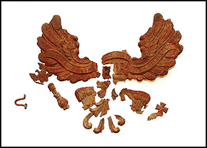
Examples of selected artefacts found in the Joachimów-Mogiły area during archaeological fieldwork: A) eagle from a German military uniform; B) fragment of artillery shell; C) bullet stuck in a tree; D) pocket contents of a fallen soldier of the Russian army: candle, pencil, firelighter, wooden candlestick and matches; E) soldier's kit: fork and spoon set; F) caltrop used as a trench obstacle; G) button from a Russian uniform; H) crucifix (figure by A. Zalewska).

From my rotting body, forest shall grow
We argue that the former Rawka and Bzura battlefield should be treated as a transnational historical monument and, in several areas, as a vast war cemetery (Zalewska & Kiarszys Reference Zalewska, Kiarszys, Zalewska, Scott and Kiarszys2017). The preserved battlescape is not only a material relic of the trench warfare and military techniques of the First World War, but also a witness to mass death (Zalewska & Czarnecki Reference Zalewska, Czarnecki, Košir, Črešnar and Mlekuž2019b). The soil is filled with countless fragmented human remains (Marchewka et al. Reference Marchewka, Konopka, Szalip-Myśliwiec, Mucha and Zalewska2019).
Alongside the numerous remains of field fortifications, some of the most visible landmarks are the resting places of fallen soldiers. In July 1915, soon after the withdrawal of the Russian army, the Germans started to create war cemeteries, collecting the bodies of fallen soldiers from the battlefield. These operations also sought to identify and mark large collective graves and mounds established during the course of the battle. The human remains in some smaller burial places were exhumed and moved to the newly created cemeteries (Zalewska & Kiarszys Reference Zalewska, Kiarszys, Zalewska, Scott and Kiarszys2017), most of which were surrounded by elaborate wooden fences, earthen banks or ditches. With their clearly defined boundaries, these First World War cemeteries must have been easily identifiable elements of the local landscape for some time after the conflict.
Within the section of the frontline near Joachimów-Mogiły, there are four surviving military burial grounds: a mass grave (320m2), two cemeteries surrounded by low, rectangular earthen banks and ditches (600m2 and 1800m2, respectively), and a large cemetery (7.55ha) with a complex layout and mixed mass graves of combatants from both armies (Figures 8–9). All these sensitive places, which contain undisturbed burials, now lie within a densely forested area. Years of continuous erosion have reduced the earthworks, and some can now only be identified using airborne lidar.
A–C) Earthworks of preserved First World War cemeteries within the study area; D) necropolis at Joachimów-Mogiły, established by the German army in 1916, with clearly visible tombs and alleys (ALS, Slope Gradient); E) one of the mass graves from Joachimów-Mogiły. After the plan of the grave was recorded, it was left in situ and covered with soil (figure by G. Kiarszys and A. Zalewska).

A team of archaeologists excavating an unmarked mass grave of soldiers of the Russian army (Resources of the ‘Archaeological Revival of the Memories of the Great War’ project, which was carried out in 2014–2018 under the supervision of A. Zalewska).

In order to provide evidence to the state heritage services of the presence of human burials, we undertook limited excavations at selected cemeteries. This evidence is an important element of the argument for the establishment of permanently protected zones. The human remains located and documented in the cemeteries were left in situ. Other remains found on the former battlefield were (after analysis) re-buried in 2018 in an earthen ossuary, created from the initiative of archaeologists, within the cemetery in Joachimów-Mogiły.
Aftermath
Local identity in the area around the battle sites along the Rawka and Bzura has long been defined in opposition to the events of 1914–1915. In the eyes of the local population, all First World War memorials were unpleasant reminders of exile from family homes and farms. Both armies were perceived as ‘alien’ and were blamed for bringing misery and poverty to the region, even though ethnic Poles formed up to 30 per cent of some military units. Returning to the devastated land and ruined villages was likely a traumatic experience for the populace. Moreover, the military cemeteries were often built on precious arable land, reducing the area available for food production. Nevertheless, instances of deliberate damage of these sites were rare. Most were ignored and gradually overgrown, becoming contested landscapes (Saunders Reference Saunders2002; Zalewska & Czarnecki Reference Zalewska, Czarnecki, Saunders and Cornish2021), with disputable significance and mnemonic power.
The circular stone tomb in the forest at the south-eastern edge of the First World War cemetery at Joachimów-Mogiły serves, in our opinion, as a symbol of the century-long struggle with the suppression of the memory of the Eastern Front in Poland (Figure 10A). It is now the resting place of German soldiers who fell during the Warsaw Uprising of 1944, and whose remains were exhumed in the 1990s from the Powązki Cemetery in Warsaw (Zalewska Reference Zalewska, Stichelbaut and Cowley2016: 161). For reasons peculiar to the end of the millennium, the Polish and German authorities decided jointly to banish the remains to the remote burial ground at Joachimów-Mogiły, ruthlessly obliterating the memory of events and of the soldiers killed in 1914–1915. This situation can be considered as a microcosm of the present status, legacy and memory of the First World War in Poland—one that has been overshadowed by subsequent wars, uprisings and twentieth-century political tensions. Such circumstances contrast with the established narratives about the Great War in Western Europe.
A) First World War mausoleum located on the edge of Joachimów-Mogiły cemetery, with inserted remains of German soldiers from the Second World War; B) a burial ceremony at Joachimów-Mogiły for the remains of First World War soldiers (photographs by A. Zalewska).

For almost 100 years, the legacy of the Great War's Eastern Front in Poland aroused little interest, both scholarly and public. As a result, there was negligible concern to establish a bond that could create a voluntary commitment to treating material relics of the Eastern Front as significant cultural heritage. The situation differs slightly depending on the region: in some areas, for example, First World War cemeteries are well maintained by local populations and organisations, such as the Council for the Protection of Memory of Struggle and Martyrdom, the Ministry of Culture and National Heritage, the Institute of National Remembrance, the Austrian Black Cross and the German Volksbund.
Conclusions
Here, we have discussed the material remains of one part of the former Eastern Front line, along with examples of associated war cemeteries. Even such a small sample, however, demonstrates both the complexity of First World War heritage on the Eastern Front and the cognitive and cultural potential of archaeology in relation to the various forms of tangible evidence. Such remnants deserve to be elevated to the status of protected monuments, as elements of transnational heritage and as proof of the strength of material memory.
To date, the state and local services have not been involved significantly in the maintenance of the material legacy of the military action on the Rawka and Bzura Rivers. Nevertheless, the centenary of the Great War raised awareness, leading to a multi-disciplinary research project with archaeology in the lead role. Notwithstanding the advances in knowledge gained (including the first complex GIS dataset for the Eastern Front), it is still difficult to treat the material legacy of the Battle of the Rawka and Bzura as anything other than a huge, multi-faceted cognitive, social and curatorial challenge.
The situation has only recently begun to change, specifically due to the visibility of the results of archaeological research, which have aroused great public interest (Figure 10B). The main goal now is a wider propagation of knowledge concerning the Eastern Front, with the hope of increasing the agency and persuasiveness of the material remains of a forgotten conflict made ‘more evident’ and, as such, ‘more present’ via archaeology. This is a key objective of the current project (2020–2021), ‘Archaeology of the Eastern Front of the Great War and the Legacy of Armed Conflicts as a Cognitive, Social and Curatorial Challenge’. In addition to its scientific goals, this research aims to engage communities in local history and its material traces, involving them in such activities as collecting data about First World War monuments, the preparation of exhibitions, public lectures, historical re-enactments, guided tours and workshops. Other activities include cooperation and knowledge-sharing with various individuals and organisations, including teachers, cultural centres, filmmakers, writers, tour guides, local government, offices responsible for war cemeteries, and international bodies, such as the Organisation for the Prohibition of Chemical Weapons.
Archaeology, together with other disciplines invested in studying the horror of wars, provides the methods that allow us to investigate, document, interpret, appreciate and activate objects and landscapes—both socially and cognitively. It is hoped that the main outcomes of the archaeological, memory and landscape studies previously undertaken in Poland will be a gradual appreciation of the ‘material witnesses’ of the troubled past and increased historical awareness. The archaeology of the Eastern Front seems to be a phenomenon that can stimulate such processes.
In conclusion, we emphasise that the results of our research, prepared in accordance with the principles and guidelines for conducting research developed by the National Heritage Board of Poland, are directed not only towards other scholars and to the public, but also to the relevant state services. We believe that these results provide a strong argument in favour of the conferral of full conservation protection to the selected sites, especially the resting places of fallen soldiers. While we cannot predict how regional and national authorities will use this knowledge, we believe that we have done our best to demonstrate the importance and significance of such protection for current and future generations.
Funding statement
The research project ‘Archaeology of the Eastern Front of the Great War and the Legacy of Armed Conflicts as a Cognitive, Social and Curatorial Challenge’ (No. 4445/20/FPK/NID) is co-financed by the Ministry of Culture and National Heritage of the Republic of Poland. The project ‘Archaeological Revival of the Memory of the Great War: Material Traces of Life and Death in the Trenches of the Eastern Front and the Transformation of the Battlefield Landscape in the Region of Rawka and Burza’ (No. 2013/10/E/HS3/00406) was financed by the National Science Centre.
Acknowledgements
We thank Paul Barford for the linguistic proofreading and the anonymous reviewers for their valuable comments.


 Open access