




Introduction
In many parts of western Europe, the start of the Neolithic brought with it the construction of the first large-scale communal monuments. Causewayed enclosures—defined by their segmented banks, ditches and palisades—became a means of drawing together disparate communities to perform rituals and to create a unified group identity. These enclosures are often found in clusters in southern England, France and Scandinavia/Denmark, and recent work has identified a remarkable group in the Baltinglass region of County Wicklow, Ireland (O'Driscoll Reference O'Driscoll2016; O'Brien & O'Driscoll Reference O'Brien and O'Driscoll2017).
The Baltinglass landscape is best known for its massive hilltop fortifications, some of which date to the Middle and Late Bronze Age, c. 1400–800 BC (O'Brien & O'Driscoll Reference O'Brien and O'Driscoll2017; Figures 1 & 2). Recently, Early Neolithic dates have been established at three of these sites (see below), complementing a number of funerary sites of contemporaneous date, highlighting the potentially exceptional nature of this landscape during the Neolithic period. One significant monument type, however, has until recently been undocumented in this landscape—the cursus.
Location of the Baltinglass landscape in Ireland (figure by author).

The Baltinglass landscape, County Wicklow, Ireland (figure by author).

Circa 3500 BC, as the causewayed enclosure tradition in southern Britain began to decline (Whittle et al. Reference Whittle, Healy and Bayliss2011: 725), Neolithic groups redirected the focus of community building towards cursus monuments. These comprise two elongated earthworks or lines of wooden posts, usually spaced 20–80m apart and extending to 100m–10km in length. They are often found as part of some of the best-known prehistoric monument complexes, including Stonehenge and Cranborne Chase (Loveday Reference Loveday2006; Brophy Reference Brophy2016: 133). When excavated, cursus monuments produce little in the way of internal features or diagnostic material culture that could indicate their function, leading some to describe them as one of the most enigmatic prehistoric monuments in Ireland and Britain (e.g. Brophy Reference Brophy2016: 6; Barber Reference Barber2018: 1). This is particularly true for Ireland, where there has never been a systematic survey of cursus monuments and only one example, Newgrange, County Meath (Leigh et al. Reference Leigh, Stout and Stout2018), has been excavated.
A recent lidar survey of the Baltinglass region is helping to fill this lacuna. Up to five possible cursus monuments have been identified, representing the largest cluster yet discovered in Ireland and further highlighting the growing importance of the Baltinglass landscape during the Neolithic (Figures 3 & 4). These monuments illuminate the complex ritual and ceremonial aspects of the Baltinglass landscape and the importance that Neolithic communities placed in the sun, their dead and in seasonal agricultural cycles. They also contribute to our comprehension of the wider cursus phenomenon in Ireland and Britain.
The cursus monuments of Baltinglass, visualised using hillshade and Simple Local Relief Models (figure by author).

Plans of the Baltinglass cursus monuments (figure by author).

Neolithic Ireland and the Baltinglass landscape
The Irish Neolithic, c. 4000–2400 BC, is often characterised by a predominance of domestic buildings and burial monuments (Smyth Reference Smyth2014), with little evidence for the characteristic monumental architecture of the causewayed enclosure or cursus traditions found in Britain. Recent Bayesian modelling (Cooney et al. Reference Cooney, Whittle, Healy and Bayliss2011) and ancient DNA studies (Cassidy et al. Reference Cassidy, Martiniano, Murphy, Teasdale, Mallory, Hartwell and Bradley2016: 372; Reference Cassidy2020) have revealed that Neolithic groups had begun to migrate into Ireland by the end of fifth millennium BC (Woodman et al. Reference Woodman, Anderson and Finlay1999: 90; Sheridan Reference Sheridan, Warren and Finlayson2010), bringing with them cultural and technological innovations such as farming, pottery, new forms of stone tools and an emerging focus on tomb building and the dead. Curiously, until recently it seemed that the tradition of causewayed enclosures did not migrate en masse with these groups. Only a handful of such sites have been discovered in Ireland: two small causewayed enclosures at Magheraboy, County Sligo (Danaher Reference Danaher2007), and Donegore, County Antrim (Mallory et al. Reference Mallory, Nelis and Hartwell2011); two palisaded enclosures at Tullahedy, County Tipperary (Cleary & Kellaher Reference Cleary and Kelleher2011), and Thornhill, County Derry (Logue Reference Logue, Armit, Murphy, Nelis and Simpson2003); and a possible palisaded enclosure at Lyles Hill, County Armagh (Cooney et al. Reference Cooney, Whittle, Healy and Bayliss2011: 574).
However, recent discoveries in the Baltinglass landscape are beginning to transform our understanding of the Irish Neolithic. Here, a concentration of 13 large enclosures occupy the highest points of a series of prominent hills (Figure 2). During a project to test the chronology of these monuments (O'Brien & O'Driscoll Reference O'Brien and O'Driscoll2017: 317; 243–9), two sites—the 8.22ha tri-vallate causewayed enclosure at Hughstown and the 11.1ha un-causewayed enclosure on Spinans Hill 1—produced Early Neolithic dates ranging 3700–3370 BC (O'Brien & O'Driscoll Reference O'Brien and O'Driscoll2017: 317; 243–9); subsequently, excavations at the well-preserved enclosure at Rathcoran also suggest an Early Neolithic date (Alan Hawkes, pers. comm.).
These enclosures are associated with large numbers of cairns. Within the Spinans Hill 1 enclosure, seven robbed-out examples may represent a passage tomb cemetery (O'Driscoll Reference O'Driscoll2016: 155–61). Five cairns associated with Rathcoran, one of which was excavated by Walshe (Reference Walshe1941) and produced some of the earliest known Neolithic burials in Ireland (Schulting et al. Reference Schulting, McClatchie, Sheridan, McLaughlin, Barratt and Whitehouse2017), likely represent another cemetery broadly contemporaneous with the causewayed enclosure. Three large cairns abutting the western side of another large hilltop enclosure at Kilranlagh may hint that this site also dates to the Early Neolithic. Other important Neolithic monuments have also been recorded in this landscape, including two Linkardstown burials dated by artefacts and radiocarbon assays to the Middle Neolithic (Ryan Reference Ryan1973; O'Driscoll Reference O'Driscoll2016: 136) and a Late Neolithic embanked stone circle at Castleruddery.
The Baltinglass landscape therefore demonstrates that Early Neolithic migrants did indeed bring with them the monumental architecture that is found in other parts of western Europe. The construction of up to five rare cursus monuments in this landscape shows not only that these people maintained their links (ideas, practices and architectural traditions) with Britain and the continent through the Neolithic, but also highlights the importance of Baltinglass as a key landscape for understanding early farming communities in Ireland.
The Baltinglass cursus monuments
A lidar survey of the Baltinglass area was undertaken as part of a project funded by the Department of Housing, Local Government and Heritage Community Monuments to record the present state of the landscape. The survey was undertaken by Bluesky Ltd in the summer of 2022, collecting data at a resolution of 16 points per metre over 122km2. The data were visualised in a geographic information system (ArcGIS 10.8.1) using a variety of techniques including hillshade, slope, simple local relief, skyview, principal components analysis and local dominance models, providing a comprehensive set of outputs for evaluation. These visualisations were examined to identify both known and new archaeological features. This assessment doubled the number of known archaeological monuments in the area, identifying a variety of new monuments of various dates, including a 42ha Bronze Age hillfort, later prehistoric ring-barrows and early medieval ringforts. It also identified as many as five possible cursus monuments clustered in an area of 10 × 4km (Figures 3 & 4); these monuments were subsequently visited on the ground. The survey highlights the important role that lidar can play in the identification of new monuments, even in well-studied landscapes, and particularly in the discovery of large sites such as cursus monuments.
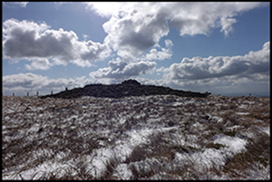
The best-preserved cursus within the Baltinglass landscape is located on Keadeen Mountain, a prominent landmark at the eastern edge of the region (Figure 5). The flat summit is crowned by a robbed-out cairn (Figure 6) positioned at the north-eastern corner of the cursus. The cursus itself is 303m in length and 32–43m in width, rising 131m in elevation along its course. It comprises a 2.8–4.1m-wide and 0.3–0.7m-high bank with an associated 2.1–2.8m-wide and 0.2–0.4m-deep internal ditch; there is some evidence for a discontinuous external ditch. Both ends of the cursus have a squared terminal. The earthworks appear to have been built in stages or through gang-working, with the northern bank larger than the southern, offsets and deviations in the size and layout of the bank and a notable narrowing of the cursus as it rises towards the summit. There are sections of the cursus where the banks widen and narrow in unison; the author infers that these convergences, divergences and other nuances in construction may have been purposefully designed. There are six breaks in the bank, two of which—both positioned centrally on the southern earthwork—have corresponding breaks in the ditches. The varying slope within the cursus restricts internal visibility, but at all points within the interior, there are extensive views of the Baltinglass landscape to the west. Conversely, the natural topography restricts visibility to the north, east and south, with the summit cairn not visible from within the cursus despite it abutting the north-eastern corner. The cursus extends in an east/north-east direction and at 7.50am on the summer solstice, when standing at the centre of the cursus looking towards the summit, the sun rises behind Keadeen Mountain, flooding the cursus and the Baltinglass landscape with sunlight.
Looking west along the line of the Keadeen cursus, with the causewayed enclosures of Spinans Hill 1 (left foreground), Rathcoran (centre midground) and Hughstown (centre background) (figure by author).

The large, robbed-out cairn on the summit of Keadeen (figure by author).

Another cursus is located at Boleylug, 98m from a tributary of the Slaney River and at the edge of a steep break of slope. It is 113m long, 24m wide and rises 13m from west (the river) to east. Its eastern terminal is rounded with the western end open. The lidar results show two 7.2–9.3m-wide parallel banks with no evidence for any entrances. The interior is notably sunken, restricting visibility to the north and east. The nearby river and causewayed enclosures of Rathcoran and Hughstown are highly visible from within the cursus, while at the eastern edge of the cursus, one of the large cairns and another possible Early Neolithic enclosure on Kilrnalagh Hill come into view. Here, again, the cursus is orientated in an east/north-east direction and aligned on a saddle in-between two hillocks to the east. Looking along the axis of the cursus, the sun rises from this saddle at 7.21am on the autumn equinox.
The cursus at Sruhaun shares a similar landscape setting to Boleylug (Figure 7). Positioned at the western base of Tuckmill Hill close to the River Slaney, its western end is truncated by modern housing. Its eastern portion survives as a 131m-long pair of parallel banks up to 7.3m wide and spaced 29.5m apart surrounding a slightly sunken area. The cursus narrows to 22m at its eastern end, where a sub-circular terminal is apparent. There are hints that the cursus crosses the Slaney River and terminates with another sub-circular terminal, potentially creating a 427m-long monument (Figures 3 & 7). This cursus has an east–west orientation, rising 51m along its length. It is orientated on a series of cairns and a causewayed enclosure at the summit of Tuckmill Hill. Although viewshed analysis indicates these features are not visible from the cursus, on the autumn equinox, at 8.15am, the sun rises over Tuckmill Hill, breaking the crest of the hill in line with the long axis of the cursus, cairn and causewayed enclosure, suggesting this was an intentional orientation.
The Sruhaun cursus in context (figure by author).

Another cursus, located at Ballinacrow Lower, follows the line of a river terrace (Figure 8). It comprises a set of broadly parallel banks measuring up to 5.4m wide and 54.5m apart, with some suggestion that the northern bank has an internal ditch. The south-western end of the cursus has a sub-circular terminal, where the axial banks narrow to 43.5m. Notably, the southern bank is straight, while the northern bank is partly bowed. The cursus runs for 185m and rises 7.5m along its length. Visibility of a cluster of potential Linkardstown burials to the north-east is restricted from within the cursus but, as the viewer reaches the north-eastern end, the burial ground comes into view. During the summer solstice, at 5.05am, the sun rises in line with the long axis of the cursus over this burial complex.
The Ballinacrow Lower cursus in context (figure by author).

Previously, O'Driscoll (Reference O'Driscoll2016) identified a probable cursus abutting the southern side of the causewayed enclosure at Hughstown (Figure 9). This is 29.8m wide and 171m long, rising 40m over its length, and is defined by two parallel banks measuring up to 5.1m wide. The cursus is orientated north-east/south-west, with its south-western end open and its north-eastern end defined by a squared terminal. This appears to be the only cursus in the Baltinglass landscape that is not associated with a major solar event; it is also the only cursus in the area that directly interacts with one of the major Early Neolithic enclosures.
The Hughstown cursus in context (figure by author).

The Baltinglass cursus monuments in context
There are approximately 25 cursus monuments known in Ireland, though only the unusual ‘hybrid’ example at Newgrange has been excavated (Leigh et al. Reference Leigh, Stout and Stout2018). While a number of short articles highlighting new discoveries and potential for future research have been published (e.g. Condit Reference Condit1995; Newman Reference Newman1995, Reference Newman, Barclay and Harding1999, Reference Newman2007; Corlett Reference Corlett2014), no systematic study of these monuments has been undertaken. The current article addresses this gap, revealing that the Baltinglass cursus monuments share some characteristics with examples found in Britain, while also displaying unique elements of both morphology and location.
Dating
Cursus monuments typically date to the Middle Neolithic and their construction followed the abandonment of causewayed enclosures (Whittle et al. Reference Whittle, Healy and Bayliss2011: 907–8). The Scottish timber cursus tradition may date to c. 3900–3600 BC (Thomas Reference Thomas2006; Brophy & Millican Reference Brophy and Millican2015: 311), pre-dating the earthen monuments of southern Britain, though Bayesian modelling by Whittle and colleagues (Reference Whittle, Healy and Bayliss2011: 830) suggests a slightly later date of 3710–3380 BC. Some cursus monuments appear to have been constructed directly overlying causewayed enclosures, as at Fornham All Saints in Suffolk and Etton in Yorkshire (Whittle et al. Reference Whittle, Healy and Bayliss2011: 907), or in close proximity to them, such as at Dorchester-on-Thames in the Upper Thames Valley (Loveday Reference Loveday, Barclay and Harding1999: 54–5).
The only dated cursus in Ireland is the unusual ‘hybrid’ monument discovered at Newgrange, which comprises a ditch-bank-ditch system with an internal line of pits surrounding a post ‘corridor’, a morphology that may be paralleled at the Keadeen cursus. The Newgrange cursus dates to 2632–2472 BC (Leigh et al. Reference Leigh, Stout and Stout2018), which falls outside the typical date of British cursus monuments c. 3600/3500–3000/2900 BC. Without more comprehensive dating of the Irish sites, it is difficult to assign them to a specific chronological horizon other than to suggest that they were probably built sometime in the Middle/Late Neolithic.
Location
Approximately half of Irish cursus monuments are located on relatively flat topography at the base of hills or coastal settings, such as Loftushall, County Wexford, or Brewel Hill 1, County Wicklow. The remainder are associated with hills, mountains and other upland locations incorporating significant changes in elevation. Some, such as Knockendrane and Coolasnaghta, County Carlow, notably terminate just below mountain summits. Others are positioned on sloping topography, running up, but rarely across, one or multiple hills, as at Knockainey 1, County Limerick. Notably, unlike the British examples, the Irish monuments are rarely associated with riverine locations.
The British examples show less diversity in location. They tend to traverse lowland areas close to, parallel with or overlooking rivers and may have been associated with areas of woodland clearance or semi-open grassland (Gibson Reference Gibson, Barclay and Harding1999: 132; Loveday Reference Loveday2006: 108; Brophy & Millican Reference Brophy and Millican2015: 297, 316–19; Brophy Reference Brophy2016: 31–2, 159; Cummings Reference Cummings2017: 162). Indeed, there appear to be few cursus monuments in upland locations in Scotland and Wales, and a deliberate avoidance of landscapes with significant topographical gradients (Gibson Reference Gibson, Barclay and Harding1999: 132; Brophy Reference Brophy2016: 59, 61). A similar pattern has been observed in England, though some of the chalkland sites, such as Rudston, East Riding of Yorkshire, show more topographical variance (Loveday Reference Loveday, Brophy, MacGregor and Ralston2016: 98).
Unlike most of the Irish cursus monuments, three of the Baltinglass examples—Sruhaun, Boleylug and Ballinacrow Lower—show a connection with rivers, either approaching, crossing or running parallel to a watercourse. Tilley (Reference Tilley1994) and Barclay and Harding (Reference Harding, Barclay and Harding1999: 5) suggest waterways associated with cursus monuments may have been sacred, with the form and position of the cursus acting to reference their symbolical importance. Cummings (Reference Cummings2017: 163) notes the potential use of rivers in Middle Neolithic mortuary practice, which may have imbued these already ritually charged liminal places with further significance. What distinguishes the Irish sites is their strong preference for traversing significant topographical inclines, often following the steepest path towards the summit. This may reflect the need to reference earlier or broadly contemporaneous burial complexes or enclosures which in Ireland were more typically located on hilltops.
Morphology
British cursus monuments typically consist of two parallel banks with associated ditches or lines of post-holes and squared or rounded terminals. The monuments are relatively straight and rectangular in plan, reflecting a common architectural framework found in other contemporaneous monuments such as timber halls and mortuary structures (Loveday Reference Loveday2006, Reference Loveday2012: 342; Brophy & Millican Reference Brophy and Millican2015: 304; Brophy Reference Brophy2016: 28). This has led some to suggest that cursus monuments represent an exaggerated symbolic house that expressed the larger group identity of the disparate communities who built each one (Loveday Reference Loveday2006, Reference Loveday2012: 348).
There is significant variation in the overall size and length of British cursus monuments, with sites ranging from 100m to 10km in length and 14–150m in width; wooden precursors in Scotland tend to be smaller and earlier than earthworks further south (Barclay & Harding Reference Barclay, Harding, Barclay and Harding1999: 2; Brophy & Millican Reference Brophy and Millican2015: 304). Loveday (Reference Loveday, Brophy, MacGregor and Ralston2016: 109) suggests that the size of British cursus monuments might reflect the size of the groups that constructed them. In some cases, these monuments have one or more entrances, usually marked by a simple break in the enclosing elements along the side of the cursus rather than through the terminals (Barber Reference Barber2018: 3).
These were not static monuments, however. Rather, they were dynamic structures subject to alterations, extensions and renovations, inferring they may have been built and modified over a prolonged period (Brophy Reference Brophy2016: 129; Cummings Reference Cummings2017: 162). Loveday (Reference Loveday, Barclay and Harding1999: 58) and Brophy (Reference Brophy2016: 77) highlight the segmented nature of some sites, such as the East Linton cursus in East Lothian, indicating that some were constructed in short segments over time or by gang-working. Similar segmented construction in the preceding causewayed enclosures tradition may suggest a continuation of ritualised communal construction practices under the guise of a new monument form. Barber (Reference Barber2018: 2) also notes the lack of symmetry in cursus banks, observing that they are often not exactly parallel, with one side straighter than the other.
Limited work on the Irish sites reveals variation in cursus length from 78m to 950m and from 15m to 89m in width, though there is a clear concentration of sites ranging 100–350m long and 20–45m wide, with the Baltinglass sites conforming with these averages. Upstanding remains are rarely found (Barclay & Harding Reference Barclay, Harding, Barclay and Harding1999: 2; Brophy Reference Brophy2016: 8, 21; Loveday Reference Loveday, Brophy, MacGregor and Ralston2016: 204), and as such, further work at the well-preserved Keadeen cursus could provide valuable evidence regarding construction and chronology. Nonetheless, preservation at Keadeen is such that detailed information regarding its construction and layout may already be extrapolated. Construction of the monument followed a similar pattern to that observed in Britain, however, the terminal banks were slighter than the axial earthworks whereas the reverse is commonly observed at British sites (Loveday Reference Loveday2006; Brophy & Millican Reference Brophy and Millican2015: 309). Keadeen is one of the only Irish examples with two terminals. Conversely, the majority of Scottish sites have only one terminal and this may reflect an intentional feature (Brophy & Millican Reference Brophy and Millican2015: 304), though as many monuments survive only as cropmarks, it is difficult to deduce their full extent without further survey or excavation.
Orientation and alignments
The importance afforded to the sun during the Irish Neolithic and its influence on monument location and orientation is vividly demonstrated within important archaeological landscapes such as Newgrange or the Hill of Tara, County Meath. At Newgrange, the inner chamber of the passage tomb is illuminated by the rising sun on the winter solstice (Hensey Reference Hensey, Papadopoulos and Moyes2017), while the Mound of the Hostages passage tomb at Tara is aligned to the rising sun during the cross-quarter day of Samhain (31 October, O'Sullivan Reference O'Sullivan2005). The newly discovered cursus at Newgrange also had a central post-lined ‘corridor’ aligned on the rising sun of the spring equinox, suggesting the importance of solar alignment was not restricted to the passage tomb (Leigh et al. Reference Leigh, Stout and Stout2018). Cults of sun worship were widespread in early religious belief and often connected to passage-tomb cosmology (O'Brien Reference O'Brien and Scarre2002: 161). The sun is the giver of warmth and light, critical for plant growth, successful harvests and survival (Prendergast Reference Prendergast2018). It is no coincidence, therefore, that monuments incorporate solar alignments converging on important seasonal events associated with the farming cycle.
Four of the Baltinglass cursus monuments are aligned on major solar events. Keadeen and Ballinacrow Lower are orientated towards the rising sun of the summer solstice, which marks the mid-point of the growing season, a critical time when decisions regarding irrigation, fertilisation and other management practices that ensure optimal harvests are undertaken. This solstice is often celebrated as a time of renewal and fertility. In contrast, the Boleylug and Sruhaun monuments are aligned with the rising sun on the autumn equinox, which marks the end of the growing cycle and the beginning of the harvest season. These orientations could have created a two-fold division of the year for the Baltinglass inhabitants that not only referenced important seasonal farming events, but also the transition from growth and renewal towards death and decline (Darvill Reference Darvill, Cunliffe and Renfrew1997; Loveday Reference Loveday2012: 347).
Similar patterns can be observed in Britain. The Greater Stonehenge cursus appears aligned towards the sunrise during the summer solstice, while the earliest section of the Dorset cursus points towards the midwinter sunset (Bradley & Chambers Reference Bradley and Chambers1988: 286; Barber Reference Barber2018: 3). But both Loveday (Reference Loveday2012: 342) and Brophy (Reference Brophy2016: 32) suggest that these are exceptions, with the latter arguing for a lack of overall patterning in the orientation of Scottish cursus monuments (Brophy Reference Brophy2016: 166). Slight variations in the course of many monuments may have rendered accurate alignment on topographical landmarks or archaeological features difficult (Barclay & Harding Reference Barclay, Harding, Barclay and Harding1999: 2) and, while some have no apparent alignment, orientation was an intrinsic element of their design. For example, a large cluster of cursus monuments in the Upper Thames Valley share a strikingly similar orientation (Loveday Reference Loveday, Barclay and Harding1999: 54–5), inferring this shared alignment held significant meaning.
Routes for the dead?
The function of cursus monuments is uncertain (Chapman Reference Chapman2003: 345), though most academics agree that they played some ceremonial or ritualistic role. The Baltinglass cursus monuments exhibit specific location, orientation and solar alignments that suggest a connection to seasonal farming cycles and possibly a need to mark and celebrate significant events associated with these. Such events could, however, have been demonstrated by less elaborate constructions, suggesting that cursus monuments likely held additional importance. It may be significant that at least three of the Baltinglass cursus monuments are aligned with significant burial complexes. Notably, at all three sites, the burial complexes are aligned directly between the respective cursus and the rising sun during the summer solstice or autumn equinox. Yet the burial complexes are not visible until the viewer exits the cursus. This may have been a deliberate design element. Newman (Reference Newman2007: 428) argues that obscuration and redirection are devices employed at many religious sites. He describes the visual restriction present when traversing the cursus on the Hill of Tara, County Meath, as something ‘otherworldly’ (Reference Newman2007: 423).
Given the varying excavation evidence, Whittle and colleagues (Reference Whittle, Healy and Bayliss2011: 907–8) caution against imposing a singular interpretation on cursus monuments. A notable connection between burials and cursus monuments in Britain is, however, apparent. Bradley and Chambers (Reference Bradley and Chambers1988: 285) and Barber (Reference Barber2018: 3, 6) note a striking emphasis on long barrows. For example, Tilley (Reference Tilley1994: 204–6) argues that the Dorset cursus is directly associated with at least nine long-barrows, while Chapman (Reference Chapman2003: 353) proposes that cursus ‘A’ at Rudston may have been positioned to maintain a constant visual connection with two long barrows. Other archaeologists have noted a broader connection between cursus monuments and mortuary sites in Britain (Brophy Reference Brophy2016: 29; Cummings Reference Cummings2017: 163). In the Brampton complex of the Ouse Valley, Sussex, the layout and orientation of three cursus monuments appear to have been influenced by an earlier mortuary enclosure (Malim Reference Malim, Barclay and Harding1999: 80). In Ireland, the absence of the long-barrow tradition results in a prevalence of passage tombs, which exhibit a clear connection with cursus monuments. Those at Newgrange and Loughcrew, County Meath, for example, are surrounded by, incorporate or align with significant numbers of probable passage tombs and other burial monuments.
The idea that these monuments formalised ceremonial routes is popular (see Tilley Reference Tilley1994; Chapman Reference Chapman2003: 353) and Cummings (Reference Cummings2017: 163) suggests that they could have acted as bounded ritualised processual routes associated with burial practices. The lack of material culture recovered from many cursus monuments has led Parker Pearson and Ramilisonina (Reference Parker Pearson and Ramilisonina1998) and Johnston (Reference Johnston, Barclay and Harding1999) to conclude that they could have functioned as ancestorial routes, with the living processing along the monument. A cursus would have separated the highly charged ritual and symbolism of the interior from the excluded and mundane external world (Harding Reference Harding, Barclay and Harding1999: 31), possibly separating the living from the dead.
Bradley and Chambers (Reference Bradley and Chambers1988: 286) argue that from their inception, the cursus may have evoked associations with the dead and may not have been built for humans, but for the sun as it rose over the skyline. We might also consider these monuments as routes for the dead, where the living processed with the deceased in a set route which may, in places, have involved a sacred river. The cursus may have directed the traveller towards their final resting place in a burial monument, which, at Baltinglass, lay deliberately just out of sight of the living processing within or alongside the cursus. The rising of the sun directly behind these burial complexes when viewed from within the cursus at significant points in the year may have symbolised the final journey of the deceased from the land of the living towards the heavens. The cursus, therefore, may emphasise the symbolic links and pathways that connected the living and the dead (Bradley & Chambers Reference Bradley and Chambers1988: 286) and the desire to reciprocally harness the power of a deified sun by channelling it into sacred spaces (Prendergast Reference Prendergast2018). The association of the dead with the cycle of the death and rebirth of crops may further explain and reinforce the relationship between cursus monuments and mortuary practices (Loveday Reference Loveday, Barclay and Harding1999: 59–60) and offer an explanation for the intrinsic integration of solar events into the Baltinglass monuments.
Conclusion
The Baltinglass landscape, with its density of Neolithic activity and massive communal monuments, has recently emerged as an important region for understanding Ireland's first farming communities and their development over time. The discovery of five cursus monuments only enhances this importance. The Baltinglass cursus cluster is now the largest group of these types of monuments identified in Ireland, with previously only pairs known at Newgrange, Knockainey and Brewel Hill. In Britain, clusters are more common (Brophy Reference Brophy2016: 137). These larger complexes represent massive investments in time, labour and resources that would have far exceeded the capacity of a local community (Loveday Reference Loveday, Fowler, Harding and Hofmann2015: 468). Therefore, they likely represent intra-regional group construction projects used to solidify disparate communities under a single cohesive identity.
The Baltinglass cursus monuments exhibit morphological similarities to British monuments and there is a preference for locations near rivers and burial monuments. But, like other Irish examples, they contrast with British cursus monuments in their preference for steep inclines and mountainous locations. As Whittle and colleagues (Reference Whittle, Healy and Bayliss2011: 907–8) have noted when discussing the transition from causewayed enclosures to cursus monuments in Britain, creativity and a desire for innovation and difference may have been a driving factor in this change, and we may see a similar drive for innovation in Ireland in this unique locational preference. It may have heightened the visual impact of these cursus monuments, both to and from the sites, and this may have enhanced the experience of those engaging with them.
While, given their diversity, it is often difficult to apply overarching theoretical frameworks to explain the function of cursus monuments (Barber Reference Barber2018: 1), the Baltinglass sites demonstrate a clear connection between the dead, major solar events and seasonal farming cycles. The rising of the sun over burial complexes during significant solar events may have symbolised the ascent of the dead into the heavens, their perceived rebirth and/or the blessing of the ancestors. The cursus may have physically demarcated the final route of the dead, where they left the land of the living and joined the ancestors beyond the visible horizon.
Further analysis of the Baltinglass cursus monuments, as well as Irish examples more broadly, holds great potential for understanding Middle Neolithic ritual and ceremonial practices. The lack of detailed analysis, survey and excavation of the broader corpus of Irish cursus monuments hinders further progress, however, and a necessary next step is a comprehensive catalogue of sites. Until then, the Baltinglass cursus complex remains a unique example of the complex ritual and ceremonial practices of the Irish Middle Neolithic.
Acknowledgements
Wicklow County Council and the County Heritage Officer Deirdre Burns supported the lidar survey of the Baltinglass landscape. The survey was undertaken by Bluesky Ltd. Thanks are also due to Dr Edouard Masson MacLean, University of Aberdeen, who assisted with mapping the solar alignments of the cursus monuments.
Funding statement
The lidar survey was generously funded by a Department of Housing, Local Government and Heritage Community Monuments Fund grant (CMF22-3-WI0).


 Open access

