




INTRODUCTION
Controlling, and criminalizing if necessary, the mobility of colonial subjects was an early priority for early modern colonial authorities. The colonies had been used as a safety valve by some states, such as Portugal and the UK, to send vagrants from Europe to work, and labour shortage dictated where they were to be sent.Footnote 1 The idea that colonial subjects could move where and when they chose was greatly undermined by the eighteenth century. Sarah Nicolazzo has shown how, in the eighteenth century, vagrancy took on a new meaning in the British colonies as labour became an essential value to the developing economy.Footnote 2 Vagrancy acts, originally copied from the metropoles, multiplied in the colonies to meet various purposes. The authorities used vagrancy laws to: control work supply; supervise the population; prevent the use of “non-conformist culture” such as obeah;Footnote 3 and as a form of social control to “improve” the nature of the population living in these territories. Some historians have suggested that, before emancipation and abolition, vagrancy laws were mostly aimed at “undesirable” Europeans, who were not carrying their weight in the development of the colony.Footnote 4 In port cities such as Calcutta and Zanzibar, vagrancy acts were used to get rid of drunk and disorderly Europeans, who were seen as a bad influence to the local communities whose labour was essential for economic development.Footnote 5 The means for sanctions against these subjects were however limited: it was not always possible to make them leave the colony, especially if they had been sent there as a punishment for vagrancy from their home country. In the nineteenth century and from the emancipation era onwards, vagrancy laws became a tool to force freed people to work in colonies relying mostly on an agricultural economy: studies on South African legislations against vagrants during the emancipation or on the West Indian British colonies and the United States after the civil war have shown how vagrancy laws were used to prevent freed people's mobility.Footnote 6 Vagrancy acts in the Caribbean colonies have often been seen as distinct from legislations and practices against marronage; however, as suggested by Robert Bancroft Cummings,Footnote 7 the distinction between the two is more subtle than initially thought. Before the nineteenth century, policing of vagrancy and marronage was carried out by masters and civilians, as were the punishments against runaway slaves. Control was thus exercised first and foremost by the plantation owners and their intendants, with help, if possible, of the local authorities. The ad hoc construction of justice in the colonies, especially in the British and French Caribbean colonies, which followed a proto-national model of development, meant that discretion on the side of the prosecutors was relatively large. Nicolazzo demonstrates how, in the eighteenth century, the “unpredictable mobility” of certain people, not easily identifiable, became synonymous with social and economic threats and therefore justified the extension of policing powers, as did marronage.Footnote 8 Viola Müller argues in this Special Issue that a more nuanced understanding of marronage is necessary to fathom the reality experienced by runaway slaves. Likewise, this article on vagrancy in the French colonies argues that the study of vagrancy acts against the new French citizens reveals more than a willingness by the local elite to prevent the mobility of the workforce. It highlights their attempts to create white urban enclaves by limiting access to the urban territory and urban institutions by freed people. The premises of racial segregation and urbanization control in colonial cities, which have usually been studied from the perspective of British colonies,Footnote 9 appear to have been well established in the agricultural colonies of the French Caribbean.
In theory, everyone after 1848 should have had freedom of social and spatial mobility and access to the judicial system and the urban market; but what happened in practice still needs to be researched. The question of former slaves’ mobility has never been framed by historians of the French Caribbean in relation to the changing perception of the urban environment in a predominantly agricultural system. How did these legal changes impact freemen and freewomen and former slaves’ access to the urban environment? The changing legal status of former slaves gave them new opportunities to move around the colonies, at least on paper. And having access to the urban environment also meant having access to the highest institutions of the colonies, particularly the courts of justice. Based on the archives of the correctional courts, this article focuses on how race and citizenshipFootnote 10 determined the accessibility of French colonial urban spaces and institutions after 1848.
URBANIZATION IN THE FRENCH ANTILLES
The development of the sugar economy in the French Caribbean territories since the seventeenth century led to a relatively high population density in the most favourable islands.Footnote 11 Calm bays such as Fort-Royal (now Fort-de-France) and Saint-Pierre in Martinique, Port-au-Prince and Cap-Français in Haiti, or Basse-Terre and Pointe-à-Pitre in Guadeloupe became important ports of commerce, growing thanks to the colonial trades of, among others, slaves, sugar, indigo, and cotton.Footnote 12 These towns, which developed out of the port and/or military defences, followed an orthogonal street plan, often bordered by drainage canals or rivers, as in Fort-de-France, creating “natural” borders to the urban enclaves.Footnote 13 Saint-Pierre was surrounded by volcanic slopes that prevented its development towards the east and was also crossed by a river on its northern side (Figure 1).Footnote 14 These canals, rivers, and hills became a border between the colonial town and the faubourgs, which grew in connection with the port economy, but were not yet subject to urban planning.Footnote 15 Other French settlements of military origins in the Caribbean remained relatively small, such as Marigot in Saint Martin or Cayenne in French Guyana.Footnote 16 Despite being a strong contender in the eighteenth-century slave trade, with more than 500,000 men and women being transported to the French Antilles, the French settlements experienced limited urban development until the nineteenth century. Small parishes or bourgs were, however, dotted along the coast.Footnote 17 Transport connections between the parishes in Martinique were relatively well established and frequent, but the geographical landscape of Guadeloupe made travel between the two sides of the island more difficult. The development of Pointe-à-Pitre, as a link between Basse-Terre and Grande-Terre, really started only with the British occupation of the island during the Seven Year's War. Drainage of the swampy grounds was necessary before any settlement was made possible.Footnote 18 The distinction between urban and rural was sharpened in the French Antillean colonies:Footnote 19 the model of economic development followed in Martinique and Guadeloupe meant that most of the workforce was spread in the rural areas to cultivate and harvest crops. The urban centres provided seats for the governmental, military, and judicial institutions, as well as some forms of entertainment for the elite and, for some, a place of residence. The number of inhabitants in the countryside was therefore much higher than in the urban centres, with an important concentration of slaves. Urban slavery may have been more limited than in the rural areas, but it did exist:Footnote 20 domestics,Footnote 21 laundresses, and day labourers lived in the urban centres or in their immediate proximity and were more numerous than the white population. The rest of the white planters resided on their plantations, the habitations sucrerie, which started to decline in the second half of the nineteenth century.Footnote 22
Map of Saint-Pierre, Martinique, 1902.

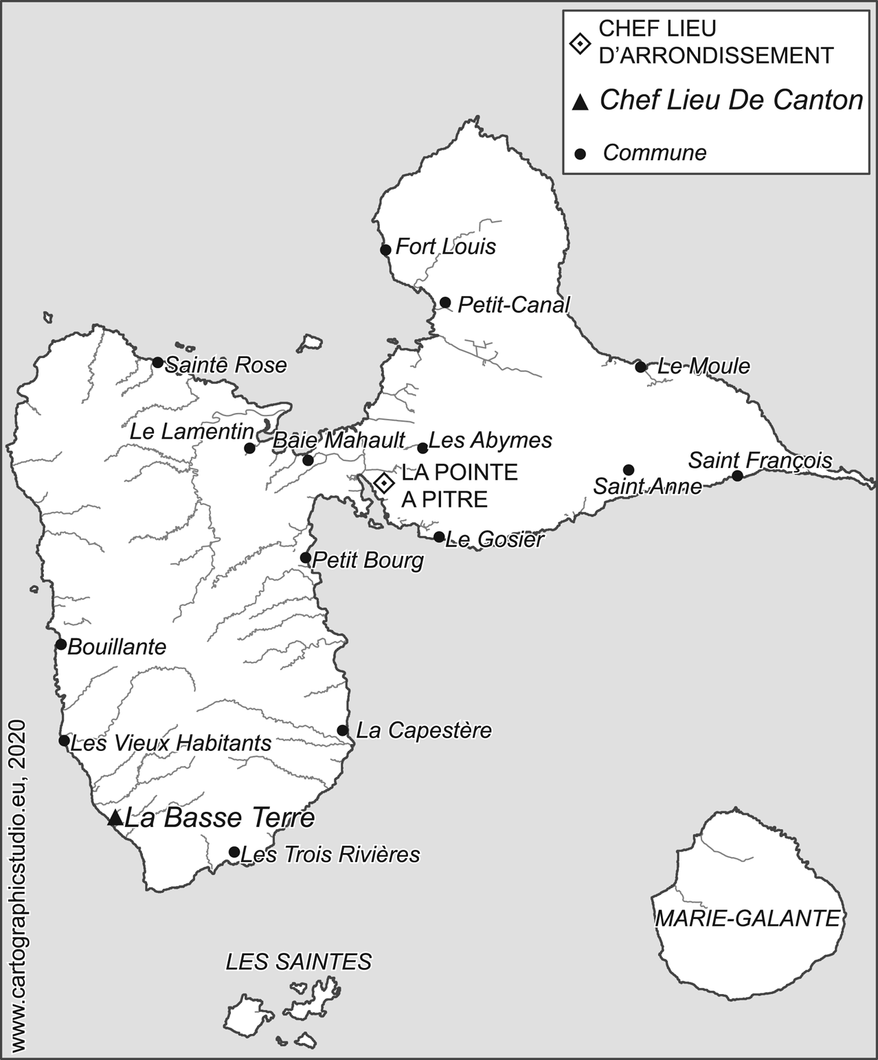
The main towns in the French Caribbean were located on the largest French islands: Martinique (Figure 2) and Guadeloupe (Figure 3), which, after the Napoleonic episode and an English invasion, continued to be governed by the French. Martinique was the official centre of the French Antilles, with the governor residing in Fort-Royal since 1790. Both Guadeloupe and Martinique's economies turned towards the production of sugar in the seventeenth century and the labour-intensive monoculture of sugar cane had a strong impact on the demographics of the islands: sixty to seventy per cent of the population were still working in the rural areas by the mid-nineteenth century.Footnote 23 The urban centres of Saint-Pierre, Fort-Royal,Footnote 24 and those of Basse-Terre and Pointe-à-Pitre developed thanks to the colonial economy and the importance of maritime trade.Footnote 25 The population living in what can be defined as villes et bourgs was therefore rather limited: twenty-three per cent of the inhabitants of Guadeloupe (without dependencies) lived in a town or large village in 1847; in Martinique this was 26.5 per cent. White people accounted for eight per cent of the total population in Martinique in 1847. The administration of Guadeloupe claimed that they could not give a precise number for the “white/coloured” ratio in 1847 but assumed it to be the same as in Martinique, and claimed that the class of freemen/freewomen was four times higher than the white class.Footnote 26 A further note in 1849 explained that white people constituted one-twelfth, or 8.3 per cent, of the total population.Footnote 27
Map of Martinique and its main towns and villages, 1835.

Map of Guadeloupe, based on an etching by Morin, 1835.
The urban centres (the bourgs, large villages, and towns) of the French Antilles were dominated thus by the free population consisting of the white elite (comprising settlers, or colons, and creoles), poor whites, the mixed-races, foreigners, and black freemen and freewomen.Footnote 28 In Martinique before the abolition, the villes et bourgs counted around 23,800 free people and 8,200 slaves. In Guadeloupe and its dependencies, 19,500 free people and 10,000 slaves lived in the towns and large villages. In contrast, rural Martinique had 24,400 free people and 64,600 slaves in 1846, while Guadeloupe had a larger share of slaves, with around 77,800 slaves and 21,800 free people (Table 1).Footnote 29 The settlement of the official colonial government in the urban centres also brought with it a certain number of metropolitan civil servants and officials who resided close to the seat of the government. Many white colon families settled in these towns, but also freed blacks who had been manumitted and left their former masters to work in towns.Footnote 30 Before 1848, slaves formed seventy-five per cent of the population in the French AntillesFootnote 31 and although most of them were employed in the plantations, some were living in the towns as domestics for white and freemen's families, and they could also be seen working in the ateliers adjoining the port.Footnote 32 According to the 1847 census in Guadeloupe, sixty-five per cent of urban families had between one and three slaves working in their household, most of them women, employed to cook, wash, and generally run the house.Footnote 33 A list of 218 slaves from the French Caribbean colonies and La Réunion, whose slaves received their freedom in 1847, gives an example of the role of urban domesticity in slaves’ occupations. Domestics counted for roughly forty per cent of the occupations of the urban slaves, along with manual labouring and working as a field hand, a much higher percentage than in the countryside.Footnote 34 At the beginning of the nineteenth century, some urban slaves were also employed as day labourers and were hired out by their masters and mistresses (notably impoverished creole women)Footnote 35 who were living in town.Footnote 36 Overall, the ratio of “whites” to “people of colour” was therefore less disproportionate in the urban centres than in the countryside, especially on the sites of original settlement, which were the richest and best built.Footnote 37 Before the abolition of slavery, the demography of the towns changed little, although the first half of the nineteenth century saw an increase of freedmen and freedwomen moving to the towns, linking urban development with the increase of free people.Footnote 38
Urban population in Martinique and Guadeloupe in the mid-nineteenth century.

Source: Tableaux de population, de culture, de commerce et de navigation (Paris, 1851), pp. 12–15.
“BEING MOBILE” IN THE FRENCH COLONIES
Following the expansion of the colonial society from the seventeenth century, the socio-economic positions and the mobility (both social and spatial) of people inhabiting the Antillean islands were strongly defined by their colour, gender, and civil status.Footnote 39 How one was to behave would depend on these criteria and going against prescribed behaviours, such as being absent from the master's house for too long or not taking care of one's family, would lead to various punishments for both white and black people.Footnote 40 These could include fines, being shunned by the community, and even official expulsion from the colony.Footnote 41 However, slaves and freemen and freewomen had to endure much harsher punishments than white people, rich or poor. Slaves were regularly whipped and sometimes tortured for bad behaviour against their masters or against another white person. The society was strictly divided and people who did not belong to the two well-defined categories of black slaves or white elite often struggled to find their place and, more importantly, their rights in this colonial society. Black freemen and freewomen, mixed-race children and adults, and poor white people, also known as petit-blancs, were constantly negotiating their position in society, in relation to each other and under the control of the elite.
Despite these strict divides between classes, members of the free black and slave classes experienced a degree of social and spatial mobility before the abolition; and opportunities for mobility could often be found in the urban centres. Since the eighteenth century, some masters ignored the colonial legislation regarding slaves’ work and freedom of movement by giving them substantial responsibilities in their business or by letting them carry out tasks away from the master's household and with little supervision. Indeed, in order to maximize their assets, some masters provided their slaves with an education and allowed them to keep small shops or take care of the accounts, or even gave them “managerial” responsibilities that, according to Coquille, the procurer of Guadeloupe, made them particularly “arrogant”.Footnote 42 In receiving permission to rent a room in town as long as they share their wages with their master, the comings and goings of slaves in the urban environment were a common sight. Their role in the urban merchant economy was thus clearly visible. Some slaves were free to sail between villages to sell their master's products; one was trained as a jeweller and permitted by his master to roam the colony.Footnote 43 The attitude of the masters towards marronage during the ancien régime sheds a similar light on the mobility of slaves: marronage was considered a problem only when slaves deserted in groups and formed “gangs”, thus becoming a threat to the general order. Petit marronage, defined as the absence of a single individual or very small group for a few days, was often treated casually by the planter or his manager.Footnote 44 Likewise, the punishment for a long period of time spent away from the plantation was contingent on the amount of time the slaves had already spent on the island: a newcomer accused of marronage was less likely to be branded than a slave who had already had the opportunity to build a network in and outside the plantation.Footnote 45 This led to situations where maroon slaves were only reported missing after a few weeks or even a couple of months.Footnote 46 Price notes that creole maroons were more likely to run away to the cities, where they knew they would be less likely to be questioned about their whereabouts, being surrounded by other people of colour, freemen, and freewomen, but also slaves, and thus experiencing a certain freedom of movement.Footnote 47
Thus, the economic interests of planters encouraged a certain mobility of slaves to and from the urban centres. But the judicial system also unwittingly aided the connection between rural areas and urban centres by pushing certain victims to seek justice against their master in urban institutions. The slavery system led to the development of a particularly cruel private justice in the hands of the white masters. Slaves brought to or born in the French colonies were subject to the Code Noir, implemented in 1685 by Jean-Baptiste Colbert. The Code Noir was meant to cover the possession, transaction, and legal status of slaves in the French colonies. One of its paradoxes resided in the legal status of a slave; whereas they were considered movable possessions (for instance they could be inherited by the children of their owner), they were still legally responsible if they committed a crime.Footnote 48 This situation meant that they could be tried by the judicial system in place in the colony and sent to prison: this sentence had a direct impact on the owner of the slave, as he was losing for a certain amount of time a member of his workforce. To counteract this loss of revenue, the colonial system developed specific regulations concerning punishment, which allowed the master to punish them privately.Footnote 49
Although most cases of mutilations and violence by owners went unpunished, a small number of slaves succeeded in getting their master condemned for excessive punishments.Footnote 50 This was made possible by the fact that slaves had a legal identity even if they were considered movable possessions. Therefore, they could access the court of justice to seek reparation. The courts of justice in the colonies were located in the urban centres and gaining access to them could be difficult if the slaves were not allowed to leave the property. However the number of freemen and freewomen had increased since the eighteenth century and they could serve as intermediaries with officials to transfer the slaves’ complaints or to help them buy their freedom.Footnote 51 Slaves could benefit – after the imposition of the Penal Code in 1828 – from the pourvoi en cassation (appeal to have the legality of a judgment assessed by the highest judicial court in Paris) if they were involved in the same criminal affair as a freeman or freewoman; by 1838 they could do it by themselves.Footnote 52 Thus, a network of information and assistance was created between rural slaves, rural freemen and freewomen, and the urban environment, and this network was strengthened by their meetings during balls, festivities, and urban processions.Footnote 53 Unwittingly, the flawed colonial justice system in Martinique and Guadeloupe helped create links between people from the lower classes, which then produced networks of information about rural and urban concerns. Likewise, the relative mobility between plantations and the urban environment afforded to certain slaves helped facilitate the exchange of political news from other countries and the metropole.Footnote 54 Urban domestics who heard and repeated their masters’ discussions during dinner were often complained about by officials, especially in times of rebellion.Footnote 55 As such, the links between slaves, former slaves, and pro-abolitionist white people were strengthened thanks to the judicial identity of the slaves and the economic possibilities of the towns, this dynamic being most visible in the urban environment where contact between people of different backgrounds was regularly observed.
POPULATION CONTROL AND RESTRICTED MOBILITY IN THE NINETEENTH CENTURY
The question of mobility became particularly conspicuous after the abolition of slavery in 1848, when the codes that regulated the travelling and movement of people (for instance the sale of a slave to another planter) officially disappeared. The abolition brought a new legal and social status to the former slaves: more than 162,000 inhabitants of Martinique and Guadeloupe became freemen and freewomen and French citizens, now deserving of treatment equal to that of white French citizens.Footnote 56 With the abolition of slavery, every citizen was given the right to travel throughout the colony, as long as he or she could prove a place of residence and means of subsistence. This meant that citizens should have been allowed to settle where they wished, also in the urban areas. The reality was very different, however. Historians have shown that the white elite in French plantation colonies refused for a long time to submit to legal and judicial changes imposed by the metropole.Footnote 57 There are several reasons for this. First, the white elite feared a loss of power and identity. Second, they were afraid of losing the opportunity to punish their slaves privately; up until that point the responsibility of punishing slaves had been controlled by private justice. In reality, restrictions on mobility had already begun after the return of slavery in 1802. Access to urban areas became more and more restricted after the Napoleonic wars with the development of vagrancy laws and an increased police and militia presence in both towns and the countryside. Indeed, the nineteenth century changed the dynamic at play during the ancien régime, with the creation of a “slave police” after the reinstatement of slavery in the colonies in 1802. Police commissaires were appointed in every town and were charged with keeping the peace and forcing ex-slaves to return to their masters.Footnote 58 Officials focused on urban areas in order to limit the apparent freedom enjoyed by certain slaves and frustrate their attempts to pass as freemen and freewomen in the urban economy.
During the discussions that preceded the abolition of slavery, the commission for the abolition of slavery, presided by Victor Schoelcher, advised the Ministère de la Marine et des Colonies (Ministry of the Navy and Colonies) to implement new legislation against vagrancy to prevent former slaves leaving for another planter.Footnote 59 The influence of the British colonies is perceptible in Schoelcher's legal provisions: in Barbados, for instance, during the apprenticeship period, vagrancy laws were designed to prevent “idleness” and used to complicate the search for a new job by former slaves. Former slaves were forced to stay in the countryside to work for their former masters to avoid arrest. The vagrancy laws in the British islands in the 1830s formed part of the white attempt to prolong the plantation system and sustain its economic development despite the abolition of slave labour.Footnote 60 In the French islands of Martinique and Guadeloupe, where economic resources were also based on the plantation system, preventing the new French citizens from leaving the countryside also became a necessity for the creoles. The abolition of slavery on 27 April 1848 led to a modification of the legal system in the Antillean colonies regarding mobility and the right to work: in order to maintain and eventually reinforce their governmental powers, local authorities quickly imposed new regulations on the movement of the new French citizens. The plantation system suffered economically and politically: the migration of former slaves to the urban centres (Saint-Pierre and Fort-de-France in Martinique, Pointe-à-Pitre and Basse-Terre in Guadeloupe) destabilized the system of private justice as much as their newly acquired freedom. In July and August 1848, various decrees were published to prevent vagrancy and idleness. The definition of vagrant was very broad: it included people who had no precise address; those who had a home but no job; those who were eating in someone else's house; those who built an ajoupa (a cabin or wooden shack); and those who had temporary employment but no home.Footnote 61 In order to tighten control of the population, the authorities encouraged the development of a (rural) police force to patrol the colonies.Footnote 62 In addition to this police force, the governor of Guadeloupe encouraged the use of militia constituted by citizens, “to protect people and property” and specifically to arrest vagrants.Footnote 63 The militia was meant to “forget all distinctions of origins”, however Schoelcher himself, during the first elections organized around universal suffrage in 1849, denounced the discrimination suffered by black people at the hands of the militia and gendarmerie. They did not hesitate to shoot black citizens who tried to free a man unjustly accused.Footnote 64 This was followed in February 1852 by the creation of the livret de travail (work pass) for labourers employed for less than a year, and new restrictions “to combat vagrancy”.Footnote 65 Eventually, on 10 September 1855, the governor of Martinique Louis Henri de Gueydon passed an edict making it compulsory to have a passport to move between parishes for everyone over sixteen years old.Footnote 66 This local legislation, published under the title Police du travail, went against the French rules of free movement but it was not until 1870 that its repeal became a subject of discussion in the assembly.Footnote 67
The increase in prosecutions against “vagrants” was not, in itself, unique to the colonies. Parallel to the bureaucratization and professionalization of the police system at the beginning of the nineteenth century (in the city but also in the countryside with the gendarmerie), a more efficient control of the population was imposed by officials from the metropole. The prosecution of vagrancy was defined by Article 270 of the 1810 Penal Code as being without a permanent address, travelling with no means of subsistence, and having no regular employment. It became an offence (délit) to be tried by the Tribunal of First Instance.Footnote 68 This legislation was officially applied in the Caribbean colonies in 1828.Footnote 69 However, as Philips has shown in the case of Barbados, where the vagrancy laws in place followed the wording of their British domestic counterparts but had very different purposes,Footnote 70 the practice of the law was much more radical in Martinique and Guadeloupe than in the metropole. The Antillean colonies could still be ruled by gubernatorial decrees and had therefore developed specific legislation on labour and vagrancy, in place until 1878. Although in the judicial archives we see an attempt by the clerk to delete any form of discrimination by not mentioning the colour or (ex-)civil status of the suspect, it becomes obvious that the law was discriminatory in practice. Indeed, in the duplicates of sentencing papers sent to Paris, the mention of colour or origins (mulatto, “mixed-race”; capresse, child born from a mixed-race person and a black person) disappeared, giving the impression that the suspects were treated equally. In reality, numerous former slaves did not have a surname and were still registered without one, giving away their origins.Footnote 71 The judicial archives thus show the specific focus set by the administration on these former slaves. It is interesting indeed to see that, except in two cases, the vagrancy cases brought to the court only concerned black people.Footnote 72
In the early months after abolition, the number of vagrants arrested by the gendarmerie was still relatively low: in August 1848, in Guadeloupe, only six vagrants among fifty-eight suspects were arrested, and at the end of the year, an average of fifteen prisoners were sent to the ateliers de discipline (type of forced labour).Footnote 73 In the session of January 1851 of the Guadeloupe Court of Appeal, ten cases referred to the délit of vagrancy.Footnote 74 It appears, however, that all of the suspects arrested for vagrancy could give an address where they lived and slept. By definition, they were therefore not vagrants but had come to town to look for work. For instance, Marcelin, a young carpenter apprentice, was born in Les Anses d'Arlet in the south of the island but came to Saint-Pierre to find employment:Footnote 75 as he was paid by the task, his work migration was legitimate and even if he had meagre resources, he could not, if they were to follow the wording of the original Penal Code, be considered a vagrant. He was, however, arrested when he decided to settle in the old town of Saint-Pierre to look for work. Multiple accounts reveal similar experiences in the years following abolition; the suspects gave their place of birth and residence but were still tried for vagrancy due to the fact that they were moving and walking within the region, searching for employment.
In the first semester of 1855, in Saint-Pierre, out of ninety-one cases tried in the Tribunal of First Instance, thirty-two were related to accusations of vagrancy (twenty men and twelve women).Footnote 76 Julie's case is representative of the treatment received by “vagrants”. She was born in Africa and lived in Grand'Rivière, working as a faiseuse de bouts (cigarette maker), but was arrested in Saint-Pierre while at work. She was then sentenced to six months in prison, the usual sentence in Martinique against vagrancy, whereas the Penal Code required a three-to-six-month sentence.Footnote 77 Had she been a man she would have been sent to work on the public roads or sent to an atelier de discipline, which were created to put vagrants to work.Footnote 78 Five ateliers de discipline were created in Guadeloupe: two in Basse-Terre and Pointe-à-Pitre and three others in the islands of Saintes, Saint-Martin, and Marie-Galante, where urbanization was almost null. Prisoners were forced to do public work, often outside the urban enclaves, but they could also be sentenced to work for a planter.
The mobility and access to urban areas of former slaves were not only limited by vagrancy laws, but also by the restructuring of the judicial system. As we discussed previously, the way the judicial system worked during the ancien régime encouraged the development of links between rural and urban areas, essential to gaining access to official institutions. However, the reorganization of the judicial system that occurred in 1828, with the imposition of the Code d'Instruction Criminelle and the Code Pénal, and the bureaucratization of the justice system from the Revolution onwards led to the creation of local courts (juges de paix and tribunal cantonal) in the more rural areas to deal with conflicts between employers and employees; in a similar fashion to the appointment of local commissaires, the judicial system was brought closer to the rural population, but it mostly benefited the white employers. Likewise, the existence of local courts prevented former slaves from going to the cities to seek redress as it was not possible to bypass the local judge, meaning that one very important reason to go to the city (to access formal institutions) became obsolete after 1789.Footnote 79
Finally, the economic opportunities offered by the towns before abolition did not increase sufficiently to provide enough outlets for the newly freed population, at least according to the government. The fact that the economic resources of the islands remained the same in the three decades following abolition suggests that the planters did not take the opportunity to change their economic model. The culture of sugar cane continued – many former slaves were now being employed as day labourers. Urbanization continued to increase but at a relatively slow pace compared to European cities.Footnote 80 Indeed, the new factories that opened for the transformation of the sugar cane economy were located close to the fields and did not encroach on the urban landscape. Thus, as various historians have shown, many socio-economic aspects of the pre-abolition Antillean society prevailed even after the abolition of slavery and the process of restraining citizens’ mobility continued.Footnote 81
Access to the urban environment during slavery was also linked to economic opportunities but the job market in the towns after abolition remained limited, agricultural labour still providing most of the employment.Footnote 82 Skilled artisans were sought after, but most of the new citizens were unskilled labourers and many former slaves chose to become owners of their cabins and small gardens, if they were successful in gaining ownership from planters. Likewise, more than 2,000 cabins were said to have been built in the Guadeloupian countryside between 1848 and 1852, and in Rivière-Pilote in Martinique, on the slopes of the mountain, former slaves joined freemen and freewomen in cultivating vegetables for domestic and market consumption.Footnote 83 In addition to the risk of being arrested as a vagrant, a heavy tax (impôt personnel) was imposed on each worker: fifteen francs per year for someone leaving a town, ten francs for a villager (living in a bourg), and five francs for a countryside inhabitant. This tax was initially imposed in 1846 in order to prevent the affranchis from leaving the plantations, where their labour was needed, and was increased in 1848.Footnote 84
The newly acquired freedom created fear in the white population (due to the large number of former slaves, the fear of riots and demands for redress, the reduction in employment opportunities as new workers entered the market) and the white elites actively blocked the migration and potential settlement of former slaves in the towns. Again, contradictory dynamics were at play in the practice of the law: on the one hand, freedom of movement had to be given to every citizen, as long as they could claim a residential address and employment (per task or per contract), but on the other hand, mobility towards the urban centres was strongly limited by the misuse of vagrancy laws in an attempt to prevent the loss of workforce on the plantations. Mobility from one plantation to another was not the main issue, however; when looking at the way the laws were used, it appears that it was mobility towards and settlement within the towns that were criminalized.
WHITE TOWNS, BLACK COUNTRYSIDE?
The white elite's efforts to hold back former slaves in the rural plantations through the strong use of vagrancy laws reveal another facet of their concerns, which was not directly linked to the possible loss of income. By strengthening the repression against “idle” or seemingly “vagrant” citizens (who did nevertheless have a place of residence), the elite also tried to limit the migration of former slaves to the urban enclaves. The cases brought to the judge of the Tribunal of First Instance reveal a strong focus on former rural slaves crossing the “border” of the urban environment, the town and its faubourgs. The records that survive show mostly suspects arrested for vagrancy and idleness who were residing in rural areas but came to Saint-Pierre or Fort-de-France to find work. “Idle” men and women who were already living in town before the abolition were very rarely reported in these archives and if they were, they were likewise condemned to six months’ imprisonment, in an atelier in the suburbs or even outside the city limits.
An interesting case was sent to the highest French judicial court, which shows the willingness of the local court to drop vagrancy charges if the suspect decided to settle on a plantation. In 1852 the cassation court in Paris broke the judgment of the appeal court of Martinique, which had dropped the case against Louis, suspected of vagrancy, who had agreed to work and live on Ducoulange's land. The cassation court claimed that Louis had indeed been in a state of vagrancy before Ducoulange's offer to work for him; therefore, the prosecution fees should not have been settled by the colony, nor should the case have been dropped. The state had the right to force Louis to carry out three months of public work, as defined by the laws of 1828 and 1848.Footnote 85 It seems that this case reveals divergent points of view on the role of regulated mobility in the colonies: whereas the local authorities were satisfied with Louis settling in the countryside to work and therefore dismissed the case against him, Parisian judges, less aware of the local situation, argued against dismissing the case.
The regulation of mobility after the abolition, however, reveals more than a simple concern over a potential lack of employees: sugar production levels in the years following the abolition did drop, but the period 1817–1882 remains a period of expansion for sugar export. Likewise, the production of secondary crops such as cotton, coffee, and cacao increased regularly after the abolition.Footnote 86 The colonies were also aware of their need to develop a more industrialized production to compete with European beet sugar, and this many years before the abolition of slavery.Footnote 87 This specific legislation on vagrancy and labour mirrors a more or less conscious attempt to limit access to the urban environment to the white, “deserving” population and prevent a rural exodus that would see the towns being taken over by former slaves. Indeed, the restrictions imposed upon black people were already seen in the treatment of freemen and freewomen before the abolition of slavery. A petition from “free men of colour”, merchants, and landowners, was sent to the French parliament in 1829 to complain about the fact that official positions in the French administration and in public office, generally located in the urban centres, were forbidden to them, in contradiction with what the old Code Noir prescribed (a freeman or freewomen would have the same right as a French citizen).Footnote 88 Preventing access to administrative positions was a means of denying them access to the “white class” and to social mobility, but it also gave them an incentive to leave the town if they could not find employment.
The abolition of slavery and the disorder that ensued had a strong impact on planters’ feeling of safety. The abolition brought hundreds of white planters to the cities. But the migration of planters to the towns in troubled times, and to Saint-Pierre in particular, is an odd reaction when compared to the first abolition of slavery in 1794. The pro-abolitionist planters of Martinique addressed planters in the Antilles by claiming that the pro-abolitionist riots in Saint-Pierre since 1790 were misrepresented by the anti-abolitionist planters as a “war between the planters and the town of Saint-Pierre”.Footnote 89 The colonial assembly in Martinique, seated in Fort-Royal since 1790 and strongly anti-abolitionist, argued that it was the people of the towns who wanted to establish equality, setting them up in opposition to the more practical people of the countryside.Footnote 90 The cleavage between the planters and merchants and petit-blancs of Saint-Pierre appeared patent in this pamphlet and certain officials played upon these dissensions to impose their views. A similar attempt by urban patriots in 1789–1792 to abolish slavery was thwarted in Guadeloupe by the community of the rural elite.Footnote 91 In February 1831, a slave uprising aimed to torch and pillage the city of Saint-Pierre: cane fields were burned, planters’ families were shipped to France or the United States for refuge, and a letter published in a French newspaper described Saint-Pierre as the “most miserable place on earth due to its succession of bankruptcies and interest rates of 50 per cent on loans”.Footnote 92 During this episode, planters’ families did not reach Saint-Pierre to find refuge but instead escaped to the metropole or to foreign countries.
In the middle of the century, the discourse had changed, both in the words of the administration and of the elite. First, the tax mentioned above and imposed on urban inhabitants was meant to “drive away from the towns the inhabitants of the countryside”. Likewise, small merchants and artisans had to pay a specific tax to do their trade, in order to “reduce the number of parasitic and miserable industries carried out by the idle men who ran away from the cultivation of the land”.Footnote 93 The government was actively pushing away anyone who was not welcome in the cities. Second, by 1848, the elite had developed a new understanding of the city: it appears that the creole elite sought help and refuge in the urbanized environment and their discourse about the urban environment changed dramatically. The written testimonies of rural planters who experienced slave riots demonstrate their logical search for help where the island official powers resided, in Saint-Pierre or Fort-de-France, and at the same time reframed their view of the urban environment as a place of safety.
Irmisse de Lalung, a creole white planter and aristocrat living with her family in Le Prêcheur, wrote in her diary in 1848:
We were expecting a serious event at Prêcheur; many scared women withdrew to Saint-Pierre. Our kin from the town asked us to join them; my uncle insisted that we moved […] we were sorry not to have M. Dujon with us […] his wife, frightened by the situation, forced him a few days before to take her to Saint-Pierre.Footnote 94
In addition to seeking the support of the governor or influential officials, the white rural elite could also count on the presence of the militia and army, and the possibility, in extreme situations, to board a boat. To the elite, the towns came to represent the safest environment in a tense situation. Seeing the streets in these towns taken over by former slaves, who publicly showed their joy when slavery was abolished, was particularly despised and feared by the anti-abolitionist elite:
From the edge of the ambush, we could see the town festivities […] the negroes, who had taken all the horses, donkeys, and carts of their former masters, roamed the streets in cavalcade, insulting the whites.Footnote 95
Dessalles, who opposed the abolition, wrote on 24 May 1848: “The streets are full of screaming and yelling negroes stopping passers-by and forcing them to shout ‘Vive la République! Vive la liberté!’”.Footnote 96
Various episodes of such violence were reported by pro-planter newspapers surrounding the 1849 elections: people of colour from Port-Louis were described as “cannibals willing to eat the flesh and drink the blood of Bissette”.Footnote 97 Similar rhetoric was used in a letter written by Bissette about the “mulâtres”Footnote 98 in Fort-de-France: “I know that there is in the town of Fort de France, more than one mulatto […] who would like to see the heads of my children at the end of a spike”.Footnote 99 In Martinique, men of colour were chosen to sit in the administration of the two main cities in September 1848, but one year later the atmosphere had soured and pro-planters took back control of the government. Rumours circulated that the former slaves were trying to repeat what had happened in Saint-Domingue and the whites started to fear the “natural barbarity of Africans”.Footnote 100 The purging of the administrations, dissolution of (urban) political clubs, and stricter control over the black population thus followed. In Guadeloupe in March 1850, after legal and administrative changes, only eight of the thirty-two mayors on the islands were of colour.Footnote 101 At the same time, a general fear of riots grew among the planters: politically engaged leaders of colour promised retribution to the former slaves, for instance in the village of Petit-Canal in Guadeloupe, the story of which is published in the Causes célèbres des colonies.Footnote 102 In addition to violent threats against the planters heard in the countryside, some rural habitations of former masters were burned and white people were forced to flee to the main towns.Footnote 103 Arson of planters’ houses in the countryside was common until 1860 and the administration blamed these fires on the “malice” of the “creole workers”, “indigenous workers”, and other “autochthone workers”.Footnote 104 An anecdote related by the abolitionist Jean-Baptiste Colson reveals the tension that existed in the countryside at the time: while visiting the surroundings of Case-Pilote in Martinique, he came across a woman, a former slave, who asked him, a béqué,Footnote 105 what he was doing there. When he asked for a glass of water, she told him to move on, sending him towards a house where she knew white people “like him” were still living. Colson explains that only thanks to the Republican symbols he was carrying and the egalitarian relations he had established from the start with the woman was he able to win her confidence and a glass of water.Footnote 106 Many members of the rural elites were still anti-abolition, and it is clear from this anecdote why they changed their views about the traditionally pro-abolition cities, moved to the urban areas for protection, and tried to prevent “the fall” of what they would consider their last bastions of power.
CONCLUSION
Urban slavery in the largest French Caribbean islands remained limited due to the fact that the agricultural land needed most work from the men and women. The towns were inhabited by the government elite, some white artisans, and many freemen and freewomen who participated in the development of the port and took advantage of the comings and goings of crews and goods. The slaves who lived in the towns were employed in domestic tasks within the household of a white or black family. Even if the number of urban slaves was limited, seeing rural slaves walking the urban streets was not a rare phenomenon. They would be sent to the nearest town by their owner to carry out certain tasks and had, if they were not runaway slaves, relatively easy access to the town, within the limits set by their owner. The nineteenth century and especially the abolition of slavery changed this dynamic: journeys that were once allowed and irregularly checked became a threat to both the town and rural elites, who feared losing their plantation workforce, their legal supremacy, and their access to the best positions. The elites, to which the magistrates presiding in the Tribunal of First Instance belonged, quickly responded to this “unchecked” mobility of the new citizens of the colonies. They misused the racially neutral legislation of the Penal Code on vagrancy to limit the mobility of former slaves towards the towns. In the metropolitan cities, vagrancy laws had the double aim of enforcing strict control of the population, while allowing and securing free movement of the “respectable/controlled population” (people who had a permanent address and means of survival). The practice of the law in the colonies, however, went against the movement of a certain category of people, who were deemed undesirable in the towns but were needed in the rural areas. The fact that they had a place of residence did not prevent them from being arrested and tried. As such, the decrees relative to the colonies and eventually the Penal Code itself became economic and migratory tools in the hands of the creole elite whose main economic resources were the plantation system and export of colonial products. The fear of losing income in an already struggling economy forced officials to find new ways to control the newly freed population and prevent their settling in more urbanized areas, especially if their hands and skills were not needed.
The towns thus became sites of contestation between the white elite and people of colour; the creoles did their utmost to keep these urban enclaves from growing even further. By twisting the meaning of the law, the elite succeeded in creating invisible barriers to the urban landscape in order to preserve it, as much as possible, as a “safe haven”, controlled and inhabited by white people, leading the way to unwritten forms of segregation.


 Open access

