The ruins of ancient Berenike Trogodytika lie on the western coast of Egypt on the Red Sea. The Roman city was built on a fossil coral reef, quite possibly on top of the remains of the earlier, Ptolemaic settlement. Archaeological excavations by two teams, one Dutch-American from 1994–2001 and one Polish-American from 2008–2015, have demonstrated the existence of a major harbour at the site. From the first to second centuries AD there is evidence for commercial ties extending from Greece and Italy to South Arabia, India, the Malay Peninsula, Ethiopia and East Africa (Sidebotham et al. Reference Sidebotham, Hense and Nouwens2008; Sidebotham Reference Sidebotham2011).
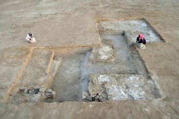
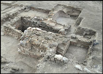
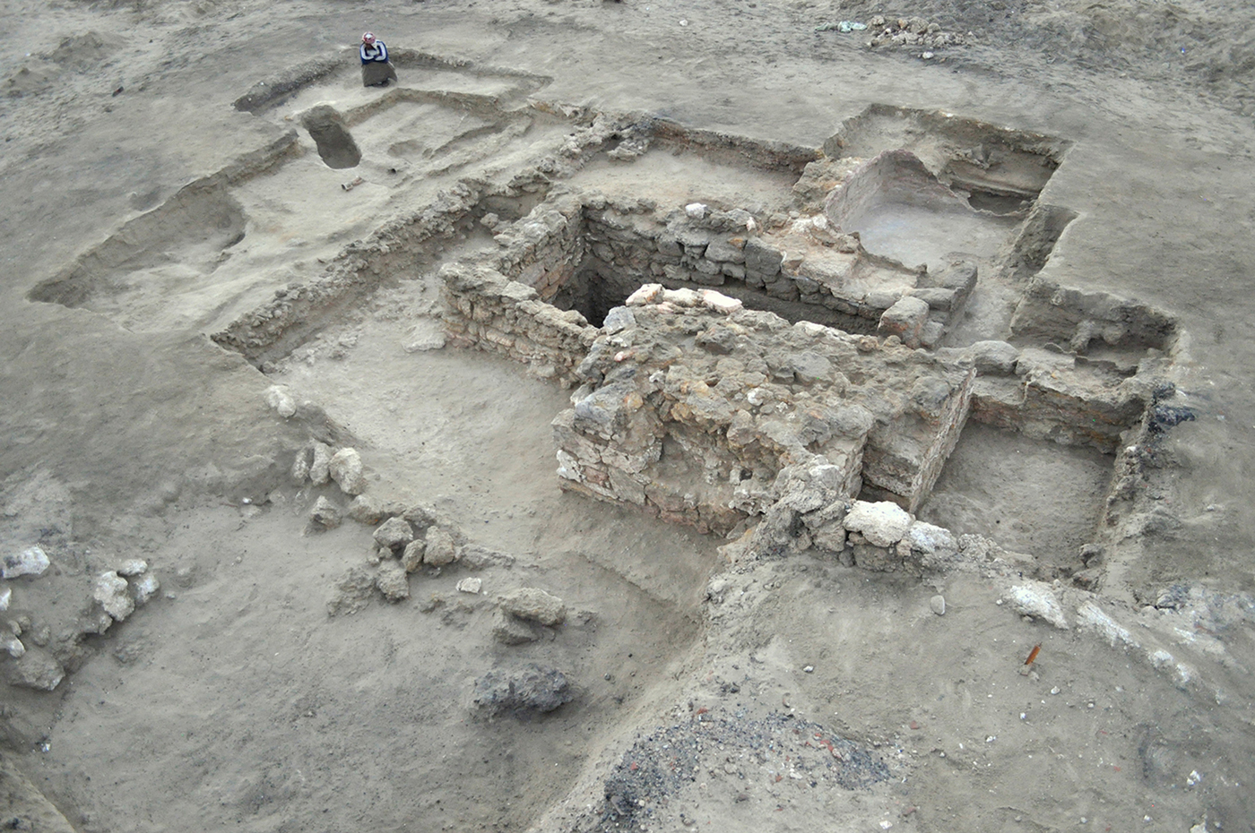
The ruins of Berenike were discovered in 1818, but the remains of the Hellenistic city, which pre-dates the Roman harbour by some 300 years, were more thoroughly investigated in 2012 by the Polish-American team. Greater attention to the Early Hellenistic settlement was triggered by the results of a magnetic survey conducted in 1999 and 2000 and 2009–2010. Excavations over the next seasons identified a huge, multi-phased building (roughly 160m long and 80m wide) consisting of three large courtyards and several associated structures, forming an enclosed fortified complex of workshops and stores (Woźniak & Rądkowska Reference Woźniak and Rądkowska2014). A line of defences was located to the north and north-east of the ‘fort’ through the magnetic survey and confirmed by excavation (Figure 1).
Complex of rock-cut foundation trenches of the north-western tower of a defensive/industrial building, viewed from the south (photograph by S.E. Sidebotham).

These fortifications cut off the site from the mainland. A double line of walls protected the western part of the fortress, while a single line sufficed farther to the east and north (Figure 2). Square towers were built at the corners and in strategic places where sections of the walls connected.
Uncovered fragment of the northern defensive wall of Berenike, viewed from the west (photograph by S.E. Sidebotham).
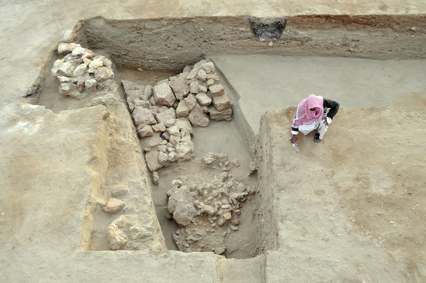
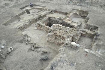
The remains of living quarters and workshops were also located, as well as Hellenistic rubbish dumps, which yielded terracotta figurines, coins and a piece of the skull of a young elephant (a molar tooth from the same species was recovered from the northernmost of the two large courtyards inside the ‘fort’). The most recent discovery is a fortified extension of the city gate (Figure 3), dating to the third century BC and constructed over a complex of rock-cut wells: the only wells discovered in an ancient city on the Red Sea coast.
Gate of Hellenistic Berenike, viewed from the north-west (photograph S.E. Sidebotham).
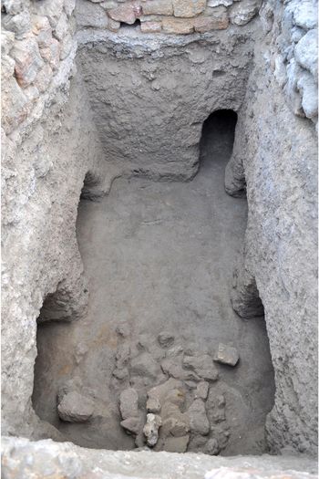
The second phase saw extension of the well's shape and narrow shaft into a rectangular, rock-cut chamber, which was more suitable for collecting the slowly flowing, potable water (Figures 4–5). A narrow rock-cut tunnel connected the well in the gate with an unexplored part of the building.
Internal chamber of the Hellenistic gate, showing the entrances of four rock-cut niches and the tunnel, viewed from the west (photograph by S.E. Sidebotham).

Water in the fully excavated chamber of the Hellenistic gate. On the right, the shape of the first phase of the well, viewed from the north (photograph by S.E. Sidebotham).

Water extracted from the well was distributed through a system of open pools located on the surface of the ground, south-west of the gate. The two largest pools may have had a total capacity of over 17 000 litres. This area was clearly important for water storage—also indicated by the presence of installations for the drainage and collection of rainwater adjacent to the gatehouse to the east (Woźniak Reference Woźniak2018: 49–59). The existence of such water-collecting installations demonstrates that there was sufficient rainfall to make collection worthwhile, suggesting a more humid climate than today.
The excavation of Hellenistic Berenike also yielded ecofacts that allow for a partial reconstruction of the economy of Hellenistic Berenike from the third to the first centuries BC (Figure 6). A considerable diversification of exploited food sources is suggested by substantial quantities of goat, sheep, cattle and pig bones discovered in the faunal material (examined by Marta Osypińska, Institute of Archaeology and Ethnology, Polish Academy of Sciences Poznań). Faunal remains also included numerous fish bones and the shells of edible mollusc species, including those restricted to mangrove habitats, which are not currently present in the Berenike area.
Hellenistic structures marked on the geomagnetic map: 1) the ‘fort’ with its three phases (blue: oldest; yellow: middle, main phase, joined with the city's fortifications; red: youngest); 2) northern defensive wall; 3) gate building (map by T. Herbich, interpretation by M. Woźniak & J. Rądkowska).

The architecture discovered in Berenike is the first-known example of Hellenistic urban architecture from the entire western coast of the Red Sea, as well as the only archaeologically investigated example of Hellenistic architecture from a city or port occupied during the Ptolemaic period in the Red Sea region.
Acknowledgements
A grant was provided by the National Science Centre (2015/17/N/HS3/00163).