

The Palatine north slope, or the area between the Sacra Via, the so-called Nova Via, the Arch of Titus, and the House of the Vestals, has attracted significant archaeological attention over the past two centuries because of its central location in Rome off the Forum (Fig. 1). The first excavations began in 1878–79 under Rodolfo Lanciani and brought to light a series of walls (Fig. 2).Footnote 1 In 1898, Giacomo Boni began his grand exploration of the Roman Forum and its environs, reaching the Palatine slope in 1901. In 1911, Boni identified a Republican house above the Sacra Via, which he dated roughly to between the 4th and 3rd c. BCE.Footnote 2 The Republican features included walls, cisterns, and drains. Although Boni correctly identified several of these archaeological layers as Republican, he was not aware that many dated several centuries earlier to the Archaic period.
Rome, area of the Vesta sanctuary: orientalizing and Archaic Age monuments. (Fulminante Reference Fulminante2014, fig. 25, redrawn after Carandini 2007, fig. 40, p. 66.)

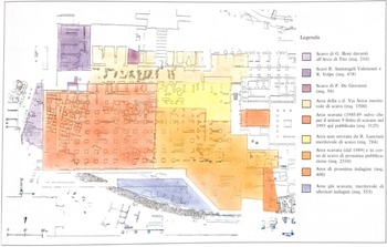
Plan of the eastern sector of the Palatine slope highlighting the excavation activity. (Carandini and Carafa Reference Carandini and Carafa1995, Fig. 8.)

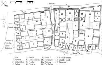
In 1985, with the collaboration of the Soprintendenza Archeologica di Roma and the University of Pisa, Andrea Carandini began excavating a large sector on the north slope of the Palatine between the Forum and the Arch of Titus and along the Sacra Via.Footnote 3 The project included the excavation of new areas of land, and the re-excavation in small areas of Boni's excavation and archival incorporation of Boni's excavations.Footnote 4 The hope was to learn more about Republican Rome to better inform our understanding of the period. Consequently, the team focused its excavation on the area where Boni had previously identified a Republican house. Over the following decades, the team ended up identifying the complexes found over this large excavation area as the Domus Vestae, the Domus Regis Sacrorum, the Domus of the Tarquins, and an eastern block of four unidentified houses on the Sacra Via, which were called Domus 1–4 (Figs. 1 and 3).Footnote 5 In this so-called Domus 1–4, Boni's “Republican house” was further explored; however, the further discovery of a monumental Archaic complex in the heart of Rome was both unexpected and unprecedented.
View of much of the area excavated by Carandini and his team from the north or the Velia. (Carandini and Carafa Reference Carandini and Carafa1995, Fig. 10.)

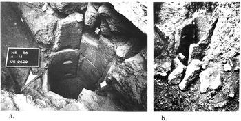
The architectural remains included multiple intact walls constructed out of ashlar cappellaccio blocks, drains, cisterns, and perhaps most significantly, intact portions of a street pavement that was identified as belonging to the Archaic Sacra Via. The cisterns (Fig. 4a–b), walls (Fig. 5a–b), and the ashlar stones from which they were built drew obvious connections between both these features and other monumental Archaic architecture, principally the Capitoline temple to Jupiter Optimus Maximus.Footnote 6 Such initial comparisons highlighted the significance of this discovery and the likely importance of such a complex in Archaic Rome.
(a) Cistern on the Palatine slope, Archaic “Domus 2” (Carandini and Carafa Reference Carandini and Carafa1995, Fig. 196); (b) cistern at the Capitoline Temple (Cifani Reference Cifani2008, Fig. 79).

(a) Profile of wall construction at Palatine “Domus 3” (Cifani Reference Cifani2008, Fig. 176); (b) profile of wall foundation construction at Capitoline temple (Cifani Reference Cifani2008, p. 89).

Carandini and his team determined that this complex was likely domestic, owing to the continued occupation of the space through the Late Republican period.Footnote 7 This interpretation is most likely correct, and current scholarship continues to support the thesis that this area was used as a domestic space in the Archaic period. During the first millennium BCE, domestic space tends to stay domestic or become public. In contrast, there is little-to-no evidence in central Italy for public and religious spaces that later become domestic space.Footnote 8 Therefore, the later Republican house in this location suggests the continuation of this space, as do the similarities to the form of the Auditorium site, discussed below.Footnote 9
Furthermore, Carandini and his team correctly redated many of the features that Boni had initially suggested as Republican to the Archaic period. The ashlar blocks were identified as cappellaccio, a type of local bedrock tuff used primarily at the end of the 6th and the beginning of the 5th c. BCE in Rome, which dated “Phase 7,” or the main construction phase, to the Archaic period. Ceramics further refined this dating to approximately 530–520 BCE.Footnote 10
This redating increased the potential significance of the excavation as one of the first Archaic domestic complexes uncovered in Rome. Other Archaic architecture had been unearthed within Rome, but nothing on this scale, in terms of the extent of preservation and the monumental remains. At the time, no comparable architecture had been discovered, and this remains true to this day. These Archaic remains miraculously had been preserved in a city filled with millennia of architectural destructions, renovations, and constructions from the Bronze Age until the present. Furthermore, the preservation of cappellaccio is highly susceptible to degradation over time as it has often been spoliated during later periods for making inclusions (caementa) for concrete.Footnote 11 Because of this poor preservation, and since many of the large-scale excavations in Rome have already been completed, it is doubtful that anything on the scale of Carandini's finds will be uncovered again soon, at least within Rome. Carandini's excavations, therefore, offer a precious window to understand early Rome, especially critical during a period with no reliable texts. Accordingly, the excavation finds have recently featured prominently in monographs by Bradley, Fulminante, and Hopkins that consider the Archaic period, and have had an impact as far afield as Ellis's discussion of the Roman imperial economy.Footnote 12
The original team's reconstruction (Fig. 6) and results have, however, been met with some skepticism from a number of scholars including Moormann, Hopkins, Lindenhout, and Wiseman.Footnote 13 Despite these critiques, no alternative interpretation has been offered. Furthermore, a series of more recent studies carried out since Carandini's excavation in 1985 now allows for the reevaluation of these archaeological remains. For example, Carandini's later excavation at the Auditorium site in Rome uncovered an Archaic residence (phase 2), shockingly well preserved because of flooding, which elucidates what a suburban domestic complex in Rome looked like.Footnote 14 Additionally, monographs by Cifani and Hopkins allow for a more holistic understanding of Archaic Roman architecture at large.Footnote 15 With this abundance of new research, the time is ripe to critically reevaluate the Archaic domestic remains on the north Palatine slope.
Carandini's reconstruction of the “Domus 1–4.” (Carandini and Carafa Reference Carandini and Carafa2017, pl. 63.)

The purpose of this paper is to reassess Carandini's excavation of the Archaic domestic archaeology on the Palatine slope and to propose a new archaeological interpretation of the data. In contrast to Carandini, who relies heavily on the historical framework outlined by Livy and Dionysius, I take any literary evidence with extreme caution since all was written several centuries later and is, therefore, of dubious reliability. Instead, I rely solely on the archaeological data and use only contemporaneous archaeology as comparanda. Because architecture is dependent mainly on the available building materials, it follows that these comparanda may be further limited to the geological regions of tuff bedrock or, generally speaking, Rome, Latium, and southern Etruria. Of these regions, contemporary architecture within Rome provides the best comparanda as it is most culturally and geologically similar.
I argue that the so-called Domus 1–4 on the Palatine slope should not be interpreted as a block of atrium houses, as Carandini originally suggested, but as a domestic complex of monumental size on the Sacra Via. Architecturally, instead of bearing similarities to Late Republican atrium houses, this newly reconfigured space is now similar to the Archaic domestic space at the Auditorium site phase 2 in Rome. This complex elucidates the development of domestic architecture in central Italy during the Archaic period and repositions the narrative of Roman urbanization.
To accomplish this, I first briefly discuss relevant contemporary domestic structures in Rome, Latium, and southern Etruria to situate the north Palatine slope within the broader context of central Italy. From this, I suggest an architectural form for Archaic domestic architecture to better inform expectations about domestic structures in central Italy, and specifically, domestic architecture in Rome. The following section turns to a reanalysis of the north Palatine slope. This is based on the first comprehensive archaeological phase plan to encompass the entire site, on the strength of which I propose a new interpretation for the archaeological remains in three phases. Because the majority of the Archaic remains under discussion are no longer visible, this research is a reinterpretation solely of Carandini's published excavation. The final part of this paper locates the Palatine slope within the context of central Italic domestic architecture and the role of Archaic Roman urbanization.
Towards a new interpretation: archaeological comparanda
Over the past few decades, archaeological excavations have uncovered domestic sites throughout central Italy at Acquarossa, San Giovenale, Poggio Civitate (Murlo), and Montetosto in Etruria; Satricum, Gabii, and Ficana in Latium; and the north Palatine Slope, the Auditorium site, and Grottarossa in Rome.Footnote 16 As mud huts were replaced by stone houses on these sites, new architectural forms were devised and innovative new technologies designed to cope with the surrounding landscape. It follows that it is necessary to consider the various architectural forms, and also the most applicable construction challenges and their resolutions.
The architectural forms of central Italy
The majority of houses in Latium and southern Etruria feature architectural similarities, including at least one long roofed corridor. Each corridor comprises a single row of rooms that open onto a porch or larger courtyard. These corridors can, however, vary in number and can consist of a one-wing corridor (San Giovenale, Ficana, and Gabii), two-wing corridors (Acquarossa), three-wing corridors (Montetosto), or four-wing corridors (Poggio Civitate (Murlo)). Satricum can be interpreted as either two single wings that are connected by a retaining wall or a three-wing corridor. Consequently, these sites can be grouped into what I refer to as the “Courtyard Wing Form.” This form illustrates a consistent domestic architectural trend throughout Latium and southern Etruria.Footnote 17 The above domestic sites are not an exhaustive list but good representative examples of this form. There are of course outliers, and not all examples fit within this model, e.g., Rusellae.Footnote 18 There are, however, enough consistencies and overlap throughout the data set to suggest general architectural trends (Fig. 7).
Categorizing the courtyard-wing forms, not to scale. 1 wing: A. Gabii acropolis (after Fabbri Reference Fabbri, Lulof and Smith2017, fig. 4); B. San Giovenale (after Nylander et al. Reference Nylander, Blomé, Karlsson and Belelli Marchesini2013, Pl. 1); C. Ficana Zone 5a and 5b (after Rathje Reference Rathje2019, TAV 1). 2 wings: D. Acquarossa Zone F (after Östenberg, Reference Östenberg1975, 142). 3 wings: E. Satricum acropolis (after Maaskant-Kleibrink, Reference Maaskant-Kleibrink1992, fig. XLVII); F. Montetosto (after Belelli Marchesini et al. Reference Marchesini, M, Biella, Michetti, Alhaique and Colonna2015, 193). 4 wings: G. Poggio Civitate (Murlo) (after Phillips Reference Phillips1972, p. 250).

Categorizing the various forms of the Courtyard-Wing Form in central Italy
Rome, however, exhibits different architectural trends. Cifani, in his article on the rural landscape of central Tyrrhenian Italy in the 6th–5th c. BCE discusses a typology of domestic structures around Rome that consists of three forms. Form 1 describes small farmhouses similar to Torrino (Torrino 1) that are no larger than 50 m2. Form 2 describes farmhouses of 5–10 rooms that range from 120 to 300 m2 in area. Examples of this form include Torrino (2), Acqua Acetossa Laurentina, Podere Tartuchino, and the first phase of the Auditorium site, or the Auditorium Flaminio.Footnote 19 Cifani's third form is of particular interest for this paper as it focuses on larger elite structures:
Type 3: large (c. 800 m2) buildings of squared blocks. The only example extensively investigated for the late Archaic period is the second phase of the Auditorium Flaminio, which is interpreted as a villa. This kind of building was probably not unique since the second phase of the Grottarossa site…is a similar structure of about 1500 m2, dated to the beginning of the 4th c.Footnote 20
Unfortunately, although an Archaic phase at Grottarossa assuredly existed, it is unclear how this complex appeared.Footnote 21 The Auditorium Flaminio, or the Auditorium site, however, offers excellent comparanda for the architecture in Rome and was exceptionally well preserved because of frequent flooding (Fig. 8). The domestic site was discovered during the construction of an auditorium on the northern side of Rome along the Via Flaminia. The site was continually occupied as domestic from 625 BCE to 150 CE. The main construction, however, like the Palatine complex, belonged to the Archaic period (phase 2) and is dated to 550–500.Footnote 22
Auditorium site Phase 2. (Terrenato Reference Terrenato2001, fig. 5.)

The Auditorium site during phase 2 represents a massive complex spanning roughly 1500 m2.Footnote 23 The complex is built primarily out of cappellaccio with rare instances of tufo lionato in opus quadratum.Footnote 24 The residential area in the northern quadrant consists of clusters of rooms around one central courtyard: three in the north, two to the west, one to the east, and seven to the south.Footnote 25 A portion of a drain is preserved in A4D running east–west.Footnote 26 Later phases or renovations of the same drain preserve and communicate the length and function of the drain, which would have channeled water from the west outside the complex under several walls into the courtyard.Footnote 27 Several portions of the floor tiles are preserved, interpreted by the excavators as reused roof tiles from an earlier phase.Footnote 28 Additional features include hearths with intact ceramic cooking vessels, a press, and a tufo ‘pozzo,’ or a well or cistern.Footnote 29
Thus, Archaic domestic architecture in central Italy can be grouped into two categories. The first is Cifani's category 3 of larger estates in Rome. These domestic sites include the Auditorium site and possibly also Grottarossa. They consist of a series of rooms that cluster around a courtyard. While Cifani referred to this as “Type 3,” for the sake of descriptiveness and clarity, this form will be referred to here as the “Roman Courtyard Composite Form.” This form has been found exclusively in Rome. The second form is the “Courtyard Wing Form,” a single row of rooms that frequently opens onto a courtyard or porch. These rows or wings can number from one to four. This Courtyard Wing Form is located outside of Rome throughout Latium and Etruria.
Comparanda for building techniques
The challenges of the local landscape informed building construction. At the Palatine slope, the major challenge was contending with the steep slope of the Palatine Hill; this slope would have to be leveled off to avoid a floor with a significant slant or walls with a significant tilt. Additionally, on a steep slope, the area was susceptible to heavy rains or erosion.
The houses at the Borgo at San Giovenale were built into a steep hillside and faced similar construction challenges (Fig. 9a). To contend with the incline, in the late 7th c., the workers created a large cut into the hillside and the fill from this cut was then placed below to create a leveling layer (Fig. 9b). This resulted in a flat terrace level. Additionally, an upper retaining wall was installed to prevent further erosion from above, and another was built below to prevent the erosion of the terrace. Drains were installed uphill of the retaining wall to collect water and let it out below the lower retaining wall (Fig. 9c). The ashlar foundations for these three houses had no foundation trenches and were therefore laid in the fill simultaneously. As a result, because the walls were laid onto the original sloping hillside, additional courses needed to be added at the lower elevation to match the higher elevation (Fig. 9d). Although there were several actions involved in the construction of the houses at the Borgo, they were all carried out around the same time: thus the terrace was made for the construction of the houses.Footnote 30
(a) Landscape of San Giovenale (photograph by B. Blome. Nylander 2013, fig. 30); (b) sketch showing the cut into the hill and the fill from the cut (after Nylander 2013, fig. 60); (c) plan of San Giovenale (Nylander 2013, fig. 27); (d) cross section of wall D3 at San Giovenale, with more courses laid further down the slope (Nylander 2013, fig. 78).

Finally, because it is a well-known and extensive early domestic site, it is necessary to briefly consider the site at Marzabotto, which was invoked as a possible comparandum for the row of Palatine houses.Footnote 31 There are a number of reasons, however, why the connection between Marzabotto and Rome does not seem to be a particularly useful one. For a start, the Etruscan center of Marzabotto is located in Emilia-Romagna, in the lower Po Valley, geographically and culturally far from the urban cluster of Tyrrhenian central Italy.Footnote 32 Its topographical and geological landscape is also drastically different, so that house construction in Marzabotto poses different construction challenges that ultimately result in different building techniques.Footnote 33 There is no volcanic tuff to make ashlars of, and the walls are built of river boulders. The completely flat landscape of the Po plain also creates completely different conditions: what is possible there is not necessarily applicable to the steep slopes of the Palatine, nor of central Italy in general. Marzabotto has so far found no parallels anywhere in Italy, outside of Greek colonies. Unlike the other Archaic building forms discussed here, which constitute an organic group, Marzabotto remains an outlier upon which it would be precarious to base a reconstruction for Archaic buildings in Rome.
A new interpretation
A major pitfall of the previous research is the overlap between archaeological evidence and the reconstruction, or put otherwise, between the data and the interpretation of the data. A necessary first step is to put forward a new archaeological phase plan (Fig. 10).Footnote 34
A new archaeological plan for the north Palatine slope domestic remains during the Archaic period. (Plan by A. Eichengreen.)

My research is mostly concerned with three major episodes of construction, the main Archaic building phase, the Archaic modifications, and the Early Republican modifications. The first period, dated on ceramic evidence to the end of the 6th c. BCE, or the main Archaic building phase, is necessarily the focus of this discussion. In Carandini and Carafa, this phase is referred to as Phase 7, but here called 7a to distinguish it from a later Archaic innovation. These walls are constructed in cappellaccio and laid into the terrace with no foundation trenches, suggesting one cohesive and simultaneous phase of construction activity.Footnote 35 Additionally, the team distinguished a second period of renovations dating to the Early Republican period, the second quarter of the 4th c. BCE (or in Carandini and Carafa, Phase 9).Footnote 36 I distinguish another period between these two, dating to the first quarter of the 5th c. BCE based on ceramic evidence and differing construction techniques from 7a that point to renovations. I refer to this phase as 7b. In contrast to the construction techniques of 7a, which was built without foundation trenches, in the 7b constructions foundation trenches are used. This suggests that the architectural features belonging to this phase were later renovations. Unless otherwise identifiable, I maintain the original dating and phasing.Footnote 37
It is worth noting that there are several phases or activities that I do not examine. The team identified 13 distinct activities within the Archaic period, or Phase 7.Footnote 38 These included constructions of entire houses, the construction of graves, and modifications to pavements. My research aims not to reconfigure the entire excavation report but instead to reevaluate where necessary and consider the more substantial moments of activity.
The main Archaic building phase (Phase 7a); end of the 6th c. BCE
Terraces and Cut 1
It is first imperative to make sense of the natural landscape and understand how this shaped the construction of the complex. An east–west cross section reveals a significant drop between a higher portion (on the plan, yellow) and a lower portion (white) (Fig. 11a–b). This significant drop is of anthropic origin, caused by Cut 1.Footnote 39 Carandini observes this drop, and interprets it as a house split into two levels (Fig. 12). Moormann, however, asserts that this type of house is entirely unprecedented during this period, and I would add further that split-level houses are unknown throughout all periods in central Italy.Footnote 40 Furthermore, an orthogonal grid plan and homoteichia, or the sharing of walls between houses is unprecedented in the 6th c. Additionally, new studies concerning concrete construction show that homoteichia does not occur until the widespread use of concrete in the last quarter of the 2nd c. BCE.Footnote 41 Ultimately, there is no contemporaneous evidence for the block of four houses like the one proposed. Moormann speculates that “in fact, one could argue, on the basis of the same lines, for a series of smaller houses or even a single free-standing house within an empty area, maybe used as a garden.”Footnote 42
(a) Archaeological plan with cross-section line indicated in red. (Plan by A. Eichengreen.)

(b) Cross section. (A. Eichengreen.)

Carandini and Carafa's profile of Domus 1, reconstructed east/west, view from the south. (Carandini and Carafa Reference Carandini and Carafa1995, pl. 54.)

With reference to the contemporary building techniques at San Giovenale it becomes possible to reinterpret this cut. Like the complex at San Giovenale, which is also located on a steep hillside, the Palatine complex lies at the foot of a slope, which would have made level construction difficult. Typically, a flat surface is required for construction, so as not to result in sloping floors or leaning walls. In order to accommodate this at San Giovenale, a similar cut was made to form two terraces, with the majority of the architecture occurring on the lower terrace. Similarly, at the Palatine, the architecture is almost entirely on the lower terrace. At San Giovenale, ashlar walls are constructed on a slope, with additional courses of ashlars laid to accommodate the slope, and the fill from the cut placed around them. Again, it is likely that the same construction technique was employed: at the Palatine, the north–south walls are constructed with additional courses in the northern portion of the walls to accommodate the slope (Fig. 5a). Specifically, these walls were built into the terrace with no foundation trenches. The absence of foundation trenches would either require cutting exactly into the layer and inserting the stones carefully and precisely into this cut, or, more likely, laying the walls, then filling with soil around them.Footnote 43 Thus, it is evident that the same technique for laying the ashlars and placing the fill around them was employed at the Palatine and San Giovenale. The nearly identical construction techniques at San Giovenale suggest that Cut 1 in the north slope of the Palatine should be reinterpreted as the creation of two terraces, an upper one and a lower one. This terracing was created specifically for the construction of the Archaic complex. The Palatine terrace, furthermore, is a very significant investment, which would only make sense for a unitary complex. If the remains instead belonged to several smaller houses, they would have been arranged following the natural slope of the hill.
Further similarities with San Giovenale are apparent when we consider the retaining walls and the drainage systems employed with them. Ammerman discusses the importance of drainage at the foot of the Palatine, with significant amounts of water and potential erosion from the hill above. He suggests modifications in the earlier fossato to accommodate the slope and drainage.Footnote 44 It is likely that many architectural details were also intended to do the same thing. A wall fragment (US 352) was found at the cut. It is likely a fragment of a retaining wall created to prevent erosion from the higher to the lower terrace. It is impossible to know for certain, but if there was indeed a retaining wall, it likely extended around the entire circuit of the cut to prevent erosion. The hydraulic elements on the upper terrace likely functioned similarly to divert or collect any water from the upper terrace or from the Palatine. At San Giovenale, similar techniques were employed. A large retaining wall surrounded the settlement to prevent flooding or erosion, with long drains running between the houses also to prevent flooding.Footnote 45 Given that a significant wall exists for these reasons at San Giovenale and the Palatine slope would have had to deal with even more dramatic environmental conditions at the foot of a steeper hill, it would not be surprising if a similar retaining wall were constructed on the Palatine slope. Other drains found to the east likely functioned similarly.
If the retaining wall (US 352) near Cut 1 did extend all along the upper terrace, it would have protected the lower terrace from the east but not from the south. It is likely, therefore, that a southern wall also protected the complex. Wall 867 runs east–west, parallel to 945 with less than a meter between them. Because of the proximity, it is not possible that the space could have been a room, and it is likely that 867 was a retaining wall protecting the lower terrace from erosion from the south. Similar architectural techniques are employed at Acquarossa and San Giovenale, where both settlement areas have substantial retaining walls to prevent erosion or flooding.Footnote 46 Wall 867 lines up with 1031, thus it is likely that 867 equals 1031 and that this wall extended over the length of the complex. If it did not, it would leave portions of the complex exposed. This would have created a bottleneck effect, with any erosion or water channeled to a very small area. A partial wall would have been less effective than no wall, putting more stress on a focused area. Therefore, the retaining wall must have extended along the entire area of the complex.
Roads
In the north, Segment 3774 of the Sacra Via was found northeast of wall 8044. The original excavators observed that the Sacra Via and the complex sit on top of homogeneous layers (Fig. 13a–c).Footnote 47 Thus, the Sacra Via is in the same phase and in the same layer as the rest of the house.
(a) Stratigraphy for the site with the period “Riempimento del fossato” in yellow dating roughly to 550 BCE. On top of this layer is the layer for the Archaic house (Carandini and Carafa Reference Carandini and Carafa1995, tav. 46); (b) the stratigraphy rests on top of the “Riempimento del fossato” (Carandini and Carafa Reference Carandini and Carafa1995, Fig. 193); (c) section of the archaic Sacra Via (Carandini and Carafa Reference Carandini and Carafa1995, Fig. 195).

To the south of the complex, archaic road fragment 980 likely intersected, connected, or became the so-called Nova Via. Thus, it is possible to imagine the complex bounded to the north and the south by two major roads.
Drains
Similar to the upper terrace, however, the lower terrace would still have to cope with any runoff water or flooding from above. A series of drain tiles running north–south can be connected including segments 8068, 8069, 8072, 8070, 8071, 8024, 8023, 8022, 1052, 8020, 8021, 8018, 8019, 8031, 2596, 8030, 2519, 8011, and 8014. Thus, all these drain segments can be reconstructed into one long drain running from the south to the north, referred to as 8072 (Fig. 14). This drain runs under a segment of cappellaccio and likely met up with the drain in the Sacra Via that includes 8040, 4119, and 4302, which will be referred to as 8040. Such a drain likely channeled water from the hill or the road to the south (980). If the drain ran underneath the cappellaccio walls to the north, it may extend beyond to the south or more likely as far as the retaining wall. The purpose of this wall was likely to channel any runoff water from the road above into a concentrated area, underneath the complex, and out onto the drain in the Sacra Via. This is corroborated by the southern portion of drain 8072, which abuts wall 1053 and suggests it was for exterior, and not interior, drainage (Fig. 14). Additionally, this drain is located just north of 945, raising the question of what its purpose would have been otherwise. Likewise, at San Giovenale, a long drain runs under the retaining wall and then in among several of the houses to divert water.Footnote 48
Wall 1053 running north–south and, to the right, abutting drain 8072, photographed from the north. (Carandini and Carafa Reference Carandini and Carafa1995, Fig. 177.)

The western drain likely acted similarly. Drain fragments 8001, 8000, 2649, 2554, and 2551 can be reconstructed into one drain. This drain, like 8072, would have diverted water from the road above. Unlike 8072, however, water was likely collected into nearby well 5234.
Exterior walls
In the south, there is likely one continuous wall running parallel north of retaining wall 867. Wall 945, running east–west, lines up with 8035 and 1633 and they are therefore equivalent to each other. This wall will henceforth be referred to as 945.
To the east, there was likely another wall running the length of the complex. Wall 1420, running north–south, connects with 8043, and 2566 and 8044. Thus, these walls are equivalent and will be referred to as 1420 (Fig. 15). The infant burials on either side further corroborate 1420 is one long continuous wall. Since archaic burials are located in proximity to an external wall (either on the interior or the exterior), this further suggests a wall in between these two burials or that these wall fragments are connected.Footnote 49 Furthermore, these burials suggest that this was an exterior wall and, therefore, the eastern limit of the complex. Walls 1420 and 945 were likely connected, forming the eastern and southern boundaries. It is, however, likely that the area to the east of this wall, between the terrace and wall 1420, was an accessible garden or pasturing space. It is worth remembering the value of this real estate in downtown Rome, and it is likely that all areas were utilized in some way or another. Because of the retaining walls and the terrace, this space was likely connected to this complex, which would have had access to it. For this reason, dashed lines are drawn between walls 1420 and 945 to show that this eastern area would have been accessible.
Wall 1420 running north–south. (Carandini and Carafa Reference Carandini and Carafa1995, Fig. 171.)

Wall 2602 running east–west abuts 2566 running north–south. Unfortunately, no other walls connect with wall 2566, so it is impossible to reconstruct the southeast further: but it should be noted that the complex likely extended further to the east. The lack of other walls to the east is likely due to the sizeable Republican complex in this area, which either covers or destroyed any Archaic remains (Fig. 16).Footnote 50 The wall between A.613 and A.617, reportedly found by Boni, further suggests another Archaic domestic complex located under these Republican remains, which unfortunately cannot be ascertained. The presence of cappellaccio pavement floor 711 abutting both these walls suggests an interior domestic space between wall 2602 and the Sacra Via. Although impossible to determine for certain, it cannot be excluded that this rectangular strip on the Sacra Via consisted of tabernae.
Phasing from Carandini's excavation. (Carandini and Carafa Reference Carandini and Carafa1995, pls. 5, 69.)

In the northern sector, 8056, running east–west alongside the Sacra Via, lines up with 4260 and can thus be connected to what will be referred to as 4260. Wall 8010, running north–south, abuts 4260. Wall 4156, preserved from the later Phase 9, dating to the second quarter of the 4th c. BCE, runs north–south, parallel to 8010. Located directly off the Sacra Via, these walls likely formed the fauces of the house. Although 4156 is significantly later, it is less likely that the occupant would choose to remodel their doorway completely than to modify the existing structure. Most importantly, the door is located off the Sacra Via, where one would expect it to be. Thus, 4260 forms the northern boundary of the complex.
The westernmost walls, 2811, 3919, and 3782 running north–south, line up and henceforth will be referred to as 2811. Since there are no wall fragments to the west of 2811, this was likely the western boundary of the complex. This is further corroborated by the presence of a sarcophagus directly to the west of 3919.Footnote 51 Wall 2811 likely connected with 945 to the south and 4260 to the north. There was likely a further northwestern area as evidenced by 3846, which abuts 3782. Without any other walls, however, it is not possible to further reconstruct this northwestern portion. It is less likely that the complex extended further to the south of 3846 since the sarcophagus suggests that wall 2811 is an exterior wall.
Preliminary conclusions: one palatial complex
It is now possible to recognize that the most likely interpretation of this unique complex is one palatial structure facing onto the Sacra Via (Fig. 17). It is important to note that almost all the architecture brought to light is concentrated on the lower terrace, which suggests that this terrace was constructed specifically for the complex and that all of the architecture is related and makes up one complex. Additionally, all the architecture is built of the same material, with the same technique, and similar ashlar block morphology and metrology. Furthermore, current scholarship reveals that homoteichia, an orthogonal grid plan, the Pompeiian-style house with the cruciform atrium, and terraced housing were all unprecedented in 6th c. BCE Italy, making it extremely unlikely that the remains are composed of multiple terraced Republican-style houses.
Proposed plan: Phase 7a: end of the 6th c. BCE. (Plan by A. Eichengreen.)

Northern wall 8010 running north–south and southern walls 1633 and 8035 running east–west strongly support this hypothesis. The fragments 8035 and 1633, as previously suggested, easily connect into one long wall. Furthermore, these wall fragments are located at a critical juncture between the western and eastern sectors, suggesting that these two sectors belong together and are not divisible. Furthermore, drain 8072, which runs the entire length of the structure, suggests a unity between the north and the south. This is further corroborated by the presence of one long wall 1053 and fragment 8010.
Interior walls
The question of reconstruction then turns to the interior walls in this complex. Because of the fragmentary nature of the remains, the composition of many of the interior walls remains unclear. For our purposes, what is most important is the identification of a palatial complex, while its internal arrangement must remain very speculative and is presented here only as a partial and tentative hypothesis. In the northeastern sector, 2517 runs parallel to fragments 8044 and 2566 of wall 1420, with less than a meter between 8044/2566 and 2517. While previously a wall in close proximity to another wall was likely a retaining wall, this cannot be the case here. Walls 2566 and 8044 must have been internal because of the pavement floor fragments 711 abutting 2566 and floor fragment 8045 abutting 8044. Therefore, it is more likely that 2517 is also a floor fragment. 2517 is at an elevation of 21.66 m, which is very close to the elevation, 21.19 m, of the nearby floor fragment 711. It is easy to understand why 2517 was initially mistaken for a wall. The preservation of the floor as a long and narrow fragment instantly suggests a long and linear feature or a wall. Additionally, both walls and floors are constructed out of cappellaccio, allowing for no distinction between the two, at least in terms of material composition.Footnote 52 Long portions of the Sacra Via have been similarly preserved. In short, 2517 has more characteristics of a floor than of a wall section.
Wall 3062 runs parallel to the south of 4260. Thus, 3062 likely abutted the two walls that abut 4260: 1420 and 1053. These four walls form R1, which contains cappellaccio fragments 8053 and 8057. It is not possible, unfortunately, to understand these fragments to any greater extent. A circular cut within 8053 suggests that it could have been employed for some roofing technology, or some other feature. 8057 could have been employed similarly, or it may have made up another wall. Directly to the east is a stone from floor fragment 2517. There are no elevations, however, taken from this stone. It is thus impossible to determine if this is a wall fragment that connects with 8057. It must be assumed it is part of floor fragment 2517.
To the south of this room, 1177 lines up with 1160 and can thus be understood as one wall, referred to as 1177. Segment 1160 should abut 1849 and 8049 to the west. The area south of 1177 can be divided into two rooms, as evidenced by 874, which abuts 945. Owing to the fragmentary nature of the documented remains, the extent of 874 cannot be reconstructed, but well 2251 to the north suggests that it is likely that it did not continue north–south. This well also suggests that part of 874 might have been used as an outdoor space.Footnote 53 These rooms can be referred to as R3 to the east and R4 to the west, and together they would have been the two southeasternmost rooms of the complex.
To the west, running perpendicular to the north of 945, is 1114, connecting with 1633. This wall will be referred to as 1114. Running parallel to the west of 1114 is 1266, which would have abutted 945. Wall 1266 lines up with 2225 and the section of 1938 running north–south. This long wall, running along the length of the complex, will be referred to as 1266. To the north of 945 is parallel wall 3051 (Fig. 18). Thus, these four walls, 945, 1114, 3051, and 1266, can be understood as R5.
Wall 1261 running east–west, view from the south. (Carandini and Carafa Reference Carandini and Carafa1995, Fig. 184.)

To the north of R5, 1141 connects with 1633, and will be referred to as 1633. Wall 1633 would have abutted 1114 and 1266. This wall runs parallel to 3051 in the south, which also abuts 1266 and would have abutted 1114. Thus, these four walls, 1114, 3051, 1266, and 1141, can be understood as R6.
Running parallel to the north of R6 is 1074. It is unlikely that 1074 extended further to the east because of wall 8036 of the cistern, which will be discussed below. Wall 1074 is cut by a circular cut 8051. Circular cut 8064, just to the south, has a similar diameter. These two cuts were likely originally to have been post holes for posts employed to support the roof. Wall 1074 would have abutted 1266. There was probably a fourth wall that connected 1141 and 1074, which together with 1266 would have composed R7, but there is no longer any trace of it.
Further north, a small segment of 2225 has been preserved, running east–west. This wall would have abutted 1266. To the east, running north–south, is 8029 and to the north, 1938. The walls on all four sides definitively articulate the narrow rectangular shape of R9. Because of its peculiar shape, R9 will be discussed in more detail below.
To the west, 2021, running east–west, would have abutted 1266. Walls 1266, 2021, 2811, and 945 can be understood as R8, the southwesternmost room of the complex. To the north of 2021 is a parallel wall running east–west, 8020. Walls 2021, 1266, 8020, and 2811 can be understood as R10. Within R10, five precious floor fragments have been preserved.
North of 8020 is a room that can be understood as R11 from walls 1845, 1938, 1759, 8020, and 3919. A burial was uncovered near the southernmost wall of R11, wall 8020.
North of R11 there would have likely been an open courtyard space. There are no walls to suggest otherwise, and furthermore, wall 803 from later Phase 9 is not sturdy enough to have been structural to the building; that is, it could not have supported a roof. Thus, this space in the later period could not have been roofed, and it is likely in Phase 9 that this was an open-air space. There is no evidence that this space was enclosed or roofed during Phase 7a, either, and it is more likely that the wall served instead as a feature in a garden space. To the west of this courtyard space, there was likely another room that cannot be reconstructed, based on the existence of 3846, which abuts wall segment 3782 of 2811.
The northwesternmost room is demarcated by 3208. While there are no walls preserved for the western and northern boundary, based on the general architectural forms from this period, it is likely that the overall shape of the building was rectangular and this area was used within the complex.Footnote 54 The eastern boundary of this wall is suggested by later Phase 9 wall 4126 running north–south and 8038, which abuts this wall and would have been equivalent to 3208. Although from a later phase, this wall is likely consistent with a repair rather than a renovation at the front of the house. This is evidenced by 8010, which continues to be a part of longer wall 4267 from Phase 9. Thus, the eastern wall of the fauces during Phase 9 is consistent with the eastern phase 7a fauces wall. This logic likely applies to the western fauces wall, and the 7a portion that is not preserved likely followed the western wall of the 7c fauces. Thus, from the Phase 9 fauces, we can understand the 7a phase fauces. Furthermore, this wall lines up roughly with the other eastern boundaries of parallel rooms R5, R6, R7, R9, and R11, and further reinforces the placement of the fauces here.
The open space in the center of all these walls is interpreted as an open courtyard, R2. It is very likely that this courtyard space was further divided into smaller spaces, in particular in the eastern portion of the courtyard, where 8049 suggests that there were additional rooms or walls to the north of R3 and R4 that cannot be reconstructed. It likely that there were walls that are no longer preserved since a largely preserved portion of the Republican domus is located directly over these two rooms (Fig. 16). Thus, it is not possible to determine whether or not this was the original shape of the courtyard. Depending on how this eastern portion of the house is reconstructed, it is possible that this courtyard represents the first instance of a cruciform atrium.
Floor levels
R9 is a space with northern, southern, eastern, and western walls, so the exact area of this room can be confirmed as approximately 1 × 5m, an exceptionally unusual size. Because of the 1m depth, it would only have been possible to walk through, making it impractical as a storage space, and furthermore, unable to hold any kind of furniture. It can only be interpreted as a space to pass through. This raises the question of where it led, since walls 2225 and walls 2021 confirm that it cannot have been a hall leading to the ground level. It must be concluded that R9 was a walk-through space that went to another level, or a staircase. Its length of 5m also falls within the exact dimensions necessary for a straight staircase leading to a second story.Footnote 55 The space's location off the central courtyard or atrium is where staircases commonly appear, and the construction technique of ashlar masonry with ashlar foundations would have sufficed to bear the weight of the second story.Footnote 56 Thus, the cluster of connected rooms R5–R11 can be reconstructed probably with a second story. It is possible that the cluster of rooms R3 and R4, as well as R1 and R12, also had a second story, although there is no archaeological evidence to affirm this. If this interpretation is correct, R9 represents the first known domestic staircase in Italy. While other archaic domestic structures (e.g., Murlo and the Auditorium site) have previously been reconstructed with a second story, these reconstructions have been purely conjectural and largely based on the passage in Livy where Tanaquil goes to the second story of the house.Footnote 57 The staircase at this structure confirms what had been previously only speculated: monumental domestic structures in central Italy could boast a second story.
Roofing
Winter and colleagues have studied the roofs of domestic spaces in Rome, among them those on the Archaic north Palatine slope complex. They concluded that domestic spaces in Rome were covered by undecorated tile roofs.Footnote 58 Similarly, it appears that the Auditorium site was covered with an undecorated tile roof.Footnote 59 It is most likely that the roofs were constructed like other contemporary temple roofs; that is, pitched and without trusses.Footnote 60 Therefore, it should be recognized that R1 is too large to be covered by one single roof. Although it is not possible to reconstruct these walls, it is likely that R1 was further broken down into smaller rooms.
While this research has suggested a new architectural plan for this structure, because of the roofing it is not possible to put forward one single architectural reconstruction. It is unclear how several rooms would have been roofed, and furthermore, whether areas on the second story were roofed or used as terrace space. Forthcoming research aims to posit several reconstructions for this space.
Archaic modifications (Phase 7b): end of the 6th-beginning of the 5th c. BCE (Fig. 19)
As previously discussed, all of the walls for phase 7a were constructed with no foundation trenches. Consequently, ashlars were placed with a fill then laid around the foundations. The main rectangular cistern (US 1283, 1285, 8036, 8041 8042), located in so-called Domus 3, however, was constructed with foundation trenches (Fig. 20a–b). Footnote 61 This construction technique, which is dissimilar from the rest of the architecture, suggests the cistern was constructed later. The foundation trenches for the cistern included ceramics that are consistent with the dates for the rest of the complex, namely 530–520 BCE.Footnote 62 It is likely, therefore, that the cistern was installed sometime after the main complex was constructed.
Proposed plan: Phase 7b: end of the 6th–beginning of the 5th c. BCE. (Plan by A. Eichengreen.)

(a) Plan of cistern (Carandini and Carafa Reference Carandini and Carafa1995, Fig. 198); (b) profile of the arch covering the cistern (Carandini and Carafa Reference Carandini and Carafa1995, Fig. 199).

Early Republican modifications (Phase 9): second quarter of the 4th c. BCE (Fig. 21)
During the second quarter of the 4th c. BCE, several modifications were made, mainly in the northern part of the complex. The northern portion of the drain and both the eastern and western fauces were renovated. Additionally, R1 was broken up into another room, R13, with walls 4103 and 4108. In the northwestern sector, a thin angular wall portion 803 is erected. This wall is too thin to be structural, but was possibly used as an outside garden or dividing wall, suggesting that this area might have always been used as an outdoor space.Footnote 63 Finally, the infant burial in R11 dates to the second half of the 3rd c. BCE and indicates the continued occupation of this space.Footnote 64 This phase was convincingly identified by the excavators and interpreted as a modification of the whole block; when seen as the alteration of a single building, it makes even more sense.
Proposed plan: Phase 9: second quarter of the 4th c. BCE. (Plan by A. Eichengreen.)

Understanding the architectural form of the Palatine slope within the context of central Italy
During the past half a century, there have been excavations at over a dozen Archaic domestic sites throughout central Italy, most significantly at Acquarossa, San Giovenale, Poggio Civitate (Murlo), and Montetosto in Etruria, and Satricum, Gabii, and Ficana in Latium.Footnote 65 All of the houses at these sites are versions of the Courtyard Wing Form, depending on how many wings are present. This form can be defined as a wing of a single row of rooms that commonly opens onto a courtyard or a porch. The Palatine slope house cannot be interpreted as a Courtyard Wing Form because it features clusters of rooms, similar to the Auditorium phase 2, rather than single rows of rooms. Because of the preservation of both the eastern and the western walls and the cistern in the center courtyard, it is impossible to configure the Palatine slope into a Courtyard Wing Form house.Footnote 66
This new reconstruction for the Palatine slope elite complex belongs to the same architectural form as the Auditorium phase 2, and possibly also Grottarossa, as Cifani suggests.Footnote 67 In Rome, a series of rooms cluster around a single courtyard. Outside of this main Palatine complex, there were likely other rooms or annexes, like A8 at the Auditorium site, that jutted out from the main structure, as evidenced by the remains of walls 2602 and 3846. Additionally, a long drain running through the central courtyard diverts water at both sites. Finally, these domestic complexes are within the same scale range. The Auditorium site is roughly 1,500 m2.Footnote 68 In comparison, the Palatine slope domestic complex is within this palatial range but at an even larger scale of nearly 2,000 m2.Footnote 69 It is also noteworthy that there are portions of the Palatine slope complex, like the annexes, that existed but cannot be reconstructed. Thus, this square meterage would in actuality have been more than 2,000 m2. The elite complex further fits within the genre of what scholars have defined as palatial or monumental.Footnote 70 In general, homes in the countryside tended to be larger than those in urban contexts. That the Palatine elite complex surpasses the Auditorium site, a large estate in its own right situated outside of ancient suburban Rome, highlights the impressive scale of this structure (Fig. 22).
To-scale comparison of select monumental Archaic complexes. A. The new plan for the Palatine north slope; B. The Auditorium site (Terrenato Reference Terrenato2001, fig. 5); C. Acquarossa Zone F (Östenberg, Reference Östenberg1975, 142); D. Poggio Civitate (Murlo) (Phillips Reference Phillips1972, p. 250); E. The borgo at San Giovenale (Nylander 2013, fig. 27).

Since the Auditorium phase 2 and the Palatine slope were constructed in similar geographical and cultural contexts, it follows that the two sites would be architecturally similar. Together these two sites begin to suggest an architecture for domestic spaces in the Archaic period in Rome that is significantly different from the domestic architecture found throughout Latium and Etruria. Or, in other words, this reconstruction endorses what Cifani previously hinted at: that Roman domestic architecture can be classed differently from its environs.Footnote 71 It should be noted, however, that this interpretation is based solely on the current state of knowledge: since these palatial sites are rare, it is possible that they have not yet been found elsewhere.
The understanding of a potentially distinct architectural tradition in Rome has larger repercussions for how one interprets the development of domestic spaces into the later Republican period. Terrenato's Reference Terrenato2001 article on the origin of the Roman villa argues that it is possible to see the Roman villa emerging out of the Archaic building at the Auditorium site.Footnote 72 If Terrenato is correct, this research would suggest that this Roman villa emerged out of the form at both the Auditorium site and the Palatine north slope: the Roman Composite Courtyard Type. Future research has the potential to further engage with the narrative on the development of Roman villa.
Another interesting point of discussion is the atrium. A core piece of evidence for the emergence of the Roman villa is the cruciform atrium, which at the Auditorium site emerges during the 5th and 4th c. BCE.Footnote 73 At the Palatine north slope, it is possible that the cruciform atrium emerges at the end of the 6th c., which would make it the earliest known cruciform atrium. The existence of the later Archaic cistern secures that there were open southern and northern branches. The fragmentary nature, however, of the eastern portion, which lies directly under a Neronian column (Fig. 16), makes it impossible to know for sure.
Conclusions: understanding the Palatine Slope within the context of Archaic Rome
The Sacra Via, or Rome's most prominent street, would have extended from around the future location of the Arch of Titus down to the Forum (Fig. 23). It was along this street that religious processions went up to the Capitoline temple. An elite complex at the edge of the Forum on Rome's most important road suggests that the individuals to whom it belonged were among the most affluent in Archaic Rome. Many powerful individuals and families including Valerius Publicola (Cic. Rep. 2.53), the Fabii (Polyb. 31.23.7), and Scipio Africanus are said to have lived close to the Forum.Footnote 74 Specifically, Scipio Nasica was said to have lived on the Sacra Via in a house given to him by the state (Dig. 1.2.2.37), and Cicero's house was said to have been located in a similar neighborhood on the northeast Palatine slope in conspectu totius urbis (Cic. Dom. 100).Footnote 75 Cicero's comment is of particular interest as it communicates how highly elite Romans valued the visibility of their homes. Marcus Livius Drusus, the tribune of 91 BCE, told his architect to build a house overlooking the Forum ut quidquid agam, ab omnibus perspici possi or “so that whatever I do can be seen by everyone” (Vell. Pat. 2.14.3).Footnote 76 Russell comments, “if the height and visual presence of these mythical houses was such a threat, we should take seriously the idea that the real elite houses overlooking the Forum were powerful symbols of the private control their owners could wield even in public space.”Footnote 77 This elite complex's high position on the Palatine slope would have made it visible to all those who frequented the Forum. Additionally, its second story, at a time when the city was composed largely of one-story stone buildings or huts, would have made it an all the more imposing display of wealth and power in Archaic Rome. Previously, burials or dress were the mediums used to communicate elite wealth. The emergence of elite complexes provided a new way for elites to display wealth and assert their power.
Plan of known buildings in Rome ca. 500. (Original plan courtesy of John North Hopkins; adapted for this research with the new plan for phase 7a inserted.)

Not only was the Palatine complex more architecturally formidable, but it would also have provided significantly better living conditions than the huts their owners’ peers lived in.Footnote 78 For example, huts would have had poorer air circulation, and the mixing of manure with straw and mud to create wattle and daub would have created a powerful stench that was likely particularly prominent during Rome's most humid months. Rain would have caused leaking roofs and muddy beaten earth floors, necessitating frequent repairs. Flooding would have been the most severe risk, threatening inhabitants of huts with death. In contrast, the Palatine and the Auditorium phase 2 elite complexes were well equipped with drainage features to divert floodwaters and with tiled roofs to keep out the rain.Footnote 79 Furthermore, several cisterns and wells at both sites signal ease of access for obtaining water. The stone walls of these complexes would also have better insulated the home during the colder months and provided a cooler reprieve during the hottest months.
Beyond the position on the Sacra Via, archaeological evidence articulates the power these individuals possessed over public spaces and within the city of Rome. The construction of the Sacra Via in the same layer of terrace fill as the foundations for the Palatine elite complex strongly suggests that the Palatine elite complex was constructed not just at the same time but also probably as part of the same building project as the Sacra Via (Fig. 13a–b).Footnote 80 Whoever owned the complex was likely responsible for the construction of the Sacra Via, or at the very least, was working in very close coordination with this project. This new discovery continues the conversation on the complexity of Archaic Roman urbanization that began at the 2013 conference, “The Age of Tarquinius Superbus.”Footnote 81
The archaeological record strongly suggests that the Palatine structure was one domestic complex. Owing to the scarcity of the evidence this new plan cannot be conclusive. But the conclusions here about this elite complex and its role in the urbanization of Rome are not dependent on this new plan or interpretation of the structure as one complex. The archaeological evidence alone allows for these connections that place the elite complex's construction and Sacra Via within the same layer.
While within the past few decades there has been an increased attention to Archaic architecture and the Archaic cities, with notable contributions by Cifani, Hopkins, and Potts, the focus has remained on civic or religious architecture.Footnote 82 It is impossible to understand the Archaic city holistically or its urbanization without considering its domestic architecture. The importance of the north Palatine complex within this canon of Archaic architecture cannot be overstated since it remains the only elite complex in the heart of Rome. It is my hope that this research positions the discussion of domestic architecture as central to discussions of Archaic Rome and Roman urbanization.
Acknowledgments
I am grateful to many individuals who helped to make this research possible. I would like to thank the members of my dissertation committee who helped to shape this piece, Nicola Terrenato, John N. Hopkins, Celia Schultz, Christopher Ratté, Elaine Gazda, and Massimo Osanna. Additionally, I would like to thank Albert Nijboer, Alessandro Pierattini, T. P. Wiseman, Paolo Brocato, Greg Woolf, and two anonymous reviewers who all reviewed this work and provided helpful feedback. While I have received help along the way, this research is entirely my own unless noted otherwise, and any mistakes remain my own.


 Open access