To save content items to your account,
please confirm that you agree to abide by our usage policies.
If this is the first time you use this feature, you will be asked to authorise Cambridge Core to connect with your account.
Find out more about saving content to .
To save content items to your Kindle, first ensure no-reply@cambridge.org
is added to your Approved Personal Document E-mail List under your Personal Document Settings
on the Manage Your Content and Devices page of your Amazon account. Then enter the ‘name’ part
of your Kindle email address below.
Find out more about saving to your Kindle.
Note you can select to save to either the @free.kindle.com or @kindle.com variations.
‘@free.kindle.com’ emails are free but can only be saved to your device when it is connected to wi-fi.
‘@kindle.com’ emails can be delivered even when you are not connected to wi-fi, but note that service fees apply.
This chapter focuses on Captain Harry Foster Dean, a Black sea captain who has been largely forgotten but belongs to a lineage of Black Americans active in African repatriation movements from at least the early nineteenth century onward. Dean’s entire life was driven by the spirit of what we may call maritime Pan-Africanism—a variant of Pan-Africanism built upon aspirations of maritime capability. This chapter reveals what Marcus Garvey’s more familiar program, symbolized by the Black Star Line, can tell us about Dean’s significance to both Black Oceanic studies and the study of empire.
This case presents a medical scenario involving a 25-year-old crew member aboard a large commercial fishing vessel who sustains severe trauma after being struck by a swinging metal crate. The patient suffers from a left-sided hemopneumothorax and spleen laceration, resulting in hemodynamic instability. The medical officer, working in an austere environment with limited resources, must rapidly assess and manage the patient using available supplies, such as a chest tube kit, uncrossmatched blood, and basic first aid materials. Key teaching objectives include identifying both visible and hidden injuries, managing critical trauma in resource-limited conditions, and coordinating with shore-based emergency medical services. The scenario emphasizes quick decision-making and life-saving interventions, such as chest tube placement and blood transfusion, without access to advanced imaging or laboratory testing. The exercise challenges responders to stabilize the patient while awaiting additional support, preparing them for trauma care in isolated or resource-scarce environments.
The chapter traces a period of growing self-confidence in Irish letters that might seem surprising in the context of the post-Waterloo recession but takes some of its charge from the strength and eventual success of the campaign for Catholic Emancipation. Between 1815 and 1830, Irish writers felt able to look more closely at the island on their own terms, a move that meant for many a new interest in coastal locations and the shaping force of the sea. The chapter proposes new watery co-ordinates for mapping Irish romanticism via the cases of Gerald Griffin, Charles Robert Maturin and Jeremiah Joseph Callanan.
The chapter focuses on the experiences and representations of the shipboard community in the late nineteenth and early twentieth centuries, to explore the changes in the imagining of ‘people’ and questions of individual and collective identity. By closely reading the novels by Joseph Conrad, James Hanley, and B. Traven, alongside the theoretical works of Sigmund Freud, Gustave Le Bon, and Hannah Arendt, it argues how fictional form diagnoses and dramatises with singular power the gradual move from Victorian ideas of the ‘crowd’ to an interwar imagining of peoples’ history and the language of rights. In the process, the chapter addresses a range of issues, from questions of race, class, and the body to the condition of statelessness and the growth of proletarian consciousness, which push the maritime novel in new directions.
In 1788, John Marshall made a prediction that was more prescient than he realized: The federal courts the new Constitution called for would be “the means of preventing disputes with foreign nations.” Marshall could not have known it, but for the next several decades international disputes over persons, ships, and goods caught up in maritime war would wash onto American shores, and into federal courtrooms. The courts’ decisions were essential to the United States’ emergence as a sovereign and independent nation. But preoccupation with Marshall’s famous constitutional rulings has obscured this story of judicial nation-building at sea. And while we have grown accustomed to the idea that “foreign affairs” are the domain of the legislative and executive branches, the political leaders who first tried to solve the puzzle of constitutional governance did not hew to such rigid notions of institutional responsibility. If Marshall’s legacy is the establishment of both judicial and national authority, this book shows that he and his contemporaries did so, first and foremost, at sea.
The Nation at Sea tells a new story about the federal judiciary, and about the early United States itself. Most accounts of the nation's transformation from infant republic to world power ignore the courts. Their importance, if any, was limited to domestic politics. But the truth is that, in the critical decades following the Constitution's ratification, federal judges decided thousands of maritime cases that profoundly shaped the United States' relations with foreign nations. Judges ruled on the legality of naval captures made by European powers, regulated the conduct of American merchants, and tried pirates and slave traders who sought profit amid the turmoil of transatlantic war. Kevin Arlyck's vivid reconstruction of this forgotten history reveals how, over time, the federal courts helped realize an increasingly bold conception of American sovereignty, one that vindicated the Declaration of Independence's claim to the United States' place 'among the powers of the earth.'
In From Survival Cannibalism to Climate Politics (2025) as well as in Law and Politics from the Sea (2024) Mann proposes the ‘commonist lifeboat’ as a political metaphor for the age of climate change. This response to Itamar Mann’s re-reading of Regina vs. Dudley and Stephens proposes a materialist reading of his political theory of the ‘commonist lifeboat’, arguing that the lifeboat may be a metaphorical and practical site from which alternatives to our current ways of doing and thinking about politics in times of climate crisis might emerge. The text brings Mann’s lifeboat into conversation with my own and other scholars’ work on radical vessels – historical and contemporary – in order to demonstrate and expand its analytical capacity as a more-than-metaphorical term. Building on Mann’s use of the lifeboat as a metaphor and a site of maritime custom, I propose to understand the ‘commonist lifeboat’ also as a material container that operates in a specific material environment: the sea. I argue that a focus on the materiality of the sea and of the lifeboat may point to political practice, community and customs yet to be invented, which may help us navigate the turbulent political environment of our time.
After Cannae, Hannibal needed a maritime base to allow reinforcements and supplies to reach him. But he failed to win over or capture Naples, an old Roman naval ally, and had mixed results elsewhere in Campania: he was successful at proud Capua. He was under-supported from Carthage for all his time in Italy, whether because they could not or would not help him. In 215, he signed a treaty of alliance with Philip V of Macedon. This brought few benefits to either party and would long be remembered by the Romans. Syracuse in Sicily went over to Hannibal in 214 but was recaptured by Claudius Marcellus (late 212). Similarly most of coastal Tarentum in south Italy was in his hands, but only between 212 and 209. In 211, when Capua was under Roman pressure, Hannibal marched on Rome as a diversionary tactic but soon withdrew. Capua fell and was harshly treated.
In 2012, Britain’s National Environmental Research Council (NERC) proposed a 25 per cent budget cut for the British Antarctic Survey (BAS), the organization responsible for science and administration in the British Antarctic. When BAS Director Nicholas Owens learned of these proposed cuts, he ignited a political maelstrom by taking the matter straight to the Foreign Office, sidestepping NERC Director Duncan Wingham. In response, Prime Minister David Cameron pledged support for BAS and ordered the funding dispute resolved. Then the crisis worsened when Owens was suspended and temporarily replaced by Ed Hill, the director of the National Oceanographic Centre.
This chapter argues that the conflict at sea was an important and frequently overlooked part of the Napoleonic Wars. Focusing primarily on the Royal Navy and French maritime forces, but also mentioning the navies of Spain, Denmark, Sweden, the Netherlands and United States, it outlines the manifold ways in which maritime warfare shaped wider events on land, and helped determine the conflict’s final outcome. It demonstrates that French attempts to invade Britain were successfully rebuffed by the Royal Navy, ensuring that Britain remained in the conflict. The chapter then offers a more modern take on the commonly misunderstood Battle of Trafalgar, arguing that it was far from decisive and did little to change the course of the war. The naval conflict continued in earnest after 1805, and the war of trade became all-consuming, particularly after the inception of ‘Napoleon’s Continental system’. Here the navy offered a stubborn resistance to the French Emperor’s objectives, helping to encourage illicit trade with the European continent while also expanding Britain’s empire and mercantilist reach elsewhere in the globe. Finally, it demonstrates that maritime support was crucial to the land war, not least Wellington’s Peninsula campaign.
The voyage data recorder (VDR) is a data recording system that aims to provide all navigational, positional, communicational, sensor, control and command information for data-driven investigation of accidents onboard ships. Due to the increasing dependence on interconnected networks, cybersecurity threats are one of the most severe issues and critical problems when it comes to safeguarding sensitive information and assets. Cybersecurity issues are extremely important for the VDR, considering that modern VDRs may have internet connections for data transfer, network links to the ship's critical systems and the capacity to record potentially sensitive data. Thus, this research adopted failure modes and effects analysis (FMEA) to perform a cybersecurity risk assessment of a VDR in order to identify cyber vulnerabilities and specific cyberattacks that might be launched against the VDR. The findings of the study indicate certain cyberattacks (false information, command injection, viruses) as well as specific VDR components (data acquisition unit (DAU), remote access, playback software) that required special attention. Accordingly, preventative and control measures to improve VDR cybersecurity have been discussed in detail. This research makes a contribution significantly to the improvement of ship safety management systems, particularly in terms of cybersecurity.
“Catherine Nicks's Intimate Economy” introduces an intimate network that spanned Europe and Asia in the late seventeenth and early eighteenth centuries, underlining how women created opportunities for themselves and their extended network. Using the case study of Catherine Nicks, the article examines how a trading company's network, in spite of the company's desire for impermeable monopolies, lent itself to women and others who could form durable intimate networks underneath the larger corporate umbrella for personal and familial economic gains. It questions how the early modern maritime and global economy worked while also examining the nature of company monopolies.
This chapter surveys the major developments in the economic history of the Greek world in the classical period (479–323 BCE). While agricultural practices and productive capacities did not change dramatically, this was a period characterized by a massive increase in the demand for certain commodities, especially timber for the ship-building and monumental-construction efforts of the period and grain to meet the dietary needs of a growing human population. It also considers the major developments in the supply and circulation of coinage in the classical period and the emergence of private banking and the expansion of credit, all of which facilitated both local and long-distance trade. As trade intensified throughout the Aegean and poleis developed more sophisticated institutions for local governance, they developed strategies to derive revenue from trade and imposed regulations on both the production and trade of commodities in which they had a special interest.
This chapter “examine[s] the encounter between Irish literature as a ‘terrestrial form of thought,’ and the ocean as a putatively alien environment.” John Brannigan draws on a host of Environmental Humanities scholarship, most specifically from Blue Humanities; his reading treats the oceanic as a critical and material space providing alternative epistemologies to humanity’s dominant land-based knowledge systems. In the “encounter with the maritime” such terrestrial thinking “would find a scene of negation, radical otherness, or utopian or dystopian release.” The chapter begins with an important reminder of “The Real Map of Ireland, a dataset resulting from the Irish National Seabed Survey which mapped the 220 million acres of “land under the sea” over which Ireland is entitled to claim sovereignty and “exclusive economic rights” under the United Nations Convention on the Law of the Sea (UNCLOS).” This new submarine “territory” that extends to almost a thousand kilometers across the Atlantic Ocean and the Maury Channel, and to the south over three hundred kilometers, Brannigan argues, “marks a submarine treasure map” and is open to capital’s inexhaustible extractive appetite.
This chapter looks at transport innovation in the mining sector between 1990 and 2016. Shipping the mining output is an expensive and in most cases an unavoidable component of the mining process. The importance of transport, in the logistics chain of getting raw materials to final users/consumers, increases over time. This triggers the need to innovate in the transport sector, which leads to making mining locations that were more remote, accessible. This chapter uses patent data to explore transport innovations in mining, both within the mining area and outside, in the form of haulage to destination. It explores all relevant modes of transport for mining sector, namely road, rail, conveyers and maritime. Through patent citation analysis, the chapter shows that most innovation originates from the transport sector and is then adopted into the mining sector.
The introductory chapter provides geographical contexts and briefly outlines both the history of the search for the Northwest Passage and the Franklin expedition. It gives an overview of the searches that ensued for the missing expedition over twelve years and emphasises the centrality of visuality and the importance of skills like drawing to shipboard life, as well as highlighting the gaps in the literature that this book will fill, in particular the neglect of rich primary-source visual material (such as on-the-spot sketches and watercolours) as a key source of information and evidence. It notes, too, the sparseness of scholarly work addressing this period of Arctic exploration history and the absence of detailed visual analyses of documentary art from the Arctic. This chapter introduces the key debates in the study of exploration literature, Victorian visuality, and historical geography. These include the gendered space of polar exploration, the imperial gaze, and theories of space and place. It looks too at how visual evidence can be seen as layers of representation, with each response departing further from the original sketch.
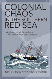
Today, the countries bordering the Red Sea are riven with instability. Why are the region's contemporary problems so persistent and interlinked? Through the stories of three compelling characters, Colonial Chaos sheds light on the unfurling of anarchy and violence during the colonial era. A noble Somali sultan, a cunning Yemeni militia leader, and a Machiavellian French merchant ran amok in the southern Red Sea in the nineteenth and twentieth century. In response to colonial hostility and gunboat diplomacy, they attacked shipwrecks, launched piratical attacks, and traded arms, slaves, and drugs. Their actions contributed to the transformation of the region's international relations, redrew the political map, upended its diplomatic culture, and remodelled its traditions of maritime law, sowing the seeds of future unrest. Colonisation created chaos in the southern Red Sea. Colonial Chaos offers an interdisciplinary approach to understanding the relationship between the region's colonial past and its contemporary instability.
The conclusion shows how persistent colonial chaos has been in the southern Red Sea. Local diplomacy retains a distinctly competitive and militaristic flavour to this day. International competition and realpolitik in the southern Red Sea has, if anything, intensified in the post-Cold War era. Looking at Puntland, south-west Yemen and Djibouti today, we see the Djiboutian government depends on money and recognition from renting space to foreign navies, while in Somalia and Yemen, rival power brokers seek to translate acts of maritime aggression into international negotiations for military and civil assistance. Opportunities to rekindle a regional culture of international cooperation exist, but are deeply submerged beneath the depths of colonial history.
This study investigates the use of augmented reality technology (AR) in the field of maritime navigation and how researchers and designers have addressed AR data visualisation. The paper presents a systematic review analysing the publication type, the AR device, which information elements are visualised and how, the validation method and technological readiness. Eleven AR maritime solutions identified from scientific papers are studied and discussed in relation to previous navigation tools. It is found that primitive information such as course, compass degrees, boat speed and geographic coordinates continue to be fundamental information to be represented even with AR maritime solutions.